

Quetico Superior Wilderness News has been reporting on the recent spring flooding events in northern Minnesota. We asked contributor Holly Scherer to share what impacts of the late spring thaw she’s witnessed so far.

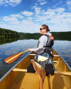
We were in utter disbelief as we stood at the end of a portage during a Boundary Waters canoe trip last summer. We had traveled through this area several years earlier and knew it was challenging. But as we stood there, we had no idea how we were going to get our gear and canoe through the mud and muck and into the distant water. After close to an hour, scrapes on the canoe, mud-covered legs, and some fiery words, we were finally back on the water. “This is bad,” I told my husband. “We’re going to need a really snowy winter and a wet spring.” And although it was the winter many hoped for, few of us imagined the spring flood that followed.
A snowy winter was exactly what we got in the Arrowhead region and it was a huge relief. And then it kept snowing, well into spring. As we rolled into May, there was a new worry on everyone’s mind. Would the lakes be open for the fishing opener?
Facebook groups and online forums were buzzing with debates and bets. Outfitters began posting weekly, and then daily, ice-out reports. Then in another be-careful-what-you-wish-for moment, it happened. In a matter of days, we went from snow-filled trails and ice-covered lakes to dangerous spring flood conditions.
The lakes were open for fishing opener but roads and portages were flooded. Lakes, rivers, and streams were dangerously high and fast moving. And as I write this in July, the lakes in the region are still quite cold. While water levels are coming down, the big spring flood left plenty of reminders of Mother Nature’s power throughout the region.
Dangers of a Spring Flood
After a spring flood there is increased danger of cold fast-moving water. I read too many stories about capsizes, rescues, and near-fatal experiences, like this one.
These stories have changed the way we use our PFDs. I know I’m not the only person who would prefer to fish and paddle down a glass-like lake without one. But during our recent BWCAW trip this month, if we were on the water, our life vests were on us. The spring flood was a great reminder to always practice water safety. You can learn more from the Minnesota DNR here.
The Bugs
Other than the weather, Minnesotans love to talk about the bugs. “How are the bugs?” is the most common question I heard during my trips to the Arrowhead region this year. My response was similar to nearly every previous year. “It changes daily and depends where you are.”
Almost every summer there’s a period of time when the bugs are unbearable. This year is no different. From what I’ve experienced, they seem to be hatching a bit later than usual and in abundance. It’s far from the worst I’ve experienced, I will say, though, that I have never seen so many deer ticks in my life. You can learn how to identify ticks here.
Mosquitoes and deer flies are annoying, no doubt. But for me, the diseases transmitted by ticks are more concerning. The Wilderness First Aid course offered by the American Red Cross recommends pretreating your clothing with Permethrin and using 40 percent Deet on your skin when engaged in outdoor activities. This is my sixth season treating my clothes with Permethrin, and while I’ve seen more ticks than ever, I haven’t found a single living tick on my body.
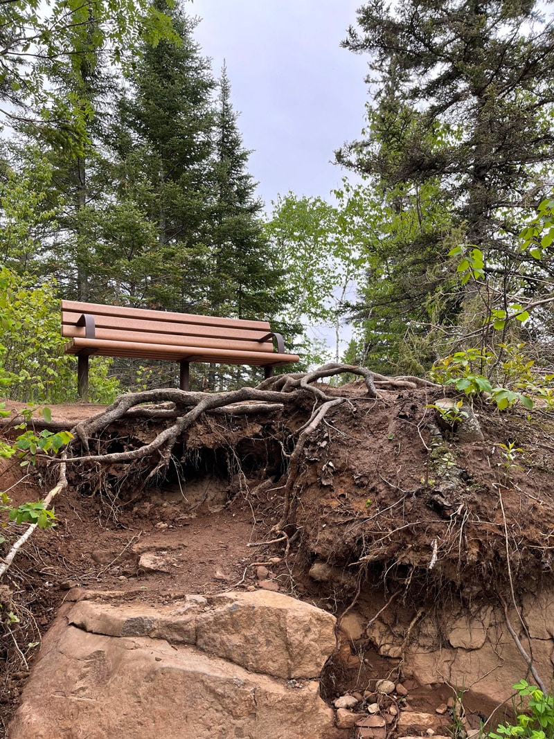
Damage from the Spring Flood
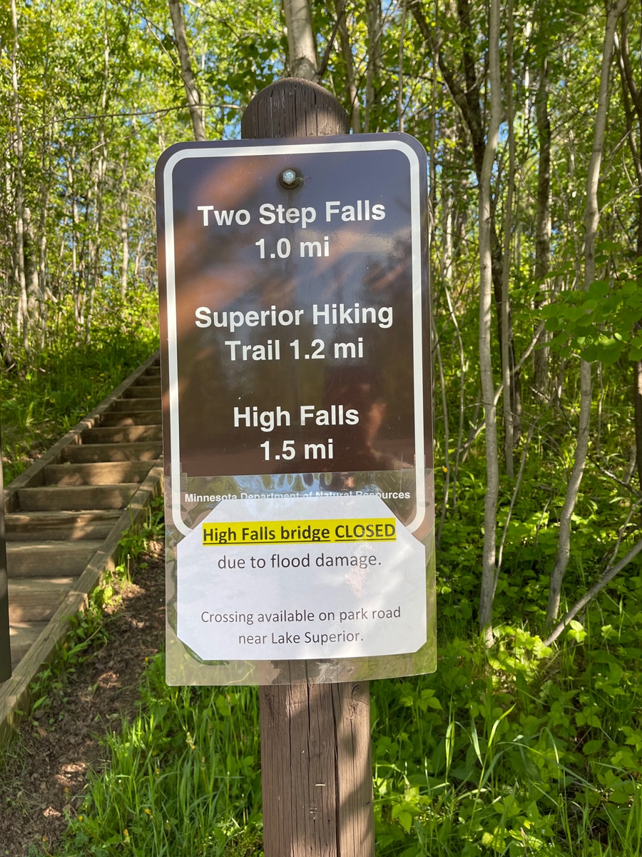
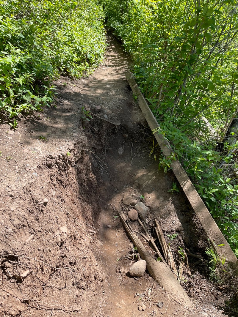
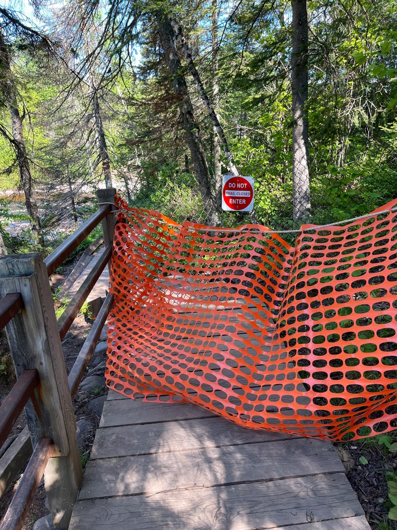
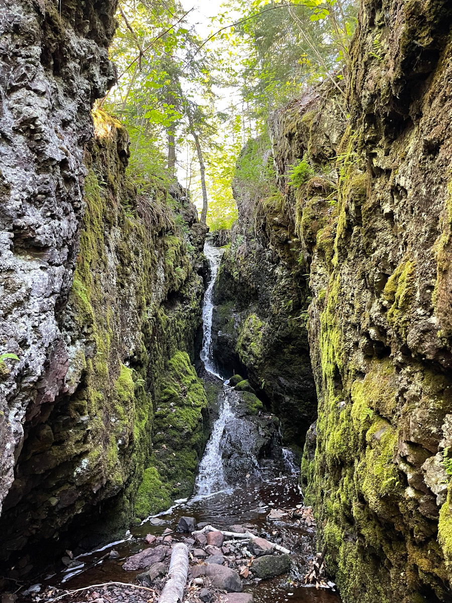
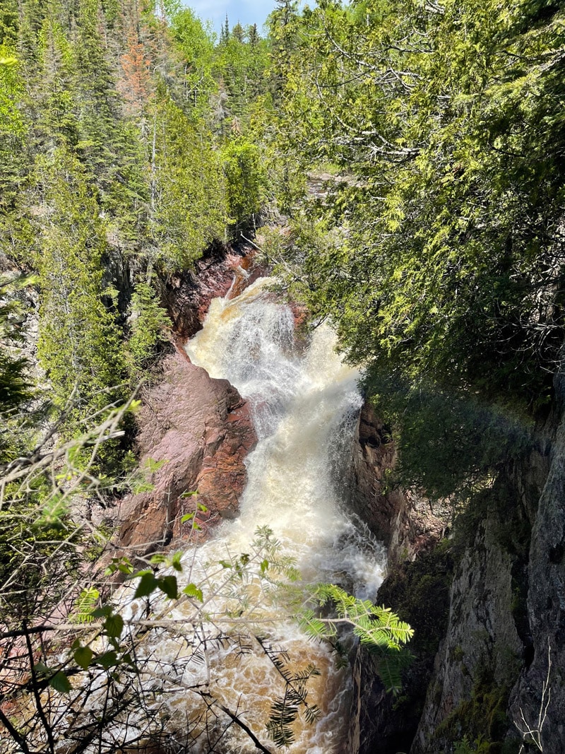
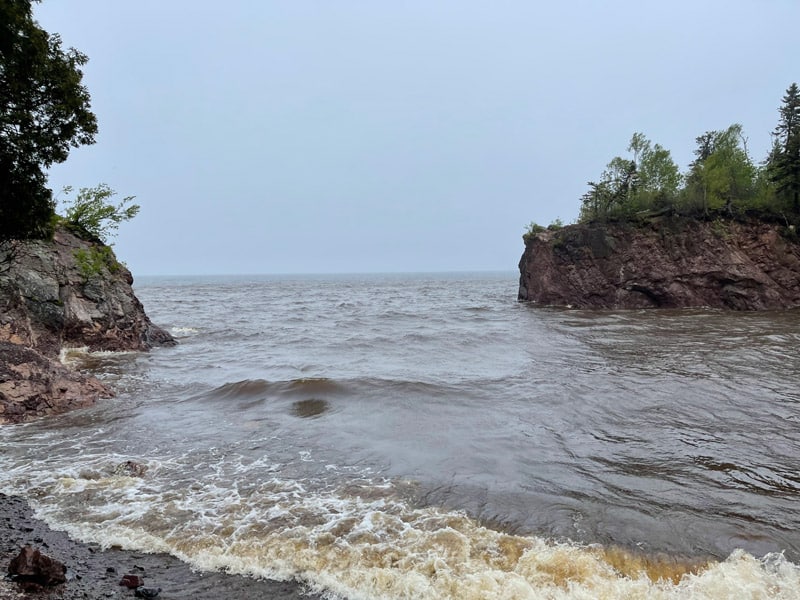
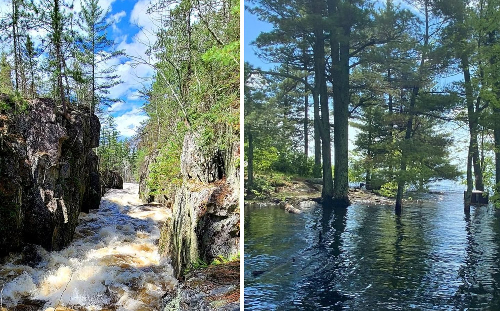
As the temperatures spiked this May and the ice melted rapidly, high fast-moving water rushed down the rivers, taking out anything in its path. The beach at the mouth of the Baptism River in Tettegouche State Park was “there one day, and gone the next,” according to a park employee. The raging river took out bridges, deposited debris, and eroded many popular trails.
If you’re planning a trip to Minnesota’s Arrowhead this summer, do a little research before you go so you know what to expect. Many parks along the North Shore sustained damage to trails and bridges. Check the MN DNR state park web pages before you go.
If you’re planning to hike on the Superior Hiking Trail (SHT), check the trail conditions here. Since the SHT and its trailheads are always changing and evolving, this is a best practice any year.
If you’re headed into the Superior National Forest check the Forest Service’s website, or call the Forest Service office for the region you’re planning to visit.
Boundary Waters Canoe Area Wilderness Closures and Alerts can be found here.
Minnesota State Park trail conditions and water levels can be found at the MN DNR web site here.
Voyageurs National Park reports campsites inundated with water, trail closures, and impaired houseboat site access points but conditions continue to improve and more campsites will reopen. Check trail conditions and campsite closures here.
It’s always best to follow the recommendations of park rangers, forest service staff, and outfitters who know the area well. When it rains, it pours, they say. While the moisture was needed, the fast and late melt brought with it danger and challenges. A reminder of nature’s power and an opportunity to reflect on how we can protect ourselves and this priceless area.
Photos by Holly Scherer unless noted otherwise.
Holly Scherer is a Minnesota-based writer, photographer, outdoorswoman, and guide. She’s most at home in the great outdoors; camping, hiking, paddling, cycling, and gardening. When she’s not on an adventure, she and her husband live in the Twin Cities where they’re fond of saying, “home is where we store our outdoor gear.”