

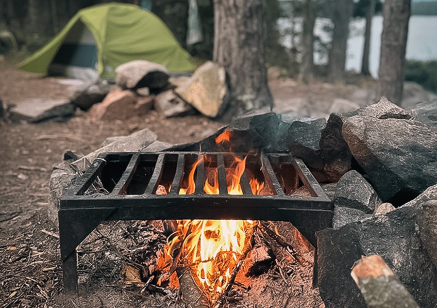
The Boundary Waters Canoe Area Wilderness (BWCAW) covers 1 million acres with over 1,100 lakes along 150 miles of the Minnesota-Canada border. Get the latest news on BWCA regulations, the mining debate, wildlife, trail conditions, camping permits and more.
Boundary Waters begins to reopen: day use permits at select entry points starting Monday
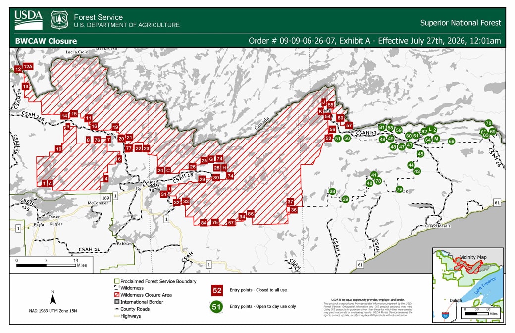
Ten days after wildfires closed the entire BWCAW, the Forest Service is reopening day-use access at select entry points starting Monday, July 27. Overnight camping could partially resume next week if the weekend brings no major fire activity.
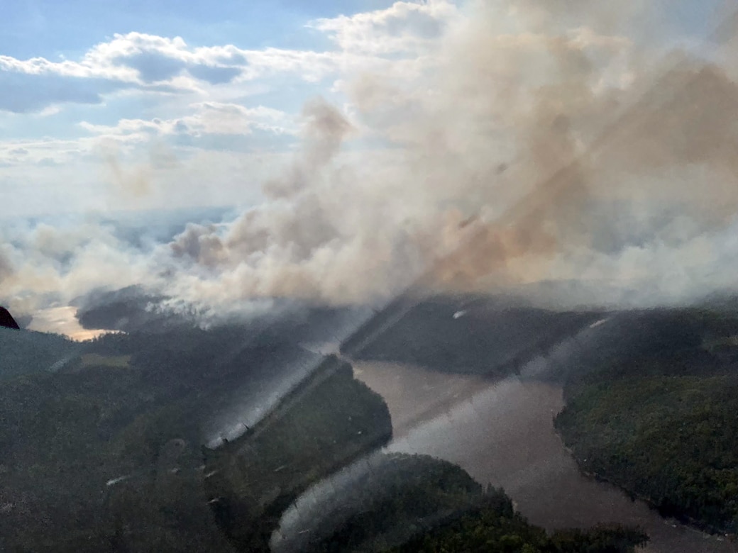
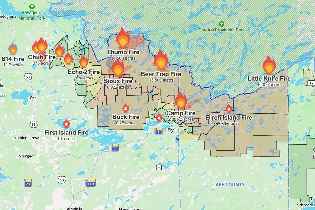
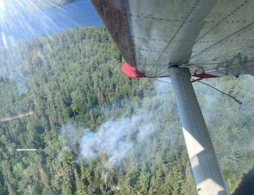
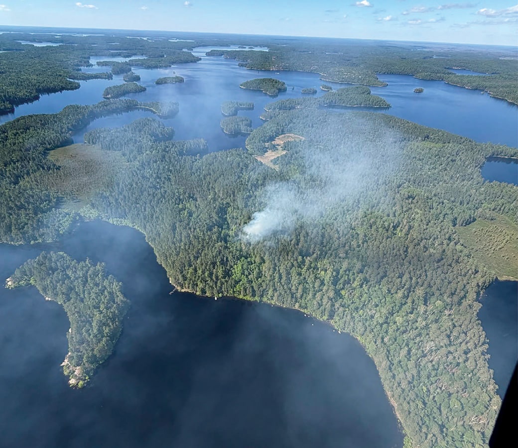
Wildfires burn approximately 68,000 acres in the Superior National Forest and BWCA
Check this page for daily updates: extreme fire conditions drove explosive growth across the forest, wilderness fires have crossed the international border into Canada, and crossed into Minnesota from Canada, according to the Forest Service and MNICS.
Boundary Waters temporarily closed to all visitors as wildfires spread
BWCAW permits are cancelled through July 24, and the closure order now formally runs through October 1, or until rescinded. The Forest Service said this week that it is assessing opportunities to reduce the closure in areas where conditions allow.
Permit canceled due to wildfires? Discover new ways to explore northeastern Minnesota
While many permits have been canceled due to ongoing wildfires in the BWCAW, there are still plenty of opportunities to explore areas outside the wilderness and nearby communities. Plan your northern MN adventure with our favorite alternatives to the Boundary Waters.
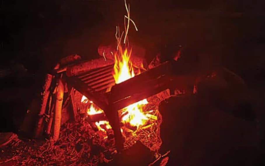
BWCAW campfire ban expands to the entire Superior National Forest and Voyageurs National Park, Quetico
Citing continued dry conditions and wildfire activity, the Superior National Forest is issuing an Emergency Forest Order banning campfires within the Boundary Waters Canoe Area Wilderness (BWCAW), effective 12:01 a.m. Saturday, July 11, 2026, until rescinded.
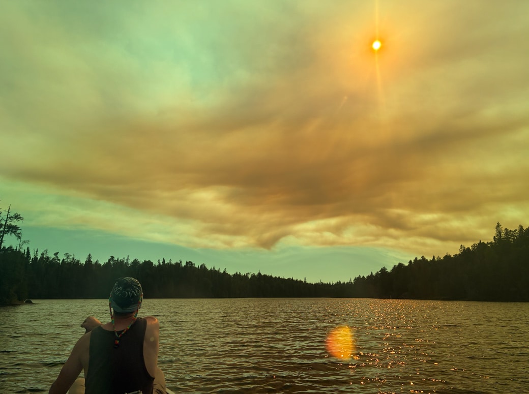
Escaping ahead of the Little Knife Fire in the BWCA
Their Boundary Waters trip started with mosquitoes, unusually warm weather, and rugged portages. “Little did we know, those trials by fire were going to be just stick kindling compared to the real fires ahead…”
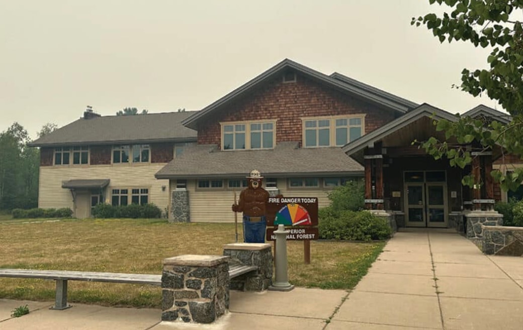
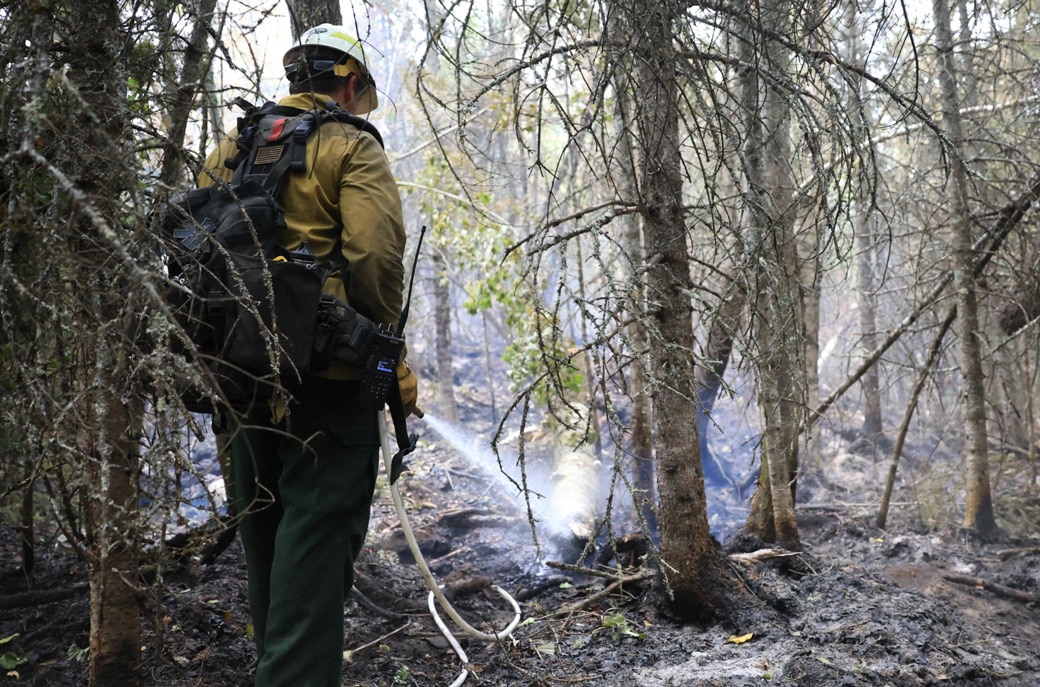
Superior National Forest, emergency responders prepare for the long haul as wildfires burn
Officials representing multiple agencies, including the USFS-Superior National Forest, held a press conference Wednesday at the Kawishiwi Ranger Station in Ely. They provided updates and plans for the wildfires burning in the BWCAW and northeastern Minnesota.
Quetico fire crosses the border into the BWCAW; Trails End Campground closed
The Forest Service estimates the Little Knife Fire at 6,000 acres on the US side, part of a fire totaling about 30,000 acres.

Boundary Waters wildfires closure affecting area outfitters and visitors
With the entire Boundary Waters closed and no reopening date announced, outfitters on both sides of the wilderness are scrambling — canceling and rerouting trips, fielding calls from visitors who flew in from across the country, and hoping the next few days bring better news.
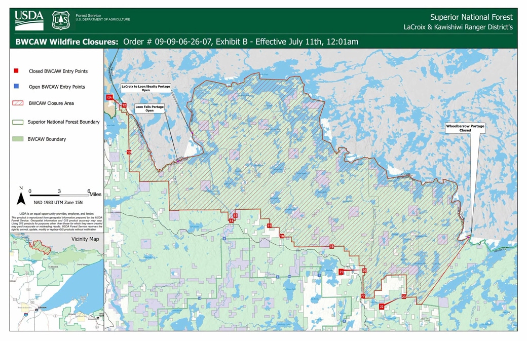
Emergency Closure Order issued for portions of the BWCAW
The USDA Forest Service is closing public access to portions of the BWCAW to protect public health and safety. One order closes three wildfire areas surrounding the Bear Trap, Thumb, and Wolfpack fires in the LaCroix Ranger District, affecting 13 entry points; a second closes 15 lakes in the northwestern Gunflint Ranger District, effective July 12, due to a wildfire in Quetico Provincial Park.
Lightning-caused Long 2 Fire contained in the Boundary Waters
A small wildfire detected in the Boundary Waters Canoe Area Wilderness last week is now fully contained, the Superior National Forest said in its final update on the fire July 5.

Researchers listen for signs of change in Quetico’s songbirds
A long-term songbird study is underway deep within Quetico Provincial Park. This spring, researchers placed 17 recording units across key habitats to monitor songbird species. Data will reveal trends especially as climate change affects the park and bird species.

Over 12,000 BWCA permits went unused last year, new policy aims to change that
The Superior National Forest is reconsidering their cancellation policy on Boundary Waters Canoe Area permits. The most visited wilderness in the country requires a permit, usually booked online. In recent years, cancellations and no-shows have been on the rise…
Campfires ban in the Boundary Waters Canoe Area Wilderness lifted
The USFS announced that the ban on campfires in the BWCAW would be lifted as of June 12. The restriction was announced due to dry conditions and elevated wildfire risk.
Three wildfires spark in the Boundary Waters after lightning storm
Three new wildfires ignited in the BWCA due to storms that passed through the area on Thursday, June 4. The Superior National Forest said that crews have been working on management and suppression techniques. The wilderness campfire ban will remain in effect through June 30.
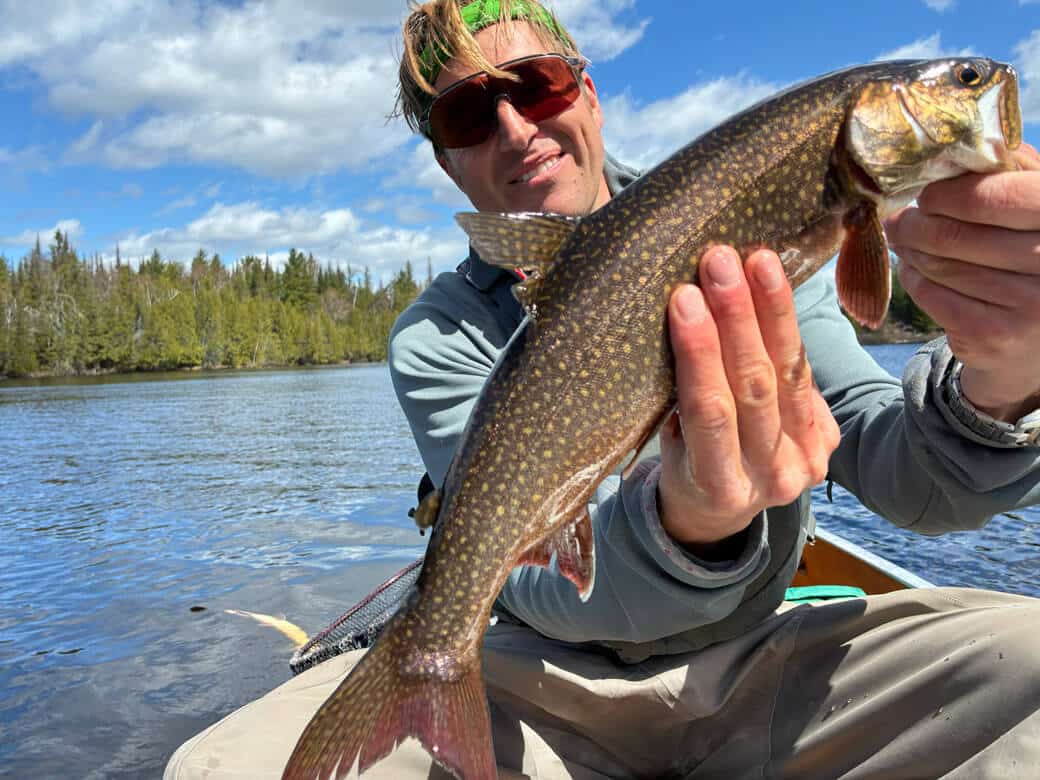
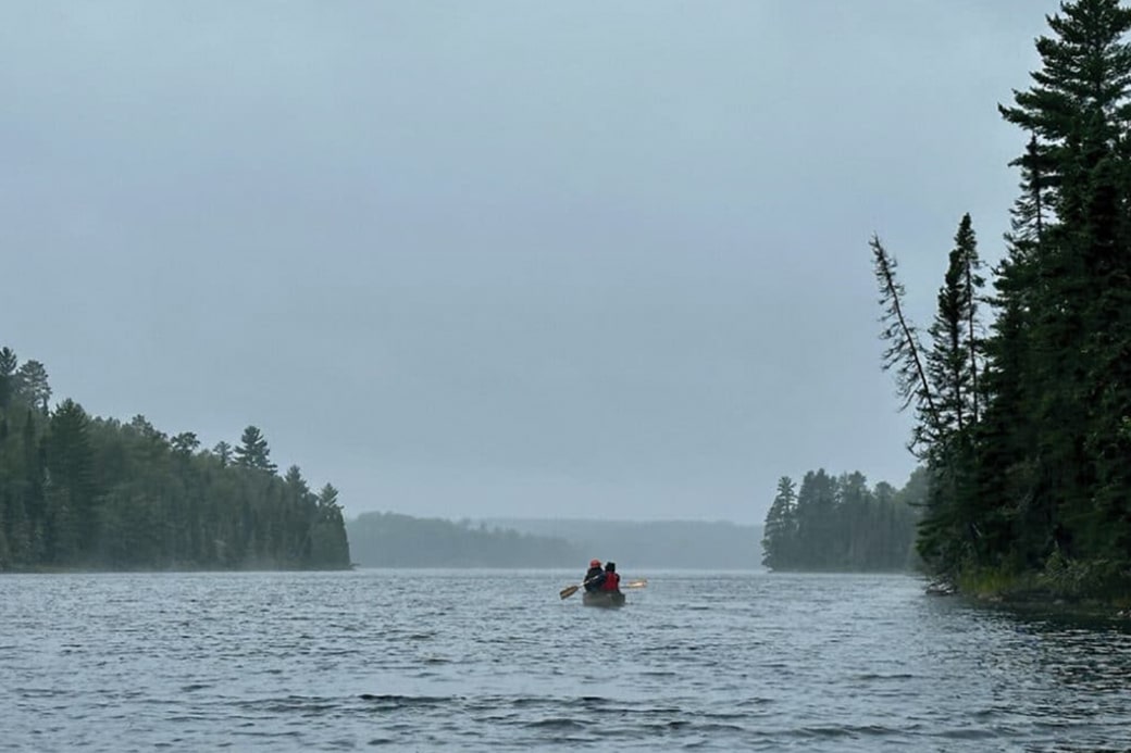
Chasing fish on Ogish
What’s more demoralizing to a wilderness canoe tripper than a 30-mph headwind? Facing a grueling 12-hour battle across the Boundary Waters, Chris Pascone pushes his limits to reach Ogishkemuncie Lake. Along the way, he discovers the power of camaraderie, and the fascinating secret behind Ogish’s famous “red-flesh” lake trout.

Birch Bay Fire update: cause determined, evacuations lifted near Burntside Lake
A wildfire broke out on the afternoon of June 1 near Burntside Lake. Driven by hot, dry conditions and light southeast winds, it spread quickly to an estimated 30 acres by evening.
Legislature cuts $1.25 million for Boundary Waters program that gets youth outdoors
Friends of the Boundary Waters lost over a million dollars for its youth program after the state voted to eliminate the funding. Lawmakers said the organization should not receive public funds because it also engages in anti-mining advocacy.
Paddlers will use Wi-Fi at Prairie Portage and Cache Bay to telephone their entry into Quetico
Starting June 8, the Cache Bay and Prairie Portage ranger stations are expected to implement a new telephone reporting system for paddlers entering Quetico Provincial Park in Canada. Visitors will be able to use the stations’ Wi-Fi to report their entry.

The camper’s guide to outsmarting bugs in Northern Minnesota
Bugs are a fixture of the northern Minnesota landscape, chasing bare-legged campers into their tents as the sun sets. As early as March, they can begin to appear, starting with ticks. By June, black flies, gnats, and mosquitoes are common. Find our top tips to beat the bugs or at least co-exist safely with them.
Report shows rise in last-minute permit cancellations for Boundary Waters
The Forest Service has published its latest permit and visitor-use report for the Boundary Waters Canoe Area Wilderness (BWCAW). While visitor numbers remain about the same, cancellations and no-shows continue to rise.
Pro tips: cold weather safety for spring canoe trips in the BWCA
Spring in the Boundary Waters offers unmatched solitude and the first signs of life, but the beauty hides a deadly risk: water temperatures that linger in the 40s and 50s long after ice-out. An experienced guide shares tips to help stay safe, warm, and prepared for the unpredictable conditions of a BWCAW shoulder-season adventure.
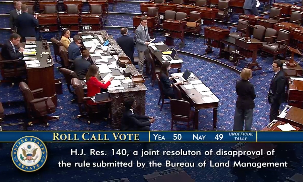
Senate votes to overturn mining ban near Boundary Waters—what happens next?
In a narrow 50-49 vote, the U.S. Senate passed H.J. Res. 140, effectively overturning a 20-year moratorium on mineral leasing in the Superior National Forest. The move clears a major federal hurdle for the proposed Twin Metals copper-nickel mine.
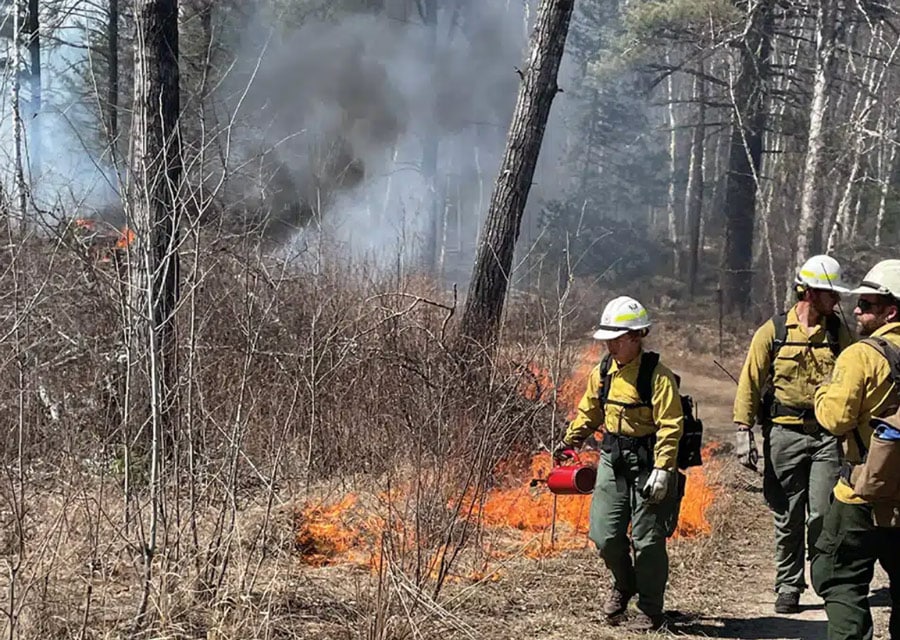
Prescribed burns planned for the Superior National Forest
Each spring, the Forest Service plans prescribed burns throughout the Superior National Forest. The work is expected to begin this month and, depending on conditions, will go through June. This is done annually to help safeguard communities from wildfires and reduce fuel loads. See which areas are scheduled for burning.
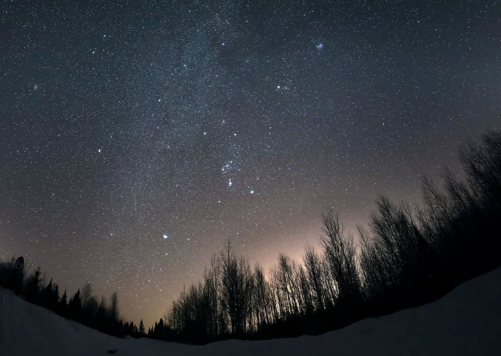
Dark Sky Week emphasizes more stars, less light pollution
Experience Minnesota’s dark skies during International Dark Sky Week, April 13-20. Minnesota is home to two certified dark-sky sanctuaries – the BWCAW and Voyageurs National Park.

When will ice be gone from northern Minnesota lakes? Updated tracker helps visitors plan
When the ice will be out on Boundary Waters lakes? Using scientific and historical data, an online thaw tracker provided by the Minnesota Sea Grant helps estimate when ice will disappear from Minnesota lakes.
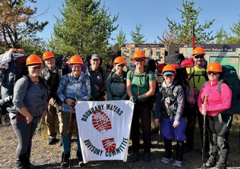
Preserving the path: how BWAC volunteers maintain 200 miles of wilderness
From the successful restoration of the fire-ravaged Powwow Trail to an ambitious new project rebuilding boardwalks on the popular Eagle Mountain Trail, BWAC volunteers are the boots on the ground keeping wilderness paths open. Crews paddle or hike in, and use traditional hand tools to clear deadfalls and protect the trail experience for thousands of hikers.
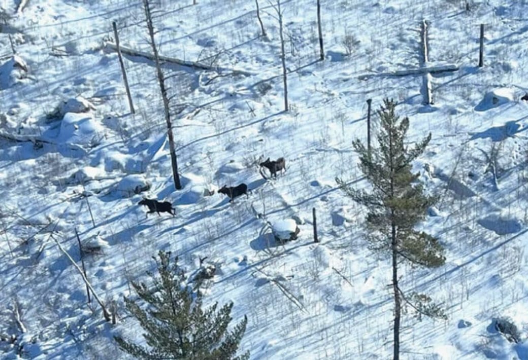
Minnesota moose survey completed, partnership plans to improve habitat
Moose populations continue to be stable, according to the most recent survey by the Minnesota DNR. The state, along with tribal, federal, county, and other partners, plans to implement a new, long-term plan to improve moose habitat across three counties and 50,000 acres.
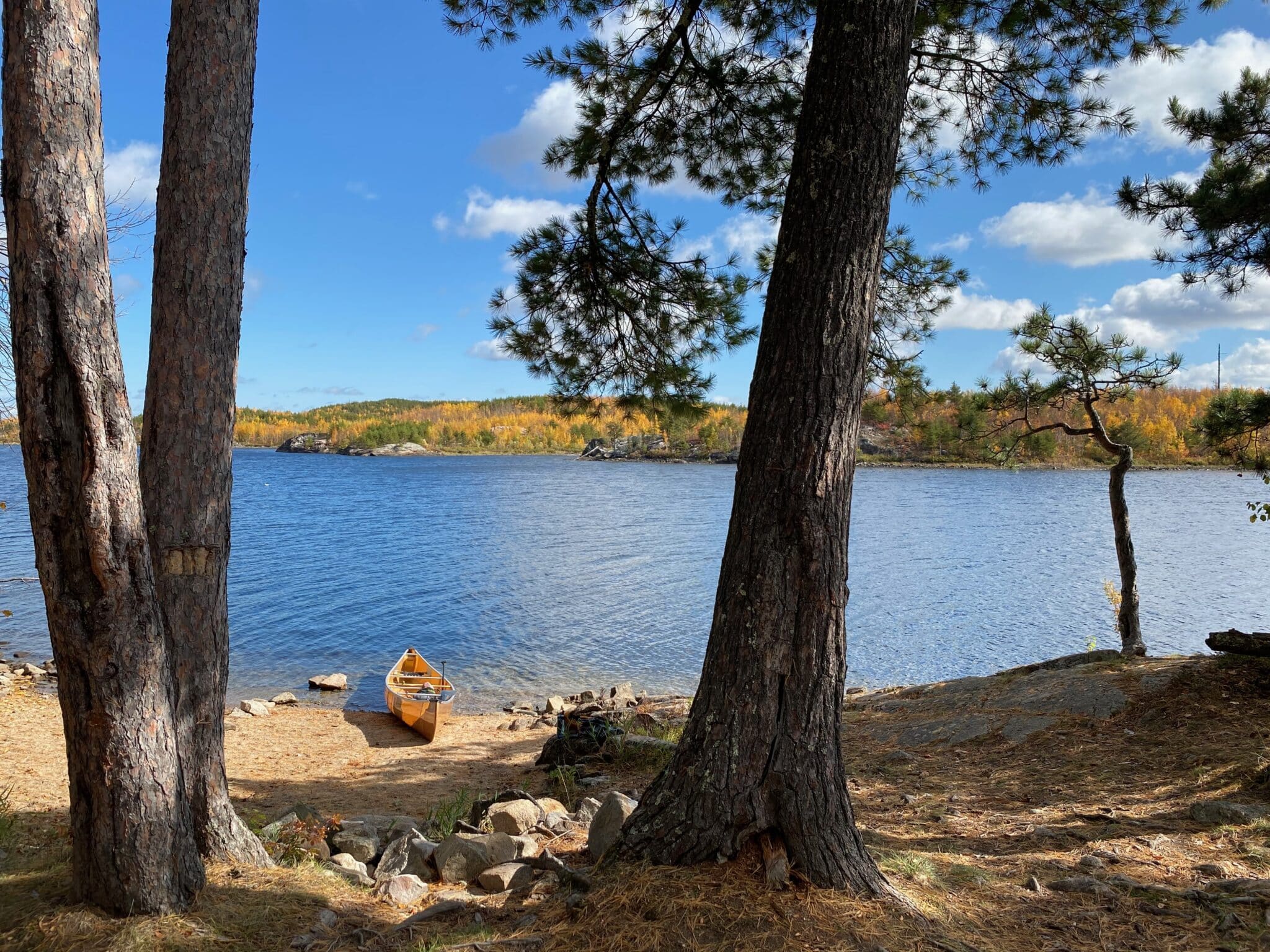
Discover Minnesota’s deepest inland lake in the Boundary Waters
It’s no secret that Minnesota has a lot of lakes—the DNR has listed 11,842 of them. Although Lake Superior is the deepest overall, Saganaga Lake in the BWCA ranks as the deepest natural inland lake. Its easy access draws all kinds of adventure-seekers to its cool, clean waters each summer.
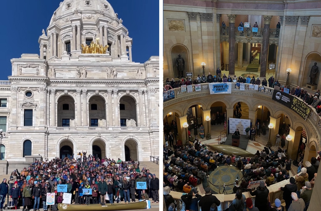
Hundreds rally for Boundary Waters as critical Senate vote looms
The fight to protect the Boundary Waters has reached a critical turning point. Following a Day of Action at the Minnesota State Capitol, all eyes are now on the U.S. Senate…