

Wildfires in the wilderness areas of the BWCAW, Quetico Provincial Park, Voyageurs National Park, and Superior National Forest:
Superior National Forest, emergency responders prepare for the long haul as wildfires burn
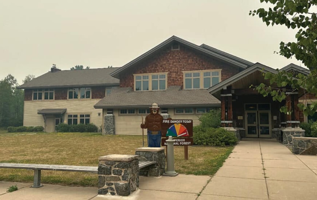
Officials representing multiple agencies, including the USFS-Superior National Forest, held a press conference Wednesday at the Kawishiwi Ranger Station in Ely. They provided updates and plans for the wildfires burning in the BWCAW and northeastern Minnesota.

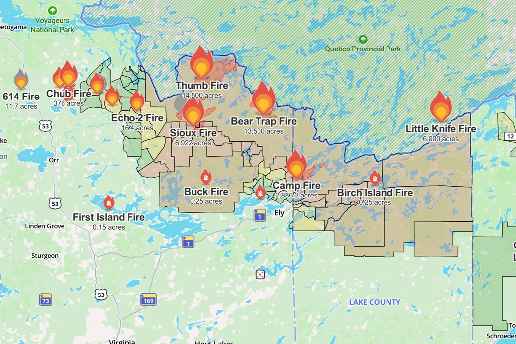
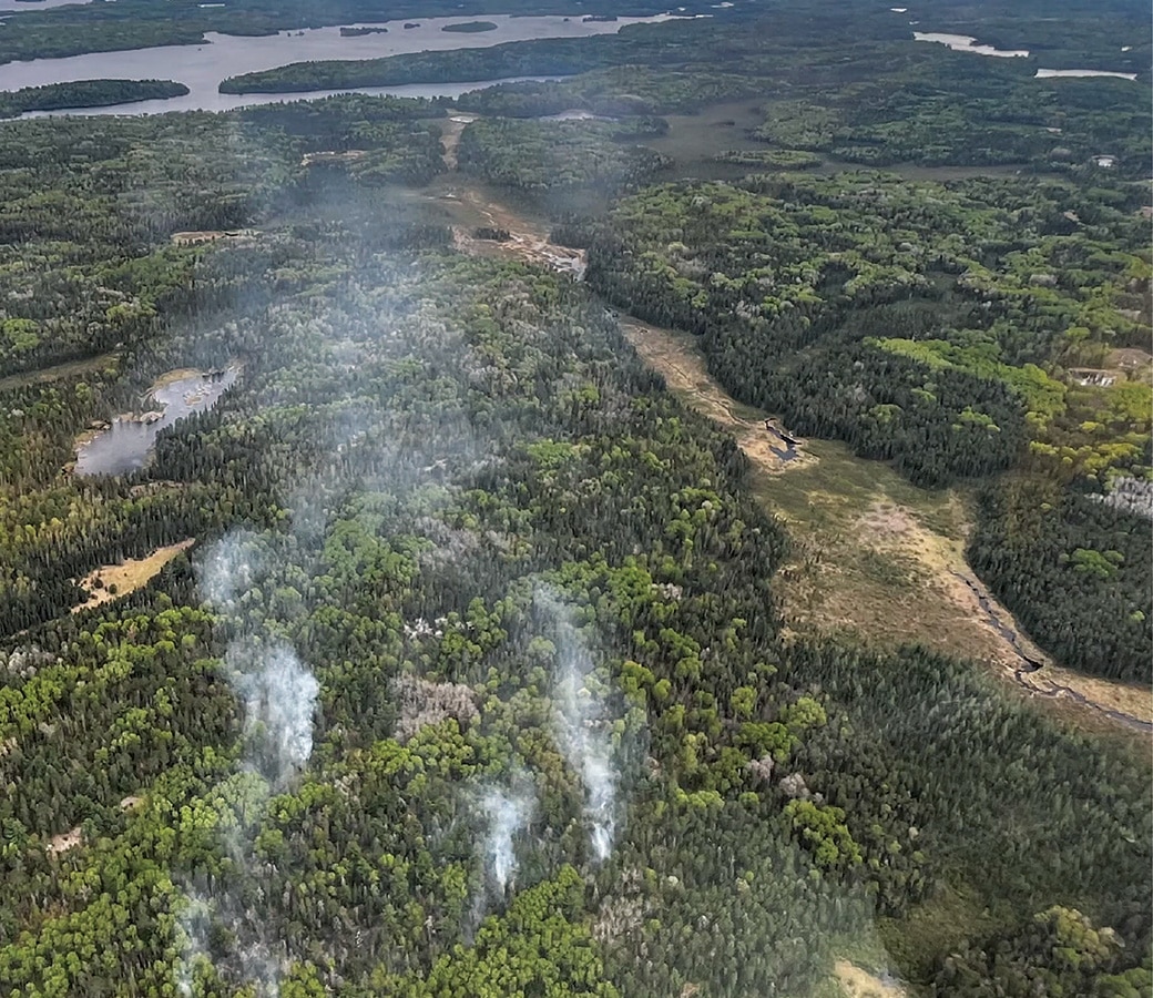
Wildfires burn approximately 55,000 acres in the Superior National Forest and BWCA
Extreme fire conditions driving explosive growth across the forest, wilderness fires have crossed the international border into Canada, and crossed into Minnesota from Canada, according to the Forest Service and MNICS.
Quetico fire crosses the border into the BWCAW; Trails End Campground closed
The Forest Service estimates the Little Knife Fire at 6,000 acres on the US side, part of a fire totaling about 30,000 acres.
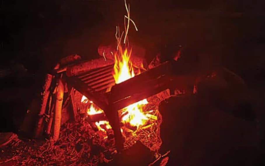
BWCAW campfire ban expands to the entire Superior National Forest and Voyageurs National Park, Quetico
Citing continued dry conditions and wildfire activity, the Superior National Forest is issuing an Emergency Forest Order banning campfires within the Boundary Waters Canoe Area Wilderness (BWCAW), effective 12:01 a.m. Saturday, July 11, 2026, until rescinded.

Boundary Waters wildfires closure affecting area outfitters and visitors
With the entire Boundary Waters closed and no reopening date announced, outfitters on both sides of the wilderness are scrambling — canceling and rerouting trips, fielding calls from visitors who flew in from across the country, and hoping the next few days bring better news.

Wildfires close Quetico’s Dawson Trail Campground and Backcountry Entry
Quetico Provincial Park has closed Dawson Trail Campground due to nearby forest fire activity, according to the park’s alerts page. All backcountry entry stations are also closed.
Boundary Waters temporarily closed to all visitors as wildfires spread
The Forest Service officially announced the closure Monday, confirming the BWCAW is temporarily closing to all visitors beginning at 12:01 am Tuesday, July 14. The agency called it a difficult decision, made after a surge of wildfires…
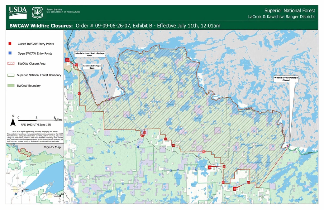
Emergency Closure Order issued for portions of the BWCAW
The USDA Forest Service is closing public access to portions of the BWCAW to protect public health and safety. One order closes three wildfire areas surrounding the Bear Trap, Thumb, and Wolfpack fires in the LaCroix Ranger District, affecting 13 entry points; a second closes 15 lakes in the northwestern Gunflint Ranger District, effective July 12, due to a wildfire in Quetico Provincial Park.

Wildfire prompts evacuations and lake closures in Quetico
Quetico Provincial Park has evacuated and shut down a sweep of lakes across its north end as forest fire FOR015 sends smoke — at times heavy enough to degrade air quality — over the park.
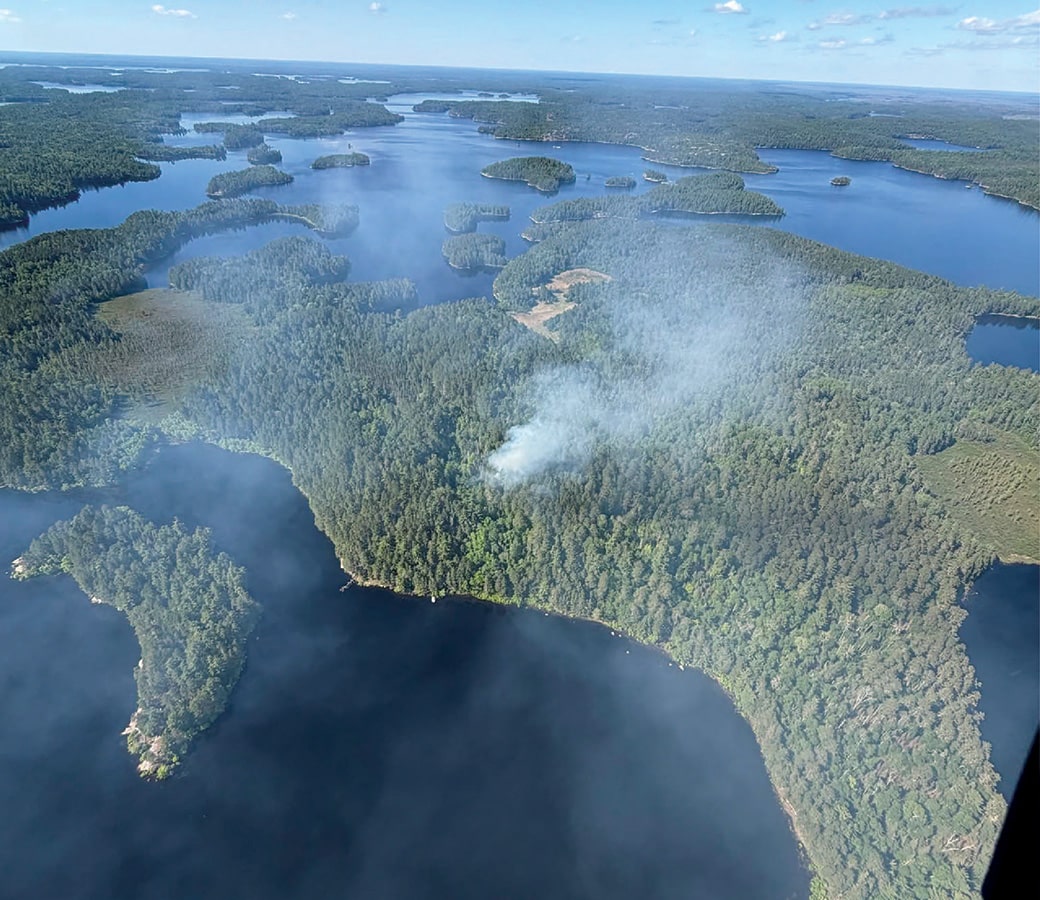
Lightning-caused Long 2 Fire contained in the Boundary Waters
A small wildfire detected in the Boundary Waters Canoe Area Wilderness last week is now fully contained, the Superior National Forest said in its final update on the fire July 5.
Campfires ban in the Boundary Waters Canoe Area Wilderness lifted
The USFS announced that the ban on campfires in the BWCAW would be lifted as of June 12. The restriction was announced due to dry conditions and elevated wildfire risk.
Three wildfires spark in the Boundary Waters after lightning storm
Three new wildfires ignited in the BWCA due to storms that passed through the area on Thursday, June 4. The Superior National Forest said that crews have been working on management and suppression techniques. The wilderness campfire ban will remain in effect through June 30.

Birch Bay Fire update: cause determined, evacuations lifted near Burntside Lake
A wildfire broke out on the afternoon of June 1 near Burntside Lake. Driven by hot, dry conditions and light southeast winds, it spread quickly to an estimated 30 acres by evening.
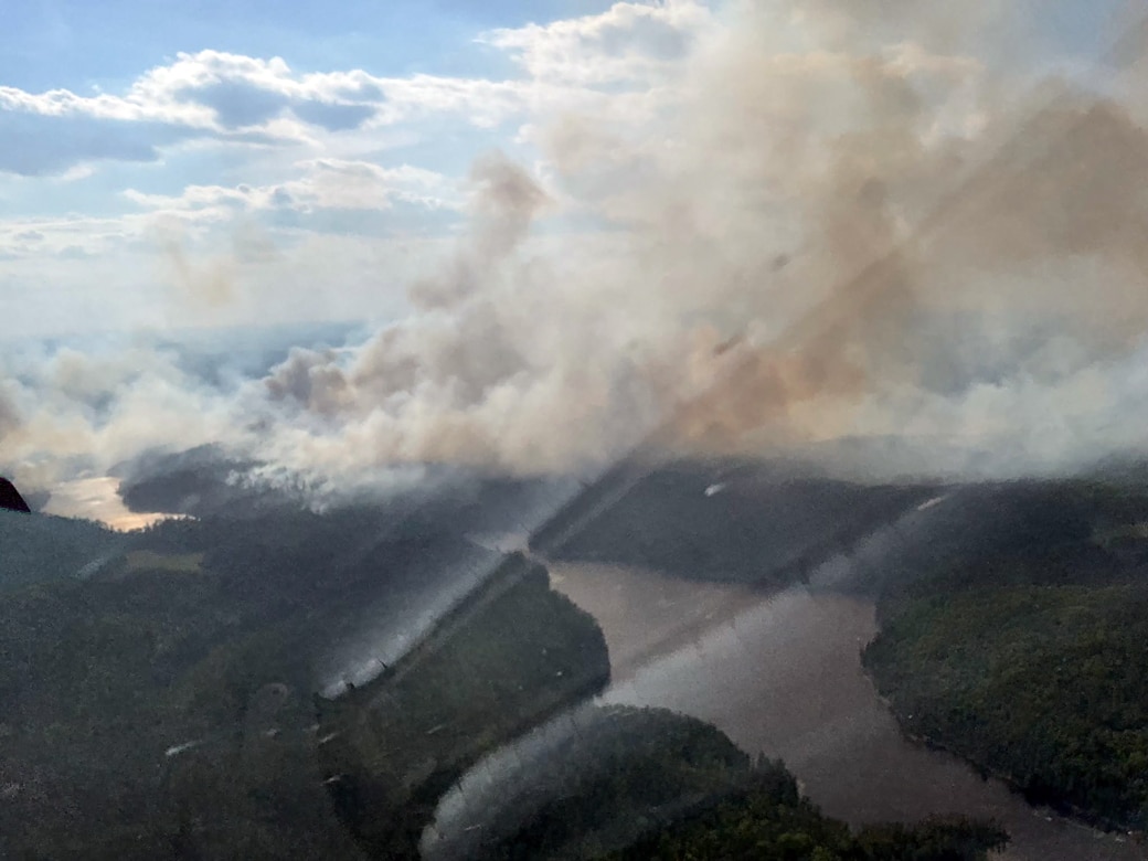
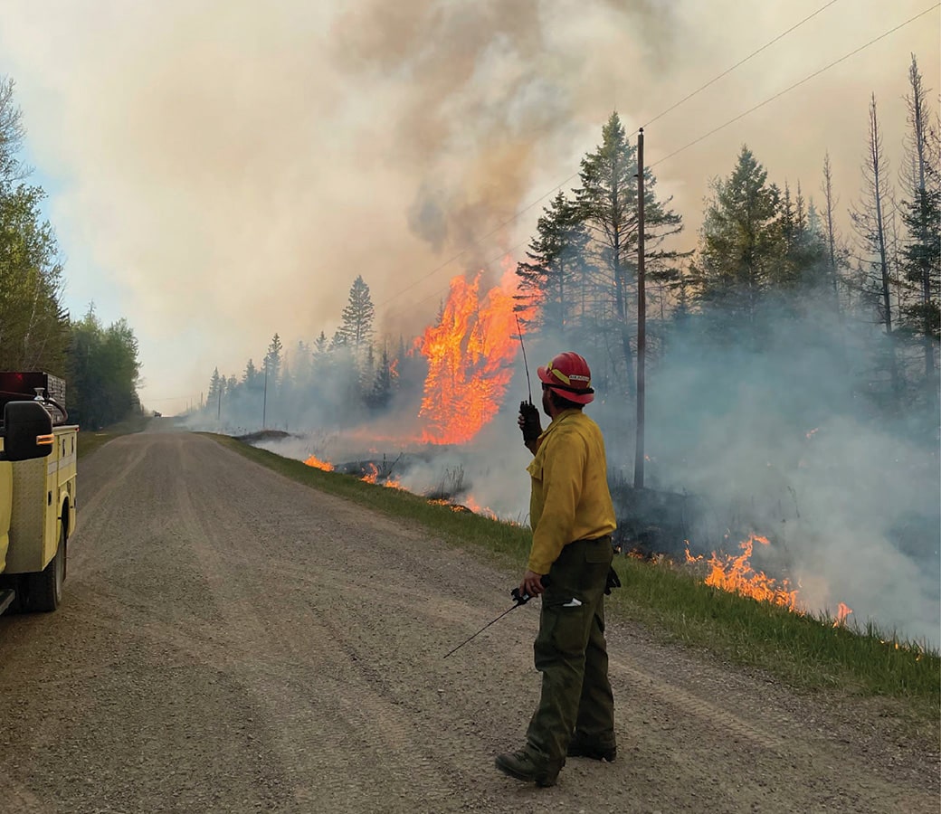
Stewart Trail Fire prompts evacuations and Highway 61 closures on the North Shore
A rapidly spreading wildfire northeast of Two Harbors has forced mandatory evacuations, damaged structures, and closed a major stretch of Highway 61. Driven by dry conditions and high winds that sparked fires across the region, crews are working to contain the Stewart Trail Fire. Here is what wilderness travelers and North Shore visitors need to know.
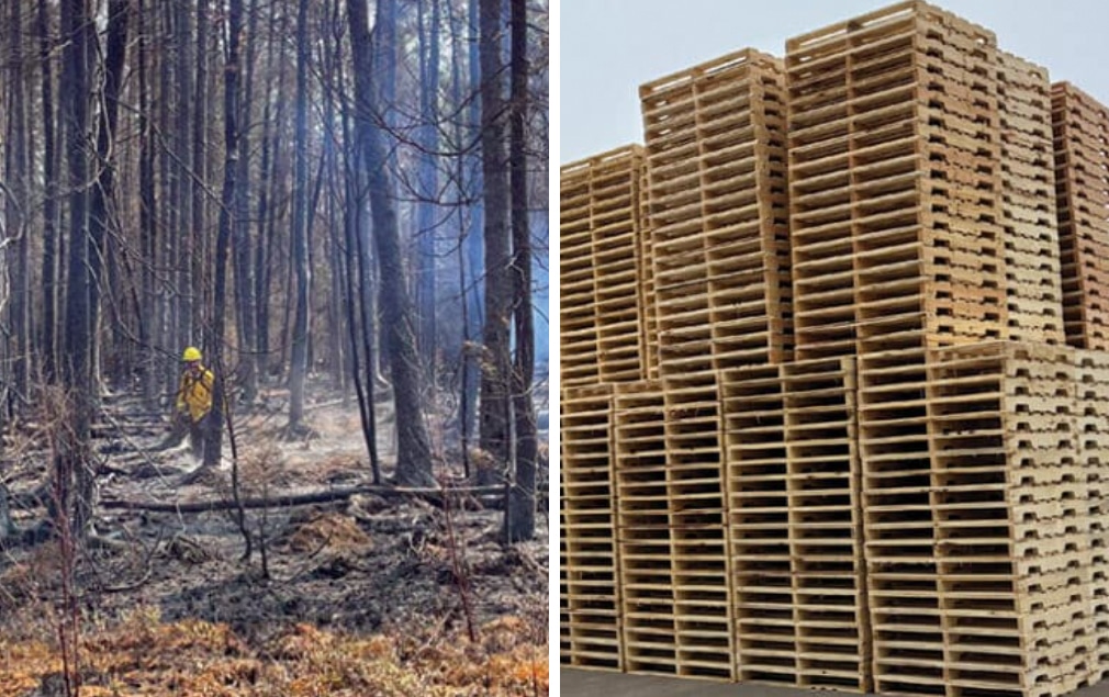
Salvaging wildfire-damaged trees in the Superior National Forest for forest products
A local company is using trees damaged by wildfire on state and federal lands to make lumber, pallets, and other products. As crews open areas, the Forest Service will restore some of the fire-impacted land with new tree seedlings and seeds.
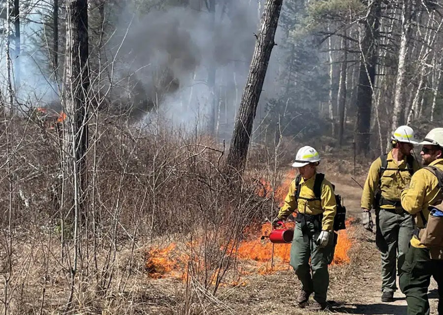
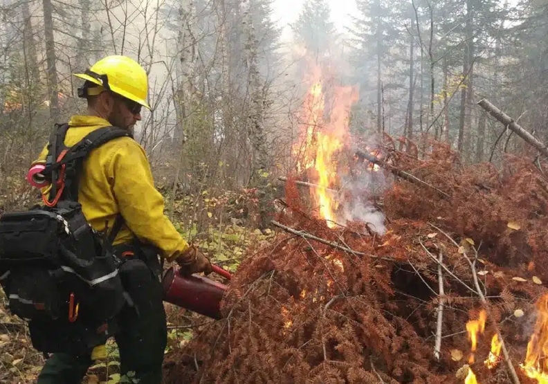
Prescribed burns planned for the Superior National Forest
Each spring, the Forest Service plans prescribed burns throughout the Superior National Forest. The work is expected to begin this month and, depending on conditions, will go through June. This is done annually to help safeguard communities from wildfires and reduce fuel loads. See which areas are scheduled for burning.
3,600 acres scheduled for burns in Superior National Forest
The USFS–Superior National Forest began prescribed burns on 3,600 acres across the forest in mid-September. The agency will continue burning through early winter in areas identified as high wildfire risk or near communities. These efforts support a healthy ecosystem while reducing wildfire danger.
Closure order issued near the Horse River in the BWCAW
A lightning strike sparked a wildfire near the Horse River in the Boundary Waters Canoe Area Wilderness. This comes after an active wildfire season has scorched nearly 30,000 acres in the Superior National Forest this year. The Forest Service has issued a closure order for the route along the Dog Sled Portage and has encouraged visitors to avoid the area.
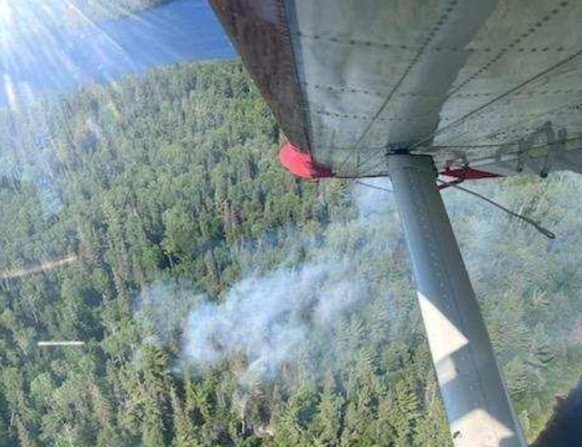
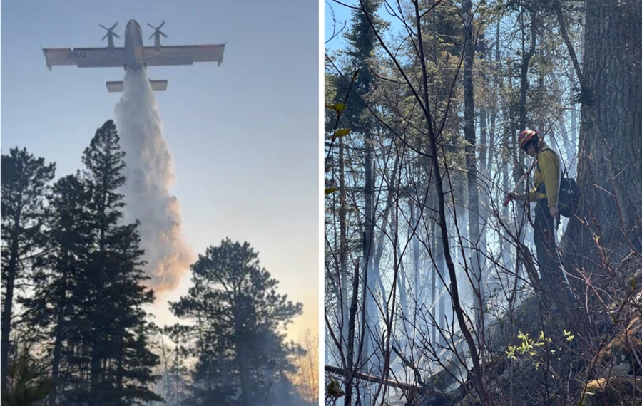
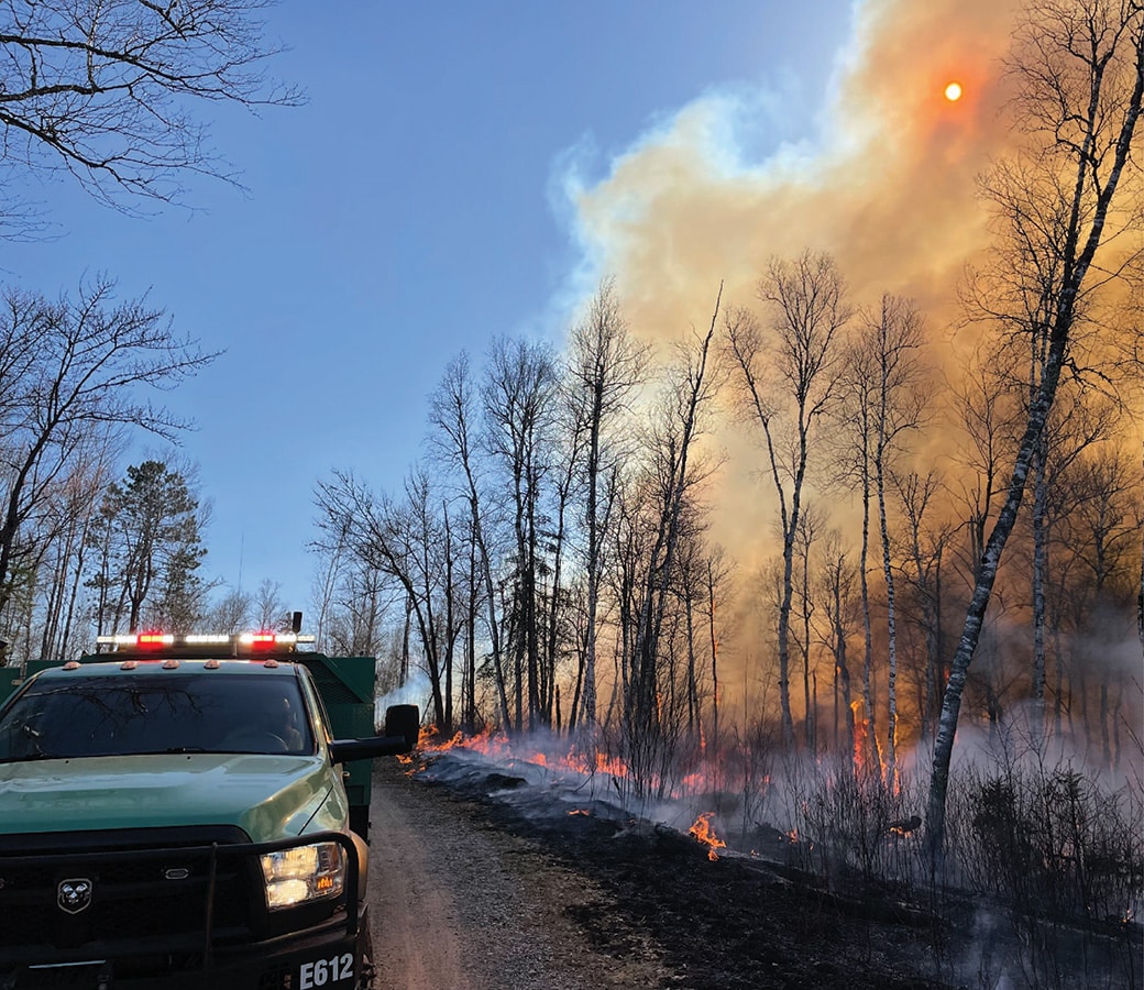
Wildfires burn in the southern part of the Superior National Forest
Crews are battling three wildfires in St. Louis County, Minnesota. The fires, which are burning in a mixed forest, are partially contained. Ground and air support, along with suppression efforts, will continue in the Superior National Forest until further notice. We will continue to share updates.
Prescribed burns begin in Superior National Forest
The Superior National Forest (SNF) will conduct multiple prescribed burns across the forest over the next month. They play a key role in supporting a healthy ecosystem by reducing overgrown vegetation while helping to protect nearby communities from wildfires.