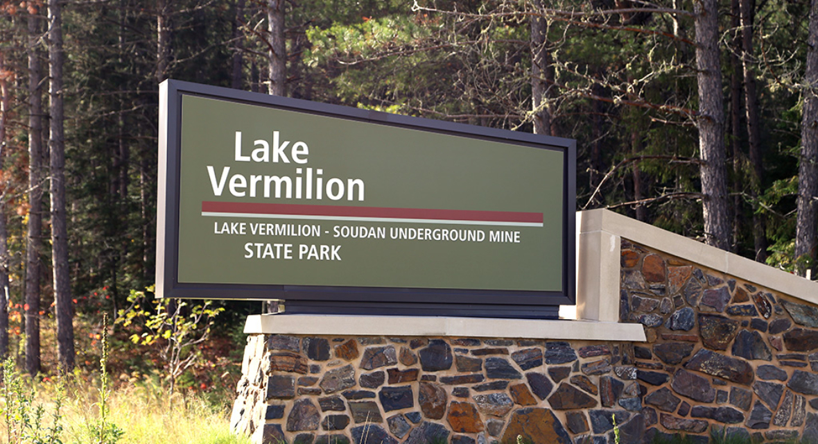
Protecting 4,000 acres, 15 islands, and ten miles of shoreline with Lake Vermilion – Soudan Underground Mine State Park
By Anne Queenan, Contributor
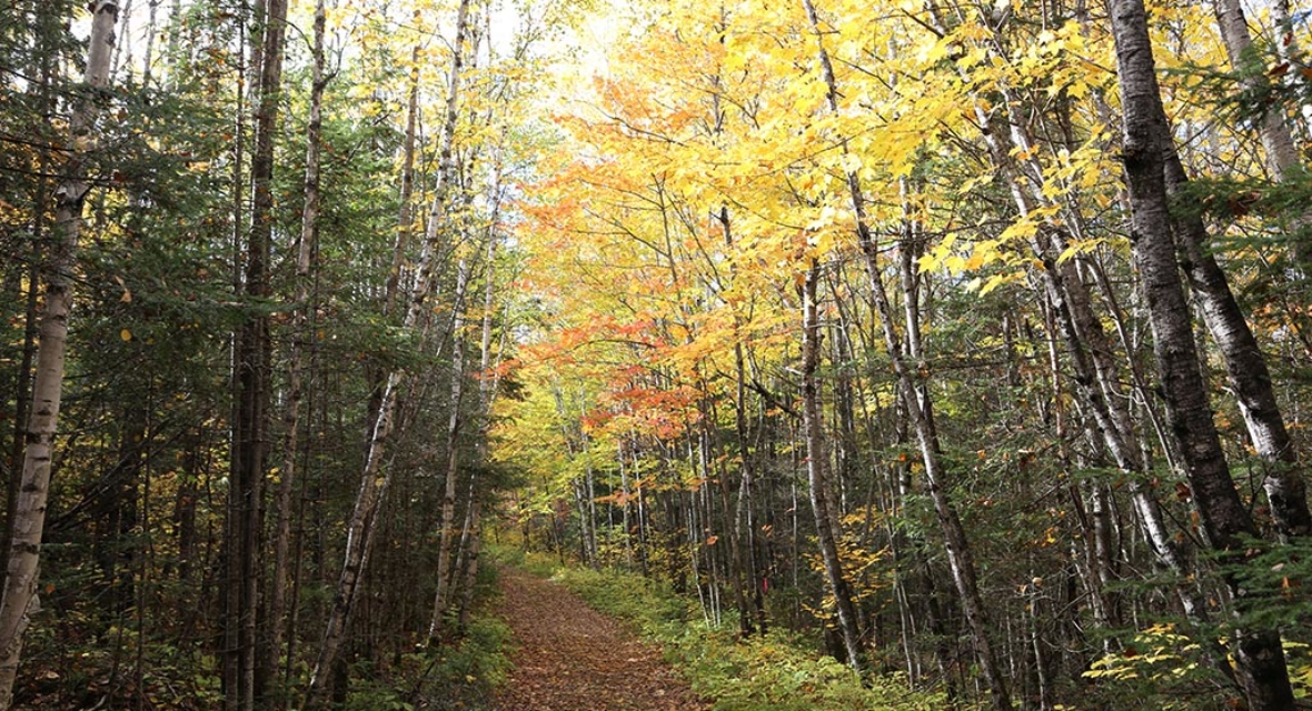
Exploring Minnesota’s newest state park
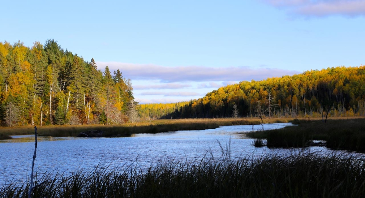
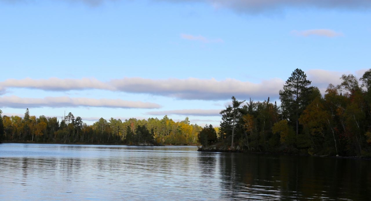
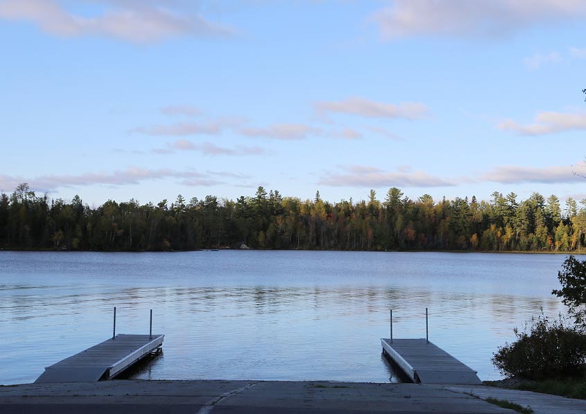
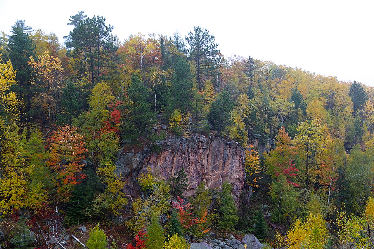
Nearly three thousand acres of wilderness in northeast Minnesota were purchased in 2010, with the intention of expanding the 54-year-old Soudan Underground Mine State Park with pristine, natural beauty. The Lake Vermilion – Soudan Underground Mine State Park received its official name in 2014 when the two properties merged as Minnesota’s newest state park in thirty years. Instead of lakeshore condominiums, initially planned along the popular Lake Vermilion, there’s now ten miles of glistening shoreline, 15 islands featuring old growth pine forests, 3,900 acres of freshwater, and 4,000 acres of park with trails and campsites.
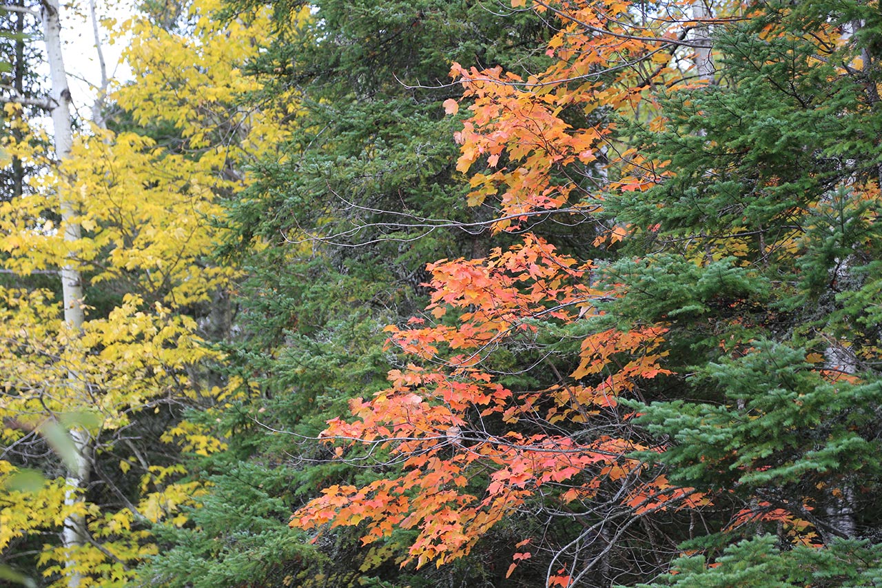
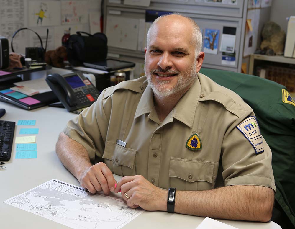
What does that mean for this part of the world? For Park Manager, Jim Essig, it means protecting what we love about Northern Minnesota. When you think about the sights and sounds of Northern Minnesota, you hear the call of the loon, the birdsong of boreal forests, the splash of walleye at the end of a line. Boaters, paddlers, and hikers can now enjoy miles of rocky shoreline lined in a hardwood palette of yellows, reds and rusts with islands of evergreens from old growth pines just across the water. The slap of a beaver’s tail can be heard near a newly built den. Timber wolves howl under stars and constellations in the dark of the night. Campers are serenaded by the nocturnal hoot of the Great Grey Owl.
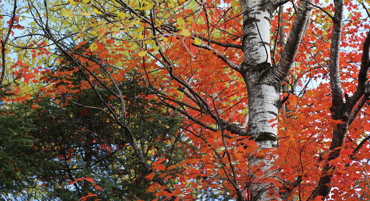
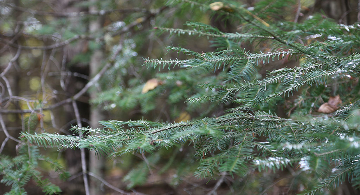
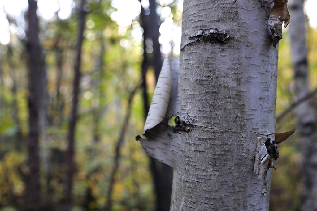
For visitors today, this gem of a park provides public access to thousands of acres of coniferous and deciduous forest, wetlands, an ancient cedar bog, fishing, wildlife and rock outcrops more than 2.7 billion years old.
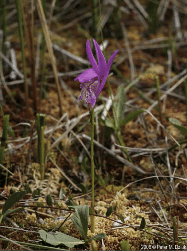
Three rare species of plants are protected here: alpine woodsia found in the cliff areas, dragon’s mouth orchids in the forested bogs, and small water crow foot growing near the ponds and streams. Animals of special concern like grey wolves, Canada lynx and bald eagles, make this park their home — along with black bear, white-tailed deer, chipmunks and fishers. The Northern Long-eared bat, a threatened species, roosted in the mine habitat until a recent bout of white-nosed syndrome dramatically lowered its count.
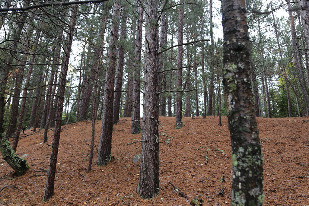
This park’s forest system integrally connects to the surrounding Northern Lakes and Forests Ecoregion. The rare, intact roots of old growth replacement pines, 135 years-old, as well as Mesic hardwood forests, fortify a network of trees and microbial communities in the forest soil. When the trees are kept together as a forest system with its canopies left whole, they protect each other, storing water and generating humidity. This contributes to a larger ecosystem in the Border Lakes, Nashwauk Moraines and Uplands regions.
The preservation of this system is seriously considered when planning for new development in the park, reports Jim Essig, the Park Manager. A fraction of Minnesota’s forests are made up of old growth replacement forests. Care in planning is evidenced in the footprint of the old logging railroad in the Soudan portion of the park. Today, a segment of the extended Mesabi Trail demarcates the 135-year-old red pine forest on one side from the mixed, deciduous hardwoods of aspen, birch and balsam on the other. It’s a visual reference to a history of clear-cutting for logging and building the community of Soudan.
Gateway to Wilderness
Surrounded by the Superior National Forest, Burntside State Forest and the Kabetogama State Forest, the park has long been a favorite stop on the way to the Boundary Waters Canoe Area Wilderness and Voyageurs National Park. On the southeast shore of Minnesota’s 5th largest lake, Lake Vermilion, it’s a twenty minute drive west from Ely on Highway 169 in Breitung Township and St. Louis County, near Tower-Soudan. For those who enjoy the wilderness of the northwoods yet find its access to be daunting, this location offers a manageable portal to its natural beauty.
HIGHLIGHTS
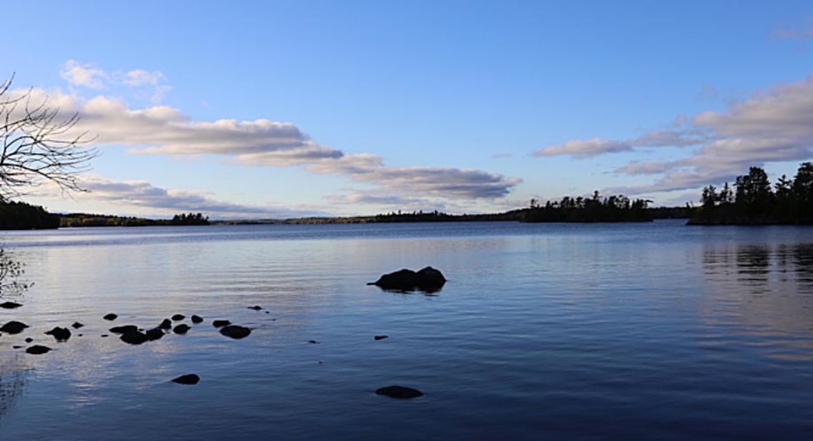
Special Shoreline
“Ecologically speaking, the protection of the shoreline on the lake is perhaps the greatest benefit of creating the park,” said Jim Essig.
In thirty years as Park Manager in Soudan, he reports a significant increase in large developments and private cabins on both the Cook and Tower ends of the lake. Though it is Minnesota’s longest shoreline, access to the lake was rapidly becoming an economic privilege until the state purchased this land. “This preserves the fish habitat that’s along the shoreline, but also the shoreline itself,” said Essig.
In order to protect the shoreline, the location of the new 33 campground sites and three new group sites are purposely located inland, to keep the native vegetation and habitat on the shore intact and undisturbed. This prevents erosion or run-off of nutrients that negatively impact the water quality and vital health of underwater vegetation in the food column. In turn, the fish remain in abundance, particularly award-winning walleye, small mouth bass and muskie.
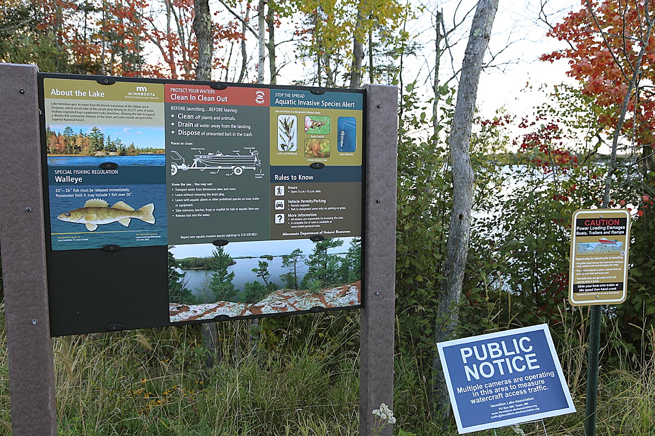
Inspired by the natural view of the shoreline from the water, volunteer residents of the Vermilion Lake Association manage two waterside picnic shore lunch areas with the U.S. Forest Service, as well as an Aquatic Invasive Species program. Its coordinator, Jeff Lovgren, encourages boaters to drain and clean their boats to help stop the spread of invasive species. This has been supported by the North St. Louis Soil and Water Conservation District, a contributing partner. “Currently, Lake Vermilion is most vulnerable to Eurasian Watermilfoil, Hybrid Watermilfoil, and Starry Stonewort. Documented infestations include Curly Leaf Pondweed, Rusty Crayfish, Chinese Mystery Snail and Spiny Water Flea. The lake does not yet show signs of zebra mussel and we believe these prevention methods will help keep that away,” said Lovgren. This group also conducts loon counts every year and reported seeing 195 loons on Lake Vermilion in 2019.
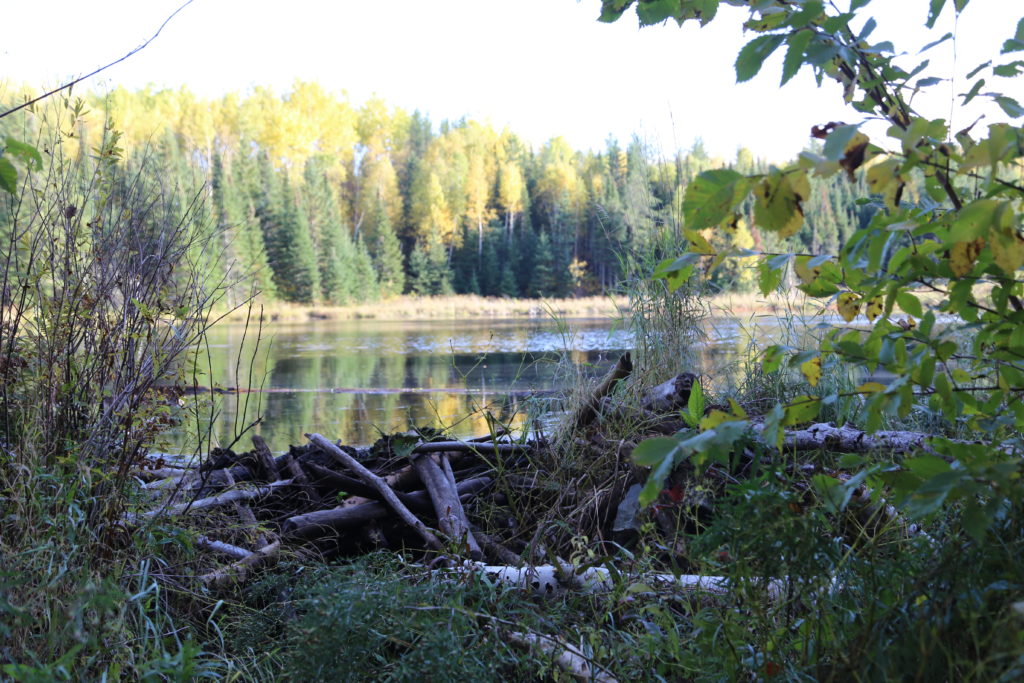
Habitat for Nature’s Engineers
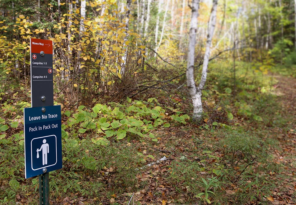
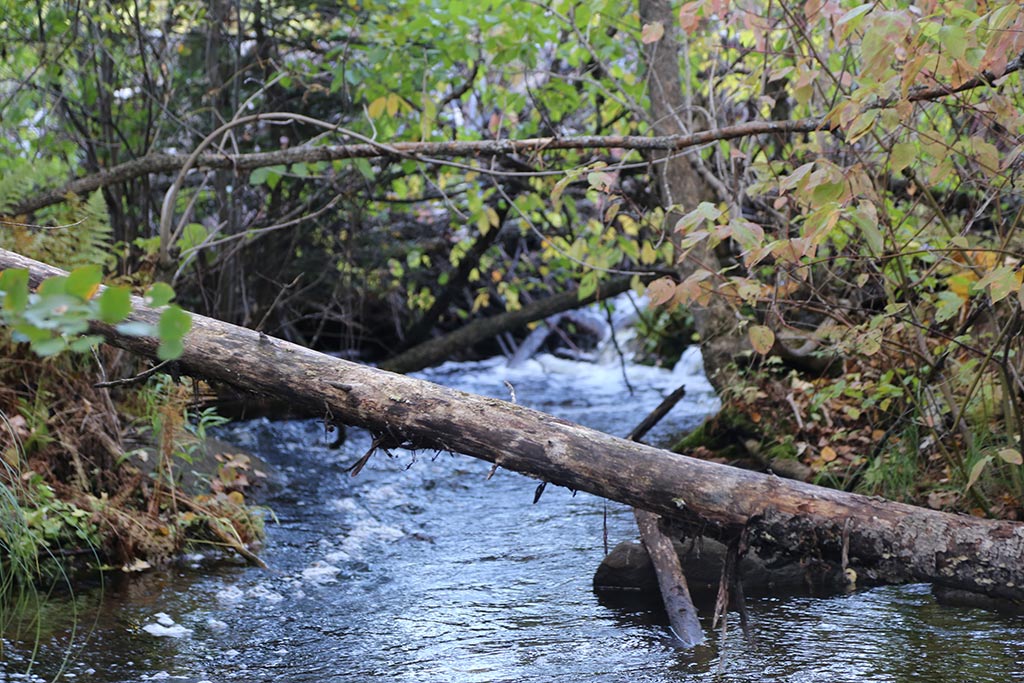
Much deeper inland, on a pristine ridgeline overlooking a wooded valley, five remote campsites are available for backpackers this spring. Hiking the nearby Wawa Way Trail means earning an opportunity to have an eye level view of a beaver’s den, visible from a wooden bridge. One sees the trickling creek on one side of the dam and an entire reservoir of water created on the other. This is part of an expansive Beaver Wetland Complex in the park. These wetlands act as a natural drainage system benefitting the water and wildlife in the park. According to the Wetlands Conservancy, they help slow the water flow down, create deeper and cooler pools preferred by trout and other fish, recharge the ground water and retain sediment. They also help clean and filter the water. Exploring this part of the trail requires waterproof boots and GPS-based location as they continue to develop this section of the park.
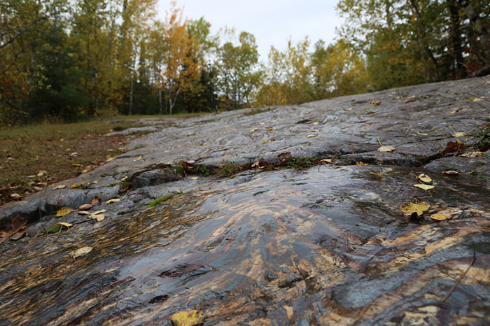
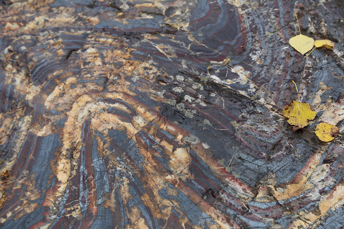
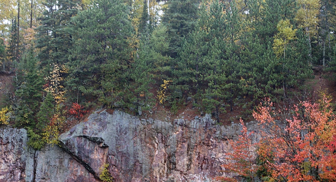
Geology – The Lure of the Bedrock and Banded Iron Formations
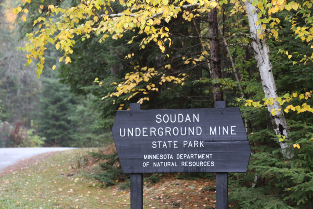
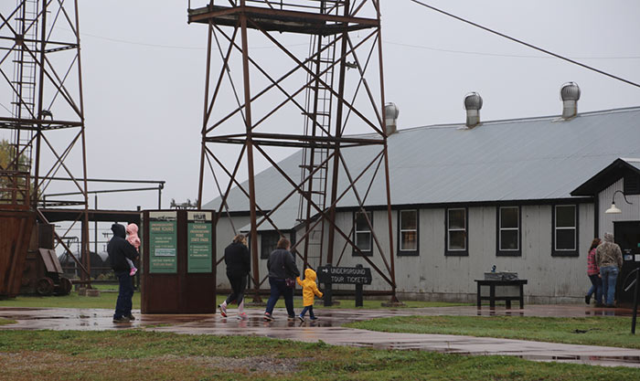
Since 1964, when the outdated Soudan Underground Mine re-opened as a state park, it has attracted 30,000 – 35,000 visitors a year who want to understand how mining historically worked and the geology behind it. Many have learned how iron ore was extracted from these bedrocks years ago from the first open pit mine in the late 1800s, and the subsequent underground mine.
Now, with the park’s expansion, camping opportunities and a scenic experience are available for its visitors who can stay for longer durations. This opens up flexibility for group programs and draws more people to the region.
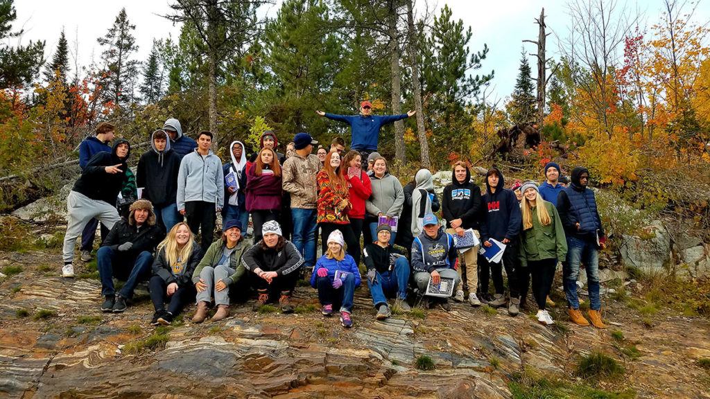
For a Wayzata high school geology class recently touring the mines, the park staff created a real geologist field experience in the new park area. Students identified volcanic and banded iron rock. They learned about Banded Iron Formations, historic volcanic activity, metamorphism and relevant glacial activity.
One student exclaimed, “an experience of a lifetime and one that I will surely never forget. I want to take my family back!”
International travelers frequently visit Soudan Hill to see one of most photographed rock outcrops of jasper, hematite and banded iron in the country. This natural banded iron formation sparks curiosity about how ancient ocean floors pressed and folded volcanic depositions into unique striations, draining and exposing these rock outcrops. It forms the Precambrian bedrock now found in the Vermilion Range from 2.7 billion years ago.
Newer fields of study have also been pursued here, including microbiology and energy physics. An underground laboratory studies ancient waters seeping in at the bottom of the mines and conducts particle physics experiments with the extreme depravation of cosmic radiation. With the expanded reach of the park, a wider breadth of subjects related to animals, plants, water and the land are now open for study.
Trails
The first phase of new hiking trail development has prioritized the Vermilion-Ridge Campground and new group sites near Cable Bay and the Armstrong Bay Day-Use area.
The new Wawa Way Trail leads to a long cross-cut trail, an old logging road currently used for snow-mobiling. A rougher section of this trail leads to the scenic Mattson Bay Overlook. Snowmobile trail maps are available through snowmobile clubs or the DNR. The Miner’s Trail is popular with the Hiking Club, located near the Soudan Underground Mine and Stuntz Bay.
For bicyclists, the paved Mesabi Trail was recently extended ten miles through the park. It will eventually connect 150 miles from Ely to the east and Tower/Virginia/Grand Rapids to the west.
How the Park Came to be – History to Today
In recent years, a group of local citizens shared their ideas on what they would like to see happen for an expanded state park on the southeast corner of Lake Vermilion. A more official plan came into place with the help of Governor Tim Pawlenty and his wife, Mary, who enjoyed attending the Governor’s Fishing Opener in 2008. On the table was a large parcel of land, 3,034 undeveloped acres, owned by the U.S. Steel Company who had designs for developing deluxe lake shore real estate. That year, state legislators designated the state park, followed by two years of negotiation for a final price of $18 million in 2010. The process was aided by State Senator Tom Bakk who helped summon support from the Iron Range community. In 2014, the boundaries between these two parks were legally removed and both properties became the Lake Vermilion-Soudan Underground Mine State Park.
Looking back through the history, the land was first inhabited by the Bois Forte Band of Chippewa, centuries before loggers and miners arrived from Europe. They knew that iron ore existed in the bedrock and shared samples with a U.S. Government blacksmith in the 1860s. Surveyor George Stuntz and George Stone secured backing from an investor from Pennsylvania, Charlemagne Tower, who invited Cornish miners to start the Soudan Mine in 1882. This formed the Minnesota Iron Company. It was eventually acquired by U.S. Steel. The mine’s ore was used in blast furnaces in order to make steel. Eighty years later, after technology advanced in taconite mining and furnaces no longer required this material, the mine was closed. U.S. Steel donated 1,229 acres of the land and the mine to the State of Minnesota in 1963. One year later, it was re-opened as the Soudan Underground Mine State Park offering public tours of the last working shaft, #8.
Today, as a result of a comprehensive plan drawn out by committed area residents with diverse interests, new exciting programs and features are being offered and planned for the park. The Citizen’s Advisory Committee reflected the values and perspectives of many, including boaters, paddlers, sportsmen, Ojibwe tribal leaders, bicyclists, anglers, campers, hikers, hunters, snowmobilers, and business leaders from Tower and Soudan.
These ideas were listened to and taken seriously, which was the most rewarding part of the process, recalls Steve Abrahamson, former Mayor of Tower. Two values being implemented are energy efficiency and water conservation. New solar technologies and grey water collection are currently being used in new park infrastructure.
Designed for Generations
Park amenities are designed to meet the needs and expectations of today’s visitors, and connect them to nature.
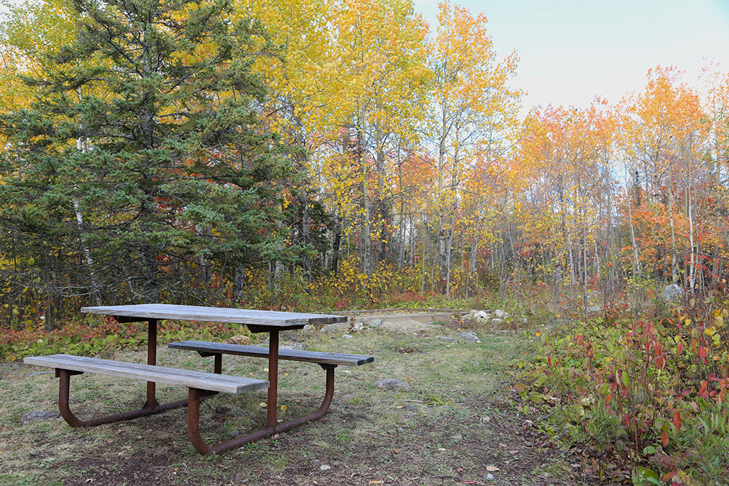
New pontoon boat tours offer visitors a chance to really see the breadth of the shoreline. For those who need to stay connected while experiencing nature, wifi is available throughout most camp sites. Recreational vehicle accommodations and water spigots are also provided at group sites, with screened pavilions, and at selected individual sites in the Vermilion-Ridge campground. These are designed to attract both the younger generation to the wilderness, many of whom have never experienced the beauty of the northwoods, as well as tried and true outdoor enthusiasts who appreciate the comfort of these amenities. The park includes a new fishing pier at Armstrong Bay and a boat launch on Cable Bay. Campers engage in canoe lessons, river outings, archery, geocaching, and astronomy programs.
In addition to the 8 camper cabins, there are two remote boat-in only campsites on the bays. In the 2020 camping season, one island near Mattson Bay will offer a house rental, and a lake lodge is also proposed to be funded.
Honoring Cultural Heritage
Two particular groups are highly significant to the history and culture of this park: the Bois Forte Band of the Ojibwe, also known as the Anishinaabe, and the local mining community of the Vermilion Iron Range. In honor of the treaty of 1854, free access to the park and traditional hunting, fishing and harvesting rights are granted to Bois Forte tribal members to respect their traditional use of resources, such as medicinal plants and birch bark, as well as the harvest of wild rice.

Discovering and Preserving History
The Bois Forte Band consults on key developments in the park. An archeologist conducts archeological research prior to development in the new park and they collaborate together to ensure that cultural history and archaeological sites are not disturbed. Tribal Elders annually tour the park. Group camp sites and eight future year-round cabins bear interpretive signage referencing Ojibwe customs and beliefs about constellations, seasons and the four cardinal directions. “We work with the band because we value them and we want to be respectful of their culture,” said James Pointer, the park’s Interpretive Supervisor.
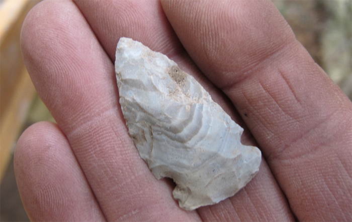
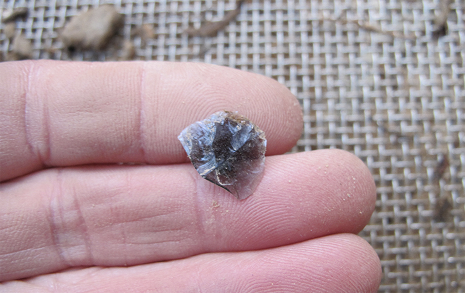
Archeologically, fascinating discoveries from digs on the Lake Vermilion side of the park have enriched the knowledge base of past Ojibwe life here. Obsidian stone artifacts found were traced back to Wyoming, specifically Obsidian Cliff in Yellowstone National Park, indicating a possible trade route between the tribes that was active hundreds of years ago. The obsidian was used to create better spear points and arrowhead points. In addition, newly discovered rock quarries indicate the Ojibwe were digging and harvesting chert which was used for projectile points, explains Dave Radford, the archaeologist for the Minnesota Department of Natural Resources. One chert artifact dates back to 5,000 – 7,000 years ago.
Preserving a Favorite Past-time
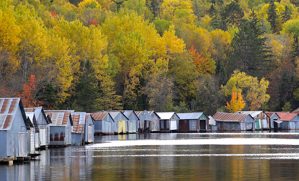
Fishing this body of water has remained a valued past-time by many, particularly the miners. Materials for 156 steel boat houses on Stuntz Bay were gifted to them in the early 1900s by their employer. When the mine closed, U.S. Steel issued leases to these families for the boathouses which are now listed on the National Register of Historic Places. The Stuntz Bay Boathouse Historic District is a part of the new park which honors the individual leases.
Community Sees Park as Draw and Benefit to Economy
As this new park on Lake Vermilion becomes more widely known, it is hoped by many citizens in the local communities that it will protect the natural environment in perpetuity and continue to attract people to this special part of the world. “There’s widespread optimism that the park has made a big difference and is going to make a big difference in the future of Tower,” said Marshall Helmberger, the Vice President of the Tower Economic Development Authority. Just as the Boundary Waters has initially attracted newcomers in local townships nearby, this new park provides another cherished attraction to the area with its beauty, solitude and outdoor experiences now easily experienced by the public.
MORE INFORMATION:
- Lake Vermilion-Soudan Underground Mine State Park
- Park Campground Map
- Uncovering History in Our New Park – MN Conservation Volunteer