


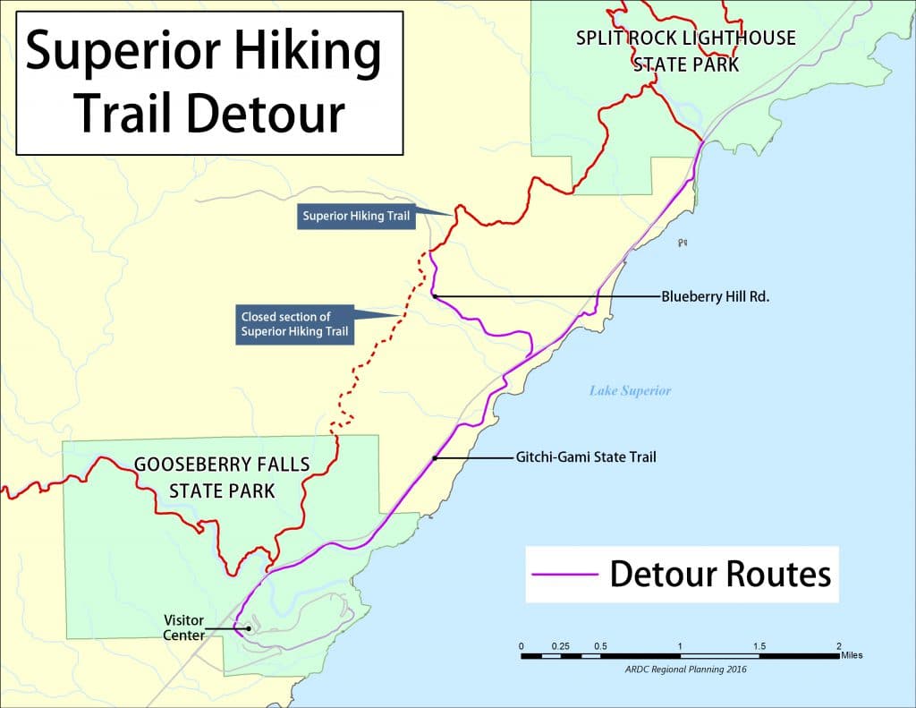
For more than five years, the Superior Hiking Trail has followed the Gooseberry River from the North Shore Highlands to Highway 61, and then sent hikers along paved trail and roads before rejoining the rugged trail.
For a trail with a reputation for twisting paths through wild forests, the detour was a disappointment – and an obstacle for the Superior Hiking Trail’s identity as a a continuous trail from the Canadian border to the Wisconsin state line.
But now, a new route that will keep hikers in the highlands has been identified.
“While we appreciate the value of the Gitchi-Gami State Trail, having [hikers] shunted onto roads and a paved, multi-use path is not a great hiking trail experience,” the SHTA says. “There are inherent dangers with roadwalks and highway crossings that we can eliminate with a separated route. The SHTA’s mission is to build, maintain, and manage a natural-surface footpath through the woods, and this reroute restores such a path.”
Problems arose with this stretch in 2015, when a private landowner who had previously allowed the trail to cross their property revoked the permission. The landowner blamed “rude” hikers who harassed him and his guests on his own land, left campfires burning, and otherwise acted irresponsibly.
“It wasn’t an easy decision,” landowner Randy Bowe told the Star Tribune. “We’ve had plenty of sleepless nights. But it came down to a few people spoiling it for everyone.”
Since then, the official route of the Superior Hiking Trail has detoured through Gooseberry State Park to the highway, and then followed the Gitchi-Gami State Trail for two miles next to Highway 61. From there, the route went back up to the trail on Blueberry Road. It was not ideal for several reasons, and the Superior Hiking Trail Association (SHTA) has now devised a permanent replacement route for the closed section.
The new route will not cross any private lands, or the state park, instead traversing primarily Lake County forest lands and some land owned by the state of Minnesota. It will take advantage of at least two existing snowmobile bridges.
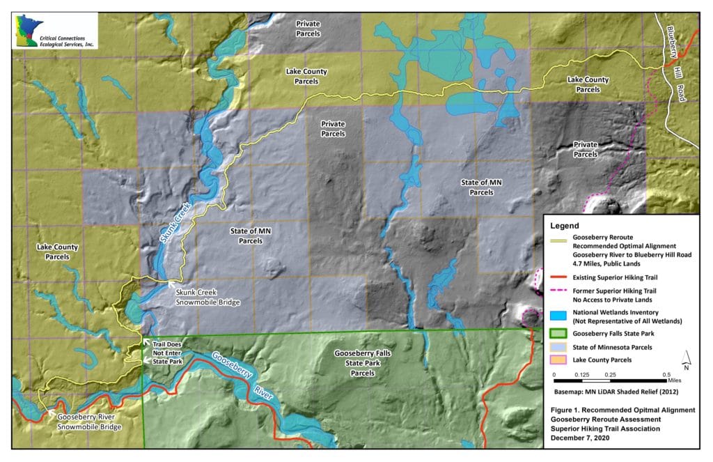
The SHTA says it has carefully designed a replacement segment that would be nearly five miles long, secured $60,000 in funding from the Iron Range Resources & Rehabilitation Board (IRRRB), and is otherwise ready to get to work.
But, once again, some trail neighbors have objected, even though the new route does not cross private property. “Some adjacent landowners have pushed back on the planned reroute, even though the Trail will be located entirely on State and County lands,” the SHTA reports.
The trail association says it has consulted with numerous experts to develop the route, and believes this new path is the best option. “We have worked with an environmental services firm to identify the best possible trail alignment that minimizes environmental impacts, appeals to trail users, and utilizes public lands for public recreation,” the SHTA says.
The route must be approved by Lake County before construction. Last month, the proposal was discussed at the county’s Planning Commission meeting, which tabled it rather than approving. The commission will instead vote on the reroute at its Feb. 22 meeting.
The SHTA is asking trail users to contact the Planning Commission in support of the route. Comments are needed by Feb. 15 and can be emailed to jill.paron@co.lake.mn.us.
More information: