


Of all the Superior Hiking Trail (SHT) day hikes, there’s one I’ve done more than all the others. Located just south of Duluth, it’s only about a 2-hour drive from the Twin Cities. While it seems to be popular with locals, I’ve never experienced the crowds other hikes, like Bean and Bear Lakes, are known for. Depending on how much time I have, I can choose to do an out and back, the whole loop, and I’ve even hiked out to the next trailhead and back. But for me, the real draw to Ely’s Peak is the dramatic beauty that comes with the changing seasons.

How to get to Ely’s Peak
I can’t recall how I ever discovered this hike but it’s been a favorite in our household as long as we’ve been exploring the area—nearly two decades. But for some reason, I still struggle to get myself to the proper trailhead. The Superior Hiking Trail’s official name of the trailhead is the 123rd Avenue West Trailhead. If you enjoy hiking, specifically on the SHT, I highly recommend picking up the latest copy of their official guidebook. In it, you’ll find everything you need to know about each section of the trail, including excellent directions to the trailheads and GPS coordinates. I always buy each new edition when it becomes available on Kindle so I can access it anytime from my smartphone.
The directions to Ely’s Peak from the Ninth Edition of the Superior Hiking Trail Guidebook can be found on page 52 and are as follows. “Northbound: Take I-35 Exit #246. Go south 4.5 miles on Becks Rd. to Commonwealth Ave./MN-23. Turn south, follow MN-23 3.8 miles, turn north on 131st Ave. W., go 0.4 miles to parking lot. Southbound: Take I-35 Exit #251B, go 8.7 miles, turn north on 131st Ave. W., go 0.4 miles to parking lot. GPS: 46.665863, 92.272477.”


Note that unless an SHT trailhead is part of a state park or the Superior National Forest, you will not find any facilities such as toilets, water, or trash. Bring what you need and pack out anything you pack in. Another important note about trailheads can be found on page 16 in the section titled Trailhead Etiquette. “Much like the Superior Hiking Trail itself, trailheads are to be shared and used responsibly. Park efficiently to save space for other users, and carpool to the trailhead whenever possible to reduce congestion. If a trailhead is full upon arrival, please find another trailhead to avoid crowding.” – Superior Hiking Trail Guidebook.
Hiking to the peak
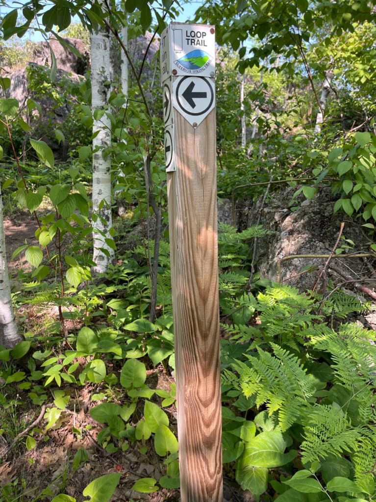
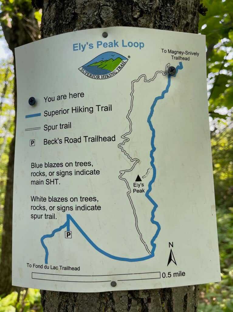
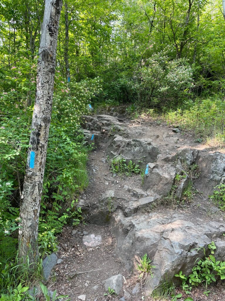
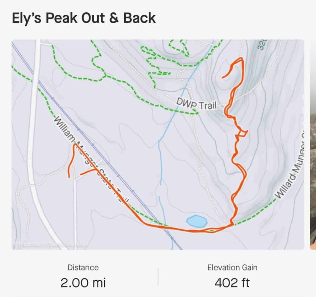
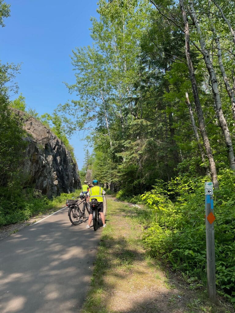
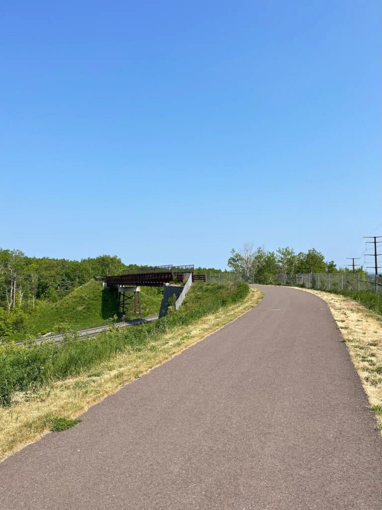
From the parking area, walk east toward the paved Willard Munger State Trail—another underhyped area gem. Follow the trail to the east/southeast. You’re heading in the right direction if you’re going toward the railroad bridge. You’ll follow the Munger Trail for about half a mile before you come to a junction where the SHT disappears into the forest off to your left. The trail is very well marked here with extra blue blazes. The main SHT is marked by light blue blazes (paint stripes) and spurs or loops are marked with white. You could take either the blue or the white trail here as they’re both part of the loop hike. But I find taking the main SHT trail—the blue-blazed trail—easier to navigate going counterclockwise. I also prefer to go up steep ascents rather than down. The spur trail going down is much gentler on my old knees.
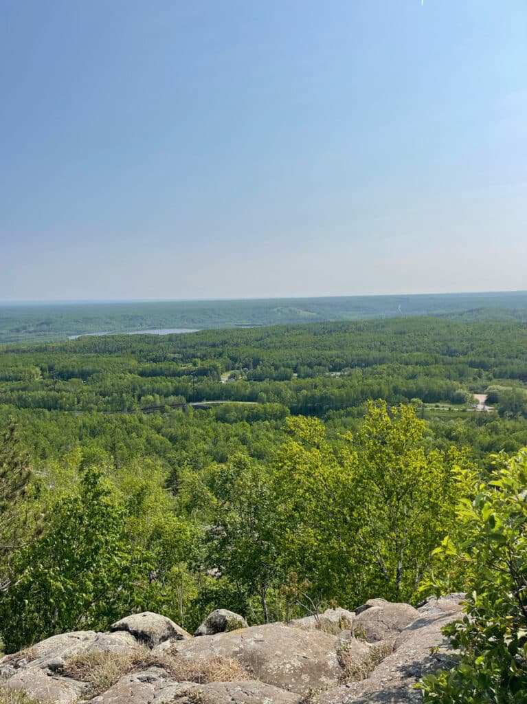
From the junction with the Willard Munger State Trail, you’ll climb about half of a mile before a small sign that will lead you to Ely’s Peak. There are plenty of scenic vistas to stop and catch your breath so be sure an allow yourself plenty of time. Many of the vistas you’ll admire in this section are of the St. Louis River Estuary, one of the largest freshwater estuaries in the country and the largest US tributary to Lake Superior. You can learn more about the importance of this estuary here.
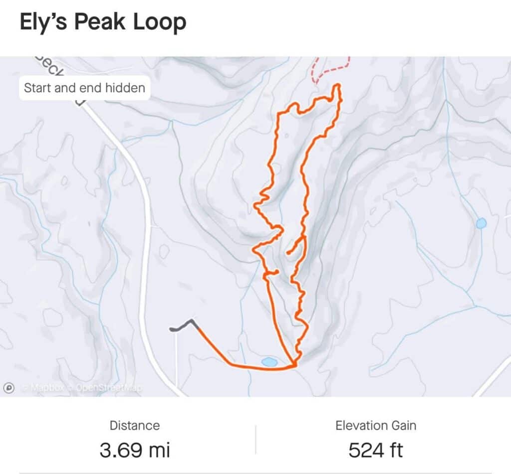
After taking it all in, you can either go back the way you came for an out-and-back hike of approximately two miles. But I highly recommend continuing north to finish the loop. Continue on the main SHT trail for about another half of a mile to reach the white-blazed loop trail. It’s just a short hike to Larry’s Lookout, overlooking Ely’s Peak. From there the trail makes a gentle descent through the forest.
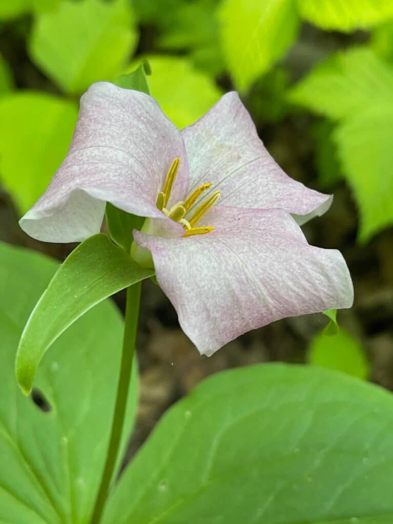
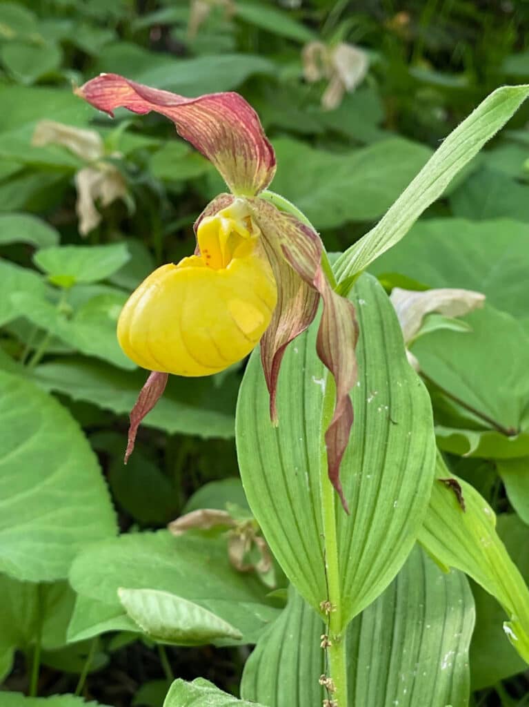
While the main attractions of this hike are the peaks and overlooks, some of my favorite delights are found on the forest floor. If you visit in the late spring to early summer, you’ll be treated to the most beautiful blanket of trilliums I’ve ever encountered. And a bit later in June keep an eye out for my favorite Lady’s Slipper—the cypripedium parviflorum—the Yellow Lady’s Slipper. You’ll also want to watch for a section of poison ivy along the spur trail.

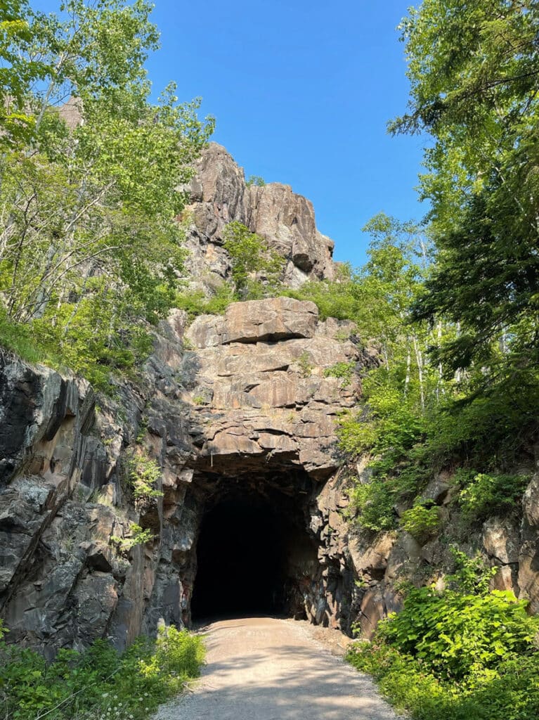
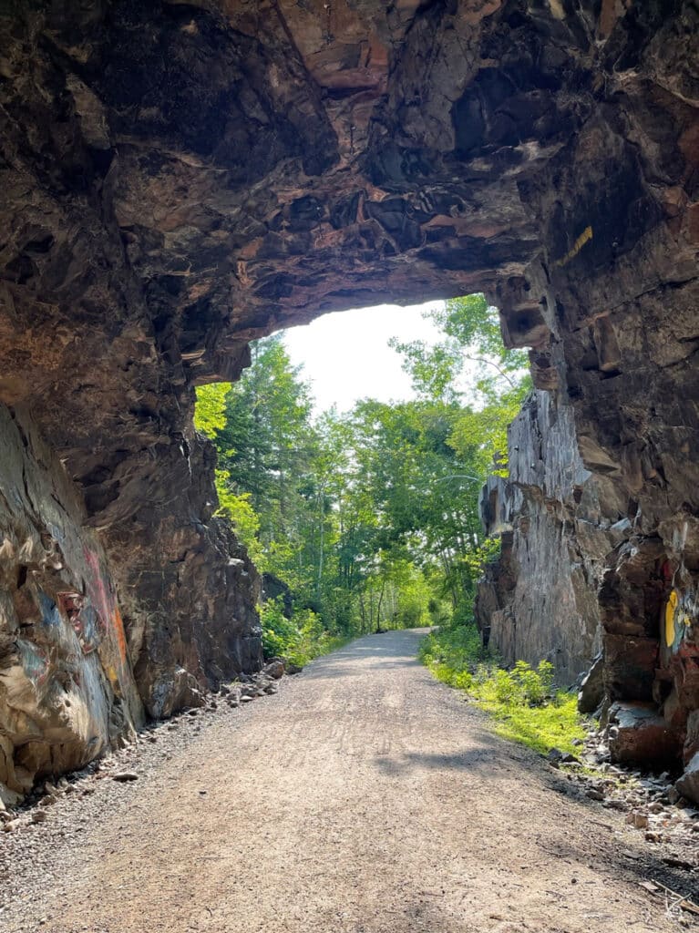
As you make your way to the end of the spur trail, you’ll want to pay close attention to the white blazes since the SHT crosses paths with the DWP (Duluth Winnipeg, and Pacific) railroad trail and mountain bike/multi-use trails. And you won’t want to miss the tunnel that makes its way under Ely’s Peak. After you’ve explored this man-made wonder, it’s just a short hike back to the Willard Munger State Trail and the trailhead parking lot.
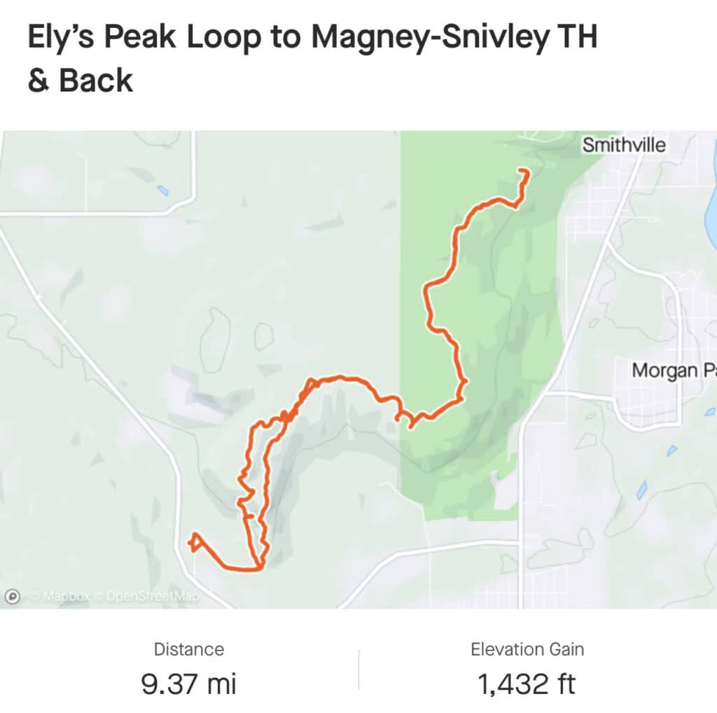
If you’d like to do a longer hike, rather than turning onto the spur trail after Ely’s Peak, you can continue north toward the Magney-Snivley Trailhead. This is a beautiful section of trail over babbling creeks and through an old-growth forest. If you go all the way to the Magney-Snivley trailhead and come back and finish the loop you’ll hike a total of around nine miles.
When to visit Ely’s Peak
I’ve already mentioned how spectacular the wildflowers are in late spring and early summer but this hike is a treat year-round. Considering that it’s relatively “easy” by SHT standards, this makes a great winter trail for hiking and snowshoeing. Although not all SHT trailheads are accessible during the winter, this one is. Again, all of this information is available in the Guidebook. There’s also a plethora of information on their website here.
Of course, all the peaks and overlooks make this a nice stop on any fall colors tour. When it comes to fall colors anywhere along the North Shore, I always recommend going early and better yet, on a weekday if your schedule allows.
Ely’s Peak is one of the shorter and “easier” hikes on the SHT. And the loop spur trail makes it perfect for a day hike. Whichever season you decide to go, be sure and go back to see what mother nature has to offer in the next season. You’re sure to be delighted.

Learn More:
SHT Sections – MN/WI Border to Duluth
The Superior Hiking Trail Guidebook
Find the digital version on Amazon
Learn more about the Willard Munger State Trail
Explore the stories and science of the St Louis River Estuary
Holly Scherer is a Minnesota-based writer, photographer, outdoorswoman, and guide. She’s most at home in the great outdoors; camping, hiking, paddling, cycling, and gardening. When she’s not on an adventure, she and her husband live in the Twin Cities where they’re fond of saying, “home is where we store our outdoor gear.”