President Theodore Roosevelt establishes Superior National Forest in February. Ontario establishes Quetico Forest Reserve in April.
1913
Quetico Forest Reserve status officially changed to Quetico Provincial Park.
1919-1922
U.S. Forest Service’s Arthur Carhart develops the first recreation plan for the Superior National Forest in response to the influx of people seeking recreation. The plan favors primitive recreation over roads.
1923
An alternate plan favors building “a road to every lake” in the Superior National Forest. Controversy arises over management of the forest.
1925
Lumber baron Edward Backus submits proposal to International Joint Commission to build series of dams along international border waters, raising water levels by as much as 80 feet, and to log off shoreline pine. Opposition to plan led by Ernest Oberholtzer.
1926
U.S. Secretary of Agriculture William Jardine establishes 640,000 acres of wilderness area in Superior National Forest in response to road controversy. Initially called Superior Wilderness, and later Superior Roadless Area, it is the nation’s second wilderness area.
1930
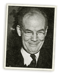
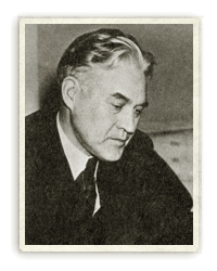
Congress passes Shipstead-Newton-Nolan Act which withdraws all federal land from homesteading, prevents alteration of natural water levels by dams, and prohibits logging within 400 feet of shorelines in Superior National Forest.
1930 – 1941
Portage trails are built by the Civilian Conservation Corp, under Roosevelt’s recovery program during the depression.
1933
Minnesota passes legislation providing state lands with the same protection Shipstead-Newton-Nolan, further protecting parts of the Superior National Forest.
1934
President Franklin D. Roosevelt establishes President’s Quetico-Superior Committee. International Joint Commission ruling ends Backus’s plans.
1943
Izaak Walton League of America Endowment forms to purchase private lands and resorts in Superior Roadless Area.
1948 – 1976
Congress passes Thye-Blatnik Act, providing authority and funds for U.S. Forest Service to buy resorts, cabins, and private lands in Superior Roadless Area. The Act is extended and funded three times: in 1956, 1961, and 1976.
Forest Service issues new management plan for roadless area, establishing a “no-cut” area and limiting motorboats to where they had become established.
1949
President Truman issues executive order prohibiting flights over Superior Roadless Area below 4,000 feet mean sea level, eliminating fly-ins.
1958
Forest Service changes name of Superior Roadless Area to Boundary Waters Canoe Area.
1964
Congress passes Wilderness Act after eight years of debate. BWCA is officially included in National Wilderness Preservation System. The Act prohibited the use of motorboats and snowmobiles within wilderness areas, with exceptions for areas where use was well established with the BWCA.
1965
U.S. Secretary of Agriculture issues 13 directives dealing with BWCA, adding to no-cut zone, zoning for motorboats, establishing visitor registration and more.
1971
Ontario announces moratorium on logging in Quetico Provincial Park.
1972
President Nixon issues Executive Order prohibiting use of snowmobiles and recreational vehicles in all national wilderness areas.
1975
217,000 acre Voyageurs National Park established. Secretary of Agriculture imposes off-road vehicle ban in the BWCA.
1978
On October 21st President Carter signs the Boundary Waters Canoe Area Wilderness Act into law. It ends logging, reduces motorboat lakes, phases out snowmobiling, restricts mining, and expands BWCA by 68,000 acres. Name officially becomes Boundary Waters Canoe Area Wilderness.
Ontario re-classifies Quetico Provincial Park as a wilderness class park, with no logging or motorboat use.
1993
The U.S. Supreme Court let stand a lower court ruling that required Four Mile Portage, Prairie Portage and the portage between Lake Vermillion and Trout Lake be closed to motor vehicles. BWCAW Management Plan approved by Superior National Forest; appealed and upheld by 8th United State District Court.
1994
Ontario signs Agreement of Co-Existence with Lac la Croix First Nation, opening up almost one-third of Quetico Provincial Park to 10 hp motorboat guiding by band members, as well as some float plane access.
1996-1998
Four bills are introduced in the U.S.Congress, three add motorized use (trucks and motorboats) and one reduces motorized use. Federal mediation process over motor portages as sought by U.S. Senator Paul Wellstone results in no consensus.
BWCAW rider to unrelated transportation bill re-opens Trout and Prairie Portages to truck traffic and closes Alder and Canoe Lakes to motorboats.
1999
July 4th blowdown affects 300,000 acres within BWCAW; Quetico Provincial Park also affected, though not as extensively.
2001
Forest Service releases new plan to use prescribed fires within BWCAW to treat July 4th blowdown.
2006
Federal appeals court upholds lower court ruling that rejected 2002 U.S. Forest Service increase in motorboat quotas on the Chain of Lakes.
Cavity Lake Fire burns over 31,000 acres in Seagull-Gabimichigami Lakes area near end of Gunflint Trail, the largest fire in BWCAW since 1894.
2007
Ham Lake Fire burns more than 36,000 acres near end of Gunflint Trail in Superior National Forest and another 40,000 acres in Ontario. Most of U.S. fire was outside BWCAW along Gunflint Trail corridor.

William I. Nolan, 1936

Henrik Shipstead, 1939
Photographs from the book Saving Quetico-Superior, A Land Set Apart

