


The ultimate spring waterfall road trip
A friend that grew up in northwestern Minnesota returned from a trip to the Arrowhead region with his family. I will never forget his enthusiasm—“It was incredible,” he exclaimed. “Majestic! I had no idea there were places that are so majestic in Minnesota.” That word—majestic—has stayed with me on every trip I’ve taken since. I’ve long since lost track of how many trips I’ve taken to Minnesota’s majestic Arrowhead region, but every time I get the same feeling. I can’t believe that there are places in Minnesota that are as majestic as these, among the many must-see natural attractions are the breathtaking waterfalls.
Established in 1909, the three-million-acre Superior National Forest offers endless opportunities for hiking, boating, camping, fishing, and skiing. The one-million acre Boundary Waters Canoe Area Wilderness lies within the Forest, butting up against Minnesota’s only national park, Voyageurs National Park, to the west. Traveling east from the forest, all roads lead to the north shore of Lake Superior. Instead of mega-resorts and attractions, you’ll find a handful of charming small towns and eight state parks, it’s a nature lover’s paradise.
The Arrowhead’s waterfalls are spectacular year-round
Shrouded in emerald green foliage in the summer, golden aspen and birch in the fall, frozen with freshly fallen snow in the winter—I am most humbled by their roaring power during the spring thaw. While every waterfall in this region is worth the trip, I’m focusing on these for their beauty, uniqueness, and smaller crowds. If you have time to make additional waterfall stops along the way, you will not be disappointed. Just don’t miss these. To make your planning easier, I’ve laid these out in a way that would make a great Minnesota waterfall road trip.
Minnesota’s most majestic spring waterfalls:

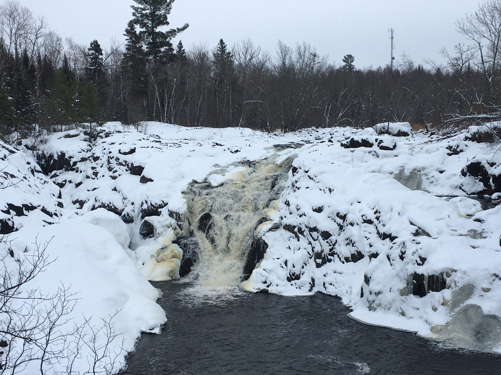
Kawishiwi Falls in winter. -
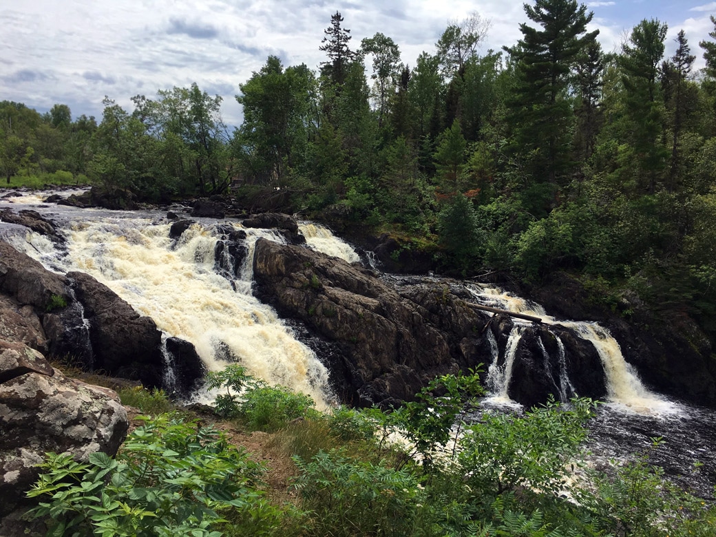
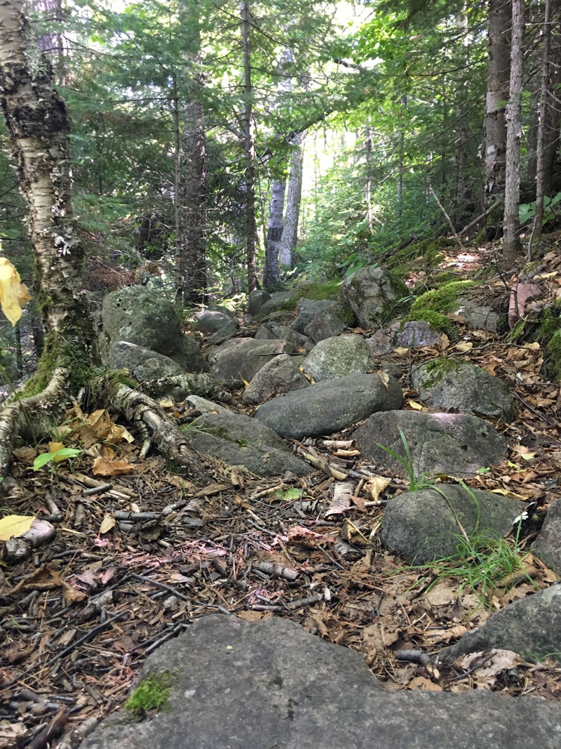
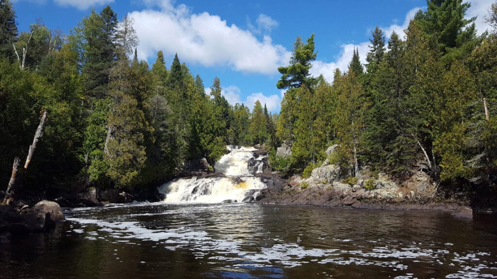
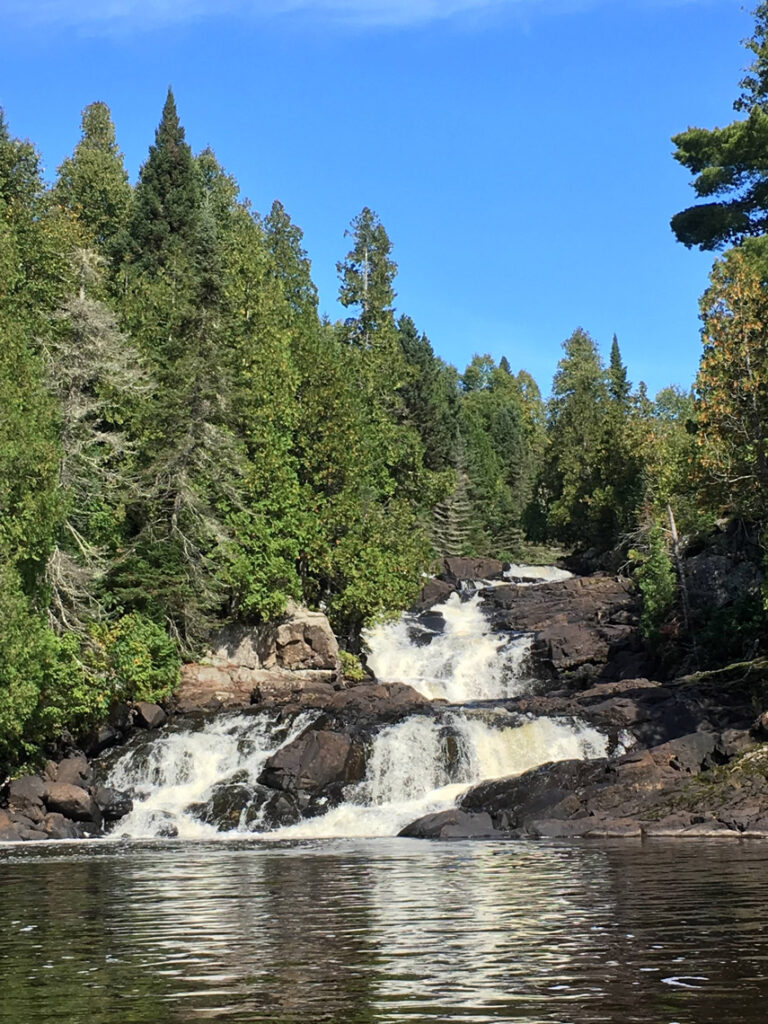
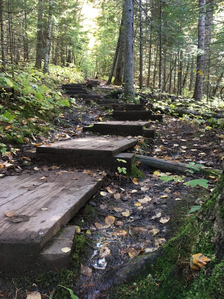
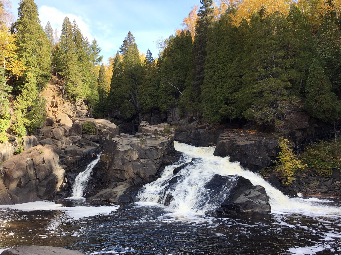
Kawishiwi Falls
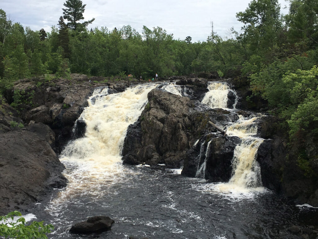
Kawishiwi Falls
When most people think of Minnesota waterfalls, they automatically think of the north shore. But there are wonderful and less visited waterfalls all around the Ely area as well. I chose these falls for their ease and accessibility. The trail to the falls is easy and less than a mile round trip. There are several wonderful overlooks where you can capture great photographs or simply sit and enjoy the raging waters. Less than six miles outside of the town of Ely, this is a great place to start or end your waterfall adventure.
Kawishiwi Falls Trail Map and Guide
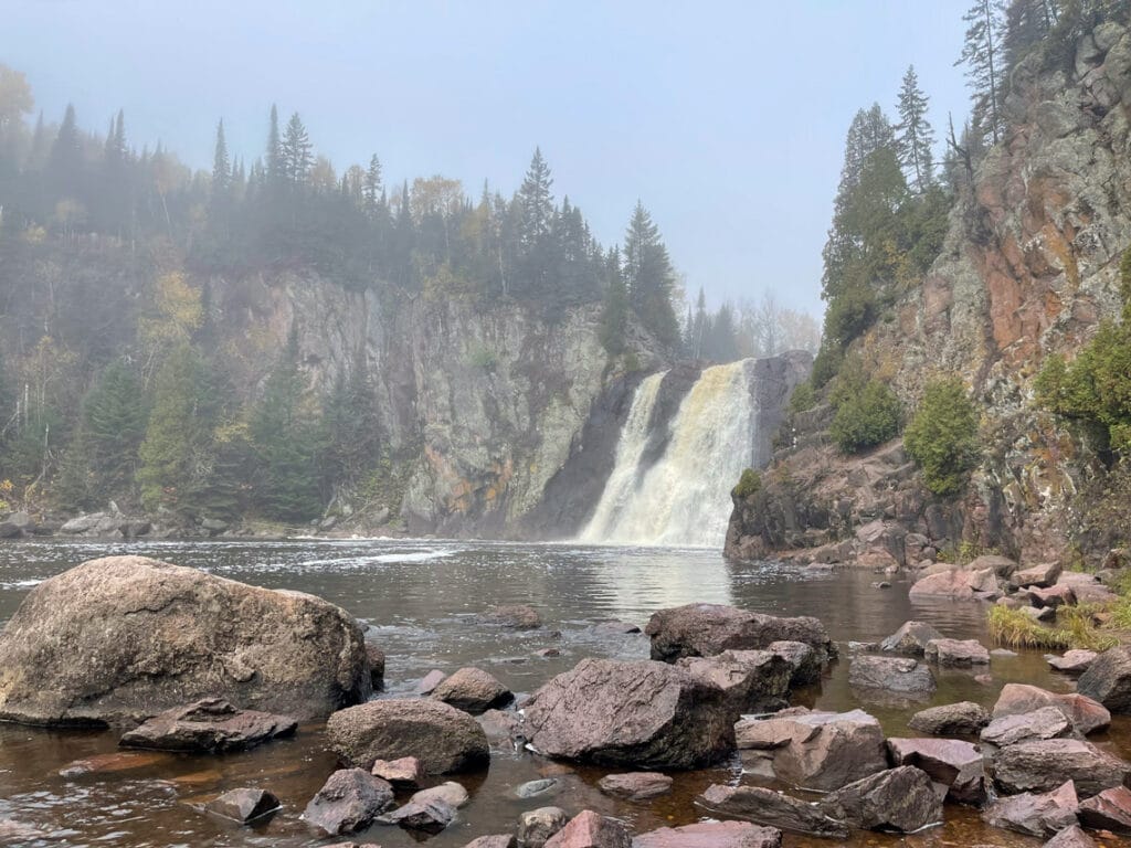
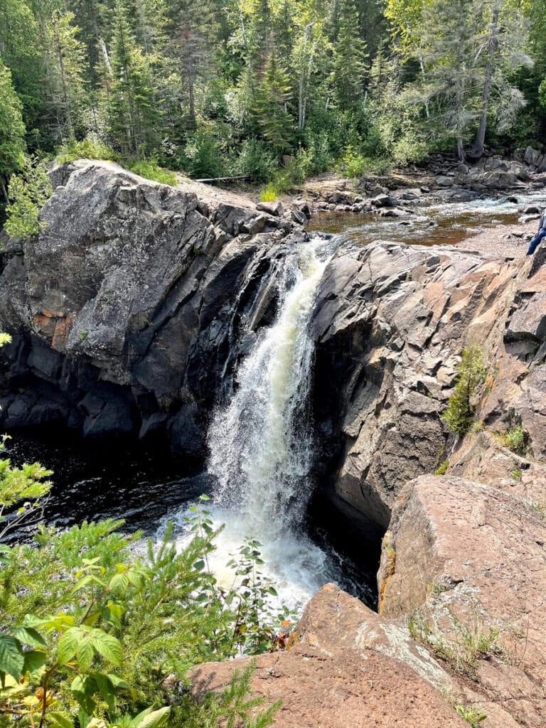
The Cascades of the Manitou River
Heading 67 miles southeast toward the north shore along stunning Minnesota Highway 1, you’ll make your way to George Crosby Manitou State Park. This is one of my favorite state parks in Minnesota for solitude. If you don’t already have a Minnesota state park permit, be sure to stop at the self-service kiosk before you park. There are very few spots in the park with wireless service, so be sure to download any maps or directions you’ll need before you arrive. This is a wonderful spot to enjoy a picnic lunch on the shores of Benson Lake. There’s a picnic area just beyond the canoe launch.
From the parking lot, find the sign for Middle Trail. It’s near the pit toilet and hard to miss. Just remember that it’s the *middle* of the three trails that start there. The Middle Trail is one of the easier trails in the park, yet much more rugged than what you’ll find in other Minnesota state parks. Watch your footing and take it slow and steady. You may want to carry traction and trekking poles in your daypack in case you encounter lingering ice on the trail.
The Cascades are about a mile from the parking lot. Don’t be surprised if you have them all to yourself, especially if you make the trip on a weekday. Once you’ve soaked in all of the solitude you can handle, return the way you came or use the Humpback Trail to complete a three-mile loop. For more experienced hikers, continue down the Manitou River Trail to either the Yellow Birch or Cedar Ridge Trails. Stop and take in the smaller falls and scenic overlooks along the way. If you have more miles in you, add on the easy one-mile loop around Benson Lake. If you have the time, it’s easy to spend an entire day exploring the rugged solitude of this spectacular Minnesota state park.
George Crosby Manitou State Park Trail Map and Guide

The Cascades at George Crosby Manitou State Park. 
Overlooks along the trail at George Crosby Manitou State Park. -
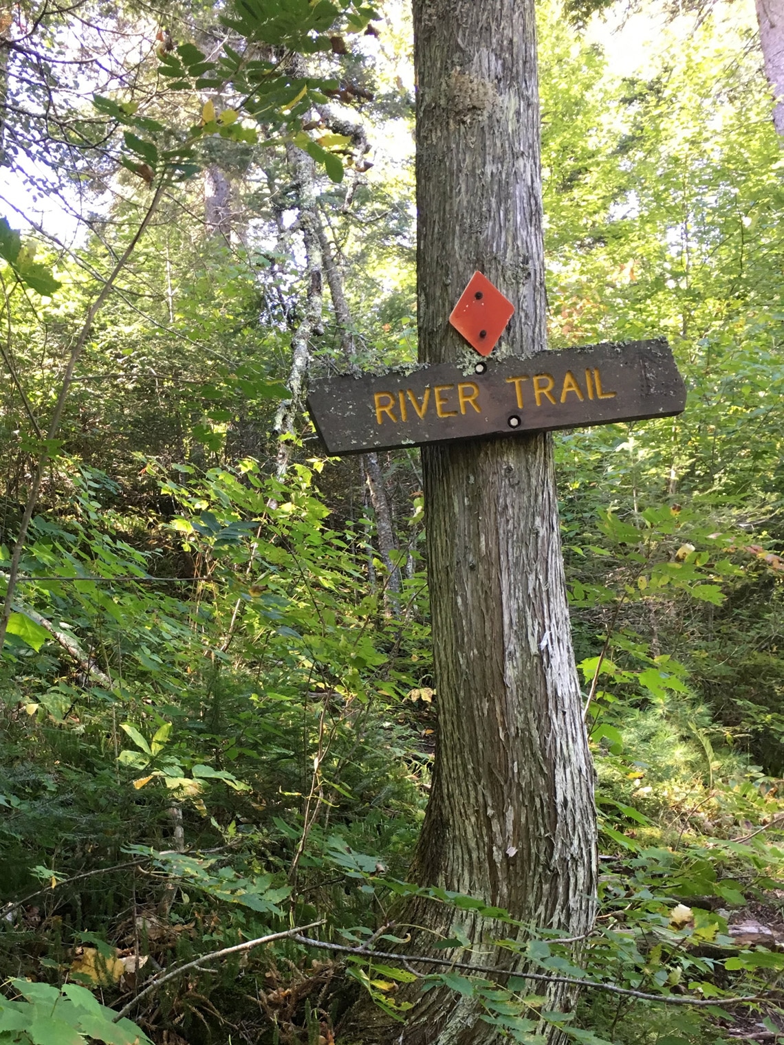
The River Trail at George Crosby Manitou State Park. -
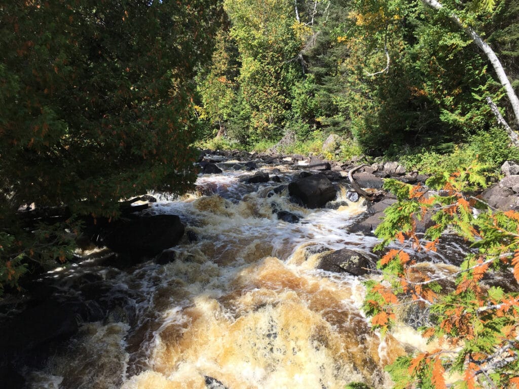
Rapids under the Superior Hiking Trail bridge.
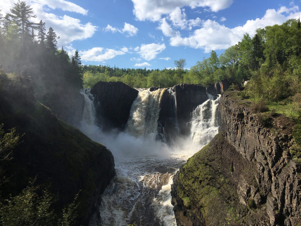
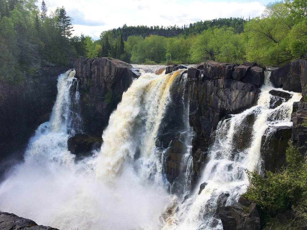
The High Falls of the Baptism River
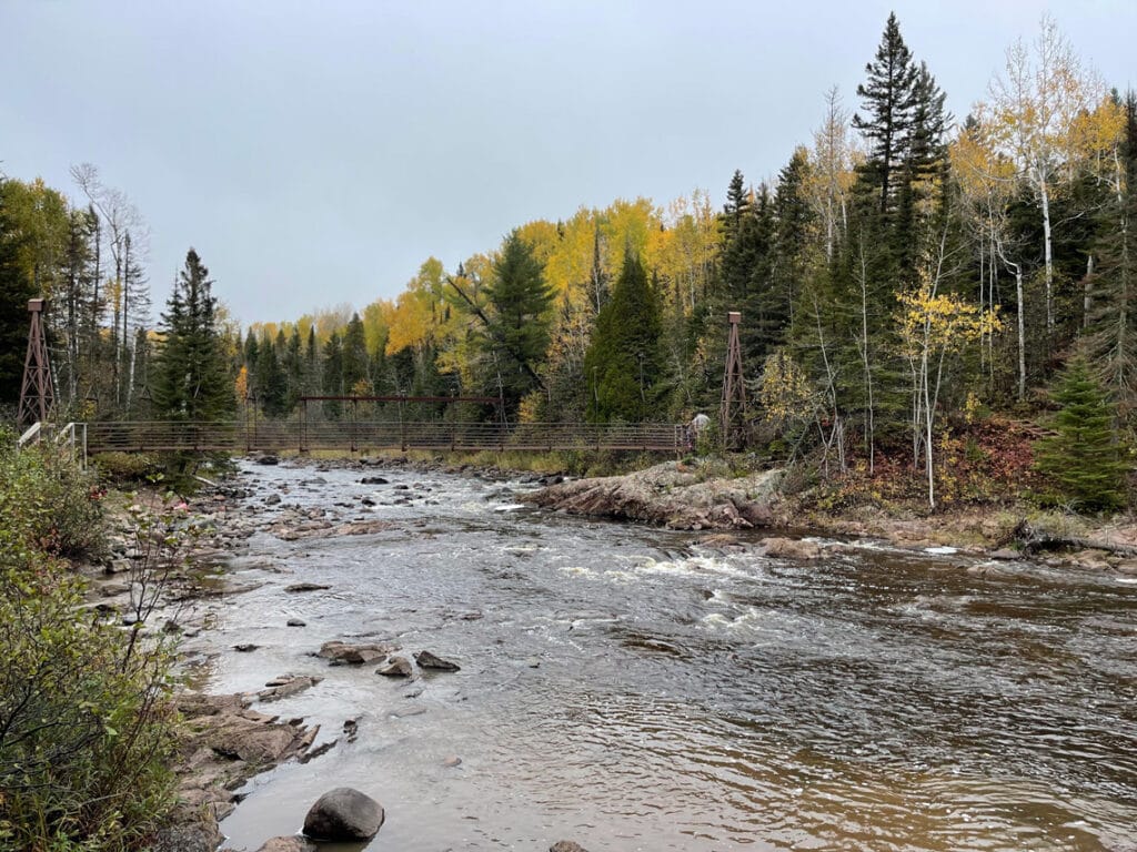
From George Crosby Manitou, it’s a short 15-mile drive to Tettegouche State Park. This is my favorite Minnesota state park and a must-see for Minnesota residents and visitors alike. Along with some of the most majestic features on Lake Superior’s shoreline, Tettegouche features the highest waterfall completely within the boundaries of the state of Minnesota.
The High Falls can be reached by following the trail along the Baptism River from the Visitor Center or from the main trailhead inland beyond the Baptism River Campground. A parking permit is required for the main trailhead. If you didn’t get one from one of the other parks on your waterfall tour, you can purchase one in the modern Visitor Center.
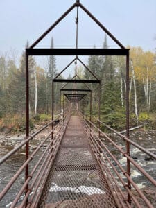
Whichever way you take to the High Falls, don’t miss a side trip to the swinging bridge and Two Step Falls. There are steps down to Two Step Falls on both sides of the river and both are worth the climb out. Expect mud and maybe some ice along the trail. The best practice for muddy trails is to embrace the mud so we don’t widen the trail and damage the supporting plant life along the trail. Bring extra socks and footwear you don’t mind getting dirty.
Tettegouche State Park Trail Map and Guide
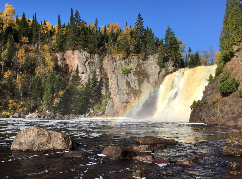

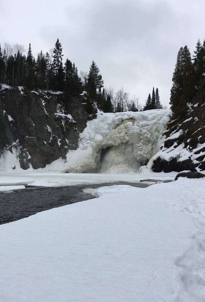
High Falls of Baptism River at Tettegouche State Park in winter. -
Trail to High Falls 
Swinging bridge above the High Falls. -
Bridge above the High Falls of the Baptism River. 
Two Step Falls at Tettegouche State Par. -
The Cascades at Tettegouche State Park.
Bonus waterfalls most people miss
Like George Crosby Manitou, you could spend an entire day, if not a week, in Tettegouche state park. Here are a couple more waterfalls that most people miss.
As you’re making your way from George Crosby Manitou, you’ll find a gravel pull-off along Highway 1, approximately 1.5 miles from Highway 61. The pull-off will be on your right if you’re heading toward the lake. Once parked, follow the well-worn path to Illgen Falls. It’s an easy hike and less than a mile round trip.
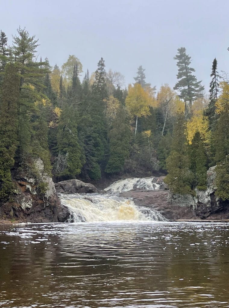
Back inside the park boundaries, you won’t want to miss The Cascades of the Baptism River. These are an easy side trip to add to your hike to the High Falls from the Visitor Center. From the Visitor Center, cross over the bridge that connects the park entrance to the main trailhead. Shortly after you cross the bridge, lakeside, you’ll see a sign to The Cascades. Follow the trail upstream on the opposite side of the river you took to the High Falls. The trail dead-ends at The Cascades. Don’t be surprised if you have the place to yourself during non-peak times.
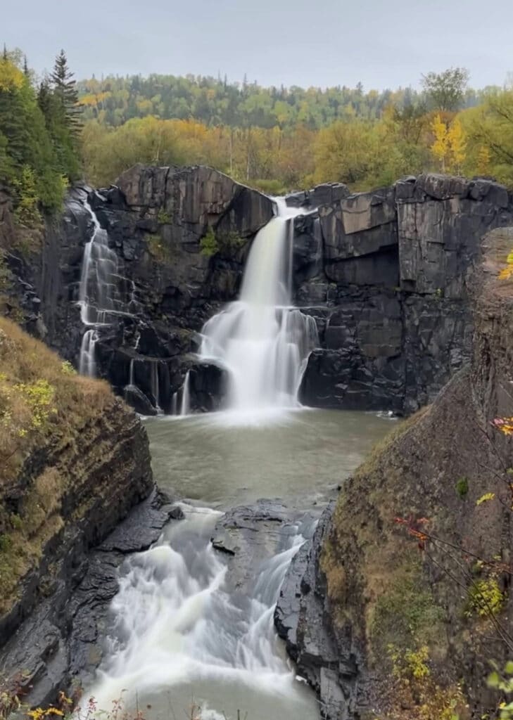
High Falls of the Pigeon River
91 miles up the north shore you’ll arrive at the Canadian Border and Grand Portage State Park. The High Falls of the Pigeon River are among my favorite falls in Minnesota—and as I think about it, among the best in the world. If you go on a sunny day, look for rainbows in the powerful spray.
The hike to the High Falls is an easy one-mile round trip and mostly paved. Stop along the way to read interpretive signs about the Ojibwe’s beautiful relationship to these lands. There are several landings with overlooks you won’t want to miss when you arrive at the falls.
If you’re up for an adventure, the Middle Falls Trail is a rugged voyage. Expect plenty of mud and the solitude that comes with it. This trail is challenging, so bring plenty of snacks and water.
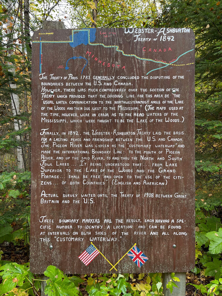
As you make your way back, continue past the Visitor Center, parking lot, and selfie station to find a historic site that details the history of the international boundary between the US and Canada. It took me 15 years to discover this hidden gem. It’s a short hike and you don’t want to miss it.
Grand Portage State Park Trail Map and Guide
-
High Falls of the Pigeon River at Grand Portage State Park. -
History of the international border at Grand Portage State Park. 
High Falls at Grand Portage State Park. -
The High Falls of the Pigeon River, seen from the Pigeon River Provincial Park in Canada.
After visiting these waterfalls in Minnesota, you’ll want to return again and again. You’ll want to see them cloaked in fall colors and freshly fallen snow. You’ll want to see them after heavy rains and during times of drought. And despite the long winters and buggy summers, you’ll swear up and down that Minnesota’s arrowhead is among the most beautiful and majestic places in the world.
Editor’s note: Google map locations are approximate, see links above for detailed information.
Holly Scherer is a Minnesota-based writer, photographer, outdoorswoman, and guide. She’s most at home in the great outdoors; camping, hiking, paddling, cycling, and gardening. When she’s not on an adventure, she and her husband live in the Twin Cities where they’re fond of saying, “home is where we store our outdoor gear.”