

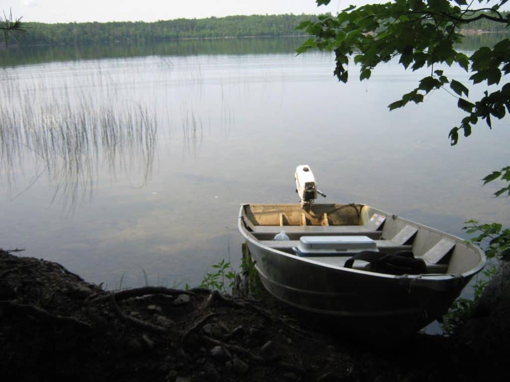
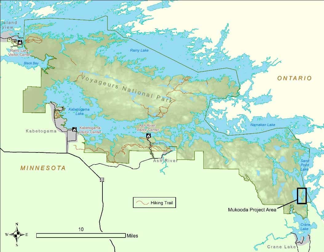
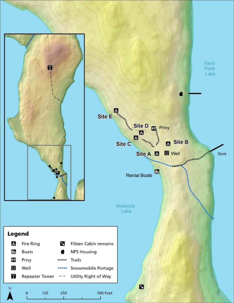
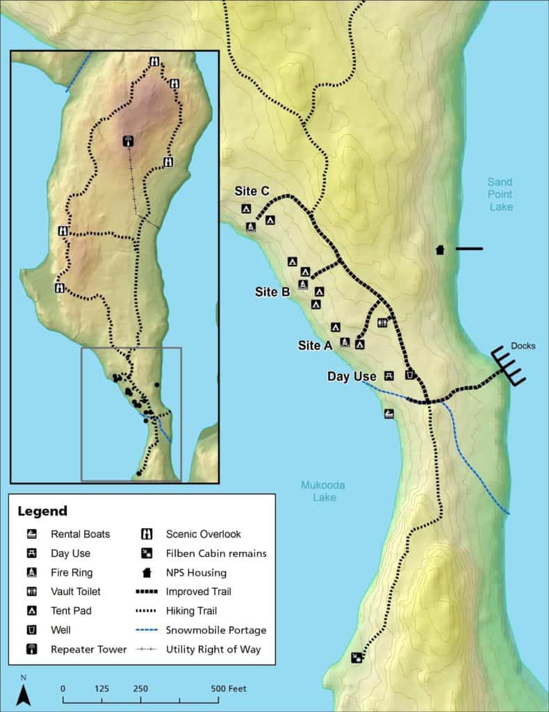
The National Park Service recently approved a plan to develop three campsites, a hiking trail, and a day use recreation area on Mukooda Lake in Voyageurs National Park. The location is on an isthmus between Mukooda and the larger Sand Point Lake. A dock on Sand Point and a portage trail connects to the sites, which face Mukooda.
The state of Minnesota established a campground at the location in the 1950s, before the park was created in 1975. The National Park Services manages it today, but the campsite features and design are outdated. One critical lack is tent pads which provided a better visitor experience and help prevent erosion and campsite sprawl.
“There is a need to update the Mukooda Lake campground because it does not meet Voyageurs National Park campsite construction standards and the current location of some sites are affecting cultural resources in the area,” the National Park Service wrote. “Further, the current dock on Sand Point Lake is insufficient to serve the needs of visitors to Mukooda Lake. The park desires to address these issues to accommodate current use and predicted increases at Mukooda in the future.”
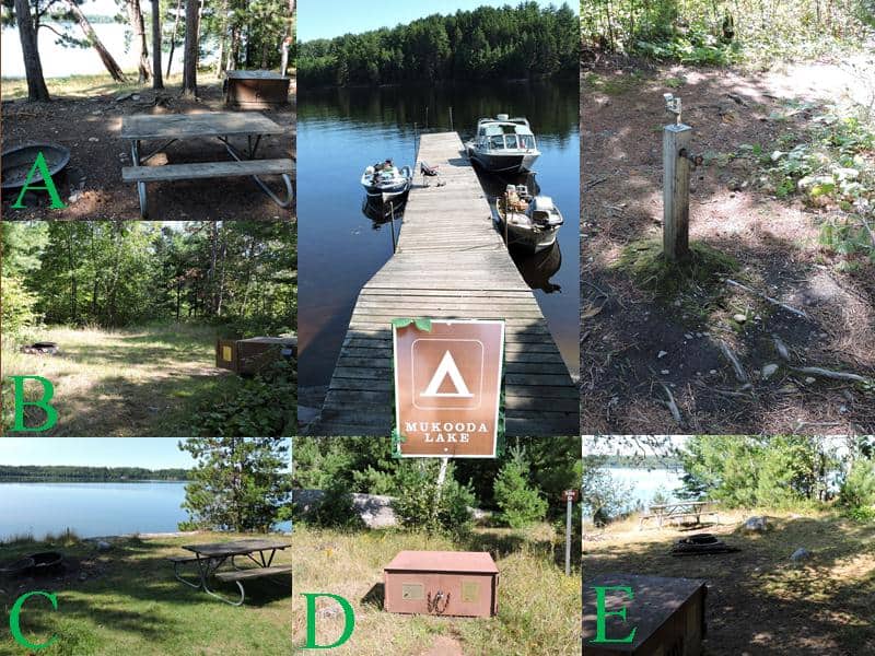 The redevelopment project will remove two less-used campsites, and upgrade three existing sites. Two sites with two tent pads each, and one site with four tent pads, will be be located along the shore, with one vault toilet and well available. All three sites will include tent pads, bear-proof food lockers, fire rings, and picnic tables.
A day use area with picnic tables will also be added, hopefully lessening conflicts between people who are camping and those visiting for a short time. A short trail will connect the area to a historic cabin site to the south.
A longer trail to the north of the campground will offer scenic overlooks of Mukooda and Sand Point lakes. The new hiking trail will be the first one in the eastern half of Voyageurs. It was first included in the Park’s 2000 management plan, but not pursued until now.
The Ojibwe name for the Mukooda Lake is Ga-namegosikag-zag (which translates as Trout Lake), according to a missionary working in 1911.
During a comment period earlier this year, the Bois Forte Band of Ojibwe, which still has treaty rights covering the region, voiced concerns about expanding the campground facilities. They said it could lead to increase use, possibly harming archaeological sites in the area, and diminishing solitude.
In response, the Park Service said it had revised the trail plan to remove one short section that would help avoid historic areas. It also pledged to increase capacity at the docks on Sand Point in phases. Instead of 10 as originally proposed, the number of slips will initially be doubled from four to eight. The agency will monitor the impacts of increased visitation, and says dock size can be decreased if it becomes a problem.