


The St. Louis River Estuary in Duluth and Superior was designated this week as a National Water Trail by the U.S. Department of Interior. The announcement came after years of work by local partners, including the city of Duluth, the Minnesota Land Trust, and the St. Louis River Alliance.
The trail’s story is one of rebirth. The 12,000-acre estuary, where the St. Louis River enters Lake Superior, was once teeming with wild rice, fish, waterfowl, and other wildlife. It has long been an important area for indigenous people, including the Fond du Lac Band of Lake Superior Chippewa.
But, decades of unregulated dumping of industrial waste in the 19th and 20th centuries nearly destroyed the ecosystem. Oil refineries, tar product manufacturers, paper mills, paint factories, and meat packing plants were among the industries that once discharged waste directly into the river. Toxins included polychlorinated biphenyls (PCBs), polycyclic aromatic hydrocarbons (PAHs), pesticides, dioxins and furans. It was designated as an Area of Concern by the Environmental Protection Agency in 1987.
Millions of dollars and years of work by citizens, government agencies, and industry have helped the estuary along a path toward health again, with efforts still continuing. Designating the National Water Trail is part of a plan to “rebrand” the area, reversing its image as polluted and promoting it for recreation.
“The National Water Trail Designation is a platform that our stakeholders and our partners can use to leverage change across a full spectrum of needs that the St. Louis River has as it is being brought back to health,” the Minnesota Land Trust said in response to the designation.
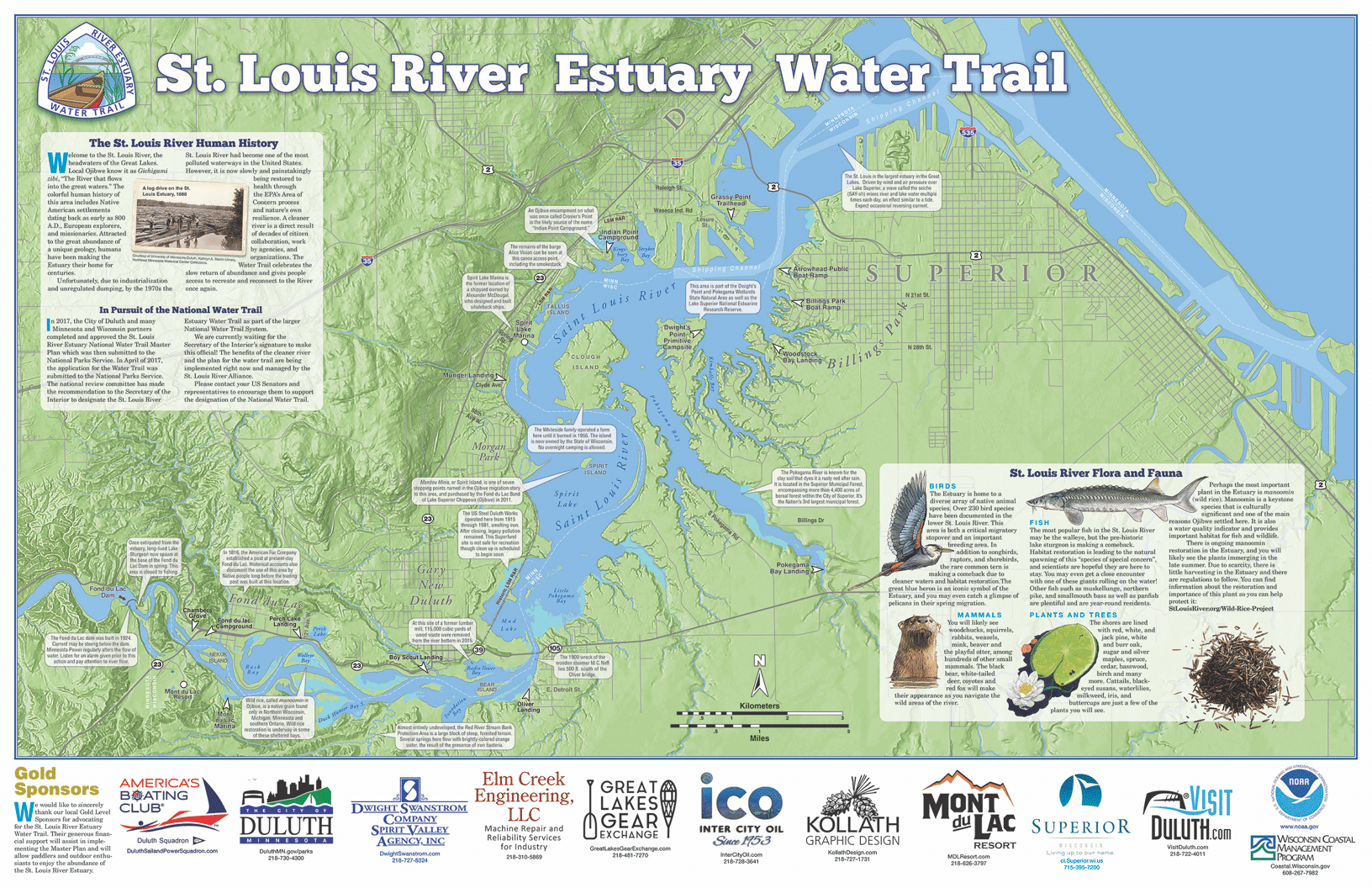
The St. Louis River Estuary National Water Trail now includes 16.5 miles of the river from the Fond du Lac Dam to Lake Superior. There are 11 designated loop routes that provide more than 70 miles of paddling and other recreation options.
The upper section of the area is offers a near-wilderness experience, with few signs of human activity, while the while the lower section is surrounded by urban development, industry, and the international port of Superior-Duluth.
“The current is slow and its wide expanse allows for small water and big water experiences as well as varied paddling experiences for all skill levels,” says American Trails, which maintains the official database of National Recreation Trails. “It’s easy to forget that the river is in an urban environment.”
There are also several launches and landings that provide access to different parts of the water trail and opportunities for food, water, hiking, biking, and parks.
“I encourage Americans to get outside, enjoy our incredible public lands and visit a nearby national recreation trail,” said Secretary of Interior David Bernhardt. “Spanning more than 83,000 miles, larger than the interstate highway system, the National Trails System provides easy access to a wide variety of outdoor experiences.”
More information:
- Trump Administration Adds 1,275 Miles to the National Trail System – Dept. of Interior
- St. Louis River Estuary National Water Trail – St. Louis River Alliance
- St. Louis River Estuary Water Trail – NRT Database, American Trails
- St. Louis River Estuary National Water Trail Master Plan (PDF) – City of Duluth
- St. Louis River Estuary: The Stories and the Science