


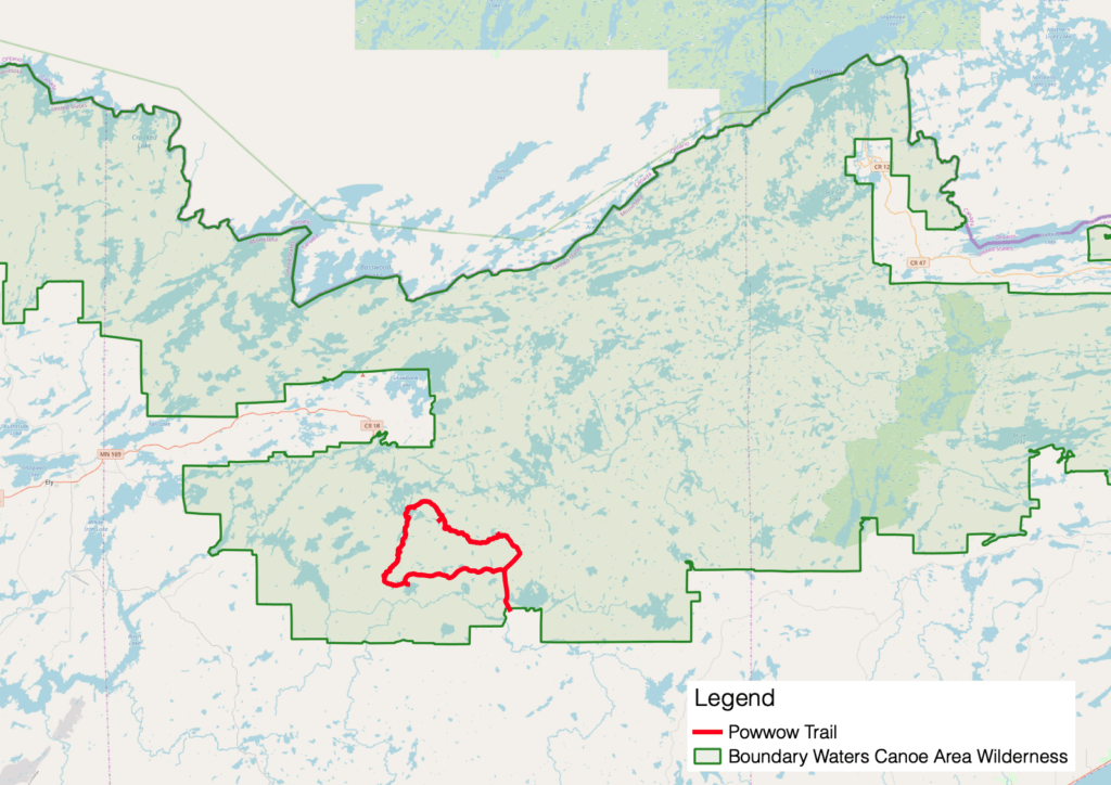
A 32-mile hiking trail in the Boundary Waters Canoe Area Wilderness is restored after being devastated by the 2011 Pagami Creek Wildfire. The Powwow Trail on the southern edge of the wilderness, near Isabella, was deemed impassable and perhaps impossible to bring back to safe hiking condition. Undaunted, a group of dedicated volunteers working with the Superior National Forest have been hard at work to restore the trail.
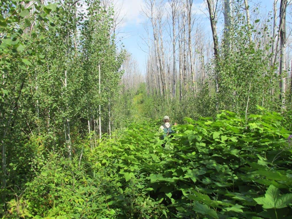
Not only did the intense flames of the Pagami Creek Fire obliterate the trail’s tread, it created hazardous conditions that impaired foot travel and navigation.
“After the fire, it looked very desolate,” said Martin Kubik of the Boundary Waters Advisory Committee told WTIP. “There were thousands of charred trees standing and since then they kept falling down.”
The Superior National Forest warned hikers of hazards: there was little shade, no trees for hanging food packs, charred ash rubs off trees onto people and gear, and the footing was poor due to growth and new deadfalls.
Now the volunteer organizers have logged countless hours clearing the path, and say the whole loop is passable again — for experienced backpackers. Kubik reported that two groups hiked it over Memorial Day weekend.
A six-mile hike from the entry point to a campsite on Pose Lake is considered the best stretch of trail and welcoming to other levels of experience.
The Forest Service worked with the Minnesota Conservation Corps to clear the trail in 2016 and 2017, but the lush growth of jackpine and other vegetation quickly obscured the route again. That’s when the agency said it no longer had the funding in its budget to maintain the whole trail, and the volunteer effort got underway.
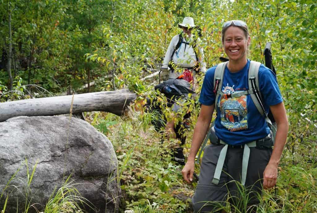
Using handsaws and loppers because of wilderness rules, the volunteer groups hiked in, camped, and worked over numerous weekends. It paid off.
“I’m very happy to say I think we are over the hump,” Kubik said. “We have saved the trail.”
But the trail champion was quick to point out that a lot of maintenance will be required for the foreseeable future. The Boundary Waters Advisory Committee manages the trail maintenance volunteer trips, with more planned this fall and in 2020. In October, experienced volunteers will circumnavigate the trail to inspect it and survey campsites.
Speaking to WTIP in Grand Marais recently, Kubik suggested next May might be a good time to try hiking the whole thing.
Spring conditions are optimal because there’s less vegetation growth early in the season, and the long days make it easier to complete the full loop in about four days. He said the biggest obstacle is a large beaver dam that can flood the trail about 2.5 miles from the parking lot.
About half of the trail is on old logging roads that were used before the Boundary Waters Canoe Area Wilderness Act of 1978. The rest of the route was designated in that legislation. While the wilderness is most popular by far for canoeing, there are 200 miles of hiking trails spread across its million acres.
Upcoming Powwow Trail presentation
How Volunteers Saved the BWCAW Powwow Trail (and You Can Too)
Thursday, October 10, 2019 – 6:30 p.m.
REI Bloomington, 750 American Blvd W., Bloomington, MN