27th and 28th.
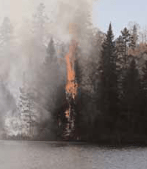
Skiiers and snowmobilers may be praying for more snow this winter, but officials in charge of the large backlog of prescribed burning in the Boundary Water Canoe Area (BWCA) say drier conditions mean greater opportunities for burning this spring.
Weather conditions will dictate progress on completing burns during 2002 and beyond, said Jean Bergerson, fire information officer for the Minnesota Interagency Fire Center (MIFC). An
earlier start should increase the acreage that can be burned this year, she said.
“In absolutely ideal conditions, we would begin burning in late May or early June,” Bergerson said. “It’s impossible to speculate how things will go. The weather forecasters have been saying since September that we’d have normal temperatures and precipitation, which we haven’t had, and they’re predicting a normal spring. The unique thing this year is that it has snowed and then melted during the winter.” In late January, snow cover in the blowdown area was at the 40th percentile, Bergerson said, which is just below normal.
First on the list for spring burning are top priority sections totaling 15,000 acres along the Gunflint Trail, as well as 2,000 acres near Crescent Lake.
Over the next several years, the Forest Service plans to burn 75,000 acres within the 375,000 acres (out of 1.1 million total acres in the BWCA) that were affected by the blowdown storm in July 1999. During that storm, highly unusual straight-line winds over 90 miles per hour snapped off and uprooted trees in a 477,000-acres swath that swept across the Superior National Forest, creating fuel supplies that continue to dry and add to the danger of
uncontrollable wildfires.
Unfortunately, prescribed burning within the BWCA is off to a slow start. The goal for 2001 was to burn more than 4,000 acres in the BWCA, but the environmental impact statement for the burns was not approved until late summer and burning didn’t begin until late September. The burns completed last fall were 313 acres along the Brule River and a 192-acre tract at Skipper Lake, 298 acres on the Liam Grade and the 109 acre tract at Iron Mash Lake. Approximately 900 additional acres were burned outside of the BWCA boundaries. Other highpriority burns were put on hold in mid-October because of wet weather. All areas that were on the drawing board last year – including the 2,600 acre Kekakabic Lake and 2,500 acre Magnetic Lake tracts – are on hold until spring, with the larger tracts to be burned next fall.
A January 2002 storm recovery update memo from the MIFC included the following details:
• During the 2001 season, there were “a few small (fire) starts in blowdown but none exceeded a few acres thanks to quick suppression.”
• Approximately 12,000 acres of fuel burning and removal – 86 percent of the total amount planned – has been completed outside the BWCA boundaries.
• The Forest Service added fire staff and equipment to its suppression resources and increased its training and communication preparations to be “first responders” in case of a BWCA fire emergency.
This winter, Forest Service officials are continuing their work on detailed plans for the upcoming burns. The plans include resource surveys, identification of ideal weather conditions, fire behavior predictions and plans for communication, public notification, logistics, traffic, medical emergencies, traffic and postburn monitoring.
For more information, people can visit the DNR’s Web site at www.ra.dnr.state.mn.us.
This article appeared in

