


“Do you think we’ll see anyone else on the trail today?” my spouse asked a half mile into a three-mile hike. “Maybe,” I said. “Last time I was here I only saw one other party and it was around the same time of year.” “But it’s a beautiful day on a holiday weekend,” he continued with a tone of confusion. “I could be wrong,” I replied, “but I don’t think a lot of people come here.” Then just as we made our final climb toward the end of the trail, we met a family heading back the way we came, surely enjoying the same solitude of the Vermilion Gorge Trail.
Nestled in the center of downtown Crane Lake lies a trailhead to one of the most magical places in Minnesota you’ve likely never heard of. This trail is a delight year-round with raging water during the spring melt, wildflowers and berries in the summer, spectacular colors in the fall, and a wintery wonderland in the colder months. And as a bonus, I’ve never encountered more than two parties of hikers.
Maybe it’s the remote location, just miles from the Canadian Border. But located just four and a half hours from the Twin Cities, two and a half hours from Duluth, and an hour and a half from Ely, it’s much closer than many of the other waterfalls we frequently flock to. Whatever it is, the Vermilion Gorge is one of the last of northeast Minnesota’s unknown gems.
Hiking the Vermilion Gorge Trail
You’ll find the trailhead to the Vermilion Gorge Trail just off of Gold Coast Road in Crane Lake, Minnesota. Since I was last here, the Forest Service has added more signage making it a breeze to find. You can find the location on Google Maps here.
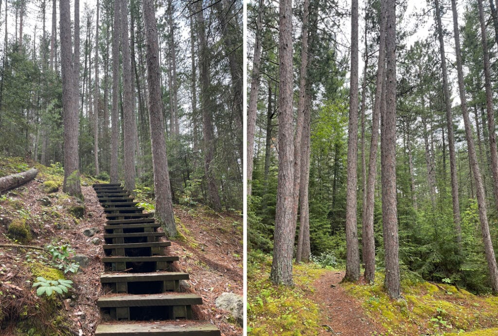
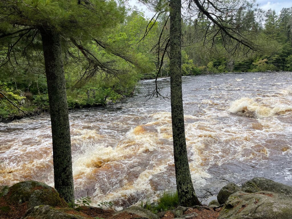
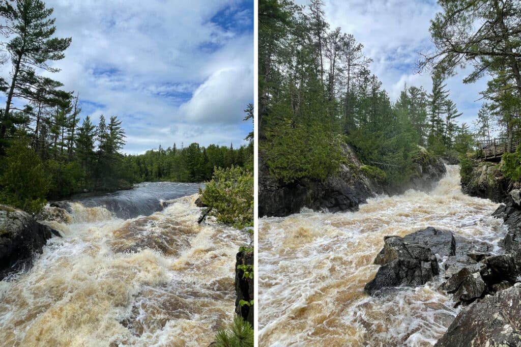
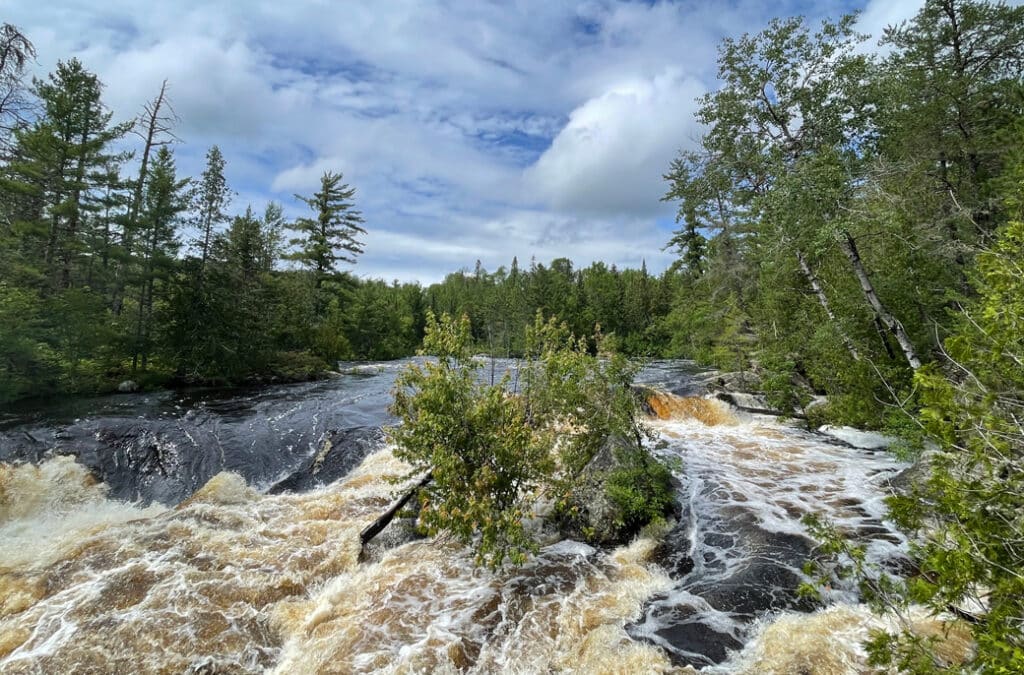
The trail starts in a heavily wooded area that can be exceptionally buggy during the summer months. But it doesn’t take long before you reach the area where the mouth of the 40-mile Vermilion River empties into the 2,900-acre Crane Lake. We were lucky to hit it while the 2024 summer flood levels were still rising. The rush of the river was simultaneously awe-inspiring and terrifying.
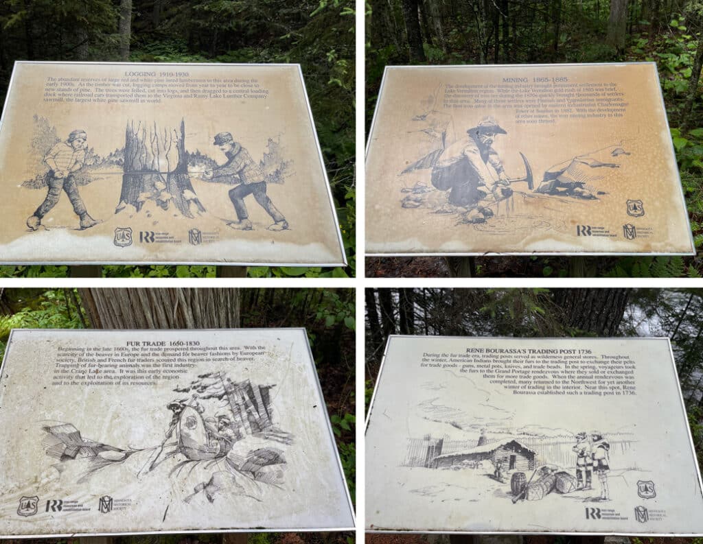
There is a second trailhead and boat dock here, near the mouth of the river, allowing users to access the trail by watercraft. From here, the trail follows a spectacular river gorge with sheer granite cliffs and rock outcrops. Pay attention to how the forest changes as you hike up the river and climb in elevation. Breathe in the smell of pine and feel the softness of the ground below your feet. As you hike back, take time to read the interpretive signs highlighting stories from the area’s colorful history.
The hike is just over a mile and a half one-way. You’ll want to allow yourself at least a couple of hours, more if you like to saunter and take photos. It’s important to stay on the trail with this hike as there are many steep cliffs and drop-offs. As always, practice leave no trace, and pack out anything you might pack in. You can learn more about hiking the Vermilion Gorge Trail and download an informational brochure here.
Don’t miss Vermilion Falls
While you’re in the area, don’t miss Vermilion Falls—another of northeast Minnesota’s best-kept secrets. There was another vehicle in the lot when we arrived on a mid-summer sunny Sunday, but I didn’t see another human other than my spouse.
Just an eight-mile drive from the Vermilion Gorge Trailhead, you’ll want to take it slow as there are sometimes sections of washboard and potholes. There’s a large and lovely picnic area and a vault toilet near the parking area. You can find the location on Google Maps here.
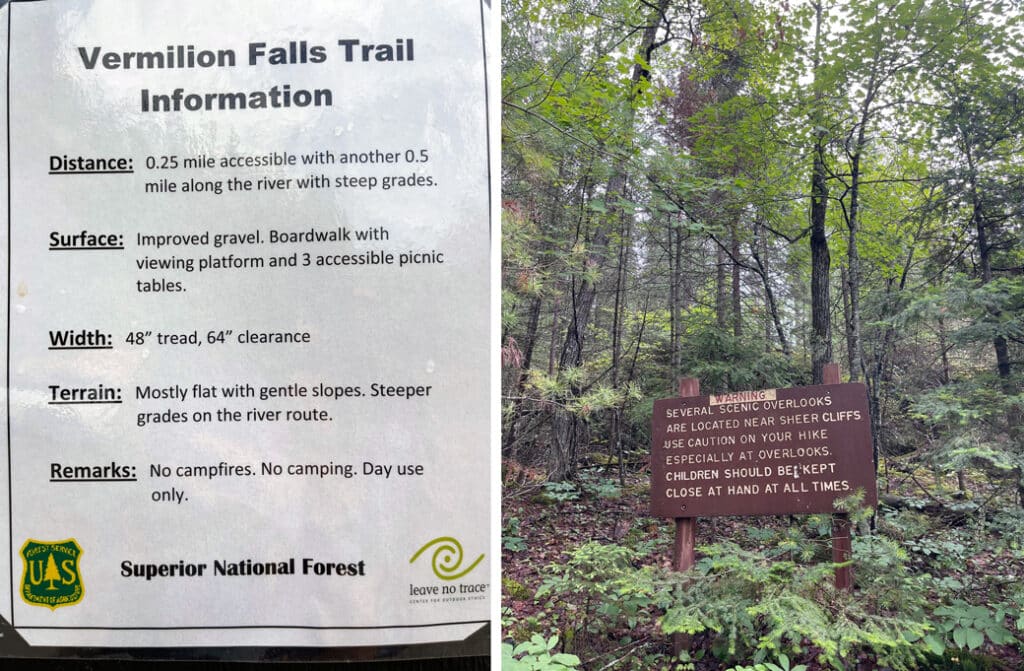
The hike is only a quarter of a mile round trip—maybe a little more if you climb and poke around. Again, watch your step as it’s steep and rocky with raging water. You’ll find plenty of observation decks for safe viewing. There are additional picnic areas along the trail which have lovelier views than any restaurant I’ve ever been to.
For a longer hike, follow the portage trail across Forest Road 491. With the falls, the distance is about two miles roundtrip. You’ll want to keep an eye out for poison ivy in this part of the forest. You can learn more about hiking the Vermilion Falls Trail and download an informational brochure here.
Explore more
This is a very lightly used area of the Superior National Forest. You won’t find heavy traffic or large crowds. It’s worth considering staying a while to explore more of what the area has to offer.
You’ll find two national forest campgrounds not far off the main road. I’ve stayed at both Echo Lake and Lake Jeanette and would be happy to go back to either. Echo Lake has a nature trail and swimming beach and I’ve never seen it full, even on a busy holiday weekend. Jeanette Lake is smaller and does fill up on weekends. When it’s not too wet, the nearby Astrid Lake Trail is a lovely hike. Both lakes are spectacular to paddle.
Crane Lake is one of the gateways to Voyageurs National Park. If you’re able to stay a while longer, there’s so much worth exploring here.
Both the Vermilion Gorge and Vermilion Falls are special Minnesota gems you don’t want to miss. The quiet and remoteness will make you wish you’d found them sooner. And if you’re going to make the trek, you might as well stick around and see more of what the Superior National Forest and Voyageurs National Park have to offer.
More info:

Holly Scherer is a Minnesota-based writer, photographer, outdoorswoman, and guide. She’s most at home in the great outdoors; camping, hiking, paddling, cycling, and gardening. When she’s not on an adventure, she and her husband live in the Twin Cities where they’re fond of saying, “home is where we store our outdoor gear.”