


“Oh, it’s just so beautiful up here,” I exclaimed as we drove along Highway 23 between Orr and Crane Lake. A long weekend of paddling and camping in Voyageurs National Park was just ahead. “I’ve been up here hundreds of times,” I continued, “and traveled all over the country, and this is still one of the most beautiful places I’ve ever been.” “Yeah, it’s a remarkable place,” my husband agreed.
I visited Voyageurs five years earlier and have been dreaming about returning to explore the park’s interior ever since. But with so many amazing places to camp and paddle in the region, it’s easy to get distracted. We’ve spent enough time in the region’s state parks, national forest, and the Boundary Waters Canoe Area Wilderness (BWCAW) that planning and preparing for those trips has become seamless. Conversely, we knew nothing about planning a paddling trip to Voyageurs National Park, so we kept pushing it off. But 2024 has been our year of national park adventures, and this was the time to finally make it happen. If Voyageurs is new to you too, check out the Voyageur’s Park Beginner’s Guide I created to accompany this story.

Start with a map
Our planning began by purchasing the Voyageurs Paddle Routes Map by National Geographic. I don’t care if it sounds nerdy, but one of my favorite things in life is to lay a big map out on the floor and look for new and interesting places to explore. Every new map I buy leads to endless learning and adventures.
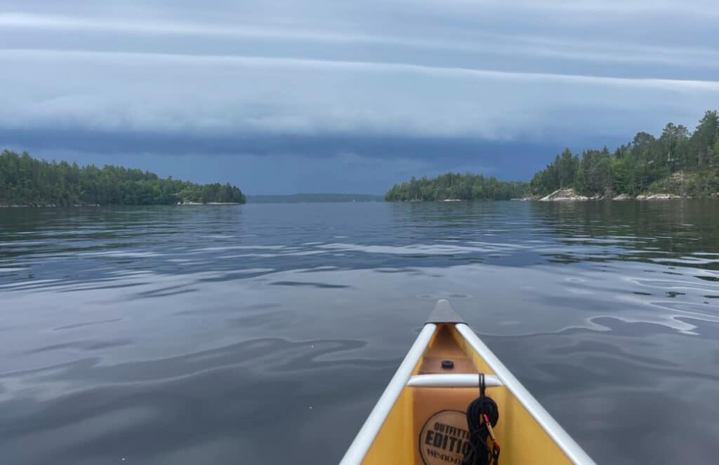
Voyageurs National Park is made up of four main lakes that we refer to as “big water.” These are enormous lakes that make it easy to get lost with a slight navigation error—which both my husband and I have made at least once during our 15 years of paddling together. These big lakes can also become dangerous when the wind and weather turn unexpectedly.
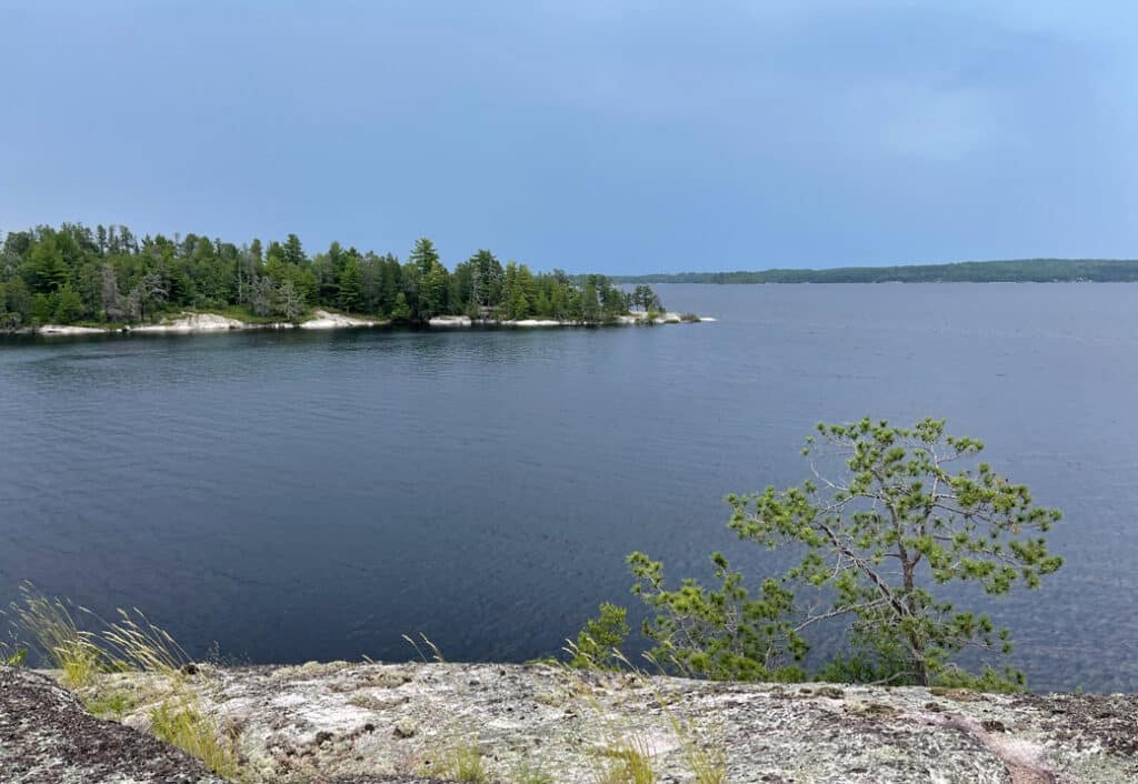
Rainy Lake is the largest of the four at 227,604 acres. It’s a whopping 60 miles long, has a maximum width of 12 miles, and is 161 feet at its deepest. Only a third of Rainy Lake is within the park boundaries. The smallest of the four main lakes is Sand Point. At just eight miles long and 8,869 acres, it seems tiny in comparison. But if a storm rolls in on your paddle out—as it did for us—the battle against headwinds and whitecaps can make it feel enormous. That said, both Sand Point Lake and the Ash River area are very manageable for paddlers with moderate skills and experience.
Build your itinerary
Once we decided that we wanted to go in on Crane and Sand Point Lakes or near the Ash River Visitor Center, we narrowed down some dates. Then I hopped onto Recreation.gov to start searching for campsites. When the website loaded, I selected Build Itinerary, entered my group size, and our starting date. There was one campsite available on Sand Point Lake for the first weekend I checked so I put it in my cart, checked out, and we started planning.
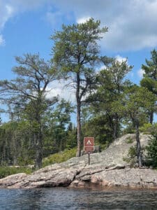
Something to keep in mind when planning your paddling and camping trip to Voyageurs is campsite designation. Voyageurs has both frontcountry and backcountry campsites. In most national parks, frontcountry refers to campsites that you can drive to in developed campgrounds. In Voyageurs, all frontcountry campsites are only accessible via watercraft—it’s like car camping but with a boat. There are 137 frontcountry sites located on the four main lakes—Rainy, Kabetogama, Namakan, and Sand Point.
Backcountry campsites in Voyageurs are located on the interior lakes of the park. They require the use of watercraft to get to designated trailheads. When you reach the trailhead, you will leave your watercraft behind and transport your gear by foot. Some of the backcountry lakes have rental canoes that can be reserved for overnight and day use. To prevent the spread of invasive species, you must never portage your own watercraft into any backcountry lake.
Consider your safety and paddling skills
In addition to big water, Voyageurs National Park is popular with motorized boaters. Before you go, it’s important to understand paddling safety and the nautical rules of the road. The American Canoe Association offers wonderful online courses you can find here. And, of course, you’ll want to wear your PFD (personal floatation device) at all times.
As it pertains to paddling, it’s essential you know your limits. Do you know how far you can paddle and how long it will take? What would you do if unexpected wind and weather rolled in? Campsites range in distance from a mile to 27 miles from the nearest boat launch. Recreation.gov shows the distance to the nearest boat launch for each campsite. Paddle Planner’s route planning tool also offers good estimates. I always assume the distance is a tad longer than I expect and am pleasantly surprised when it’s not. Always choose campsites that fall well within your comfort zone. There’s no shame in starting small.
Next, consider how comfortable you will be navigating when you’re on the water. These lakes are beyond breathtaking with big bays, rocky shorelines, and endless islands. These remarkable features also make them more challenging to navigate. Before you go, brush up on your map reading and compass skills. We also have GPS apps and devices. You can download the Voyageurs GPS Waypoints here. GPS is a great addition to paper maps but should never replace them. I even go as far as to bring a couple of copies.
Print your permit and pack your bags
Within five days of the start of your trip, you’ll need to log into Recreation.gov to print your permit. I also recommend taking a screenshot so you have a digital copy as a backup. All members of your group are required to view and follow all information contained in the Voyageurs National Park Camping Video. Phone coverage is spotty in the park so it’s best to prepare everything you might need in advance.
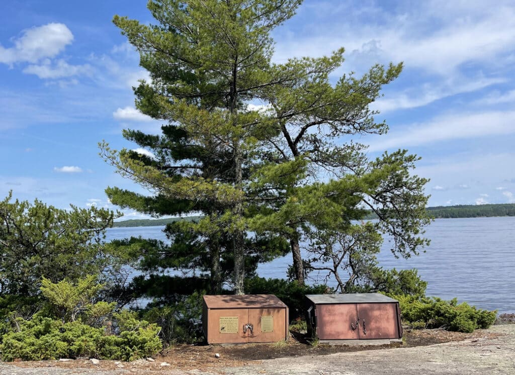
If you’re familiar with paddling and camping in Minnesota and beyond, there are a few key differences to note. Food, trash, and other scented items should always be secured and Voyageurs makes it easy with large bear boxes at each campsite. You’ll also enjoy the added luxury of picnic tables and comfy tent pads. Reservations are required for all frontcountry and backcountry campsites. As much as I love being able to wing it, I enjoy the reassurance of knowing I’ll have a place to stay, especially during the peak summer months and on holiday weekends. Voyageurs also offers group campsites which are not an option in the neighboring Boundary Waters Canoe Area Wilderness nor most of the Superior National Forest.
A magical weekend paddling and camping
Since we booked our trip to Voyageurs just one month in advance, the start of our epic adventure was upon us in a flash. Hoping to be prepared for whatever Mother Nature threw at us, we drove up the day before and spent the night at the Echo Lake Campground in the Superior National Forest—just 10 miles from the Crane Lake Boat Launch. As windy as it’s been recently, we were prepared for high winds and planned to be on the water around sunrise since it’s typically calmer during the earlier and later parts of the day. Luck was on our side, however, and the wind was quiet for most of our trip.
We launched on the morning of July fourth and the boat traffic was surprisingly intense. Since campsite check-out isn’t until noon and check-in is at three, we had plenty of time for a side trip to hike the Mukooda Trail. The first thing we did before starting our hike was secure our food and scented items using odor-proof bags and Ursacks. It probably wasn’t necessary since there was a lot of traffic that day, but nothing will ruin a paddling and camping trip quicker than a bear or chipmunk chewing through your canoe pack to get a taste of your toothpaste or bug spray.
Hiking a historic trail
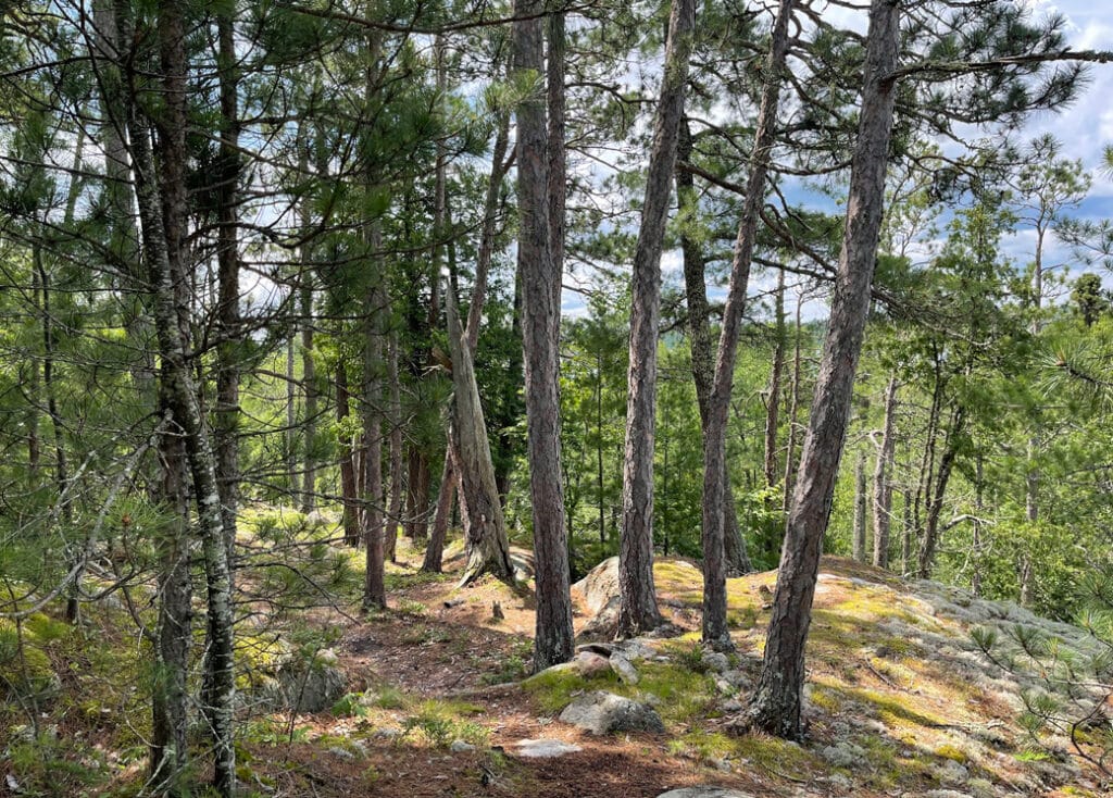
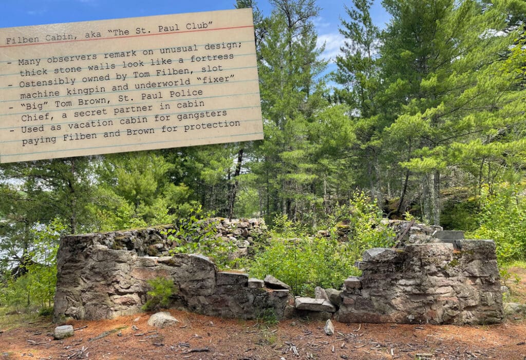
The hike was beautiful but soggy and buggy. That made our breaks on the top of ridges so much sweeter. We also enjoyed a handful or two of the season’s first wild blueberries. If you take this hike—and I recommend you do—make sure you leave extra time to learn about the ancient creatures living in Mukooda Lake. And don’t miss the spur trail to Filben Cabin to learn about the crime and corruption that took place on this peaceful lake.
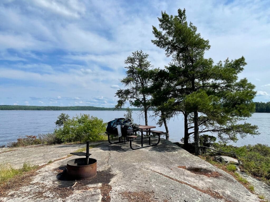
After a leisurely lunch in the Mukooda day-use area, we were back in the canoe to paddle the final four and a half miles to Stoneburner Island—our home for the next three nights. After we got settled in, we took a swim in the crisp lake and crossed one more item off our Minnesota summer bucket list.
The campsite was stunning, and anywhere else, it would be a five-star retreat. But with the heavy holiday boat traffic, we were both questioning whether we’d made a mistake. Although it was noisy, we made the best of it and enjoyed the evening before the mosquitoes chased us into the tent shortly after sunset.
The next morning was remarkably quieter and remained that way for the rest of the weekend. We savored two full days on Stoneburner Island fishing, swimming, reading, and watching the family of loons who lived in the bay behind our campsite. Unexpected but brief storms rolled in each afternoon which forced us to take much-needed breaks from the lackluster fishing and afternoon sun. On the final evening, we were treated to a turtle laying eggs on the island. She didn’t choose the best spot and it was hard not to intervene, but it’s always a joy to be so immersed in the natural world.
Expect wind and weather
We set an early alarm for the final morning, hoping to beat the potential storms forecast for that afternoon. We sipped our coffee, packed up, and did a couple of walkthroughs to ensure we left Stoneburner better than we found it. About three miles into our 10+ mile paddle back to Crane Lake, ominous clouds rolled in. It wasn’t long before the wind picked up and cut our paddling speed in half. And as the wind settled down, it started to rain and continued to until we had our canoe and wet gear all loaded up. While the weather on our paddle out wasn’t ideal, I could think of nowhere else I’d rather be on that mid-summer Sunday.
We did our best to avoid having too many expectations for our first paddling and camping trip in Voyageurs National Park. We knew we should expect big water and motorized boats. And to be honest, the first day—which was a holiday—was a bit much. But the remainder of the trip exceeded every hope and expectation we had. Voyageurs National Park is one of the best national park experiences I’ve had and is the perfect representation of Minnesota’s natural resources. I wasn’t sure if we’d feel this way leading up to the trip, but we both enjoyed it immensely and can’t wait to go back.
Subscribe for next week’s post: How to visit Voyageurs without a boat…
Holly Scherer is a Minnesota-based writer, photographer, outdoorswoman, and guide. She’s most at home in the great outdoors; camping, hiking, paddling, cycling, and gardening. When she’s not on an adventure, she and her husband live in the Twin Cities where they’re fond of saying, “home is where we store our outdoor gear.”