Flowing through Superior National Forest and reaching Lake Superior at Duluth, the St. Louis River and the watershed surrounding the river encompasses over 3,000 square miles. The river runs through both boreal forest and farmland, and is home to iconic Minnesota species including smallmouth bass, walleye, and northern pike. The Minnesota Land Trust has been working in the estuary (where the river meets Lake Superior) in partnership with other groups and state agencies to restore features that have become compromised by pollution, debris, and development. Their work is ongoing, and their vision is to aid restoration of the river ecosystem, as well as the health of Lake Superior. Recent accomplishments:
Published with permission of the Minnesota Land Trust.
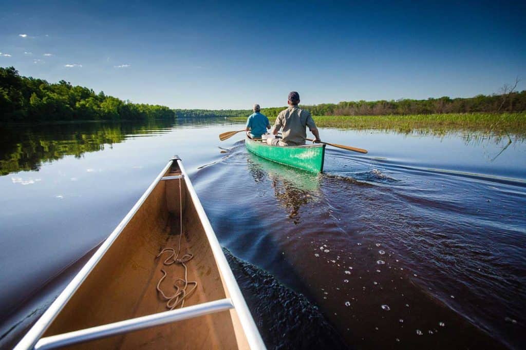
The St. Louis River estuary is a unique, 12,000 acre wetland complex between Duluth, MN and Superior, WI, where water from the St. Louis River mixes with the water from Lake Superior. This mixing produces an incredible amount of biological productivity, and numerous species of fish, birds, and other wildlife depend on the estuary for their survival.
The Estuary also includes the Duluth Superior Harbor, mid-America’s gateway to global trade and the nation’s busiest freshwater harbor. More than a quarter million residents and 3.5 million tourists live, work and visit the area every year.
Early History of the River
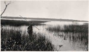
Wild rice (manoomin in Ojibwe) is a staple and a crop of significant cultural importance for the Ojibwe people. At one time the St. Louis Estuary may have sustained over 3,000 acres of wild rice, and was harvested for generations.
Sadly, during the 1800’s and much of the 1900’s, unregulated chemical dumping, untreated sewage releases and other physical disturbances finally overwhelmed the natural ecosystem and the environmentally sensitive wild rice beds all but disappeared. And wild rice is our canary in the coal mine: the loss of natural wild rice beds tells a story of greater habitat loss for a wide variety of birds and reflects diminished water quality that affects even more species.
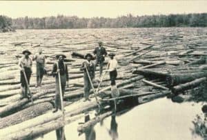
In the 1860’s, development along the river accelerated. Sawmills left a tremendous legacy of waste deposited directly into the river, forming thick layers of sawdust and wood debris.
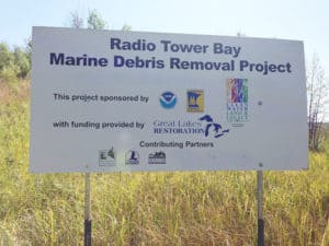
For example, Radio Tower Bay was the site of an historic sawmilling operation constructed on pilings over the water. Much of the sawdust and slabwood from the milling operation ended up on the bottom of the bay, greatly reducing the quality of underwater habitat for fish and making the bay nearly useless for recreational value.
More industrial sites were built along the river, producing paint, steel, concrete and even World War II battleships. These and other waste sources resulted in so much pollution that people were advised to stay out of the water and refrain from eating the fish. By the 1980’s it was clear that something had to change.
Bringing back a river
Fortunately, the river has seen a remarkable turnaround thanks in part to the Minnesota Department of Natural Resource’s St. Louis River Restoration Initiative, which the Land Trust has been a part of since 2011. One of the key components of the initiative has been to restore the natural systems of the St. Louis River where it enters Lake Superior, while at the same time creating opportunities for people to engage with the river in a sustainable and healthy way.
Radio Tower Bay
Status: Completed
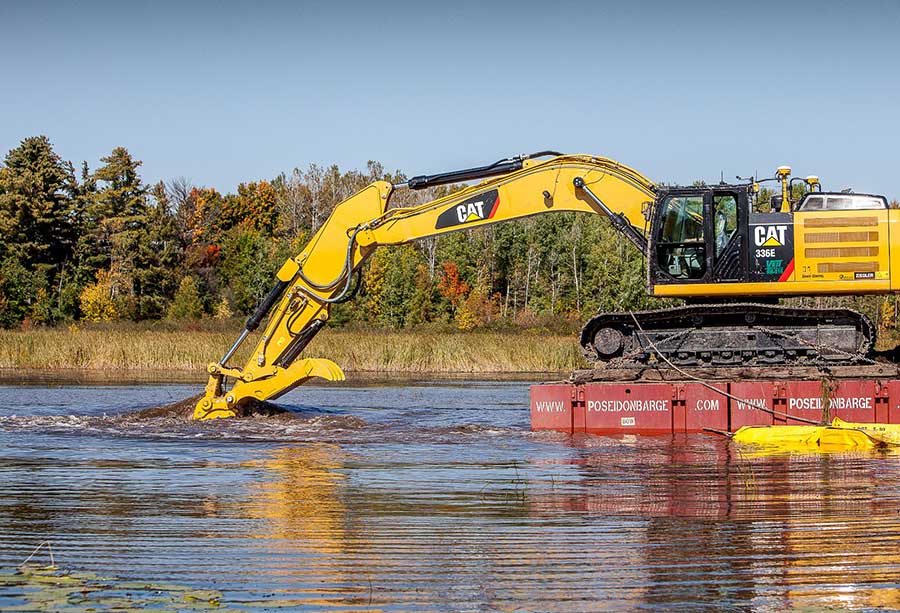
From the late 1800’s through the early 1900’s, Radio Tower Bay was the site of an historic sawmilling operation constructed on pilings over the water. Much of the sawdust and slabwood from the milling operation ended up on the bottom of the bay, greatly reducing the quality of underwater habitat for fish and making the bay nearly useless for recreational value.
From 2011-2016 the Minnesota Land Trust in partnership with the Minnesota DNR oversaw the clean-up and restoration process for Radio Tower Bay. The process involved removing over 200 40-foot wooden pilings from the 1700’s and 1800’s that used to support a railroad trestle across the bay. Next, over 4 feet of sawmill debris was dredged from the bottom of the bay, most of it still intact wood! All in all 115,000 cubic yards of wood waste was removed. The wood waste will be repurposed to help mitigate pollution as a cap on contaminated soil further downstream on the St. Louis River.
Wild Rice Reseeding
Status: Ongoing
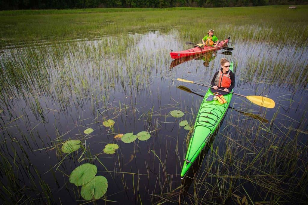
With the help of our partners the Fond du Lac Band of Lake Superior Chippewa, 1854 Treaty Authority, Minnesota DNR and Wisconsin DNR, we are now in the process of reseeding wild rice – the largest ongoing reseeding project in the United States. Plans are to reseed 7 sites throughout the estuary covering more than 200 acres, over multiple years. The next time you paddle through make sure to stop and see the rice stands growing tall out of the water!
Chambers Grove
Status: Completed
Extensive improvements to Chambers Grove, Duluth’s western-most park, were completed in 2016, as part of the larger project to restore the 12,000 acre St. Louis River Estuary as it runs between Duluth and Superior, Wisconsin.
A 1,000-foot steel retaining wall at Chambers Grove that had been installed years ago had the unintended consequence of eroding the shoreline, preventing boat access to the river and destroying important fish spawning habitat. The Minnesota Land Trust, Minnesota DNR and City of Duluth recognized the opportunity to replace this hardened shoreline with walleye and sturgeon spawning beds by removing the wall, redirecting the current and establishing the gravel and rock bottoms necessary for reproduction in the St. Louis River.
Fortunately, small gains in spawning habitat have large results for fish populations throughout the river and Lake Superior due to increases in larvae and fry survival. The project also improved recreational access to the river, making the investment pay off in multiple ways for the public. With the installation of an ADA-compliant kayak launch and six ADA-compliant fishing platforms along the shoreline, Chambers Grove is now accessible to even more people.
Grassy Point/Kingsbury Bay
Status: Ongoing
Jutting out into the St. Louis River in Duluth’s west end is Grassy Point. Historically two sawmills operated here, disposing of an equivalent of more than 30,000 dump truck loads of sawdust and scrap lumber into the shallow waters. Now, more than 120 years later the habitat is still considered impaired, and without intervention will continue to be an underwater desert.
The Minnesota DNR and the Minnesota Pollution Control Agency (MPCA) have begun removing much of the wood waste and recreating desirable coastal marsh features like sheltered bays and low islands. As a project partner, the Minnesota Land Trust will be working with biologists to design and revegetate the area using native aquatic, wetland, and floodplain plants to provide quality marsh bird and songbird habitat. When completed, the project will create a bright new opportunity for people to fish and bird watch right in the heart of Duluth.
What’s Next: Read on at mnland.org
More about the St. Louis River Water Trail at MN DNR >
More about wild rice and water quality in Northern Minnesota >