

By Greg Seitz
This summer, thirty years after a pair of trailbuilders first started flagging a hiking route along the ridges overlooking Lake Superior on Minnesota’s North Shore, the Superior Hiking Trail will be finished—mostly.
The final section of the trail, connecting it to the Wisconsin border southeast of Duluth, should be completed by Labor Day. Hikers will then be able to travel from that point all the way to the Canadian border on the trail that has been called one of the best in America. But the work is never done. Hundreds of volunteers will continue to put in thousands of hours each year keeping the trail in good condition.
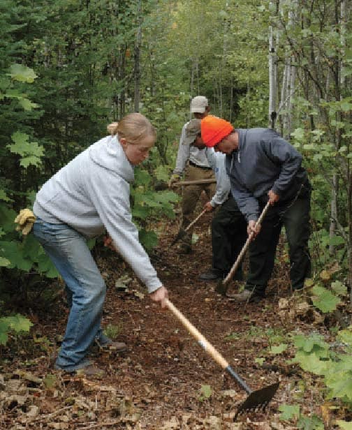
“We have job security for our volunteers,” says Jo Swanson, outreach coordinator for the Superior Hiking Trail, the organization which maintains the trail. “Every year, we have to clear the trail all over again.”
In the spring, trail workers remove trees and clear brush that blocks the path. All summer, they repair and replace bridges, clean and maintain campsites, and keep trailheads in good shape. In 2015, about 300 volunteers logged 6,000 hours of trail maintenance.
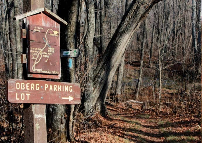
Those hours come in a variety of ways, including several trail-clearing weekends each summer, when groups of volunteers, including some with chainsaws, ensure the whole path is passable. Volunteers have also adopted each of the trail’s 95 campsites, as well as all its trailheads. These individuals visit a couple times a year to make sure their assigned areas are up to the Superior’s high standards, many of them traveling from the Twin Cities.
“It’s amazing to consider the hours people put in on the trail, but also the time people take out of their lives to drive up,” Swanson says. “Not only do that many people love the trail, but love it enough to keep it going.”
There is always more to do, and Superior Hiking Trail Association executive director Gayle Coyle says the increase of extreme rainfall events resulting from climate change is making the job even more difficult.
“We lose more stream banks to erosion, and our wooden handset bridges which we used to be able to build with a maintenance supervisor and volunteers, are no longer good enough in many cases. We have to move to longer, more engineered bridges, which are more expensive and can’t be done with volunteers.”
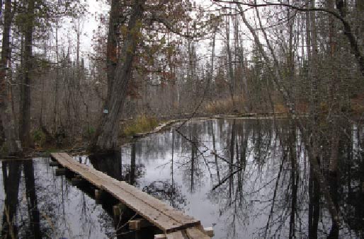
In June 2012, record-setting rains hit the North Shore, including the Superior Hiking Trail. Flooding of Lake Superior tributaries between Duluth and Gooseberry State Park changed river channels in such a way that the rivers will never be the same.
“The waters were so high and so fast that as they went around outside curves, they dug into the bank, and then deposited stone on the inside of the curves. Now whenever you have a minor rain event, the outside bank is being eroded even more, because the inner shoreline is covered in rock.”
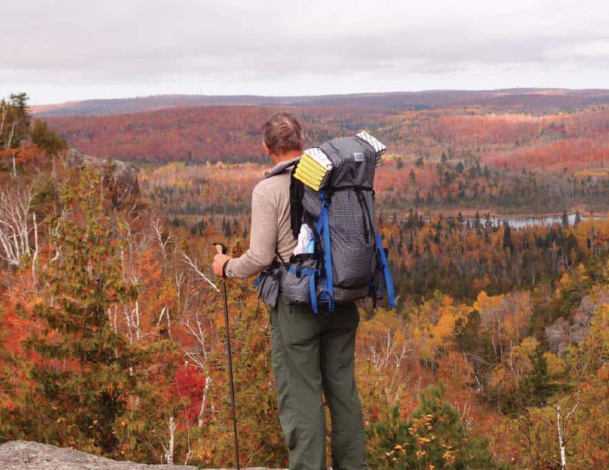
With this new reality and 300 miles of trail to maintain, SHTA always needs more volunteers. All the work pays off for the approximately 25,000 people who travel the Superior Hiking Trail every year. While a few hundred folks hike the whole thing, the Superior Hiking Trail has always been designed as ideal for day hikes, meaning it’s a popular destination for many, no matter their experience or strength.
“All ages and backgrounds come to enjoy the trail,” Swanson says. “It’s fantastic for day hikes, and we have a lot of opportunities to go explore for an hour. But then we have people heading out for a thru hike for two or three weeks.”
With two more miles of the trail in the works, there will be that many more options for hikers. The new and last section planned will go from Jay Cooke State Park to the Wisconsin border. An extension of the trail through Duluth to Jay Cooke was completed between 2004 and 2007.
When the trail was first built in the late 1980s and early 1990s, it blazed a path through wild forests, following the flags of Tom Peterson of the Minnesota Department of Natural Resources and Greg Wester of the Minnesota Conservation Corps. They approached the task by identifying stream crossings and vistas and other key points, and then figuring out how to connect the dots. The pair recently recalled the adventurous job in a story by Sam Cook in the Duluth News Tribune. “We’d explore for three or four days at a time,” Wester said. “Some areas, you knew there were going to be overlooks. You got there, and it was as spectacular as you thought.”
Most of the trail crosses lands owned by the U.S. Forest Service, the state of Minnesota, and local counties and municipalities, but it also includes more than 60 pieces of private property. To cross Duluth, trail planners focused only on public lands, which is surprisingly abundant in the city.
“Duluth always had trails along their creeks that went from the top of the ridge to the lake,” Coyle says. “The Superior Hiking Trail is now incorporating and connecting those city trails.”
There are no backcountry campsites in the Duluth section, so a true “thru-hike” is usually the 255 miles from the northern edge of the city all the way to Hovland, MN, a couple miles short of the Canadian border. There it connects to the Border Route Trail, which traverses the eastern section of the Boundary Waters Canoe Area Wilderness, and then to the Kekekabic Trail.
Ultimately, it is hoped that the national North Country National Scenic Trail will bypass 100 miles of bogs in northern Minnesota, which were designated as its official route in the 1980s, and instead follow the Superior, Border Route and Kekekabic trails. Federal legislation is required for such a re-route.
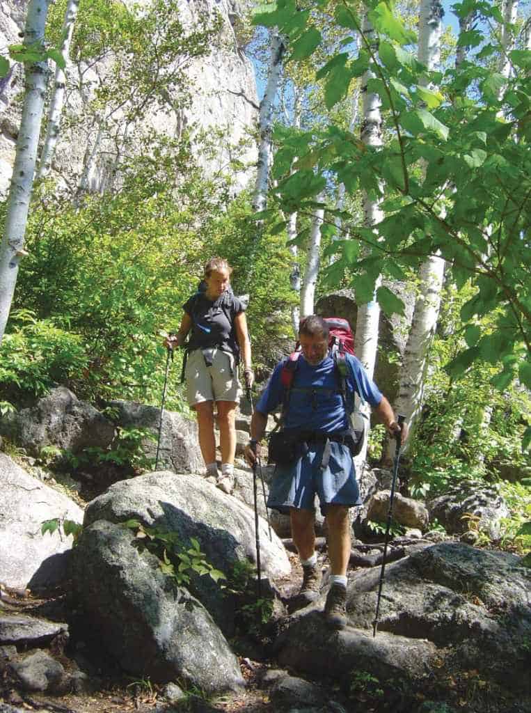
Wherever it wanders, from the rocky shores of Lake Superior to the peaks and valleys of the Sawtooth Mountains, the trail passes through some amazing terrain. It crosses rivers rushing down toward the big lake, follows rocky ridges through stands of aspen and pine, and even dips down to the very edge of the lake for two miles, where hikers can walk next to earth’s largest freshwater lake in the world, on one of the best trails in the world.
Find out more at http://www.shta.org