


Last summer’s drought contributed to several significant wildfires on the Superior National Forest. The largest and most destructive was the Greenwood Fire, near Isabella, which burned about 26,000 acres in August and September.
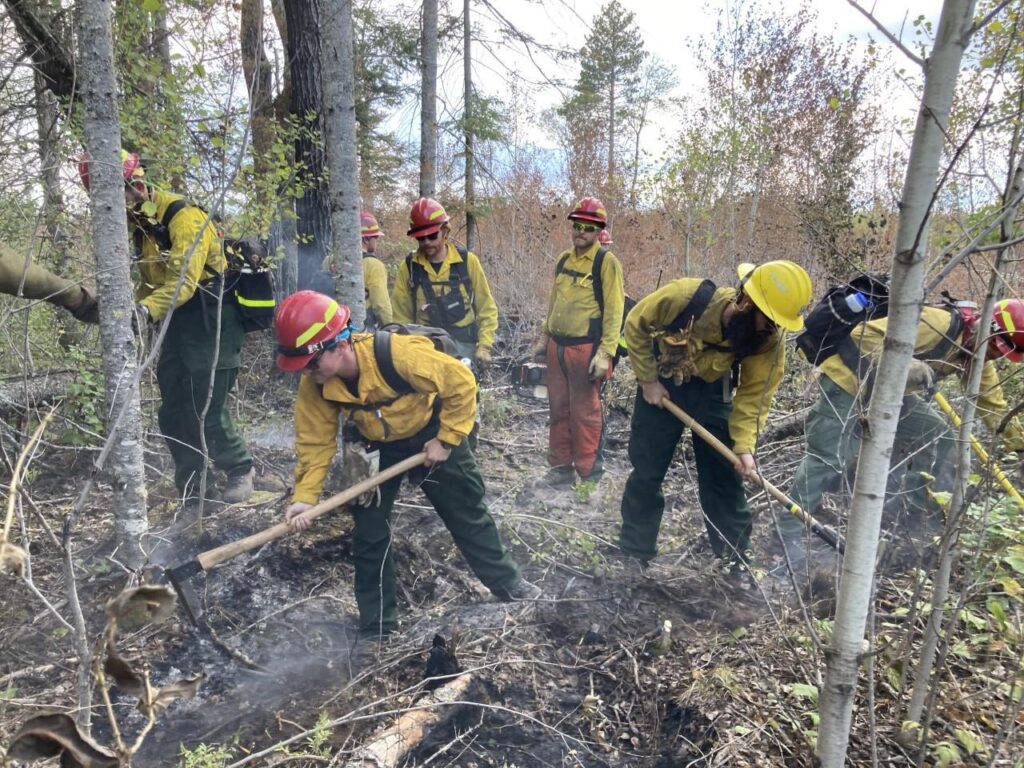
Within days of the fire being extinguished, a group of experts from the U.S. Forest Service were studying its impacts and stabilizing critical sites. A Burned Area Emergency Response (BAER) team includes physical scientists, archeologists, biologists, engineers, and geographic information system specialists from across the agency.
This rapid assessment and action is intended to quickly identify any further threats to people, resources, or the ecosystem and prevent problems from worsening. They also provided a detailed map documenting burn intensity and other factors, and providing recommendations for where to place warning signs.

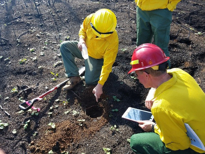
U.S. Forest Service soil scientists and biologists evaluating soil properties after Greenwood Fire, 2021. (Photo by Laurie Gawin, U.S. Forest Service) 
Mosaic of moderate and high soil burn severity in a mature red pine stand after the Greenwood Fire. (Photo by Laurie Gawin, U.S. Forest Service) 
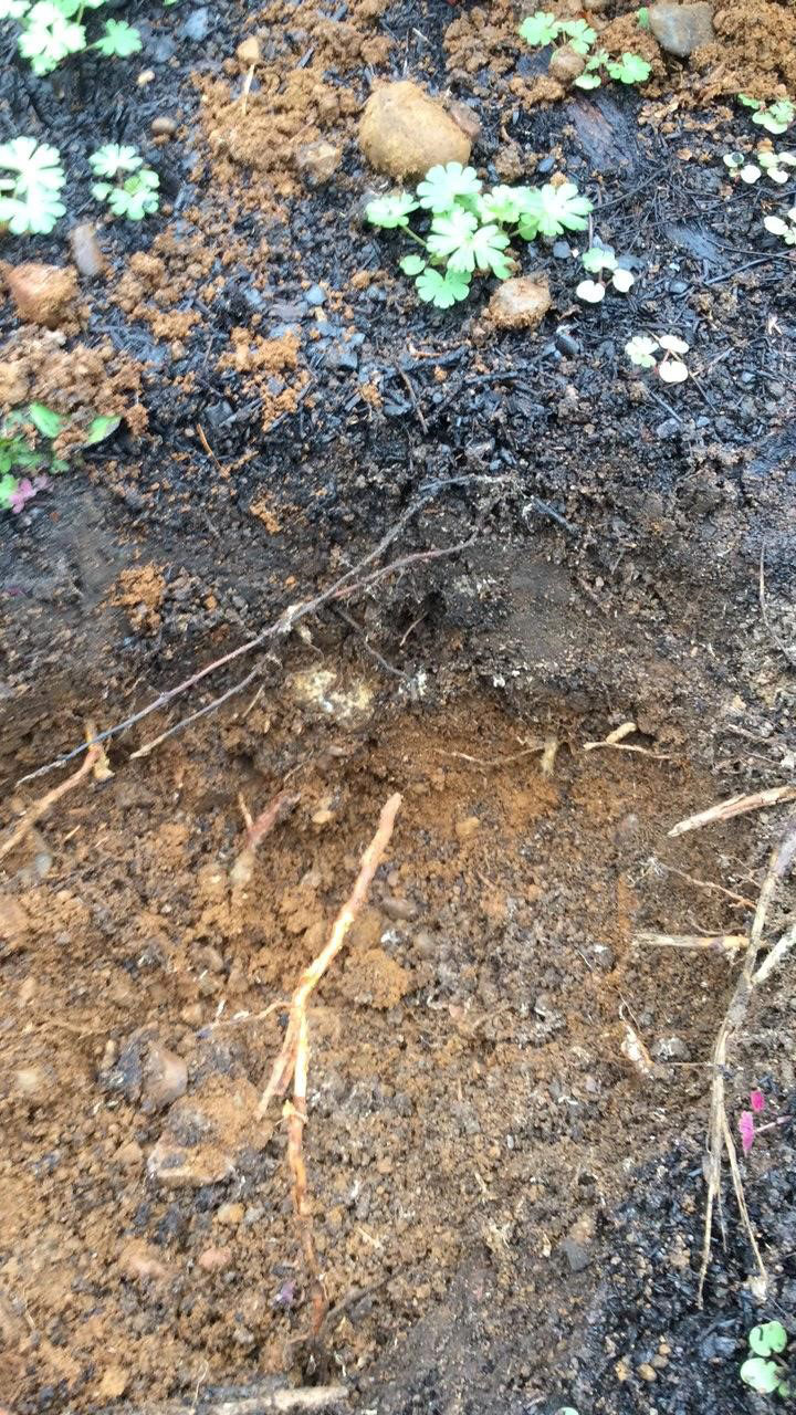
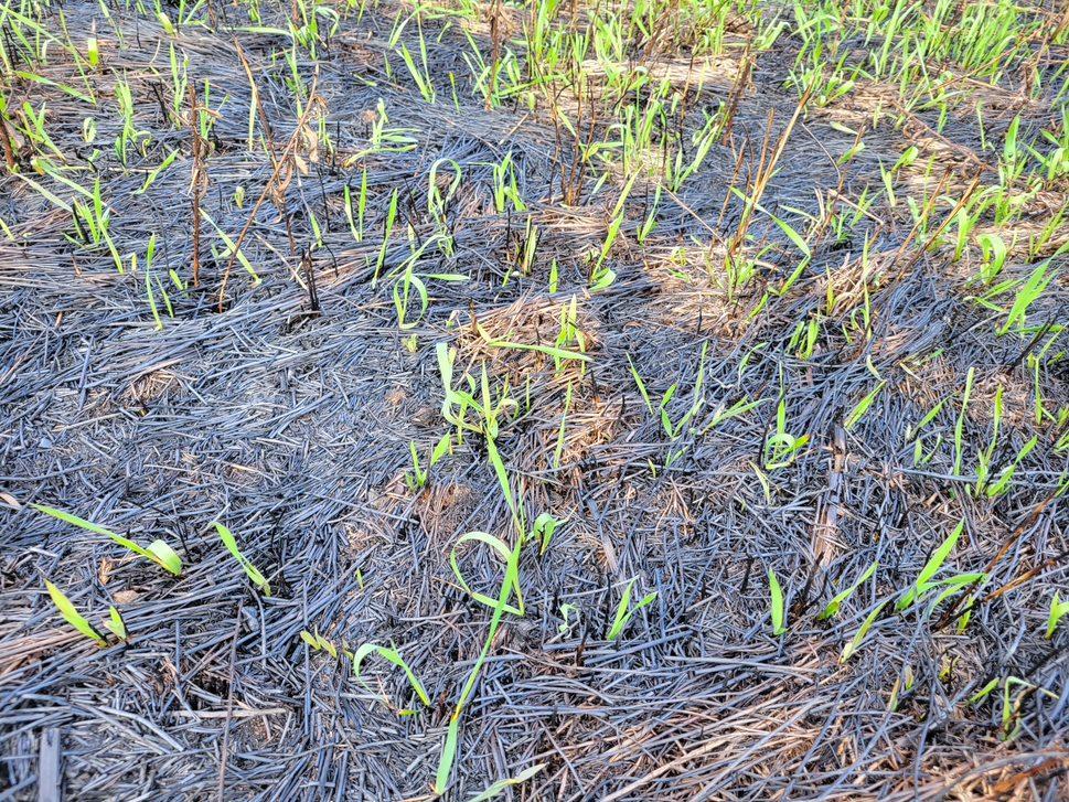
The soil surface dug to 30 cm at figure 2 location. Note vegetation sprouting weeks after fire passage. (Photo by Laurie Gawin, U.S. Forest Service) 
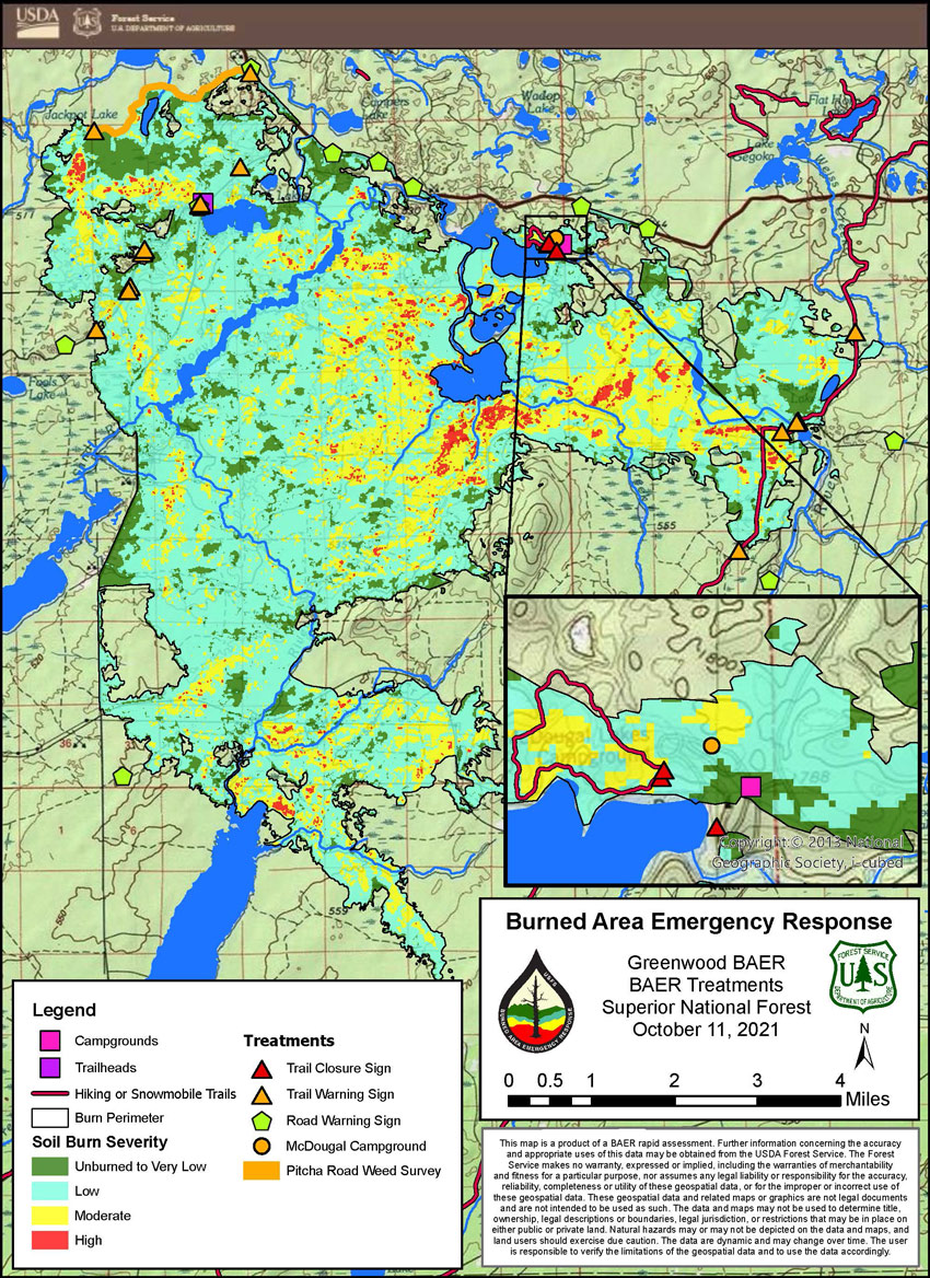
Greenwood BAER treatments map (courtesy U.S. Forest Service)

“Examples of critical values include homes and cabins and their occupants, ecosystem and habitat health and function, timber stands used for federal revenue, and heritage artifacts and cultural sites,” wrote Superior National Forest soil scientist David Morley, a member of the team. “Consequences are the adverse effects to these values from the fire.”
Fires are a natural and important part of the forest’s ecosystem, so many of its effects on nature can be beneficial. But, while the team reported threats to human safety and public and private facilities, they say the ecology seems mostly intact. They predict the forest will recover and regrow naturally, with the soil still fertile, for the most part, and the generally flat terrain presenting few erosion problems.
The team identified two key problems: hazardous trees in popular recreation areas, and the potential for invasive species to spread into the burned area. On the northeastern side of the fire perimeter, line that was cut to prevent its spread is near areas currently infested with non-native plants. But the forest was bouncing back already last fall.
“We were already seeing vegetation coming in just weeks after the fire went through in some of those areas,” Morley told KBJR.
Based on their recommendations, the McDougal Lake Campground and other nearby public facilities remain closed until safety issues from burned trees that could easily fall can be addressed. Next summer, the Forest Service will survey the areas and take action to prevent invasive species from expanding into the disturbed and vulnerable fire areas.
More information:
- What happens after the fire is out? – Superior National Forest
- Flourishing after flames: A new study has good news for the Greenwood Fire area – KBJR
- Burned Area Emergency Response – U.S. Forest Service