

Updated August 26, 2021:
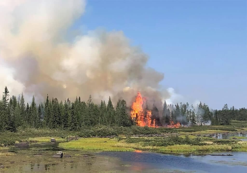
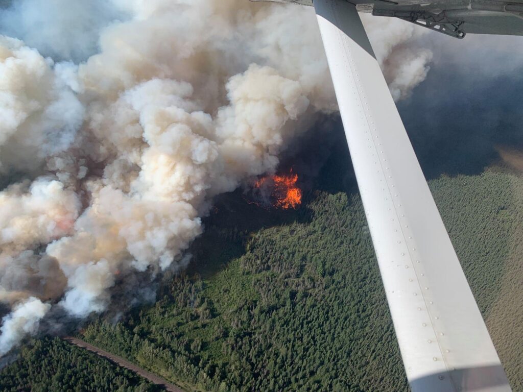
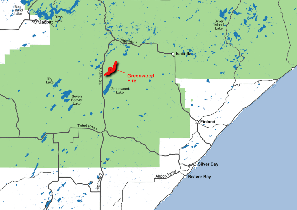
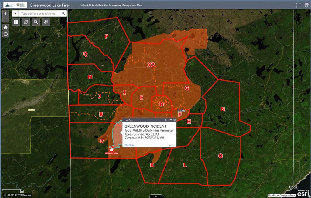
A wildfire discovered on Sunday August 15 grew rapidly, threatening people inside and outside the Boundary Waters Canoe Area Wilderness. By Wednesday, the Greenwood Fire had grown to about 4,000 acres. By August 26, the fire had escalated to over 25,000 acres.
Superior National Forest Greenwood Fire Information Line: 218-499-9441
Daily Updates from Superior National Forest
“Fire activity increased earlier than normal because of extremely dry vegetation, warm temperatures and gusty winds. Early in the afternoon, the fire made a run and developed a pyrocumulus cloud resulting in extreme fire behavior and fire-created lightning. The cloud was visible for miles in all directions and smoke and ash from the fire were reported as far away as Lutsen. The preliminary estimated acreage today is 19,493. Air resources, heavy equipment, and ground crews who were working on the fire had to be pulled off for their safety. New evacuations were triggered north of Highway 1 and east of the Slate Lake Area. Lake County Emergency Management evacuated 159 dwellings…Fire behavior yesterday was extreme with torching, wind-driven runs and long-range spotting. Vegetation is at a near historic level for dryness contributing to extreme fire behavior. We are expecting more favorable weather and less active fire conditions for the next few days. ” – Greenwood Fire Update 8.24.21
August 16, 2021:
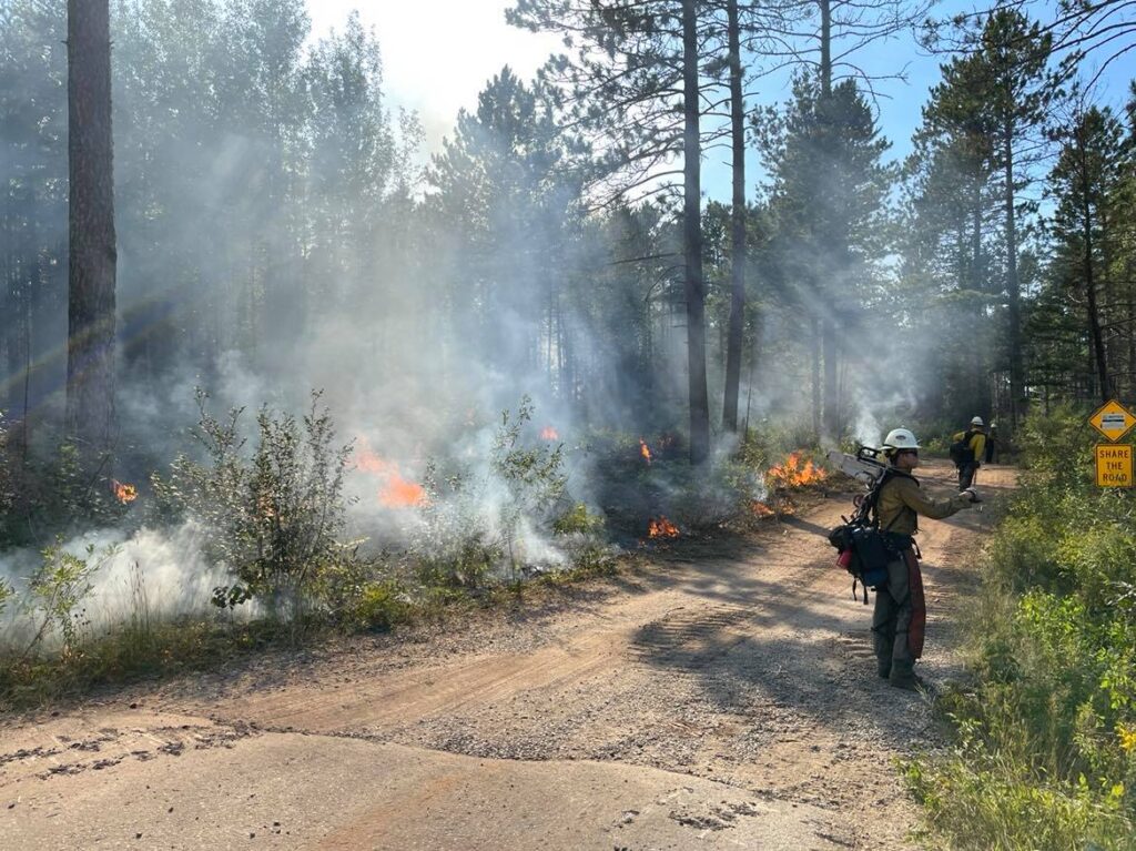
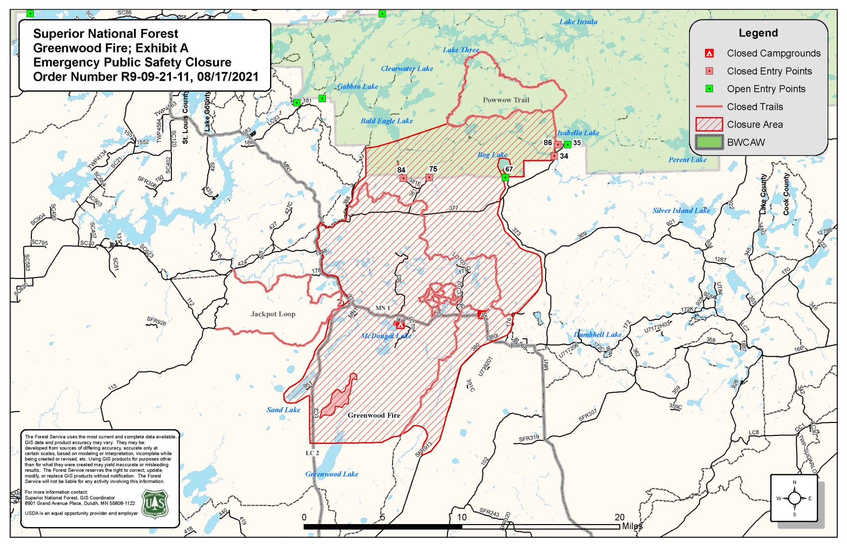
During the day on Monday, evacuations were carried out for about 75 cabins and homes in the area. Sections of Highways 1 and 2 were closed. The McDougal Lake Recreation Area was also closed. The fire grew quickly as conditions reached “near critical fire weather” during the afternoon evening, with temperatures around 85 degrees and winds 5-15 mph with gusts 20-25 mph.
Firefighters observed extreme fire behavior during the day yesterday, with the flames blazing through the tree canopy. Burning embers were also blowing far out in front of the fire, igniting more of the forest and increasing the risk across a larger area.
The fire is located in an area currently deemed “Very High” fire danger by the Minnesota Department of Natural Resources.
“The extreme dry conditions mixed with warm temperatures, low humidity and winds have resulted in longer response times that require more extensive mop up efforts to contain recent wildland fire activity than we typically see during traditional spring and fall wildfire season,” the Minnesota Incident Management System said.
About 24 hours after the fire was first spotted, the Lake County sheriff closed Highway 2 from Forest Hwy 11 to Hwy 1, and Highway 1 from New Tomahawk Rd to Lankinen Rd.
A federal Type 2 incident management team is taking over the fire, allowing local incident managers to remain available for other fires. Additional firefighting resources have also been requested.
So far, two helicopters, one fixed wing aircraft, eight engines, two bulldozers, and two tracked vehicles have been working to contain the blaze. Also on Monday, Minnesota governor Tim Walz authorized the National Guard to assist with firefighting efforts in the area.
“This summer, Minnesota has experienced abnormally high temperatures and a historic drought resulting in dry conditions conducive to wildfires. I am grateful to the Minnesota Department of Natural Resources for their tireless efforts to combat wildfires in our state,” said Walz. “The Minnesota National Guard’s additional support will be critical to responding to these wildfires and protecting the safety of Minnesotans and their property. I am proud that our Service Members have again answered the call to serve their fellow Minnesotans.”
The National Weather Service says the area is again in near critical fire conditions, and the next several days are expected to remain high risk.
No open burning, including campfires, is allowed throughout the area, including the entire Superior National Forest and Boundary Waters wilderness. The state’s incident management agencies announced today that it is moving to preparedness level 5, which calls for securing firefighting resources locally, regionally and nationally.
“Fire activity in Canada was very active today. A smoke column was visible from the United States,” the Forest Service said on Monday. “The fires have pushed to the north, but are also backing towards the United States border. The Superior National continues to communicate with Canada daily and continuously monitors these fires.”
Today marks one month since a large part of the northwest Boundary Waters was closed to visitors because of the threat from Canadian fires. Officials recently extended the closures due to the continued risk.
More information:
- Fire updates via Superior National Forest Facebook Page
- Greenwood Fire – Incident Information System
- Statewide fire danger & burning restrictions – Minnesota DNR