


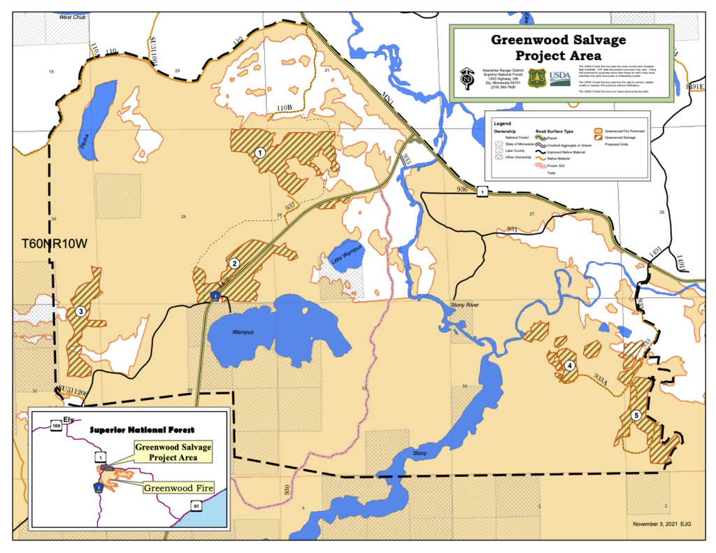
The Superior National Forest is considering allowing loggers to cut red pines on up to 250 acres in the 26,000-acre area burned by the Greenwood Fire. The agency says sites located near Isabella were damaged by the fire, but still contain valuable lumber.
The accelerated plan could see cutting occur this winter, with foresters concerned charred wood will quickly degrade. Because of its small size, the Forest Service could choose to exempt it from full environmental review. But, some details have been released and public input is currently being accepted.
The areas targeted for salvage are all on the north side of the burn area, on both sides of Highway 2 and up to the south side of Highway 1.
Two large blocks included in the plan were actually logged last summer, before the Greenwood Fire, as part of the Forest Service’s Pearl Project, which was approved in 2015. Limbs and other woody material left behind by the timber harvest is thought to have quickly dried during drought conditions, and contributed to the intensity of the fire in the stands.
The trees now proposed for harvest in those areas were left behind by loggers as the largest specimens on the sites, providing wildlife habitat and seed source for regeneration. But based on damage to their lower trunks and canopies, foresters don’t expect them to survive.
“Removing standing dead red pine through salvage harvesting would capture some value by providing wood products,” wrote Aaron Kania. “Areas would be monitored to ensure regeneration is taking place and tree planting would occur where there is limited remaining seed source.”
The plan calls for cutting pines over five inches in diameter that have fire scarring more than 10 feet up their trunks, or badly damaged crown. The large blocks that were harvested have about 137 acres of such timber. Less damaged trees will be left standing. Other smaller areas to the west and east have scattered severely burned plots of up to several acres in size.
Questions or comments are requested by Nov. 19. Sent to project leader Linda Merriman at linda.merriman@usda.gov or by mail to Kawishiwi Ranger District, 1393 Highway 169, Ely, MN 55731.