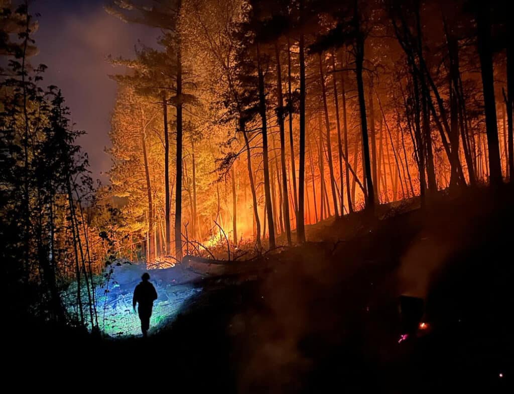
Birch Bay Fire breaks out near Burntside Lake, north of Ely
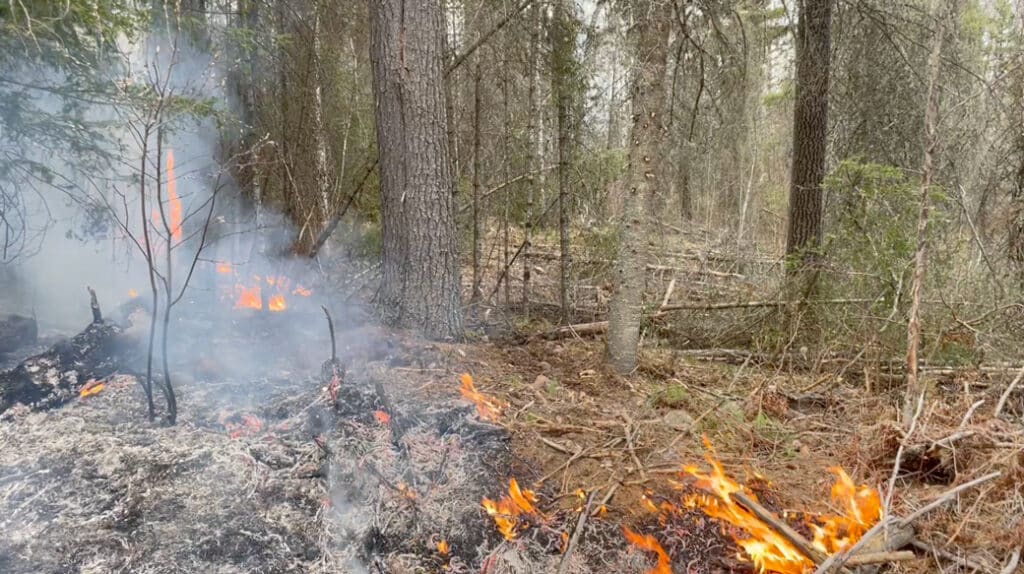
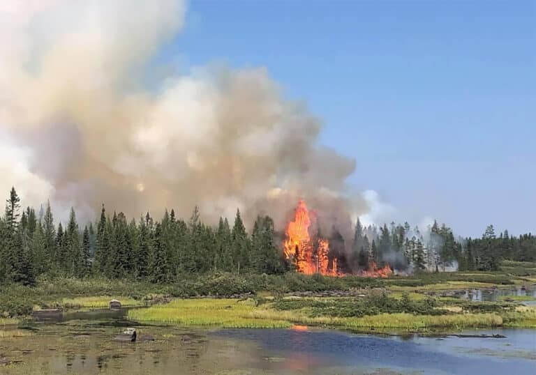
A wildfire broke out on the afternoon of June 1 near Burntside Lake. Driven by hot, dry conditions and light southeast winds, it spread quickly to an estimated 30 acres by evening.


A wildfire broke out on the afternoon of June 1 near Burntside Lake. Driven by hot, dry conditions and light southeast winds, it spread quickly to an estimated 30 acres by evening.

A rapidly spreading wildfire northeast of Two Harbors has forced mandatory evacuations, damaged structures, and closed a major stretch of Highway 61. Driven by dry conditions and high winds that sparked fires across the region, crews are working to contain the Stewart Trail Fire. Here is what wilderness travelers and North Shore visitors need to know.

A local company is using trees damaged by wildfire on state and federal lands to make lumber, pallets, and other products. As crews open areas, the Forest Service will restore some of the fire-impacted land with new tree seedlings and seeds.
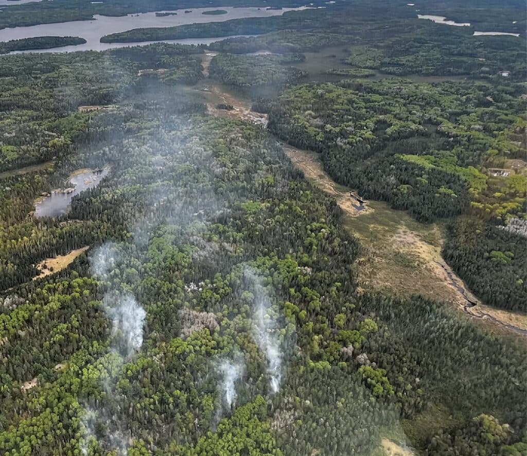
A lightning strike sparked a wildfire near the Horse River in the Boundary Waters Canoe Area Wilderness. This comes after an active wildfire season has scorched nearly 30,000 acres in the Superior National Forest this year. The Forest Service has issued a closure order for the route along the Dog Sled Portage and has encouraged visitors to avoid the area.
The Spruce budworm, native to Minnesota, has spiked in numbers as state and federal agencies, along with conservationists, are working to mitigate the issue. Repeated and sustained outbreaks, seen in dead or dying balsam fir and white spruce are a signal of poor forest health…
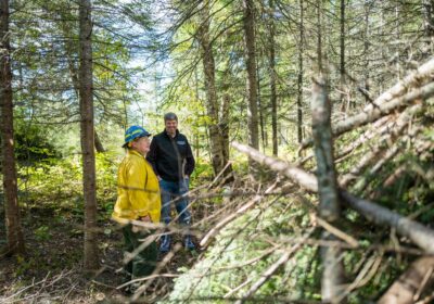
The Kawishiwi Ranger District is developing a forest plan to reduce the risk of wildfires near the Boundary Waters Canoe Area Wilderness and surrounding communities. The goal is to support a diverse and healthy forest, reducing combustible fuel, and to assist wildland firefighters in managing forest fires more effectively.
A 72-acre prescribed burn was in progress just south of the BWCA, and declared a wildfire when a spot fire started beyond the planned burn area.
A wildfire is currently burning near the end of the Gunflint Trail in the BWCAW. The US Forest Service says the fire was detected between Spice Lake and Ogishkemuncie Lake in the Boundary Waters Canoe Area Wilderness.
Project studies potential of converting excess fuel for forest fires to useful material for several purposes.

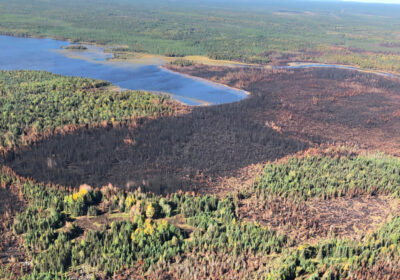
The Fourtown Lake Fire was allowed to burn to some extent, helping restore a healthy forest and reducing firefighting resources needed.

Blaze burns small area on northeastern end of National Park, leading to evacuations and temporary closures.
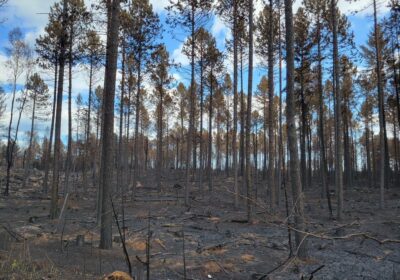
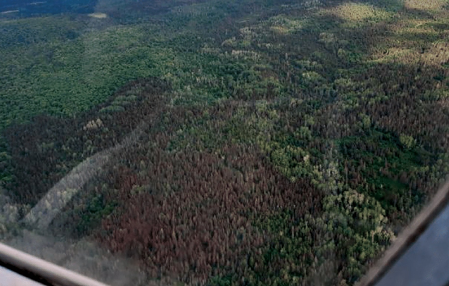
Burned trees on Superior National Forest may be opened to loggers. Plan focuses on one percent of the area burned by this summer’s biggest fire in northeastern Minnesota.
Questions and answers about the wildfires consuming parts of northern Minnesota. Where do the animals go? How much of the BWCA has burned?
Superior Hiking Trail closed, Boundary Waters closed due to fires. Updated maps, photos from fires in Boundary Waters Canoe Area Wilderness and Superior National Forest as official information is available. Greenwood Fire grows, Moose Lake Fire detected…
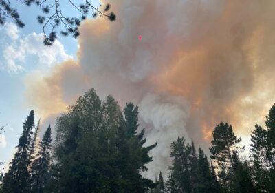
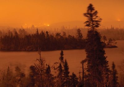
Fire increases to over 19,000 acres creates a pyrocumulus cloud resulting in fire-created lightning, new evacuations but weather conditions could be more favorable soon.
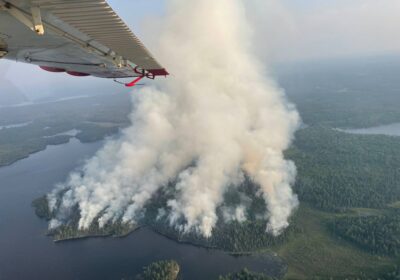
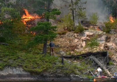
Forest Service shuts down wilderness area as large wildfires burn and drought continues, efforts to find visitors by canoe, float plane.
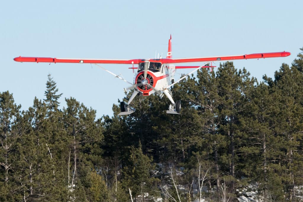
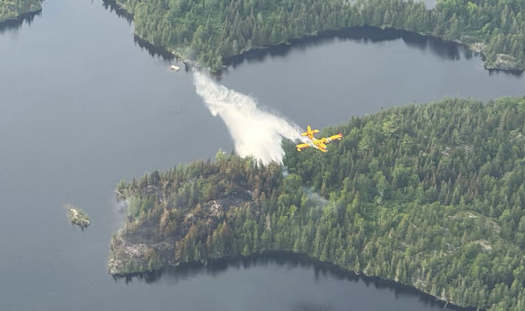
Aircraft purchased by the Forest Service in the late 1950s work on everything from wildfire, search-and-rescue, to wildlife management.
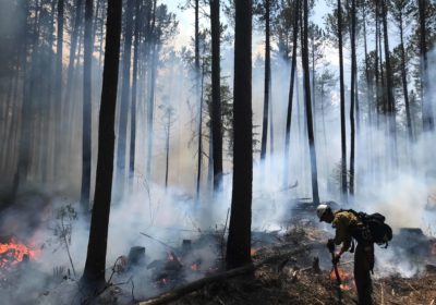
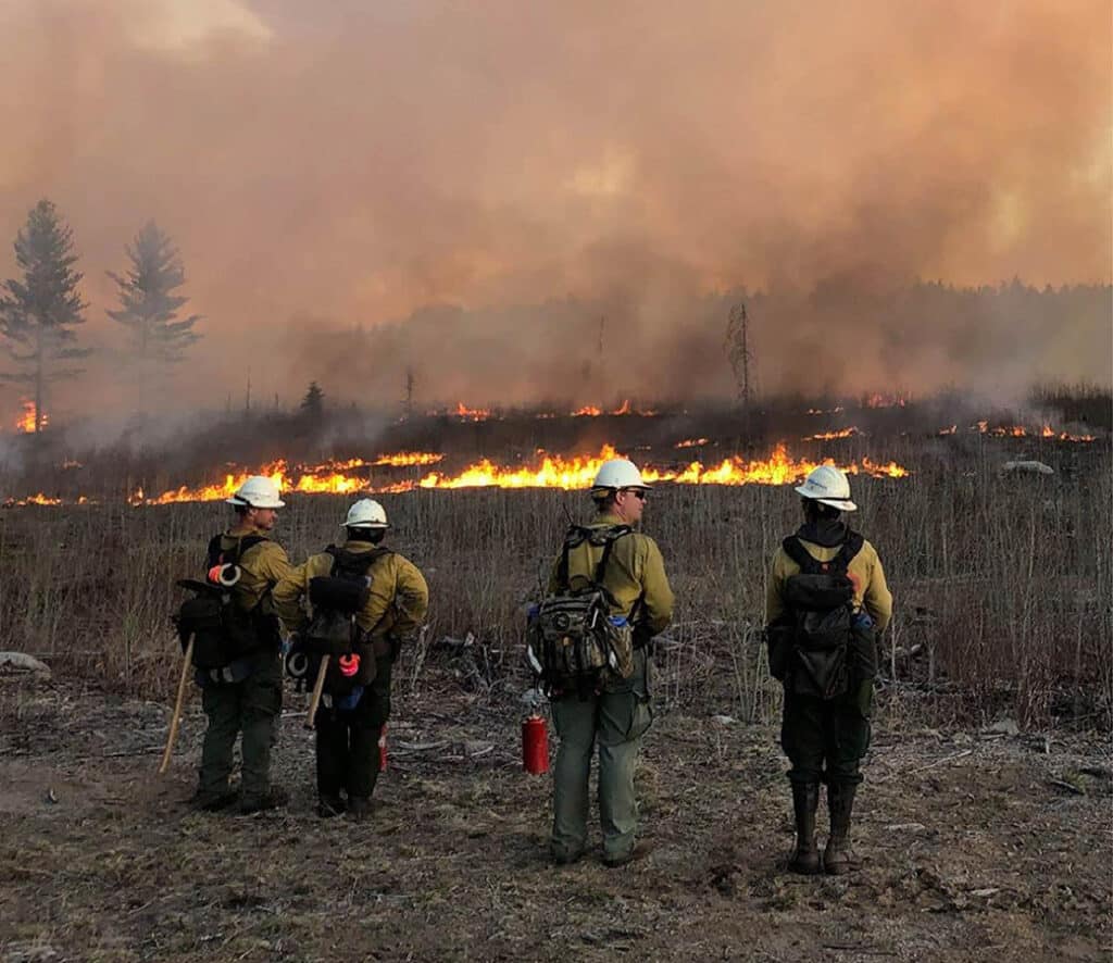
Forest Service urges campfire caution as it fights another forest blaze ignited by Boundary Waters wilderness visitors.
Conditions are causing concerns about wildfires in northeast Minnesota, as authorities urge campers and others to exercise caution.
In May 2007 an out of control campfire off the Gunflint Trail grew into a wildfire that burned 75,851 acres. Ten years later, the forest is at a turning point…