

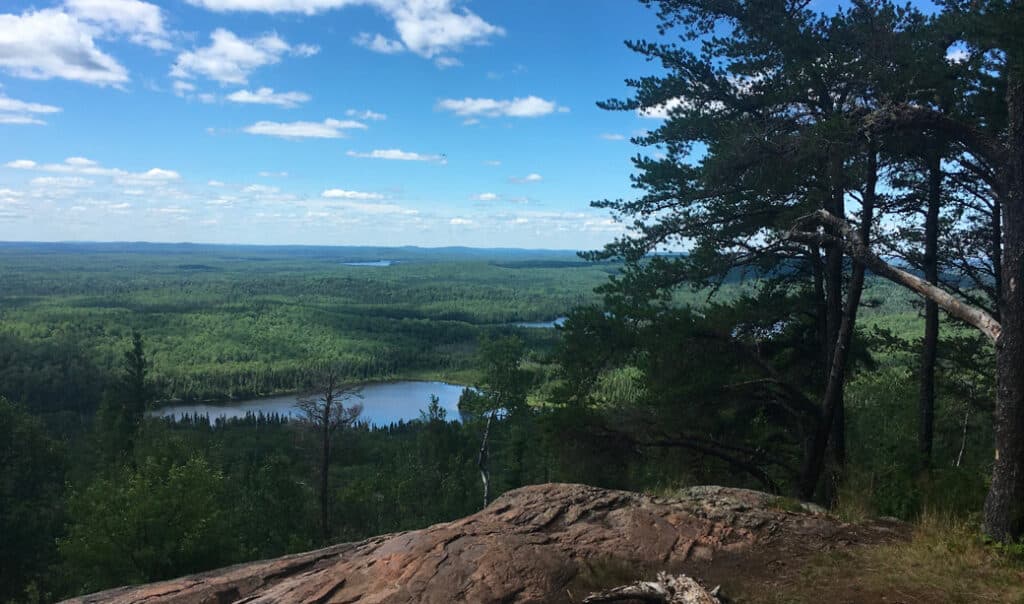
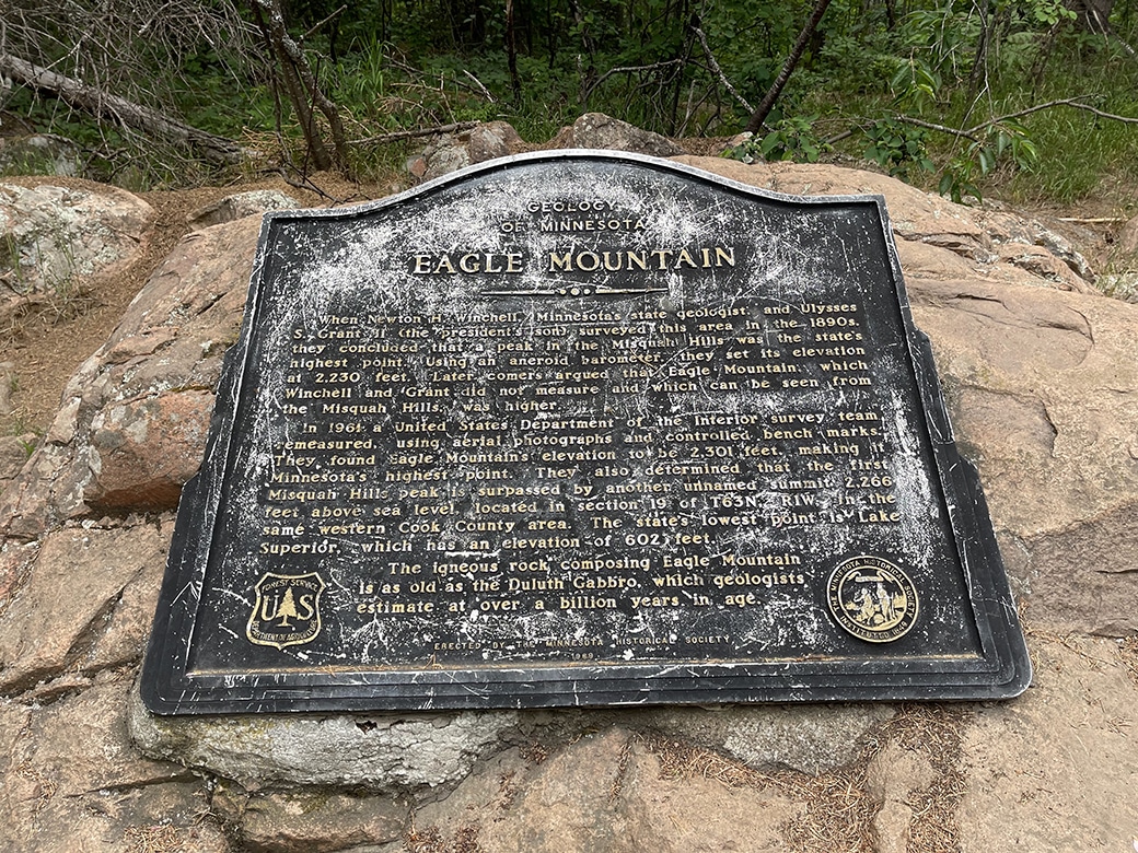
I wonder what that dog is barking at, I thought to myself as I sat on top of Eagle Mountain—the highest point in Minnesota. Having seen plenty of evidence that moose were in the area, that’s the first place my mind went. As it turns out—I learned later while meeting the same dog on the trail—it was just another party of hikers.
I’d been sitting on top of Eagle Mountain for more than 30 minutes, enjoying the breeze and slight relief from the otherworldly level of bugs. It had been hours since I heard any manmade sounds before that bark. I marveled at the abundance of quiet and solitude I found in just three and a half short miles.
Where to find Eagle Mountain
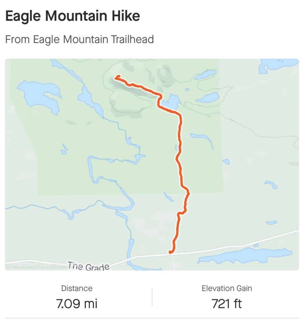
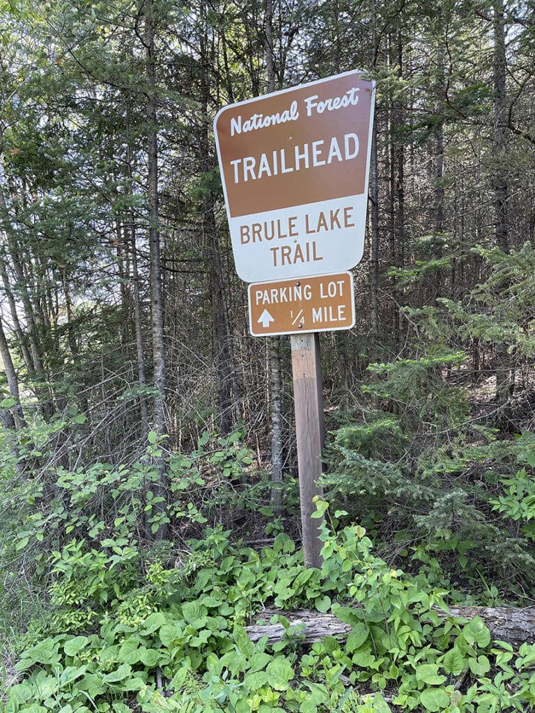
The highest point in Minnesota—Eagle Mountain—can be reached via a three-and-a-half-mile one-way hiking trail located 22 miles north of Lutsen and 20 miles northwest of Grand Marais. From Lutsen, take Caribou Trail from Highway 61. As you drive up Caribou Trail, keep your eyes peeled for a Superior Hiking Trail (SHT) Trailhead next to Caribou Lake. If you have energy left after your Eagle Mountain summit, there’s a short, but steep, hike here to White Sky Rock that offers epic vistas year-round. The trail to White Sky Rock is a short spur off the main SHT trail. You can find a map here.
Follow Caribou Trail until it ends at The Grade (Forest Road (FR) 170) and turn right. Parking for the trailhead to Eagle Mountain is located on your left-hand side about 4 miles up The Grade. Be sure to download any maps and check the weather before you leave Highway 61 because it’s unlikely you’ll have wireless service at the trailhead.
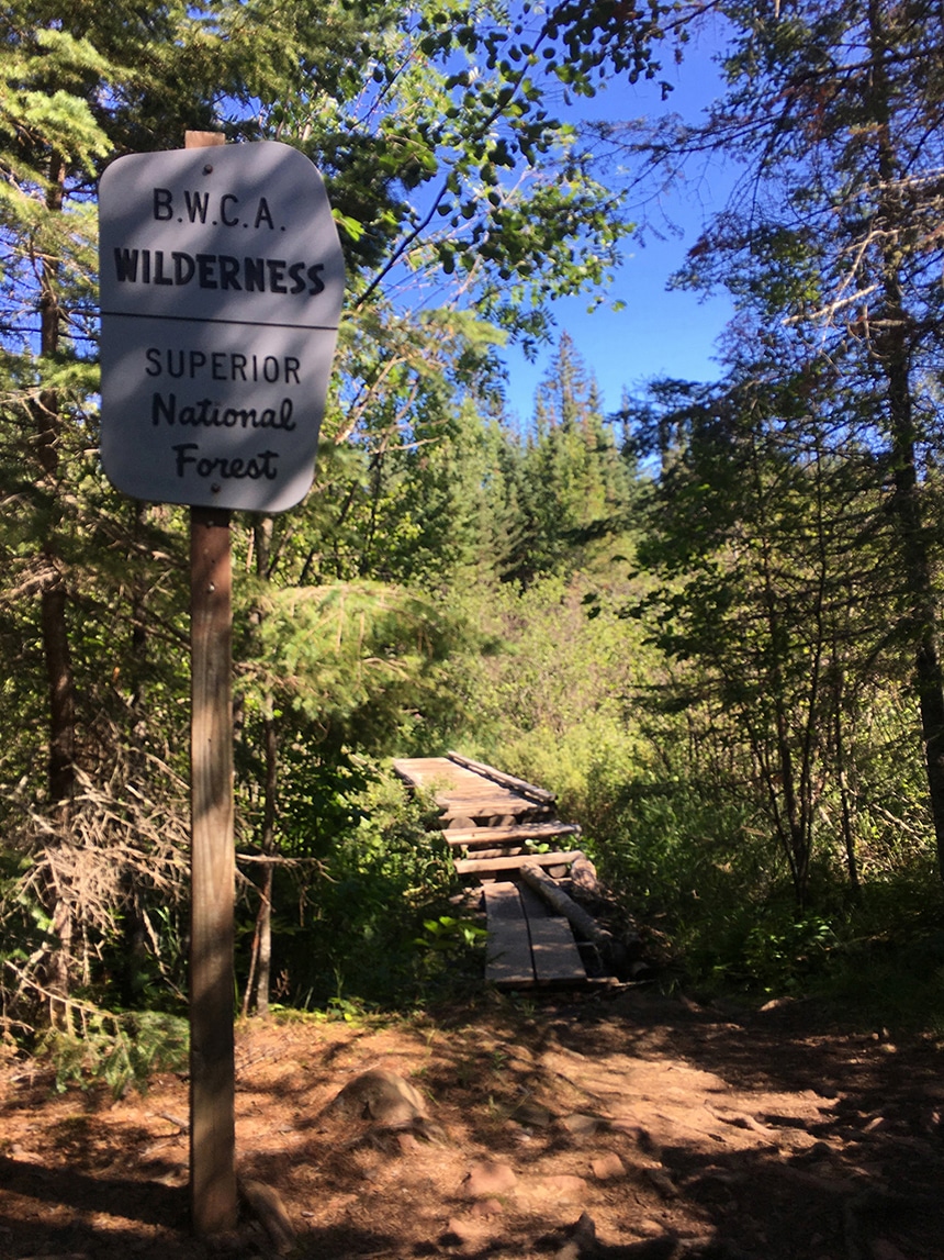
After lacing up some sturdy shoes, and filling your daypack with snacks, water, bug repellent, and other emergency items, you’ll want to remember to fill out a self-issuing permit. Much of the trail passes through the Boundary Waters Canoe Area Wilderness (BWCAW) where special rules apply. Be sure to read the rules on the back of the permit carefully, or prepare yourself ahead of time by watching these three short videos. Of special note, ensure that you limit your party to no more than nine people and avoid packing in glass or metal containers except medications, insect repellent, and cylinders for gas stoves. Familiarize yourself with the Seven Principles of Leave No Trace to ensure you leave this protected area better than you found it.
How to reach the summit
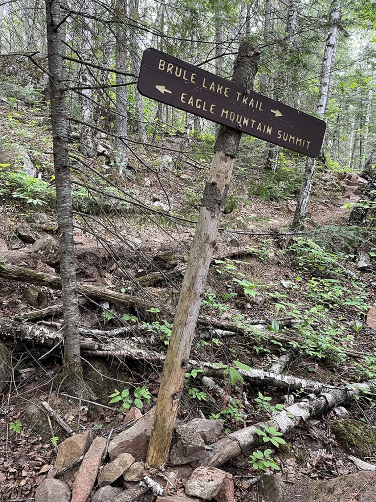
There are technically two trailheads that will get you to the top of Eagle Mountain. The trailhead directions I just detailed are for the “easy” way. Eagle Mountain can also be reached from the Brule Lake Trail. A short road walk from the Brule Lake Entry Point parking lot brings you to the Brule Lake Trail. While there are a couple of flat and easy sections, most of the trail is quite difficult and nearly impossible to follow at points. That said, I’m happy I did it. If you’re experienced in navigating the wilderness and hiking in the challenging terrain of northeastern Minnesota, you might enjoy the challenge. It’s about eight miles from the parking area at Brule Lake to the intersection of Eagle Mountain. Considering the trail’s difficulty, you will likely want to plan to spend the night on the trail. This requires an overnight permit from May through September that you can purchase from a Forest Service office or an area outfitter. You can use the self-issuing station from October through April.
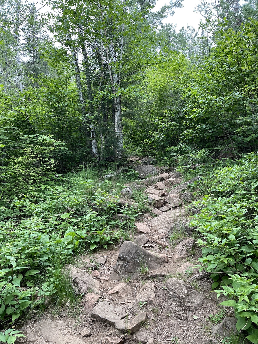
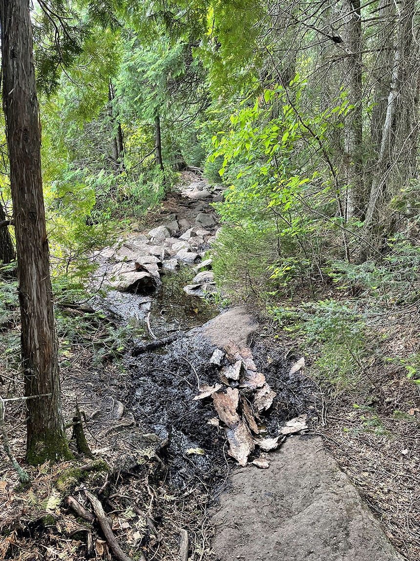
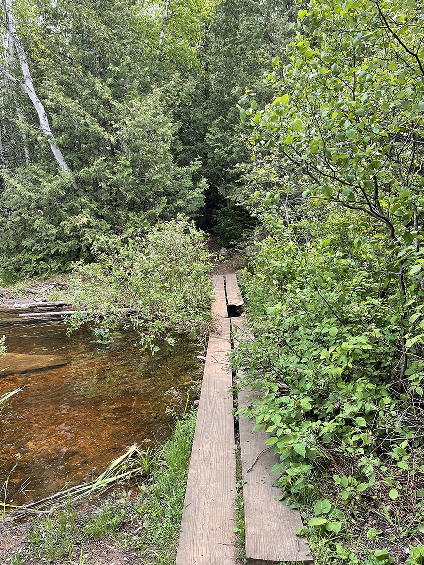
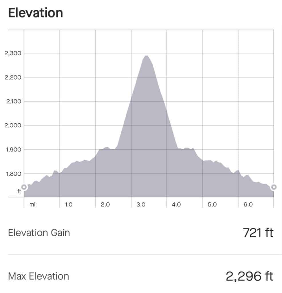
The easier of the two routes is about seven miles round-trip. Most descriptions of the trail label it as difficult due to plenty of rocks, roots, and mud you will navigate before reaching a steep climb at the end that is less than a mile. But don’t let that deter you. I’ve hiked this route many times and have seen people of all ages and physical abilities reach the summit. Just be sure to pack plenty of water and snacks and remember the adage slow and steady wins the race.
I always carry trekking poles in my day pack and I always end up pulling them out on this trail. One of the Seven Principles of Leave No Trace and a rule for travel in the BWCAW is to travel on durable surfaces. This means walking “in single file in the middle of the trail, even when it’s muddy” according to the USDA Forest Service. Circumnavigating a puddle doesn’t seem like a big deal if it were just you. But one set of tracks leads to hundreds of tracks leading to the widening of trails and erosion that negatively impacts plant life and trail stability. Trekking poles will help you keep your balance while navigating these tricky spots. They’ll also help take the pressure off of your knees and joints while going downhill. As it pertains to mud, I always choose footwear that dries quickly in the warmer months. In the winter, I wear footwear that is insulated and waterproof. And it never hurts to pack an extra pair of socks.


Plan for your trek up Eagle Mountain to take anywhere from four to eight hours depending on your fitness level and how long you stop for breaks and photo ops. For longer hikes like this, I always plan for two miles per hour plus one hour. That means I’d plan to spend four-and-a-half hours on the trail. I’ve been tracking my hikes and canoe trips for many years and I find this to be a perfect estimate for me, although it might be longer or shorter for you.
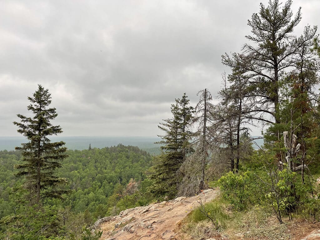
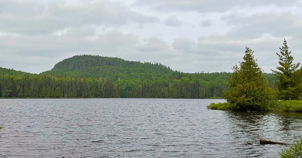
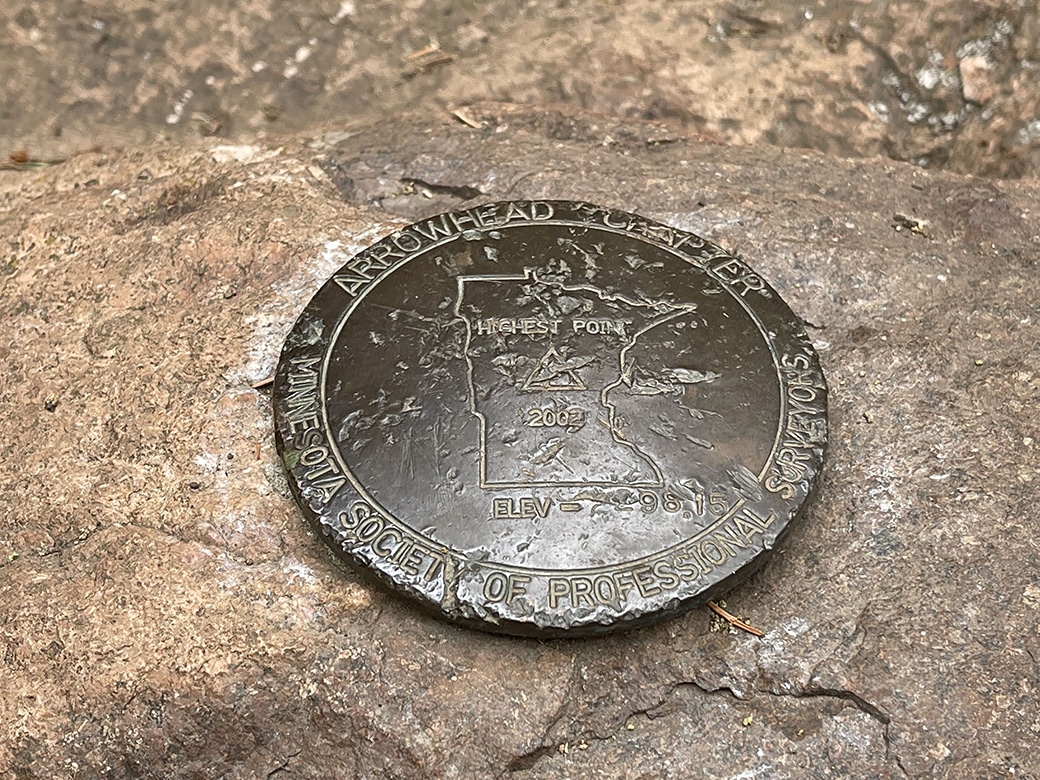
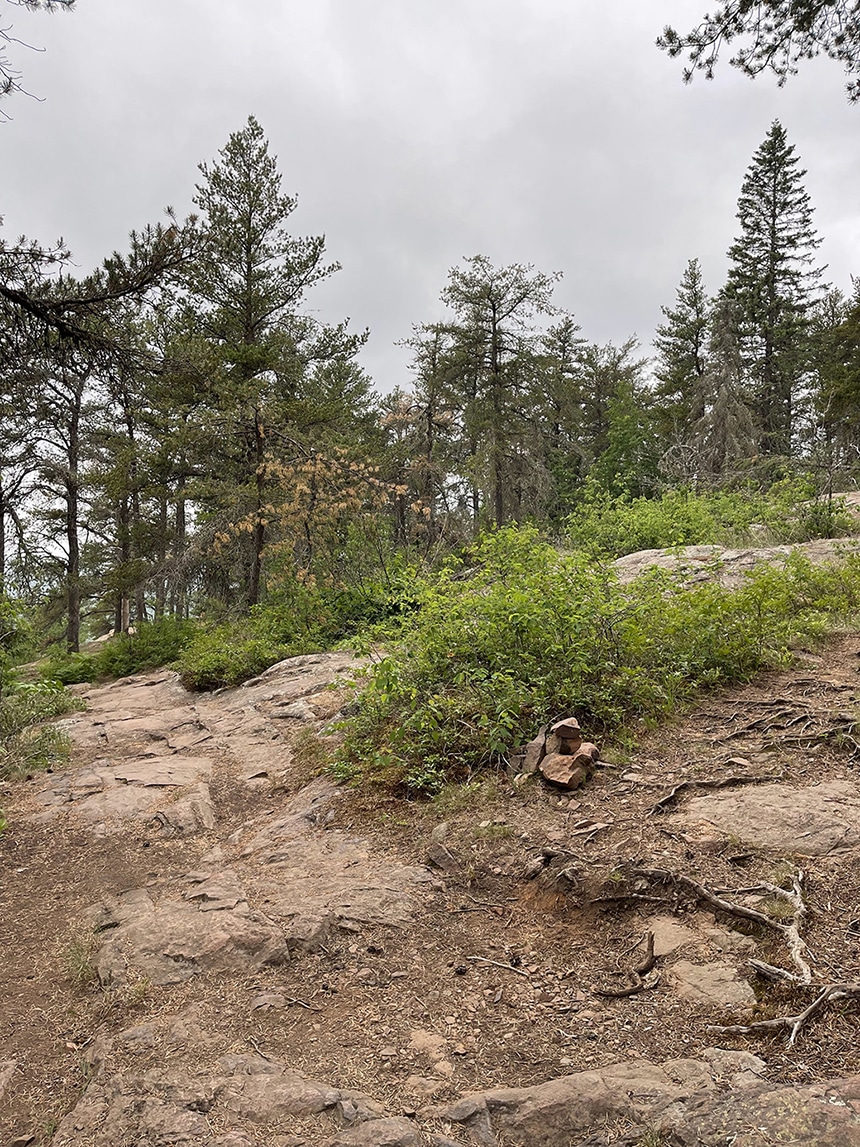
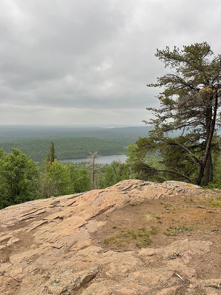
As you make your way to the summit, you’ll come to a small overlook on your left. After taking a short break to refuel and drink some water, continue up the trail. When you get to the top, you’ll see the trail split, and a couple of rock cairns to your right. Follow this trail to the highest point marked by a brass sign and survey disk. After taking some selfies to document your accomplishment you’ll want to make your way down to the flat ridge to enjoy a cool breeze and scenic vistas. Study the map before you go and impress your friends by naming all the lakes you can see. The lake right below you is Shike Lake and right behind that is Zoo Lake. Then see if you can spot Eagle or Cascade Lakes in the distance. Always use caution along steep ledges.
Eagle Mountain pro tips
After savoring the epic scenic vistas atop Eagle Mountain, take it nice and slow on your way down, leaving lots of margin to look up and look down. There is an amazing abundance of plants and wildlife to photograph and discover. On my most recent hike, I enjoyed Pink Lady Slippers, also known as Moccasin Flowers, surrounded by a sea of bunchberry blooms. I also noticed the wild blueberries had a good number of buds that should provide a tasty snack for other hikers later in the season. And I have to mention all of the moose scat I saw, but no moose … that day.
Hiking trails seem to be busiest late morning to late afternoon. I found that to be true at Eagle Mountain as well. If you go early in the morning, you’re likely to have the trail to yourself. Especially if it’s a weekday.

If you’re looking to camp nearby, there are several Superior National Forest Campgrounds that are a short drive. Crescent Lake and Two Island Lake are the two closest but feel free to explore all of your recreation opportunities here. Select the Camping Recreation Opportunity Guide to download and print before you go.
Eagle Mountain is a must-see for anyone who enjoys longer and more challenging hikes that reward you with quiet, solitude, and epic scenic vistas. By planning ahead and being prepared, you’ll create memories and a sense of achievement that will enrich your life for years to come. You can find more resources to start planning your hike to Eagle Mountain below.
More to explore:
Learn more about the Eagle Mountain Trail
Download the USFS Eagle Mountain Guide
Learn more about the BWCAW rules and regulations
How to practice Leave No Trace in the Boundary Waters and elsewhere
National Park Service’s guide to rock cairns
Holly Scherer is a Minnesota-based writer, photographer, outdoorswoman, and guide. She’s most at home in the great outdoors; camping, hiking, paddling, cycling, and gardening. When she’s not on an adventure, she and her husband live in the Twin Cities where they’re fond of saying, “home is where we store our outdoor gear.”