


When people picture canoeing in northern Minnesota, they often imagine the Boundary Waters Canoe Area Wilderness (BWCAW). This remote destination offers paddlers access to over 1,000 lakes and 2,000 campsites. But the BWCAW isn’t the only place for unforgettable canoe-camping adventures. We’ve selected thirteen routes in the Superior National Forest, outside the designated wilderness. These routes offer excellent paddling without the need for a permit. We include maps and key details to help you plan your trip.
Thirteen water trails
Did you know the Superior National Forest features many quiet lakes and canoe routes perfect for last-minute trips or for those who didn’t get a BWCAW permit? We’ve put together thirteen canoe camping routes across the Forest. These spots are ideal for spontaneous getaways and serve as great alternatives to the BWCAW. Some even feature access to hiking trails. Most are easy to navigate and suitable for all ages and skill levels. Most routes work best for non-motorized boats, while others allow motorized boat access.
Before you head out, check with a ranger station for current conditions. Additional maps, campsite, and portage trail information can be found online. Some lakes are accessed by forest roads, which can vary in condition and difficulty. Remember, you probably won’t have cell coverage in most areas.
Ely, MN
Ely, with a population of about 3,500, sits in the heart of the national forest and right on the edge of the BWCAW. We’ve included three great routes in the area that offer pockets of solitude and wilderness-style campsites. You can get additional information and maps at the Kawishiwi Ranger Station east of town.
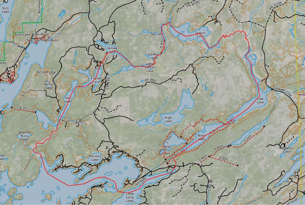
Circle Route
This 20-mile canoe route combines 10 lakes, 2 rivers, and multiple backcountry campsites that you can access by water on a first-come basis. You’ll find a lovely mix of thick pine forests and prime animal habitat, both defining features of the north. Set aside time to hike the Bass Lake Trail system, which has several loop options.
Good to know: This route crosses part of Burntside Lake, which is a large lake northwest of town. Keep a careful watch on the weather as the wind can create large, treacherous waves on the lake. Beaver activity can also change river conditions and water levels. You can find directions and information here.
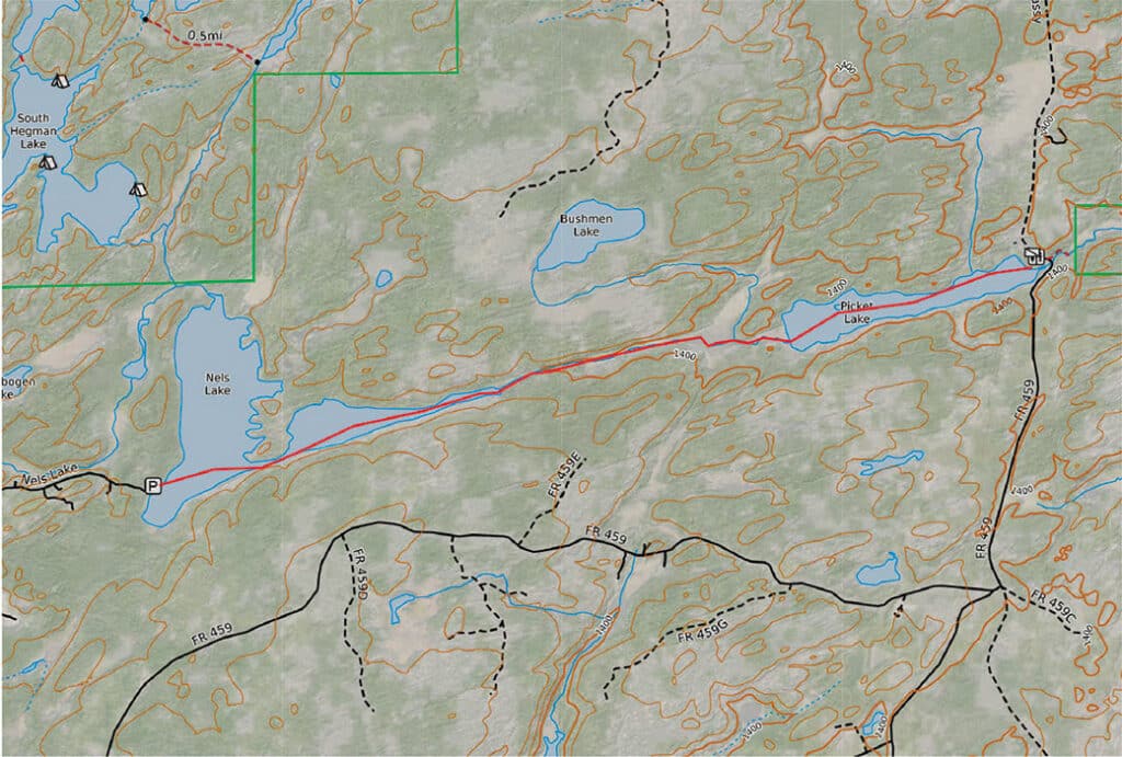
Nels-Picket Route
This quiet lake features three first-come, backcountry campsites that share many characteristics with those found in the BWCAW. Each site includes a fire grate, a small boat landing, and a latrine. All are accessible by boat. Visitors can also take an optional day trip to Picket Lake to the east. Depending on creek levels, you may need to portage along Picket Creek.
Good to know: This route lies outside the BWCAW boundary but connects to other canoe routes within the wilderness. You can also start at Picket and head to Nels (more info on that below). You can find directions and information here.
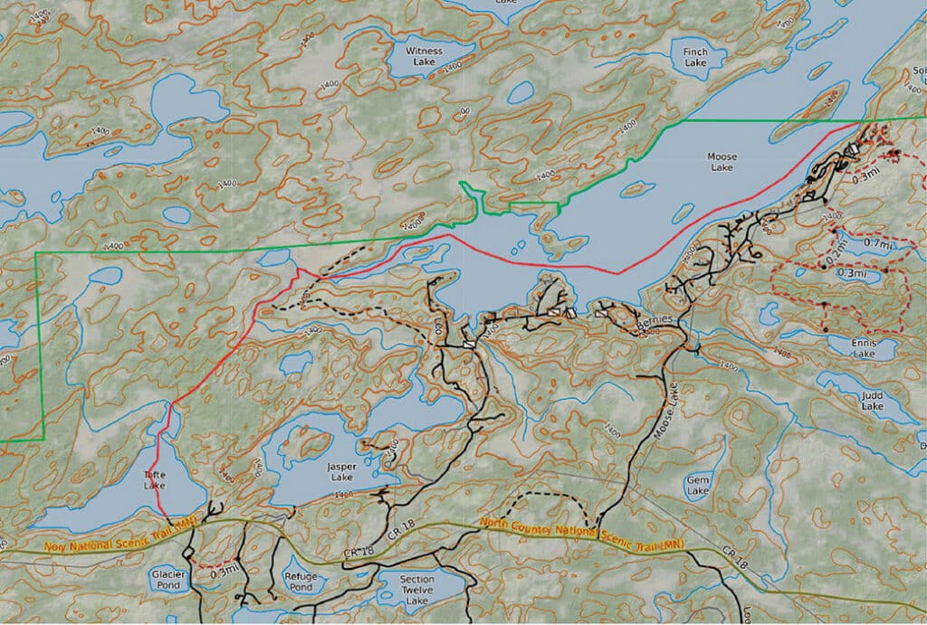
Tofte Lake
This lake is a great choice for paddlers who want a wilderness-like experience. You can access the lake using two different boat landings. One option is to start at the Moose Lake Entry Point #25, located outside the wilderness. From there, paddle southwest to the small river that flows out of the lake. Continue paddling and taking one long portage into Tofte Lake. Alternatively, you can launch from an easy boat landing on the south end of Tofte Lake.
Good to know: This lake has four backcountry campsites and a boat ramp. Nearby lakes within driving distance offer day trip options. Anglers will appreciate this lake, known for its trout population. You can find directions and information here.
Cook, MN
The small town of Cook serves as a gateway to many recreational opportunities, including Voyageurs National Park. You can get additional information and maps at the LaCroix Ranger Station off Hwy 53 north. We’ve included three great canoe camping options that provide beauty and solitude.
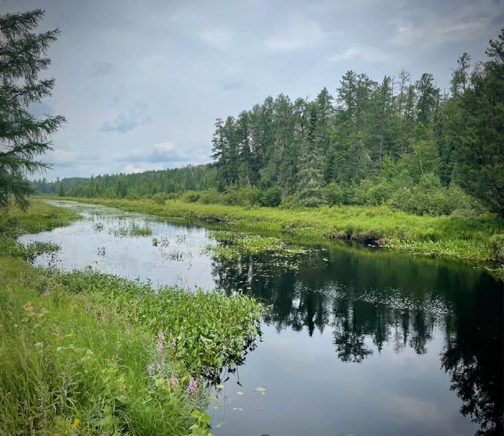
Hunting Shack River Route
Paddlers can explore these four interconnected lakes, accessed by the river, for a taste of what the BWCAW offers. Spend time hiking the seven miles of trails that wind around and near the serene lakes. Six first-come, primitive campsites along the route have a small fire grate and latrine.
Good to know: River conditions and levels may vary along this canoe route due to beaver activity. Roadside parking off the Echo Trail is available. You can find directions and information here.
Picket-Nels Route
This quiet lake features three first-come, backcountry campsites that share many characteristics with those found in the BWCAW. Each site includes a fire grate, a small boat landing, and a latrine. All are accessible by boat. Visitors can also take an optional day trip to Nels Lake to the west. Depending on creek levels, you may need to portage along Picket Creek.
Good to know: This route lies outside the BWCAW boundary but connects to other canoe routes within the wilderness. You can find directions and information here.

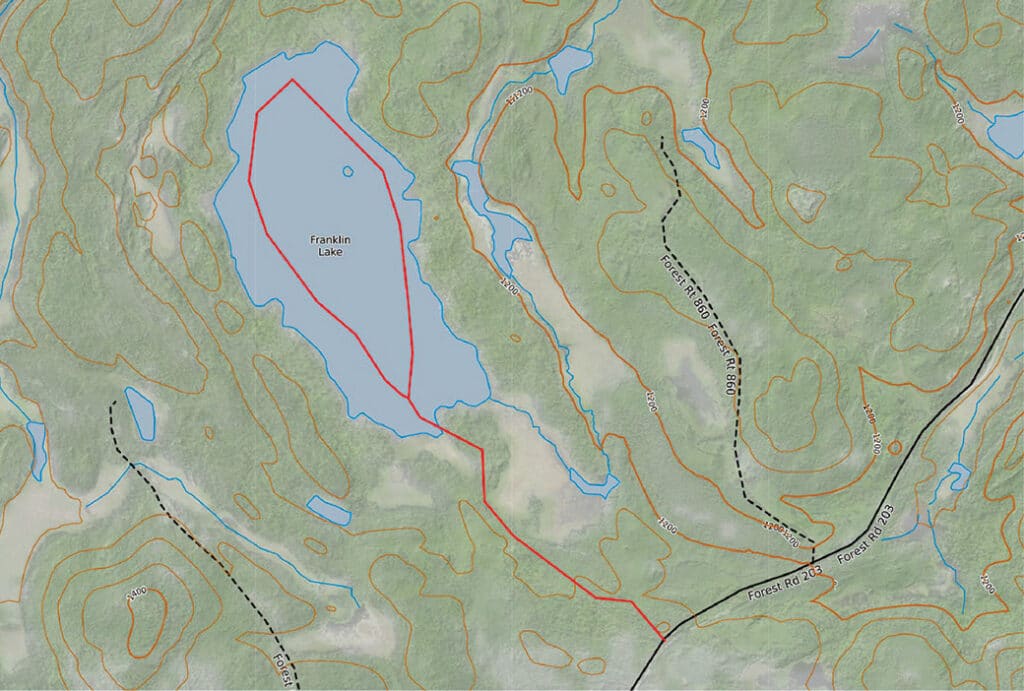
Franklin Lake
This 156-acre lake lies west of Crane Lake and just south of Voyageurs National Park. Two backcountry campsites sit along its shorelines. A variety of fish species inhabit the lake, making it a popular spot for anglers.
Good to know: You’ll find a short portage from the road, which allows ATV access. The parking lot accommodates four vehicles but does not allow trailers. You can find directions and information here.
Grand Marais, MN
Grand Marais sits along the shore of Lake Superior near the eastern edges of the BWCAW. The two routes we’ve included all begin along the Gunflint Trail. This National Scenic Byway heads north toward Canada. Originally a footpath to inland lakes, the trail has served travelers for generations.
Twin Lakes Route
This cluster of lakes offers a taste of a wilderness trip with easy access between them. Paddlers can choose to stay at one of the five backcountry campsites or portage from lake to lake using one of four portage trails, each varying in difficulty.
Good to know: The longest portage crosses private property along a former railway. Stay on the trail, and avoid camping or driving on it. You can find directions and information here.
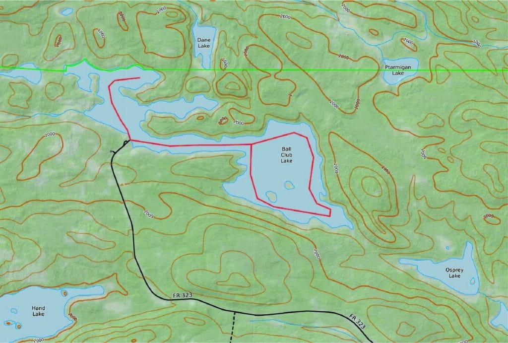
Ball Club Lake
You’ll find two easily accessible campsites on this lake. One sits right by the parking lot, and the other lies a short canoe paddle or motorized boat ride away. Also, the lake hosts multiple fish species, including brook trout, northern pike, walleye, and yellow perch.
Good to know: The campsites are primitive and include a fire grate and latrine. You’ll need to bring a way to filter lake water, and you must pack out all garbage. You can find directions and information here.
Tofte, MN
The quaint town of Tofte sits right along the shoreline of Lake Superior. About 1.5 hours north of Duluth, it welcomes recreationalists who enjoy hiking, fishing, canoeing, and exploring. Visitors can stop at the Tofte Ranger Station on Hwy 16/North Shore Scenic Drive to get maps and information.
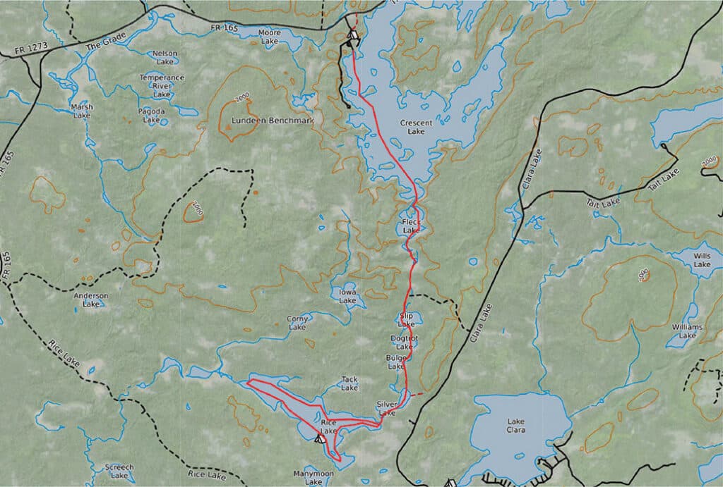
Crescent Lake Route
Crescent Lake lies entirely within the Superior National Forest. Visitors can camp at one of the waterfront sites, which offer easy access to fishing, or paddle south for a wilderness-style canoe trip.
This route, one of the oldest watertrails connecting Lake Superior to Knife Lake along the Canadian border, has served the Ojibwe for generations. The four-mile journey starts at the boat landing on Crescent Lake and includes seven short portages to Rice Lake, where paddlers can choose from three first-come campsites.
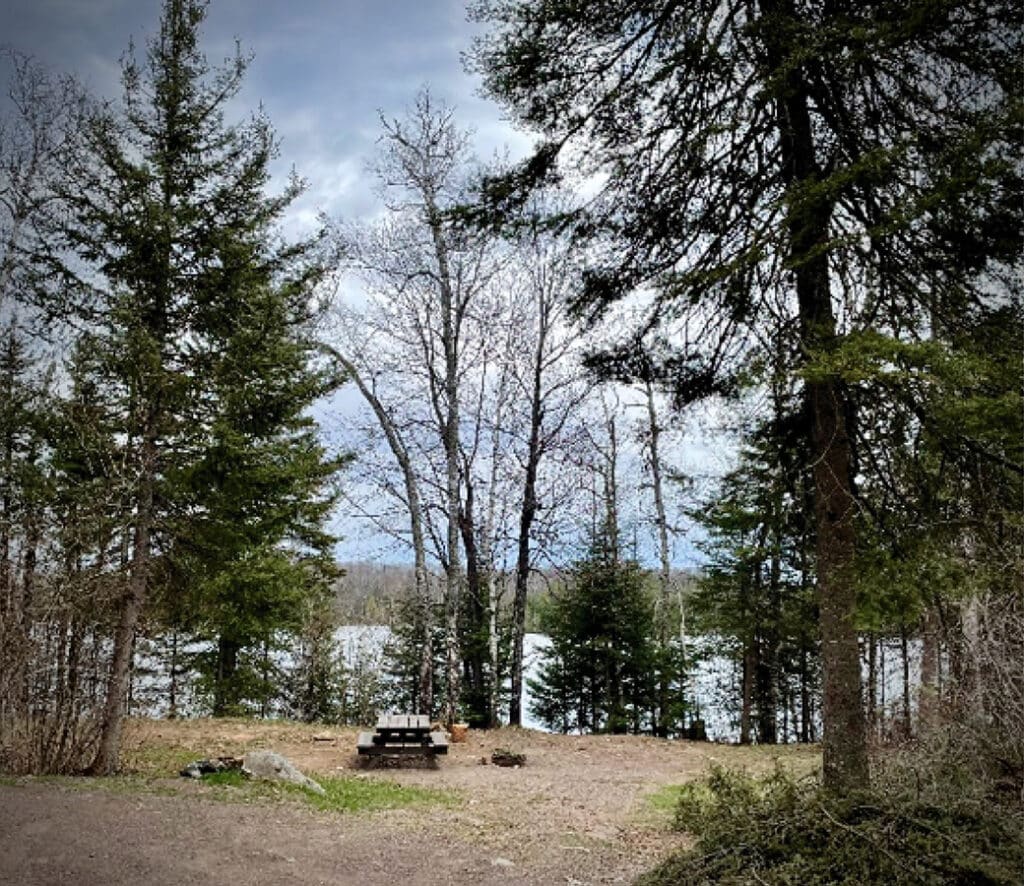
Good to know: The campground sites include picnic tables, campfire grates, water pumps, and vault toilets. A fishing pier is located within the campground. Backcountry sites are primitive and have a fire grate and latrine. Motorized boats can also access the lakes, so this is not exclusively a canoe route. You’ll need to bring a way to filter lake water, and you must pack out all garbage. You can find directions and information here and here.
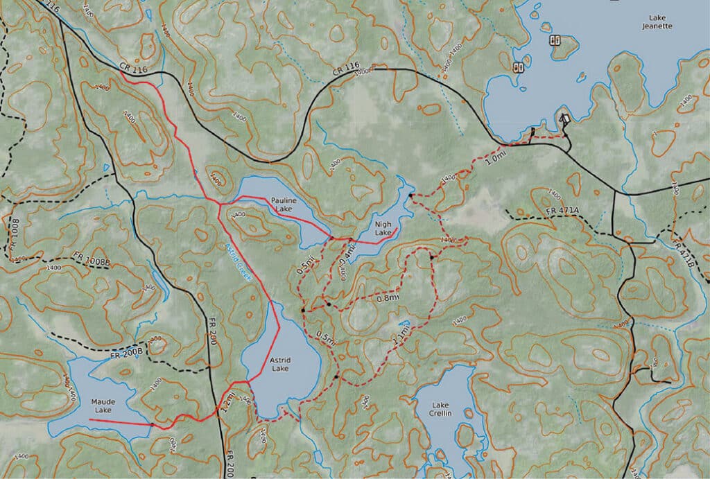
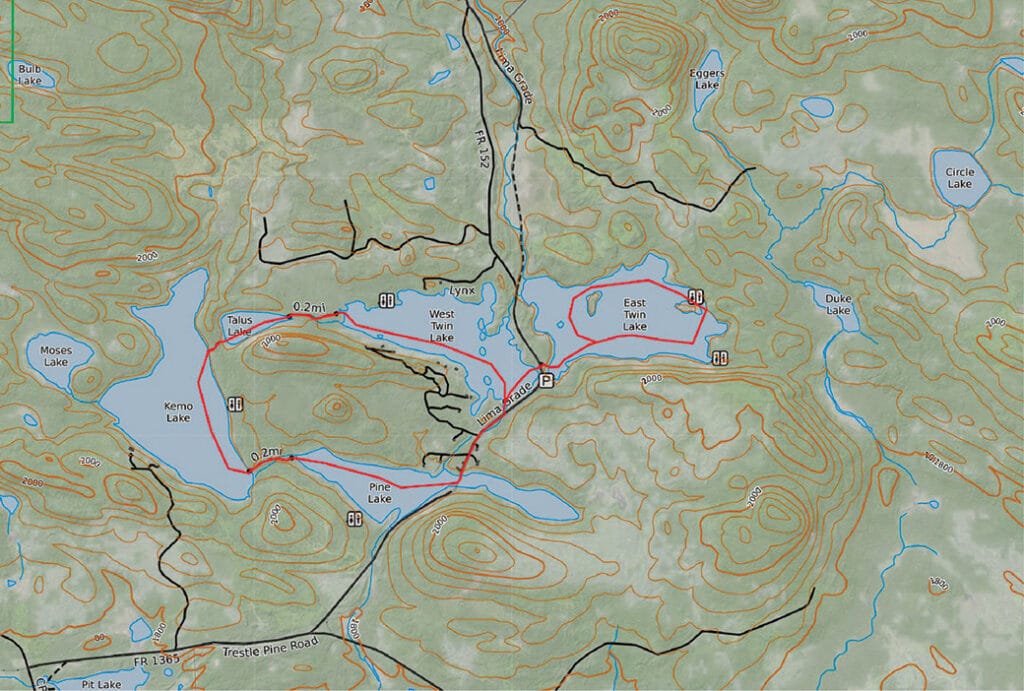
Divide Lake
This small lake caters to paddlers and hikers. It offers three campsites. Two are for car campers, and one backcountry site is accessible only by canoe. A two-mile hiking trail circumnavigates the lake through the boreal forest.
Good to know: This fee-based campground does not accommodate RVs. Anglers will appreciate this lake, which is stocked with trout. You can find directions and information here.
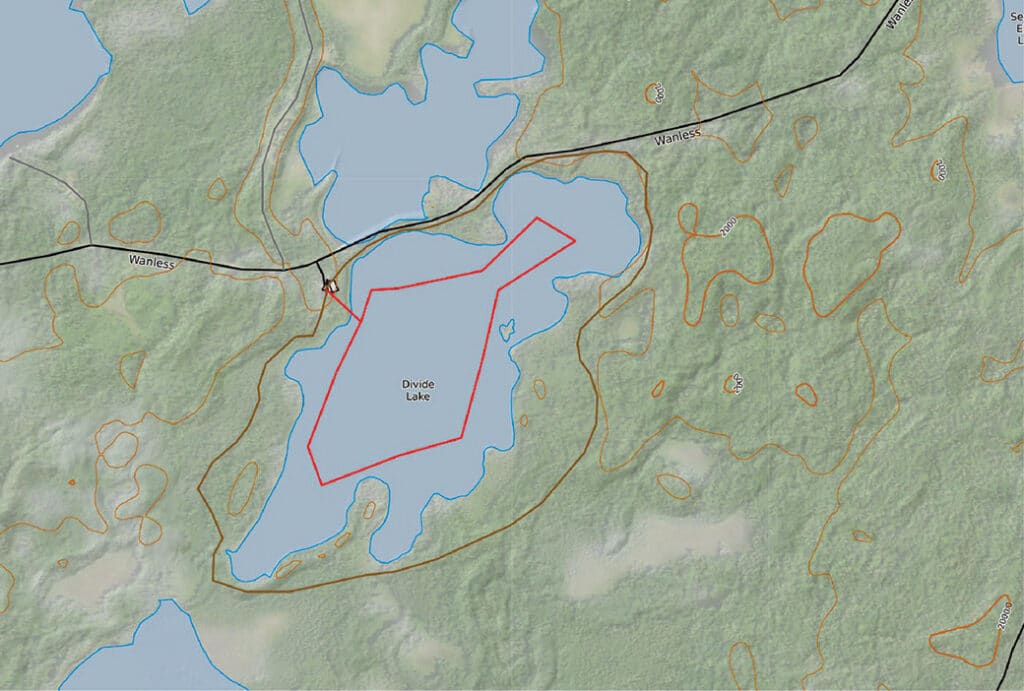
This map shows the Divide Lake Route and hiking trail. It is for informational purposes only and should not be used for navigation.
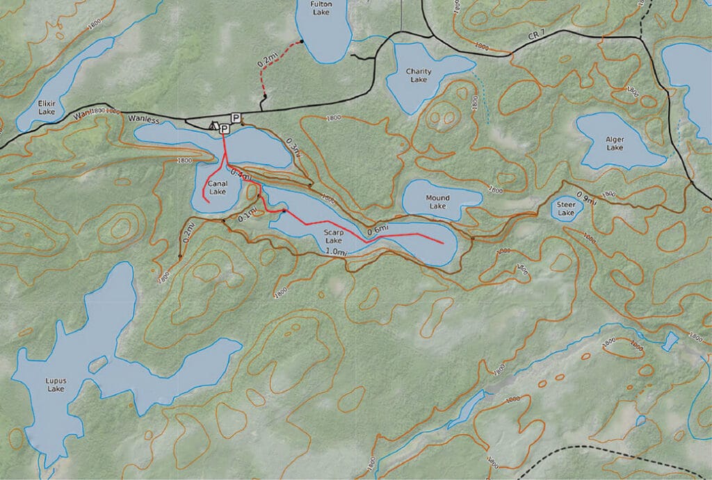
Hogback Lake Route
This recreation area offers multiple camping opportunities and provides lake access for both motorized and non-motorized boats. Day hikers and backpackers can also explore five miles of looped hiking trails that run alongside lakes with primitive campsites.
Good to know: Three campsites allow pull-in parking and may accommodate an RV. Visitors can reach five additional backcountry campsites by boat or on foot. You can find directions and information here.
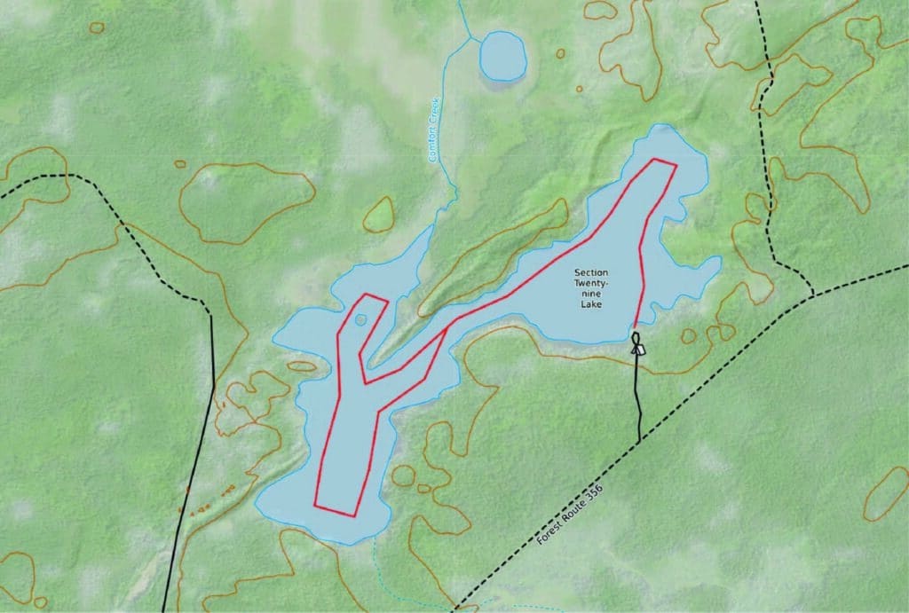
Section 29
Four campsites dot the forested shoreline of Section 29. This angular, scenic lake supports populations of walleye and northern pike. Additionally, visitors can also drive from this lake to nearby lakes, most of which offer carry-down access.
Good to know: A boat ramp is available. Pack out all garbage and have a way to treat or filter lake water. You can find directions and information here.
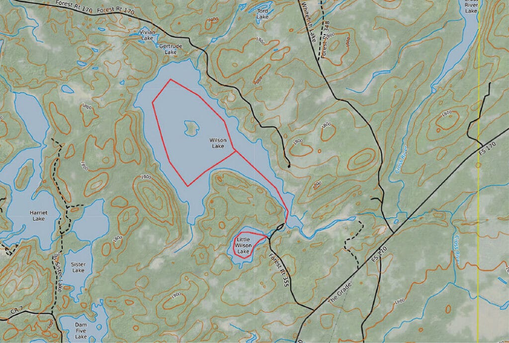
Wilson Lake
This pair of lakes, Wilson and Little Wilson, offers one of the easiest access points and a true backcountry experience. You can reach four campsites by car or take a boat to camp at one of the primitive sites along either lake.
Good to know: According to the Superior National Forest, a portage connects Wilson Lake to Sister Lake in the west. Pack out all garbage and bring a way to filter water from the lake. Three of the car-camping sites may accommodate an RV. You can find directions and information here.
Enjoy, respect, and protect
Many animals live in the national forest, including black bears, moose, gray wolves, and lynx. The changing seasons offer visitors something to appreciate all year round. If you visit, enjoy the forest, and help keep it beautiful by leaving it better than you found it. Be sure to pack out all your garbage, bring a way to treat or filter your water, and store food properly. Check area fire restrictions and any other alerts or closures before you go. Lastly, keep your voices low to increase your chances of seeing wildlife.