

A historic canoe trip that was one of the earliest conceptions of what would become the Boundary Waters as a canoe area is the topic of a recent story in the Minnesota Conservation Volunteer magazine. Writer Ryan Rodgers joined retired Forest Service employee Tom McCann and companion Ewart Martens on the 100-mile loop in 2021, a century after Arthur Carhart first traveled the route.
For the past few years, trip leader McCann has been promoting the anniversary of the trip Carhart took in 1921, when he explored a new idea for the U.S. Forest Service: recreation.
“As a canoe country, [it] would have few, if any, competitors,” Carhart wrote in a report following the trip.

He expressed a revolutionary vision of the Boundary Waters as better left alone. Carhart seemed to foresee a future when hundreds of thousands of people would visit each year to enjoy a place where people are only visitors.
McCann and another crew first completed the route in 2020, traveling forgotten portages that had been disused for decades. That was preparation for the anniversary trip, commemorating a big moment for what would become designated wilderness, almost fifty years before the Wilderness Act provided a legal definition.
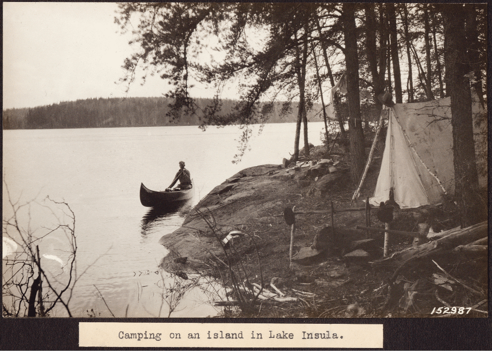
“On a spring day a century after Carhart’s trip, my companions and I are pushing off into this labyrinthine lake land, now known as the BWCA, to trace the historic route taken by Carhart and a fellow Forest Service worker, Matt Soderback, back in 1921.
“We carry nine days of food, a BWCA permit, and a stack of Carhart’s reprinted photographs, hoping to see the wilderness much as the two men saw it and to find some of the places where Carhart took his nearly 100 photos.”
The new article includes several photos from the recent trip taken from the same spot as Carhart’s captures. They show an area that is more forested now than 100 years ago, as the region slowly regrows from logging.
The article also compares the wild character of the Boundary Waters to its other possible fate: a developed recreation area. Rodgers notes that, when Carhart took his trip, the Forest Service was considering a proposal to build a road connecting the Fernberg Road and Gunflint Trail, bisecting what is today some of the most remote parts of the wilderness.
“Northern Minnesota, like much of the country, was mostly roadless and inaccessible, but here, as in many places, pressure was mounting to build roads for the newly affordable automobiles that brought tourists from cities and sent visitor counts to America’s public lands soaring,” Rodgers writes. “Tin-canners, as auto tourists were called for their littering habits, demanded roads to drive on, and the government obliged by commencing a road-building binge, much of the effort targeting national forests.”
In part thanks to Carhart, no road was ever built across the heart of the Boundary Waters. The proposed route is only traversed today by the rustic Kekekabic Hiking Trail, where backpackers undertake the challenging 40-mile hike. The woods remain wild, with visitors parking their cars at the edges and proceeding by foot or canoe.
Arthur Carhart passed away in November 1978, just a month after the Boundary Waters Canoe Area Wilderness Act was signed, designating most of the area wilderness protection.
More information:
Paddling Into the Past, by Ryan Rodgers.
USFS: A century later, Arthur Carhart’s recreation plan for the Superior National Forest lives on