“Whereas we have many million acres of other types of forest land to meet demands of our people for that type of play, we have only the one lake country nationally reserved suited to give this particular kind of play. This fact makes it of extreme importance that the recreational development of the Superior National Forest be of the best, and is that the recreation utility of this forest have a greater weight in its total use scheme than a similar activity in forested areas of other types, of which we have many.”
– Arthur Carhart, 1922
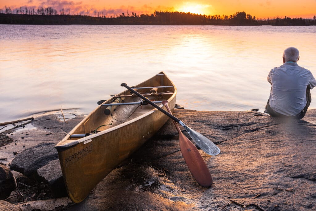
A legendary canoe route through the heart of the Boundary Waters was essentially lost to time for decades, until this fall, when a group of paddlers retraced the famed “Circle Tour” for the first known time since the 1960s. They report it’s still worthy of expedition by paddlers looking to retrace more than a century of documented human travel.
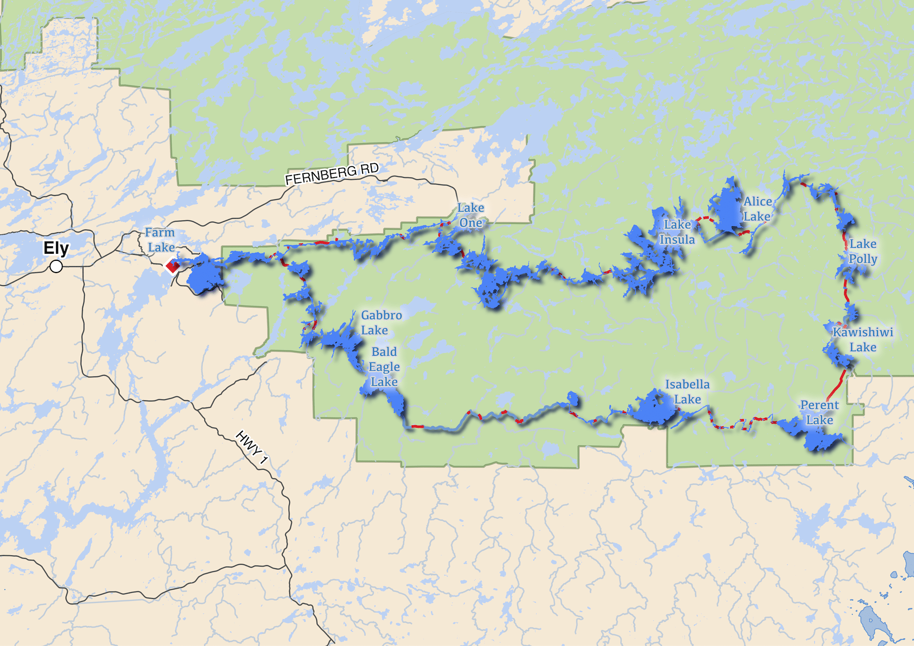
The Circle Tour starts and ends east of Ely, traversing nearly 100 miles of the Boundary Waters without exiting the federally-designated wilderness. People have been paddling, portaging, and dogsledding the route since the early 20th century.
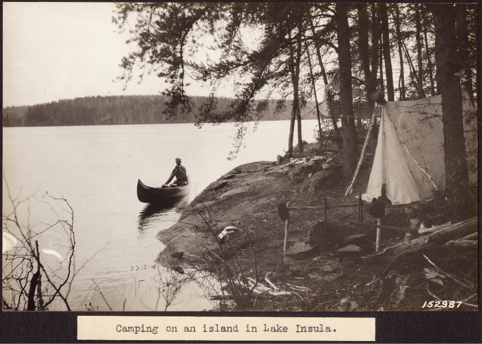
Between 1900 and 1920, it was part of trap lines operated by famed trappers from Isabella, Tom Parent and Bill Pembles. Then, in 1921, it was traveled by influential Forest Service landscape architect, Arthur Carhart, and a team surveying the area for possible wilderness protection and recreational opportunities.
This year’s retracing of the route was more than 40 years in the making, spurred by retired Superior National Forest employee Tom McCann of Grand Marais. McCann first heard about the Circle Tour in 1978 when he was stationed nearby in Isabella.
“I was interviewing an elder resident named Ted Fredrickson and our conversation turned to his contract work for the Forest Service during the ‘nineteen-teens,'” McCann said. “He had an old map showing the long portage between Perent Lake and Kawishiwi Lake. This was part of his maintenance contract area. I asked Ted who built the portages in that area. He pointed to an island on Silver Island Lake and said ‘All these portages were built by a trapper named Tom Parent.'”
Parent gave his name to one of the major lakes, even though government surveyors are said to have misspelled it as “Perent.” The trapper had built the portage between Kawishiwi and Perent around 1901, and used it in summer and winter with partner Bill Pembles.
“Tame Tom” and “Wild Bill” would make autumn scouting trips along the route, then come back in winter to set trap lines. They made observations of beaver that remain familiar today.
“The 2020 crew paddlers saw firsthand how the plentiful beaver prepared their homes and dams for winter,” McCann said. “Winter food piles were being cut and fresh mud was used to seal their structures.”
Then, in 1921, Carhart and a team traveled the route. Carhart has become a legend in wilderness preservation as a visionary who laid out principles of wilderness management long before the 1964 Wilderness Act. He submitted a report to the Forest Service in 1922 laying out a plan for protecting the Superior National Forest roadless areas, and improving them for canoe travel.
In a strange parallel to 2020, Carhart traveled the route in the wake of the Spanish Flu pandemic. He had himself been stricken by the virus in the fall of 1918. He first visited the Superior National Forest the next year. McCann found additional documentation of the Circle Tour in historic Forest Service literature, and a 1948 publication describing a 1925 trip around the circle.
In the 1960s, logging operations all but obliterated one key portage, and the full route was abandoned. People wishing to complete the loop typically exited the wilderness for a short stretch to avoid the missing portage.
This September, McCann and a group of wilderness enthusiasts traveled the whole route once more. At 94 miles with many portages, McCann warned that it’s probably not suitable for most family trips, but hopes more people will tackle it now that the route has been blazed again.
The seven-person group launched at the Farm Lake landing on September 25. They split into two parties, each with its own permit, to make it easier to travel at different speeds and spread out to multiple campsites. They had also anticipated possibly have more people than the limit of nine, and wanted to give themselves flexibility.
Over the next five days, the group went east through the Numbered Lakes to Insula and Alice, before working their way south to Kawishiwi. At the Forest Service campground there, they met supporters and spent a night enjoying food and friendship. “Kawishiwi Lake Campground became a hive of activity: friends were greeted, stories swapped, fish tales told, gear refurbished, fresh dry clothes were donned, food reorganized, and new supplies obtained. A descendant of Tom Parent from Schroeder arrived to greet the crews,” McCann said. “Despite temperatures in the mid-twenties, the overnight crew awoke refreshed and ready to hit the trail again.” It was October 1, and there were no longer any BWCAW permit quotas. The group self-issued new permits to re-enter the wilderness.

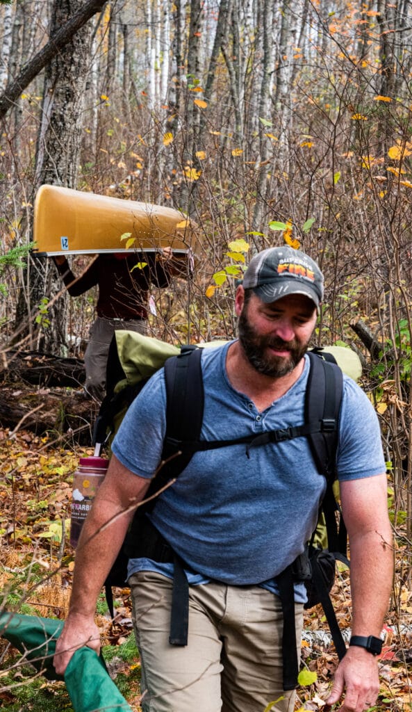
Chris O’Brien and Harvey Sobiek at the beginning of the portage. 
Tom McCann and Mike Crook on the portage.

Then it was on to the two-mile Kawishiwi-Perent portage. It had been first blazed around 1901 by Tom Parent. Later logging obliterated it, as timber companies covered it in slash and other waste. In preparation for the adventure, McCann first rediscovered and mapped the lost portage during the summer.
It took the crew a mere 3.5 hours to get everyone and everything across the portage. The weather was clear and cool and perfect for hauling canoes and gear. McCann said the portage passes through a diverse forest, including a high ridge studded with maple trees that “shimmered with reds and golds.”
On the last day, the crew was planning to exit the wilderness where they had begun — at the landing on Farm Lake. But when they arrived on the lake, the wind was so strong they changed plans and instead headed for Silver Rapids, the same place Arthur Carhart had started and finished his 1921 trip.
McCann is currently working on more historical research and outreach. He is preparing a presentation for Canoecopia, and planning a trip to Denver to visit Arthur Carhart archives there, as well as a visit to the Aldo Leopold Foundation in Wisconsin to learn more about Leopold’s friendship with Carhart.
Additional information:
- Follow the day-by-day Trip Report here
- Lakes: Farm Lake, Kawishiwi River, Lake One, Two, Three, Four, Hudson, Insula, Alice, Fishdance, Malberg, Koma, Polly, Townline, Kawashachong, Square, Kawishiwi Lake, Perent Lake, Perent River, Isabella Lake, Isabella River, Bald Eagle Lake, Gabbro Lake, Little Gabbro Lake, Clear Lake, Kawishiwi River
- Kawishiwi-Perent Portage coordinates: Kawishiwi end: 47.835704, -91.104914; Perent end: 47.813140, -91.120141.