

A key error in the computer models that predict the flow of potentially contaminated water from the PolyMet copper-nickel mine in northern Minnesota means the discharge would drain toward the Boundary Waters watershed, not the St. Louis River and ultimately Lake Superior, as has been assumed since the project was proposed.
Engineers had based their calculations on the assumption that the water level in a taconite pit next to PolyMet was higher in elevation than PolyMet. The error was based on using data from almost 20 years ago, during a period of record high water.
The Timberjay newspaper reported that the mistake was discovered by scientists with the Great Lakes Indian Fish and Wildlife Commission (GLIFWC). They say that after running the model with the correct elevation figure, it became clear that the Partridge River, a tributary of the St. Louis River, would be uphill from the PolyMet mine, and the Peter Mitchell taconite pits will be lower when the mine closes.
“Because of this error, the calibration model has the local direction of groundwater flow 180 degrees reversed from the actual conditions during the calibration period,” John Coleman. of GLIFWC told the Timberjay.
Rather than being at an elevation of 1,616 feet, the Peter Mitchell pit is expected to be at 1,300 feet. That is 275 feet lower than PolyMet’s mine pit’s level.
In a follow-up comment on the Timberjay’s website, editor Marshall Helmberg explained the issue, “These two pits are located about a mile apart and are separated by highly fractured bedrock. It doesn’t take a genius, or even a computer model, to figure out which way at least some of the water from the PolyMet pit will flow—towards the Peter Mitchell pit, which drains into Birch Lake.”
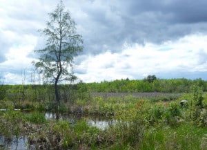
Birch Lake is located on the South Kawishiwi River, about 14 miles of upstream of Fall Lake in the Boundary Waters Canoe Area Wilderness.
Contacted by the Timberjay, neither the Minnesota Department of Natural Resources nor Barr Engineering, the consulting firm that worked on the model, disputed the error. A DNR memo acknowledged the lower water level in the Peter Mitchell pits was likely correct, and that groundwater could flow from PolyMet north to Birch Lake. Barr simply said the 1996 water level they used, one of the highest ever recorded at the site, was the only information available.
Both Coleman of GLIFWC and Kathryn Hoffman, an attorney with the Minnesota Center for Environmental Advocacy, said the models must be run again with the correct data.
“The co-lead agencies, if they expect to do a credible job, need to do a thorough independent re-running of this model. They can’t just rely on PolyMet’s consulting partner. The only other entity that’s run it says it’s flawed,” Hoffman told the paper.