

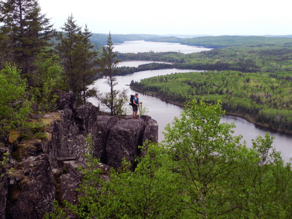
Most people visit the Boundary Waters Canoe Area (BWCA) to paddle its many world-class lakes. However, little traffic is seen along remote hiking trails located throughout the wilderness. Located in quiet pockets of the forest, the trails seem more like animal paths. Due to a lack of signage and regular maintenance, hikers can experience a remote, if challenging hike.
A new non-profit, the Boundary Waters Heritage Trails (BWHT) recently formed with the expressed interest in preserving historic trails within the wilderness. The mission of the organization is to continue the initial work that originated through the Boundary Waters Advisory Committee (BWAC) in 2002. This includes stewardship through advocacy and education along with collaboration with the US Forest Service.
The organization’s focus is on maintaining heritage trails listed in the USFS BWCA trail inventory. Some of the trails were on the trail inventory at some point, but for a variety of reasons, were eventually removed. As a result, the BWHT will document and hopefully, return to use those historic trails previous visitors enjoyed in the past.
History of the trails
Trails have been in the area for a long time. There’s evidence that people have inhabited the area as far back as 12,000 years. Fast forward to the 1900s, when the Forest Service established roughly 50 fire towers throughout the region as a response to wildfires. Routes to these towers would eventually become interconnected hiking trails. Eventually, logging companies added forest roads and railroads. When the Wilderness Act of 1964 was instituted, many of these were abandoned. While the woods reclaimed some roads, others were developed as hiking trails by the Forest Service and other organizations like the BWAC.
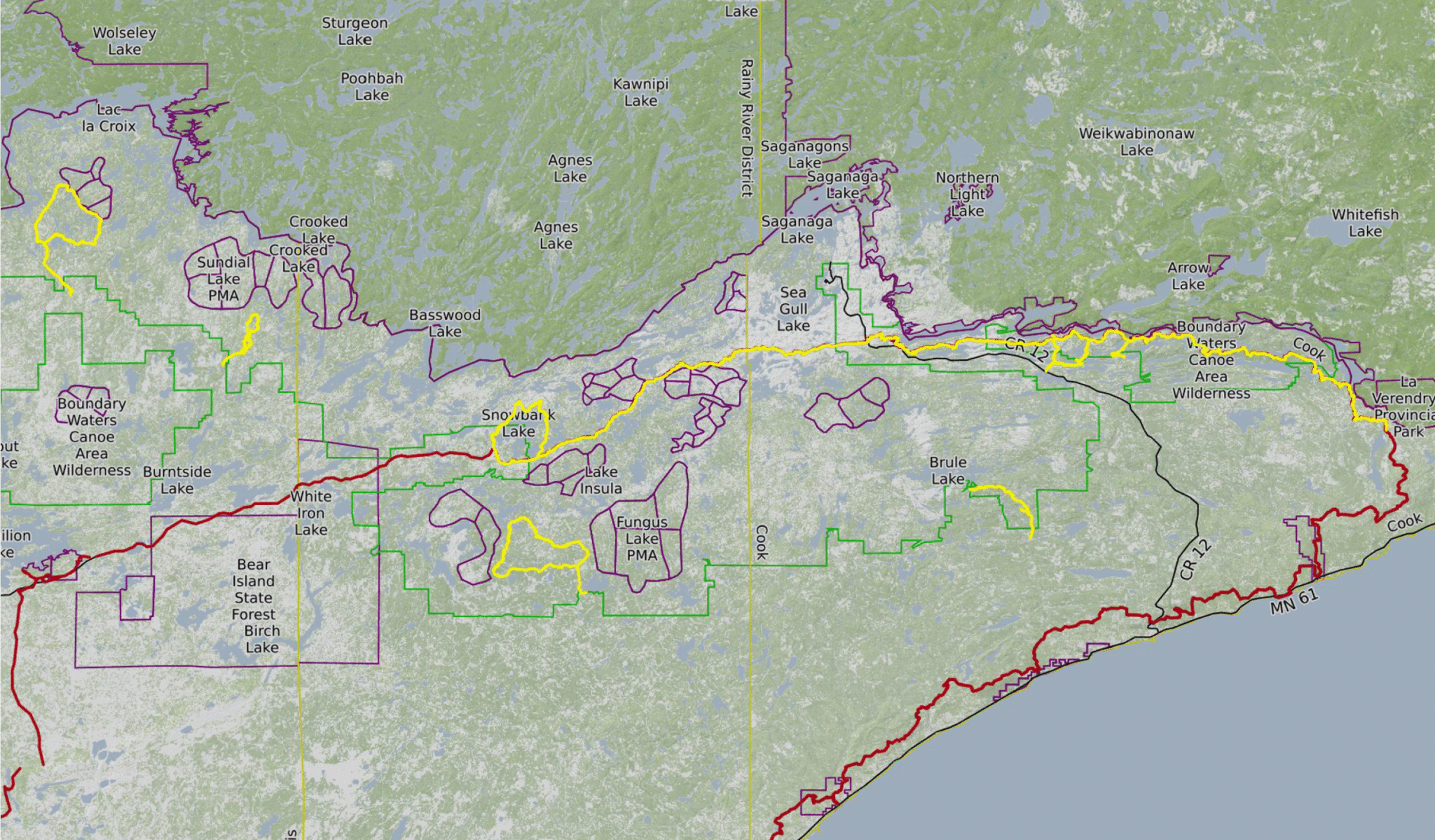
Currently, there are 12 established hiking trails within wilderness boundaries. They vary in length, the longest being 65 miles. Scattered throughout the region, they require a visitor’s permit. According to the USFS, 476 permits were requested for BWCA hiking trails in 2022.
Existing maintenance efforts
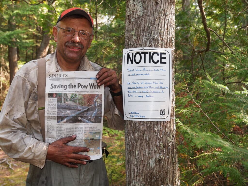
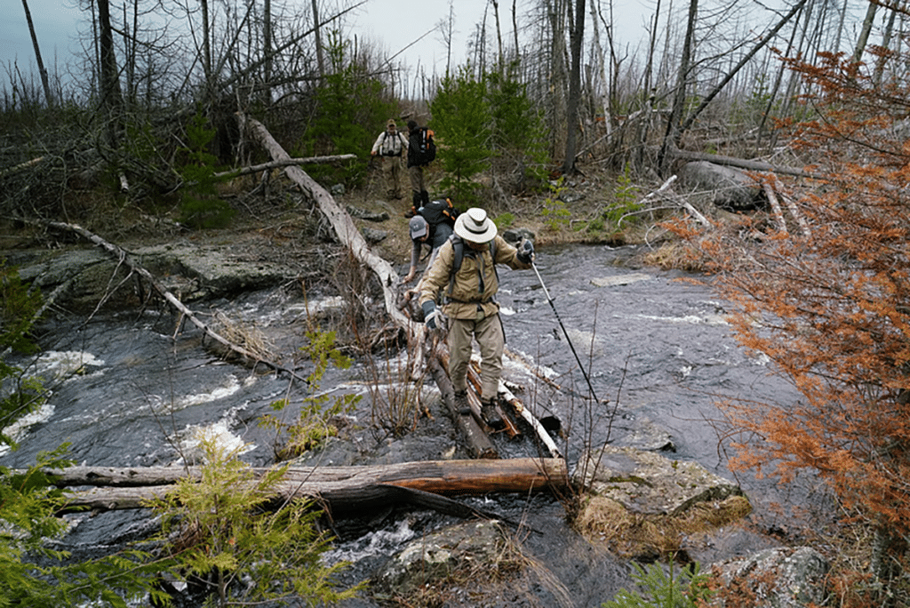
Organizations like the BWAC, Kekekabic Trail Chapter, and Border Route Trail Association hosted maintenance trips this past season. Five years ago, the North Country Trail Association jumped on board as well. Some of the efforts focused on the Powwow Trail located in the south-central portion of the BWCA Wilderness. Severely impacted by the Pagami Creek Fire of 2011, the trail is a landscape in flux. Crews work in cooperation with the USFS to clear and maintain various trails.
Goals for 2024
For the Boundary Waters Heritage Trails, a goal is developing an online hub to document trails and educate visitors on the preservation of the trails. They envision a place where people can get involved in historic conservation. One of the founders, Martin Kubik stated, “The organization is as grassroots as it can get.” While the organization is not going to create new trails, they have aspirations for restoring trails along former recreational trails and old logging corridors. “Current maps don’t show old logging roads. We’d like to provide access to areas that have old recreational trails or logging roads, using what already is there,” he says.
The founders have a long history of supporting BWCA trails. Together, Martin along with Nero Jain organized the Kekekabic Trail Club in 1990 and the Boundary Waters Advisory Committee in 2002. Because of their initiative, hikers can access the Powwow Trail in the BWCA. Through volunteer trail maintenance efforts, facilitated under an agreement with the USFS, they’ve continued maintaining trails. Wanting to continue that collaboration, the BWHT appreciates the unique opportunities that historic trails offer. They emphasize that hiking trails provide another great way for people to recreate within the BWCA.
Highlighting wilderness trails
There are over 200 miles of hiking trails within the BWCA. Even the most established routes provide solitude and a way to explore deep within the boreal forest. If you go, remember that these are wild and rugged trails. With little to no signage they’re minimally maintained to protect the wilderness setting. Some of the longer trails have been included here.
Border Route Trail, Entry Point 81
Following the edge of the Minnesota and Canadian borders, this cliff-bound trail rises a couple of hundred feet above wilderness lakes. 65 miles long, this point-to-point trail is rugged and remote. It has been recently included in the North Country Trail Association’s network of trails.
Eagle Mountain Trail, Entry Point 79
Topping off at 2301’, this 7-mile trail (round-trip) offers views from the highest point in Minnesota. Because this trail is within the wilderness, it is minimally maintained and is steep and technical in places. Located north of Lutsen, this trail offers day-trip users a remote adventure.
Kekekabic Trail, Entry Point 56
Originally built in the 1930s by the USFS and used to reach the Kekekabic Fire Lookout Tower. The 39-mile point-to-point trail begins east of Ely and ends at the Gunflint Trail. A part of and maintained by the North Country Trail Association, users can access the trail at its eastern or western trailheads.
Powwow Trail, Entry Point 86
Located southeast of Ely, this newly restored trail was impacted by the Pagami Creek Fire in 2011. Users will experience 28 miles of trail that is amidst regeneration from wildfire.
Sioux Hustler Trail, Entry Point 15
Located northwest of Ely, this 30-mile loop trail is deep within the boreal forest. Visitors along the route should take in the views at Devil’s Cascade. It plunges 75 feet through a deep granite gorge below Lower Pauness Lake.
Ways to get involved
Most importantly, building a vision for the future of BWCA trails while understanding the value of the past is what drives the organization.
Additional founders include Ken Hupila, a wildlife photographer based in Ely, and Tiffanie Ellis, a Duluth public school educator. The IRS has approved the Boundary Waters Heritage Trail application for tax-exempt status.
Those interested in learning more can contact Martin Kubik at wtrails2@yahoo.com.
More info:
- Boundary Waters Heritage Trails to bring back historic hiking trails – Ely Echo
- Boundary Waters Canoe Area Wilderness – hiking trails
- Bringing history to life: Hiking the BWCAW
Wilderness guide and outdoorswoman Pam Wright has been exploring wild places since her youth. Remaining curious, she has navigated remote lakes in Canada by canoe, backpacked some of the highest mountains in the Sierra Nevada, and completed a thru-hike of the Superior Hiking Trail. Her professional roles include working as a wilderness guide in northern Minnesota and providing online education for outdoor enthusiasts.