


Fixed-wing aircraft fitted with sensor “stingers” are flying over northern Minnesota, spearheading a geophysical mapping effort led by the USGS and the Minnesota Geological Survey. These flights—part of the national Earth MRI initiative—are targeting critical minerals like nickel, cobalt, platinum-group elements, manganese, copper, and gold, essential for clean energy and national security. While the data promises to deepen geological understanding, whether it will trigger expanded mining in northeastern Minnesota remains unclear.
Mapping of critical minerals
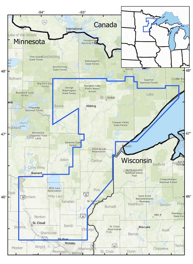
The USGS began collaborating with the Minnesota Geological Survey in August. Together, they are working to modernize geological maps of the Duluth Complex and Cuyuna Range in northern Minnesota.
Using fixed-wing aircraft equipped with geophysical technology, the teams are collecting data on potential mineral resources. These include nickel, cobalt, platinum group elements, and manganese. The USGS has listed these as critical mineral resources vital to the U.S. economy and national security. The Energy Act of 2020 established this definition, stating that critical minerals are vulnerable to supply chain disruptions and crucial to manufacturing key products.
“This USGS program allows the Minnesota Geological Survey to improve our understanding of the state’s geologic resources, including materials necessary for cleaner energy and national security,” said Robert Tipping, Director of the Minnesota Geological Survey. “It accelerates our mission to provide the geologic information needed to manage and protect Minnesota’s mineral and water resources.”
All of the critical minerals serve various technologies. Manganese, cobalt, and nickel play essential roles in lithium-ion batteries that power computers, tools, and vehicles. The teams are also collecting data on the potential presence of copper, iron, and gold within the survey region.
Critical minerals—ongoing debate
The only critical mineral extensively mined in the state is iron from taconite. It remains to be seen whether the latest data will support further mining interests in northeastern Minnesota.
A decade-long debate surrounds the possibility of copper-nickel sulfide mining in the region. Twin Metals Minnesota, a Chilean-owned company, is actively working to reinstate two permits to mine copper-nickel. If the proposal moves forward, the company plans to develop a mine complex just outside the Boundary Waters Canoe Area Wilderness.
Environmentalists warn that pollution from this type of mining would irreparably damage the region’s watersheds. Meanwhile, mining advocates promote it as an economic opportunity. So far, no company has mined copper-nickel in Minnesota.
Creating a modernized map
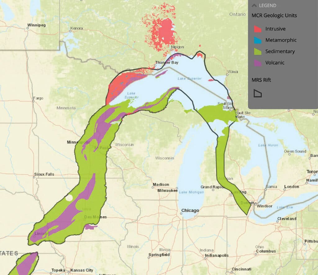
The project will help map Precambrian geologic formations within the Duluth Complex. Specifically, this complex is primarily composed of igneous rocks that formed around 1.1 billion years ago during the Midcontinent Rift. The broader region also contains older metamorphic and sedimentary rocks, some dating back 2 to 4 billion years. Additionally, the Duluth Complex underlies a significant portion of the bedrock in northeastern Minnesota.
The survey also aims to identify Midcontinent Rift-related intrusions, which are expected to contain magmatic sulfides with economic value. These sulfide deposits form when metal-rich liquids separate from molten rock and concentrate valuable metals, such as nickel, copper, gold, and platinum. The Midcontinent Rift, a 1,200-mile-long geological feature, formed approximately 1.1 billion years ago and extends through northeastern Minnesota.
Region to include the Duluth Complex
The Earth Mapping Resources Initiative (Earth MRI) leads this effort. Earth MRI began in 2019 to better map the nation’s surface and subsurface.
In addition to geophysical surveys, the initiative includes geochemical reconnaissance, LiDAR-based topographic mapping, hyperspectral imaging, and detailed geologic mapping.
The economic benefits may be far-reaching, but environmental risks must be carefully evaluated. “Partnering with state surveys helps us achieve national goals like mapping the critical minerals the U.S. needs,” said Jamey Jones, science coordinator for the USGS’s Earth Mapping Resources Initiative. He added, “The Minnesota Geological Survey contributes to both national efforts and state-level knowledge vital to water resources, hazards, and the resource economy.”
The USGS has contracted with geophysical consulting firms to complete the survey. According to the USGS, small, fixed-winged aircraft will carry sensors that collect data without emitting pollutants or posing risks to humans or wildlife. Additionally, the instruments will not capture photos or videos. All flights will originate from multiple airports, fly over more than 20 counties, and take place during daytime hours only.
Funding for this initiative comes from the Infrastructure Investment and Jobs Act.
More info:
- Low-level flight to image geology over the Duluth Complex & Cuyuna Range in Northeastern Minnesota – USGS
- Geology of Minnesota
- Duluth Complex