

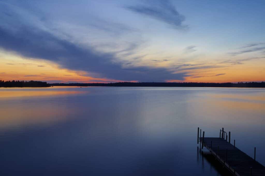
“Lakes and streams in the watersheds bordering the Boundary Waters Canoe Area in northern Minnesota offer some of the most pristine water quality in the state.” says a new report by the Minnesota Pollution Control Agency.
The MPCA has released a set of reports focused on two watersheds that contain much of the Superior National Forest and Boundary Waters Canoe Area Wilderness. Research and monitoring work with local partners has found most waters in the area are in nearly “pristine” condition.
The reports are part of a statewide effort to assess the health of all watersheds and prepare plans for restoring and protecting them. While watersheds in other parts of Minnesota have been found to be plagued by nutrient pollution and other contaminants, and efforts are focused on reducing pollution and restoring water quality, the Rainy River Headwaters and Vermilion River watersheds are highlighted because they need continued protection.
“The rivers and lakes in these watersheds are some of the cleanest waters in the state,” says Katrina Kessler, MPCA assistant commissioner for water policy and agriculture. “That’s why it’s so important that we focus not only on restoring waters that don’t meet water quality standards, but also protecting lakes and streams from becoming impaired in the first place. That’s especially true for areas like the Boundary Waters that are enjoyed and treasured by so many residents and visitors.”
The agency says the biggest reason the water is in such good condition is due mostly to the fact that the watersheds are mostly undeveloped. Forests and wetlands absorb rainwater and runoff before it can reach lakes and rivers.
The MPCA and its partners are focused on several strategies to protect clean water in the region, including: conserving forests, creating shoreline buffers, properly installing culverts, and maintaining septic systems.
Wild watersheds
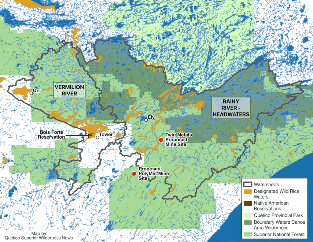
The Vermilion River and Rainy River-Headwaters watersheds are sparsely populated and heavily wooded. They are also home to some of the most beloved lakes and rivers in the state, including Lake Vermilion, Burntside, and the border lakes in the Boundary Waters.
The MPCA reports that the 1,035-square mile Vermilion watershed is home to just 14,423 people, or 14 people per square mile. Agency scientists assessed aquatic life in 21 stream sections, with just one failing to meet water quality standards. They also assessed nine streams and 32 lakes to determine suitability for recreation, finding that all met the standards.
The much larger Rainy Rivers-Headwaters watershed, at nearly 3,000 square miles, is home to 6,784 people — less than three people per square mile. More than 99 percent of the watershed is undeveloped, containing almost all of the Boundary Waters wilderness.
In the Rainy River watershed, the MPCA analyzed 62 stream sections and found that 97 percent “fully support fish and other aquatic life.” All assessed lakes except one met water quality standards for recreation like swimming and boating.
Copper country
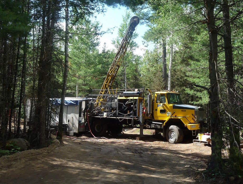
The Rainy River Headwaters watershed also includes the proposed Twin Metals copper-nickel mine site, and other areas with sulfide ores that mining companies are exploring. The hardrock mining industry is the largest polluter in the United States, according to the United States, and the potential for new mines is one factor that could affect the future of the watershed.
“Elevated concentrations of trace metals such as copper and nickel can adversely impact fish, aquatic invertebrates, plants, and amphibians,” the reports read. “There is concern that this mining could adversely affect the unique and sensitive water resources in the BWCAW, which is downstream of the proposed mining site.”
The agency says that those operations are not a main priority for the report, as proposals require permitting from state and federal agencies.
“Permits include enforceable requirements about how the facilities are constructed, operated and eventually closed. Permits also include effluent limits and extensive requirements for monitoring and reporting to the MPCA during operations to ensure that facilities operate in compliance with permit requirements.”
The reports recommend that mining permits not just consider water quality, but also how operations might affect water quantity, temperature, and more.
Wild rice woes
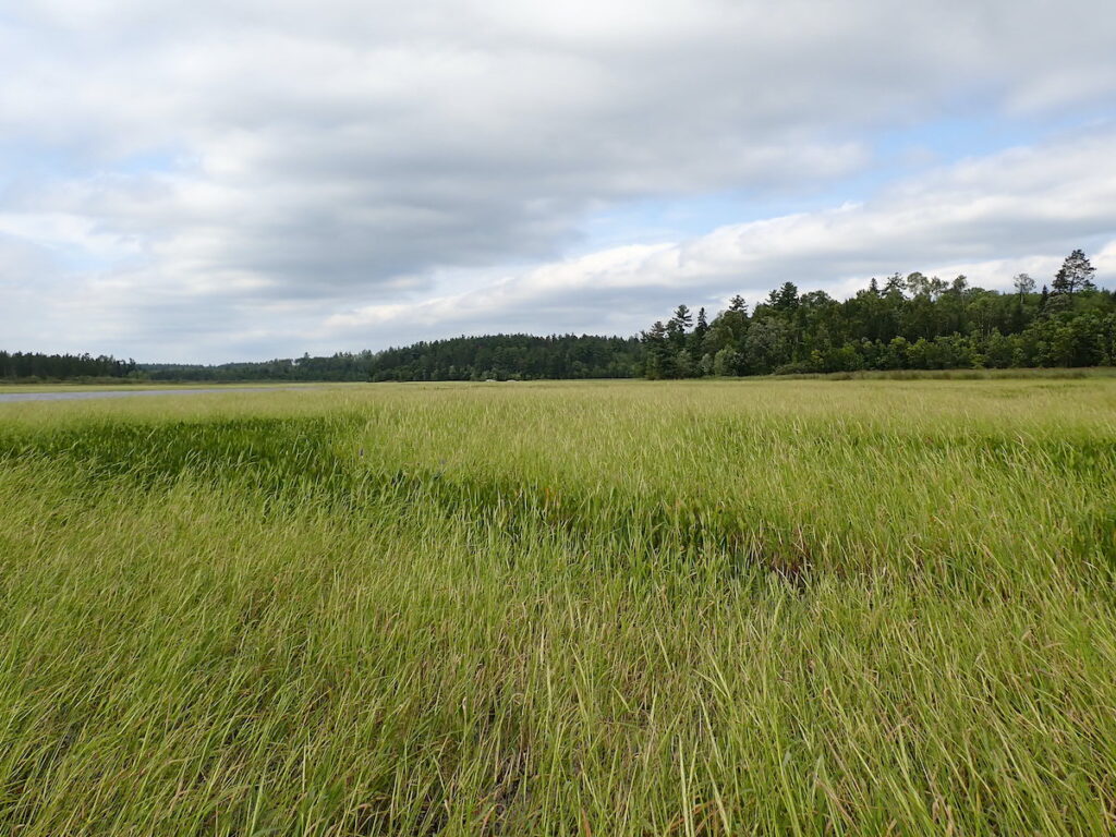
One key contaminant in the region is sulfate, which is discharged by existing taconite mines and could come from proposed copper-nickel mines. The common chemical compound can disrupt the chemistry of mud on the bottom of lakes, harming manoomin, or wild rice. The grain is an important food source and cultural resource for Native people, and protected by law.
Manoomin and sulfate have been the subjects of numerous conflicts between tribes, environmental groups, and the mining industry. One aspect of the disagreements found its way into the report. While the state has a scientific standard for sulfate discharges into wild rice waters, the legislature has passed a law that prevents it from being enforced.
The U.S. Environmental Protection Agency is currently developing a list of wild rice waters impaired by sulfate, and could ultimately force Minnesota to enforce its standard. It leaves the issue in limbo, complicating the water quality studies.
“Although there is a Class 4A sulfate water quality standard that applies to waters used for the production of wild rice (Minn. R. 7050.0224), waters in the RRHW were not assessed against this standard. Current Minnesota state law precludes the MPCA from assessing any waters against the standard at this time (Laws of Minnesota 2017, ch. 93, article 2, section 149).
“The EPA recently proposed adding certain waters to MPCA’s impaired waters list, based on the wild rice sulfate standard. The proposal is not yet final at the time of the writing of this report. The proposal was open for public comment until June 30, 2021. After considering public comments and making appropriate revisions, the EPA will transmit the final list to Minnesota. The MPCA will develop the appropriate path forward for these waters once the final list is received.”
Comment on reports
The reports, which include a Total Maximum Daily Load study and Watershed Restoration and Action Plan, are available on the MPCA website: Vermilion River, Rainy Rivers – Headwaters.
The MPCA opened a 60-day comment period on the reports on August 30, which will close on October 29. The agency doubled the standard comment period length because of wildfires which have disrupted the lives of many residents in the watersheds.
Submit comments to or request information from Amy Mustonen, 218-302-6638, 800-657-3864, MPCA, 525 S Lake Ave #400A, Duluth, MN 55802 by 4:30 p.m. on Friday, Oct. 29, 2021.