
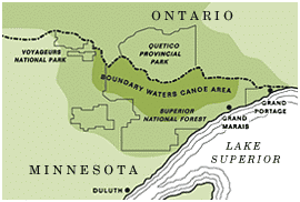
Closure area reduced, opening 40 campsites
The Forest Service has reduced the Little Knife Fire’s closure area, reopening 40 campsites that had been off-limits. The fire itself remains unchanged at 4,815 acres and 90% contained. Visitors are reminded not to camp on any site still marked “closed” within or near the former closure footprint, and to watch for snag trees at risk of falling on portages, campsites, and latrines inside the old fire perimeter. See the full story here.
August 4 update:
Little Knife reaches 90% containment; management returns to the forest
The Little Knife Fire, which crossed into the BWCAW from Quetico Provincial Park in mid-July, is 90% contained at 4,815 acres, according to the August 4 daily update. Overnight rain slowed fire activity further, and management of the fire returns to the Superior National Forest this evening, ending weeks under the National Incident Management Organization. Today’s report will be the fire’s final standalone daily update “unless there’s a significant change in conditions.”
July 28 update:
Trails End Campground to reopen July 29
The Forest Service announced it will lift the closure of Trails End Campground on July 29, nearly two weeks after it was closed. Recent rain has moderated fire activity, officials said, with no recent wildfire spread near the campground; firefighters remain actively engaged in suppressing the Little Knife Fire nearby.
July 15:
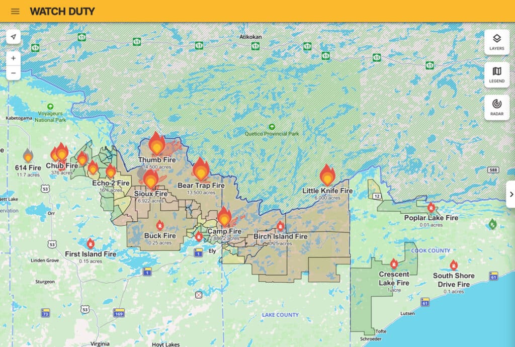
A wildfire burning in Quetico Provincial Park has crossed the international border into the eastern Boundary Waters, the Forest Service reported July 15. The fire — which the Forest Service says was previously known as Ontario’s FOR028, and is now called the Little Knife Fire on the US side — burned across Monument Portage between Swamp and Ottertrack lakes, and heat-detection mapping shows growth as far south as Ogishkemuncie Lake.
The Forest Service estimates the Little Knife Fire at 6,000 acres on the US side, part of a fire totaling about 30,000 acres.
Heavy smoke has prevented reconnaissance flights, so estimates are based on heat-detection mapping. “The Forest Service will continue to monitor progression as conditions allow,” the agency said. The fire is burning in the area closed to visitors on July 12, when a 15-lake closure — including Ottertrack, Little Knife, and Lake of the Clouds — was issued because of the then-approaching Quetico fire.
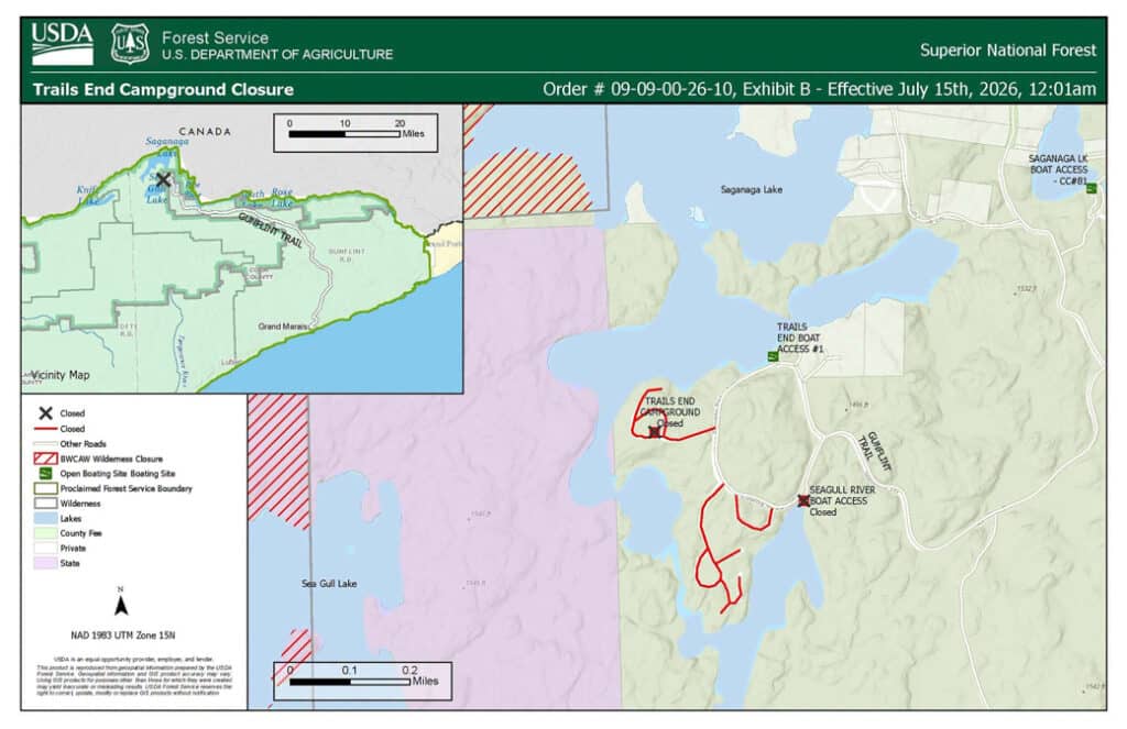
In response, the Superior National Forest temporarily closed Trails End Campground, at the end of the Gunflint Trail, effective 12:01 a.m. July 15. “This closure is about keeping people safe,” the agency said, citing dangerous smoke, unstable conditions, and rapidly shifting fire behavior. The closure remains in effect until the fires are contained and the risk to the public has decreased. Cook County has implemented its Ready-Set-Go notification system for a northern portion of the Gunflint Trail area; residents can monitor the county’s Ready-Set-Go map.
The Little Knife Fire is the third fire to cross the international border in this event, after the Bear Trap and Thumb fires burned from the BWCAW into Canada earlier this week. The Forest Service says it is coordinating daily with Canadian fire officials.
Airspace over the area is restricted. At a Wednesday briefing, officials noted the standing FAA prohibited airspace over the Saganaga and Seagull area, plus a temporary flight restriction covering fire operations — and reported an apparent drone incursion over one of the fires, which forces firefighting aircraft to the ground. “Drones and firefighting aircraft do not mix,” said Justin Miranda of the National Incident Management Organization.
An Air Quality Alert is in effect through Thursday, with heavy smoke rated “Very Unhealthy” expected to settle over communities from Ely east across the forest in the evenings. Smoke has been reported along the Gunflint Trail and in Grand Marais.
We will update this story as agencies release new information.
Fire information lines:
218-881-2091 (8 am-8 pm) | BWCAW permittees: 218-235-4400 or 218-235-3113
More information:
- Superior National Forest Alerts (USDA Forest Service)
- Cook County Ready-Set-Go map
- Ontario Forest Fire Info Map
- July 2026 Superior NF Wildfires (InciWeb)
- Watch Duty Maps
Get Fire Updates
Stay informed on recent wildfires, campfire bans, park closures, straight to your inbox.