

By Sally Nankivell, Northeastern Minnesotans for Wilderness Board Member
A recent snowmobile trail controversy has resulted in a familiar scenario: local motor enthusiasts versus environmentalists, each passionately arguing over the Boundary Waters Canoe Area Wilderness (BWCAW) and adjacent public lands.
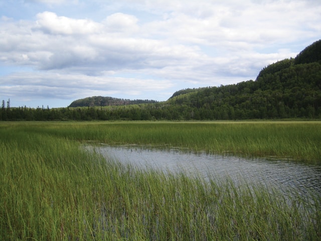
The area in question is in the Vento Unit, located off the Arrowhead Trail in the Northeast part of the BWCAW. For over 40 years cabin owners at McFarland Lake have been using a trail, often referred to as the Tilbury Trail, that was cut through the Superior National Forest by local residents. The trail runs from McFarland Lake through the Royal River area to South Fowl Lake, and is used to access South Fowl Lake for ice fishing.
While the trail was not located in any protected wilderness when it was constructed, it has always been an illegal trail, as it is against the law for citizens to cut a trail through a national forest. However, when the Boundary Waters was established, this became not only an illegally created trail, but an illegally created trail that ran directly through the Boundary Waters, and across a very sensitive area. The Royal River and the Royal Lake area harbors some of the rarest plants in Minnesota.
Three winters ago, with very little snow cover, the inevitable happened: ATV riders rode on the illegal trail that the Forest Service had been ignoring for so many years. With ATV damage done to this sensitive area, the Forest Service finally made an attempt to close the trail. However, their attempts have been less than successful, as the barricades that were erected were removed by the local snowmobilers, who have continued to use the illegal trail.
Forest Service Gunflint District Ranger Dennis Neitzke has bowed to pressure by McFarland Lake cabin owners and the Cook County Commissioners to replace this illegal trail. The fact that there will be a replacement trail at all is frustrating to many environmentalists, as there is already access to South Fowl Lake off of a road just a short drive from McFarland Lake, and it doesn’t seem appropriate to reward illegal behavior with a new trail. However, because it appears inevitable that a trail will be built, environmental groups have compromised in the hopes that by advocating for the proposed route that runs along current road beds, they will be able to protect the ridge running along the Royal River and Royal Lake and the sensitive plant and wildlife species that inhabit the area.
Five alternative trail routes were proposed by District Ranger Dennis Neitzke, and he has narrowed his decision down to two possible routes: Alternative 2, which runs across the side of the bluffs bordering Royal Lake and Royal River, and Alternative 4, which runs adjacent to the Arrowhead Trail and South Fowl Lake Road. Of these, Alternative 4 is the route advocated for by environmental groups, and Alternative 2 is the route favored by the local snowmobile riders, as well as the Cook County Commissioners and by all indications, District Ranger Dennis Neitzke. The latter group prefers this route because it is shorter and is closest to the original trail.
There are many problems with Alternative 2, including the following:
• The route is located as close as 400 feet from the BWCAW, along a bluff. The sight and especially the noise of what snowmobile advocates claim will be 200 snowmobiles each weekend will carry far into the wilderness.
• This bluff area is sensitive to erosion.
• The construction of a new trail would be detrimental to lynx habitat, as the addition of any compacted surfaces diminishes their advantage in hunting and therefore their ability to reestablish themselves in the area. None of the proposed alternatives comply with the Forest Service’s obligations under the Endangered Species Act.
• The Royal River area has been designated by the Forest Service as a “Special Interest Area” because of its plant diversity and the rare plants located on the cliffs and in the river drainage area. The Forest Plan states that “no new development, including campsites, trails and portages will be allowed in this area.” And yet the Forest Service is proposing that a snowmobile trail be built along this very cliff, within 400 feet of the BWCAW. According to the Forest Service’s Biological Evaluation, there are 21 state or federally listed species of rare plans that exist or could exist in the project area.
• Although the trail is intended to be a winter use trail, it is inevitable that ATV traffic will follow, creating erosion, impacting the sensitive plant species in the area, and bringing the threat of invasive species.
The Forest Service has only conducted an Environmental Assessment, and yet it is clear that the National Environmental Policy Act requires that an environmental impact statement be prepared. It is immensely frustrating that the Forest Service, charged with protecting our public lands and the BWCAW, is not doing all it can to protect this sensitive area.
Dennis Neitzke had hoped to make a final decision by the end of the year, with construction of the new trail beginning soon afterward. However, the Forest Service has been overwhelmed by comments, in particular the carefully researched and written comments by environmental groups and individual environmental advocates. Therefore, it is not likely that a decision will be arrived at until sometime in 2006. If the Forest Service chooses Alternative 2, as appears likely, there will be an immediate appeal. If after the appeal process the Forest Service remains with Alternative 2, there will likely be a lawsuit by environmental groups.
This article appeared in the Fall-Winter 2005 issue of Wilderness News