

Last year’s hot and dry summer of drought left the Quetico-Superior region vulnerable to wildfires. Several large fires burned on both sides of the Canada-U.S. border, including the Greenwood Fire in Superior National Forest, and more than two dozen blazes that eventually merged in Quetico Provincial Park.
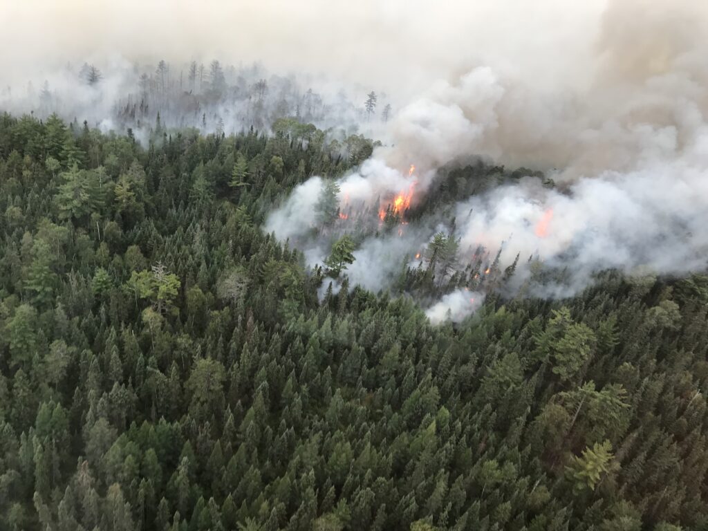
While only a couple small blazes burned in the Boundary Waters Canoe Area Wilderness, across the international border in Ontario, about 14 percent of Quetico burned. Parts of the park began closing in mid-July, and the entire backcountry was closed to all visitors on August 17, 2021. Areas away from the fires were re-opened September 11.
But that was all irrelevant to American paddlers, who make up the majority of Quetico’s visitors. The park was off-limits to American for 19 months in 2020 and 2021 due to COVID border closures, only reopening in November of last year. After missing two open water seasons, Quetico is likely a priority for many paddlers.
Border crossing
There is still one challenge: the Canadian government is not yet allowing Remote Area Border Crossing permits, which allow canoeists to cross the border from the Boundary Waters to Quetico. All visitors to Canada must currently cross the border at authorized ports of entry such as Fort Frances and Pigeon River. People attempting to enter Canada must show proof of vaccine and meet other requirements, which can’t be easily confirmed in wilderness crossings. That means Quetico’s three entry points on the border, Lac La Croix, Prairie Portage, and Cache Bay, remain closed, until at least May 31.
Map and photos show burn severity
Quetico Provincial Park recently released a map intended to help visitors understand what they might experience in burned areas.
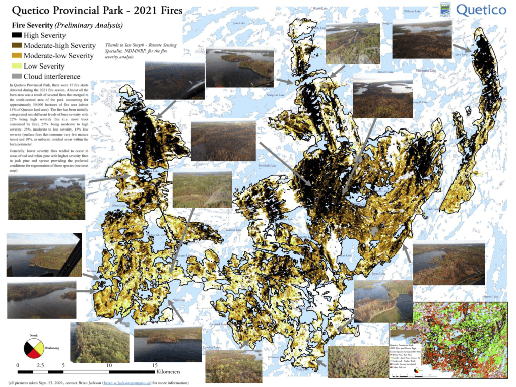
“This method uses satellite imagery from just prior to the fire compared to imagery taken just after the fire and looks at the change in tree cover to estimate how severe the fire was,” the park said. “We were also able to fly the burn area on September 15th to get pictures.”
“As the map and pictures show, the fire was very diverse ranging from areas of low severity surface fires that show little mortality of mature trees at this time to areas of high severity which create ideal conditions for regeneration of jack pine, spruce and aspen.”
Data analysis
Their observations and analysis show the fires had very different impacts across the 123,553 acres hit by blazes last summer.
Analysis of the data showed that in 22 percent of the area, high severity fire consumed almost all the trees. Another 25 percent was moderate to high intensity, and another 25 percent moderate to low intensity. Fifteen percent was low in severity, generally surface fires that didn’t consume mature trees, and 18 percent that didn’t burn at all.
Paddlers will adjust
Coincidentally, the freshly burned areas are in the southern part of Quetico, near the United States border. While fire is a natural and essential part of the boreal forest ecosystem that comprises Quetico, and the burned area is open to visitors unless posted otherwise, many paddlers will probably avoid the area because of scenery, firewood availability, and a lack of trees to hang food packs.
All that adds up to meaning it might be a good year to explore the northern part of the park that is accessed via standard border crossings and Canadian entry points.
More information:
- Quetico Provincial Park – Ontario Parks
- Remote Area Border Crossing Program – Canada Border Services Agency