

The U.S. Forest Service has published a proposed rule to rescind the 2001 Roadless Area Conservation Rule. Public comments are due Sept. 21.
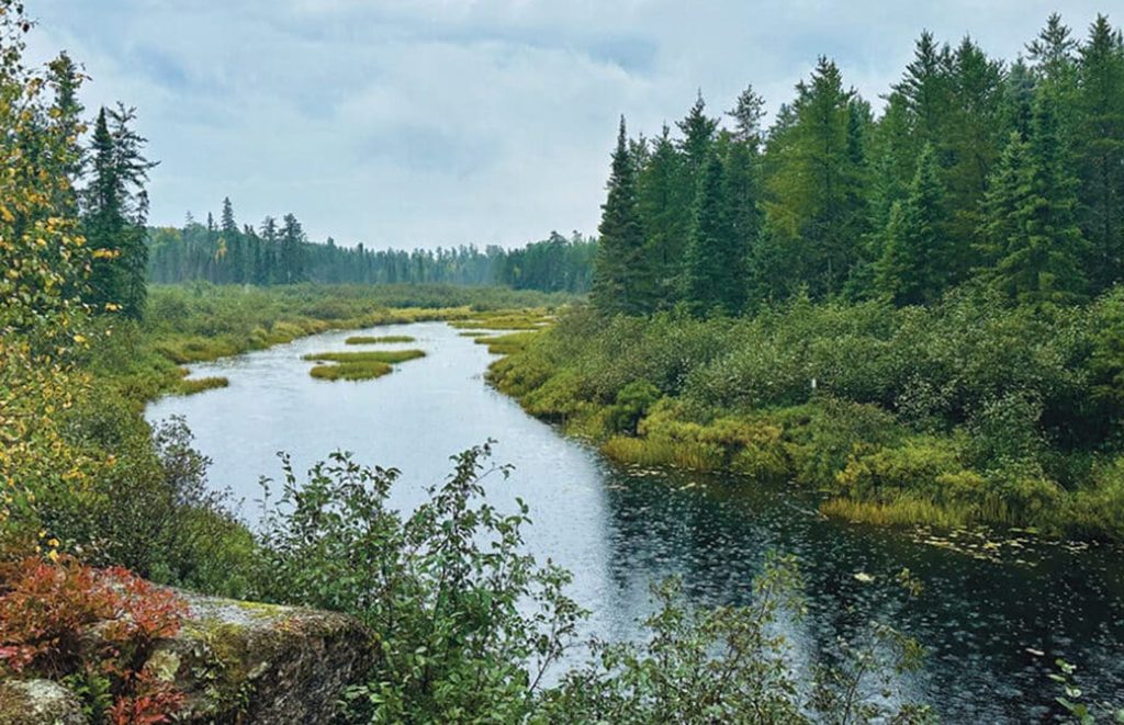
On the same day Gov. Tim Walz signed an executive order aimed at keeping copper-nickel mining out of the Boundary Waters watershed, federal officials were moving in a different direction on the forest that surrounds it.
The U.S. Department of Agriculture announced Aug. 18 that it wants to do away with the 2001 Roadless Rule — the regulation that has kept new roads and timber harvest out of the undeveloped corners of the Superior National Forest for a quarter century. The proposed rule was published in the Federal Register two days later. The public has until Sept. 21 to weigh in.
Quick facts
- Action: proposed rule to rescind the 2001 Roadless Area Conservation Rule
- Agency: U.S. Department of Agriculture, Forest Service
- Announced: Aug. 18, 2026. Published in the Federal Register: Aug. 20, 2026
- Docket: FS-2025-0001. RIN: 0596-AD66
- Comment deadline: Sept. 21, 2026
- National area affected: approximately 58.5 million acres of inventoried roadless area, per the Federal Register notice
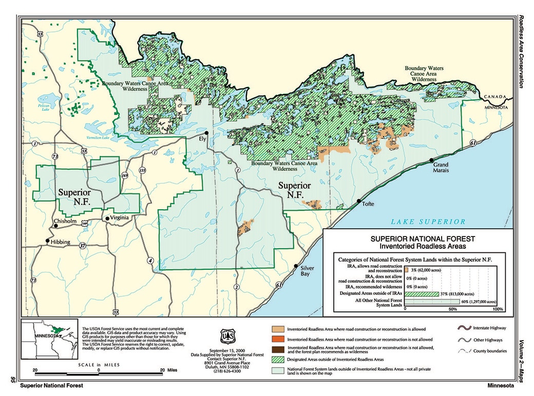
- Superior National Forest: about 62,000 acres of inventoried roadless area, roughly 3 percent of the forest, per Forest Service maps — also the statewide total for Minnesota
What is the Roadless Rule?
It is a federal regulation, finalized in January 2001, that bars new road construction, road reconstruction and timber harvest in a specific inventory of undeveloped areas on national forest land. It came out of a public process that drew more than 1.6 million comments. When Wilderness News covered the rule in 2004, 96 percent of the nearly 76,000 comments filed from the Quetico Superior region supported keeping the protections in place.
The rule doesn’t create wilderness, though. It applies to land that simply hasn’t been developed, some of it adjacent to the Boundary Waters Canoe Area Wilderness. We looked at what those protections cover, and what removing them would mean for the Superior, in an earlier explainer.
What is the Forest Service proposing?
The proposal would strike 36 CFR part 294, subpart B — the piece of federal regulation where the 2001 rule lives — and with it the national prohibitions on roads and timber harvest in inventoried roadless areas.
The Federal Register notice puts the area covered by those prohibitions at roughly 58.5 million acres of National Forest System land. In its announcement, USDA described 44 million acres as currently restricted, and said 11.3 million acres of inventoried roadless area already sit near existing roads. More than 95 percent of that land, the agency says, is in 10 states: Alaska, Arizona, California, Montana, Nevada, New Mexico, Oregon, Utah, Washington and Wyoming.
If the rescission goes through, each national forest’s own land management plan would govern its roadless areas, according to the notice — and those plans can carry restrictions of their own. Idaho and Colorado have separate state roadless rules that wouldn’t be affected.
USDA prepared a draft environmental impact statement alongside the proposal. The notice says the rule by itself authorizes no ground-disturbing work and requires no changes to forest plans, and that any actual road or timber sale would still have to clear review under the National Environmental Policy Act and other law.
How much of the Superior National Forest would be affected?
The Superior National Forest contains about 62,000 acres of inventoried roadless area — roughly 3 percent of the forest — according to the Forest Service’s inventoried roadless areas map for the Superior. The agency’s roadless area state maps give that same 62,000-acre figure as the statewide total for Minnesota, out of about 2.84 million acres of national forest land in the state.
The agency’s announcement doesn’t name the individual roadless areas in the forest.
Katelynn Rolfes of Environment Minnesota, quoted by FOX 9, put it this way: “The roadless areas of the Superior National Forest and the Chippewa National Forest are some of the last wild forests we have in Minnesota.”
Why does USDA say it wants the rule gone?
The agency’s case is about wildfire and forest health. In a statement issued with the announcement, Agriculture Secretary Brooke Rollins said: “For too long, outdated restrictions have kept tens of millions of forested acres off-limits to the very treatments that improve forest health and reduce wildfire risk to our communities. Today, we filed a proposal to restore authority to local forest managers who know the land best, removing the barriers that have kept them from doing the work the land demands. It’s time to turn the page on the failed roadless rule and return our forests to health and productivity.”
USDA also said Forest Service analysis found more than 40 percent of inventoried roadless areas carry high or very high wildfire hazard potential. The governors of Montana, Utah and Wyoming issued statements supporting the proposal, according to the agency.
The other piece of the agency’s argument is local control — that decisions about this land belong with the officials managing it on the ground. That comes as the Forest Service reorganizes. We’ve written separately about what the agency’s move to Utah means for the Superior.
Not everyone is convinced
Conservation groups dispute the wildfire rationale. Save the Boundary Waters, pointing to analysis by The Wilderness Society covering 1992 through 2024, says wildfire ignitions were lowest in designated wilderness and second-lowest in inventoried roadless areas. Environmental groups have also argued that building roads into undeveloped forest fragments wildlife habitat and puts water quality at risk.
No statement specific to the proposal from the Superior National Forest was available at the time of publication. Comments are being taken through the national docket, not through individual forests.
How to weigh in before Sept. 21
Comments are due by Sept. 21, 2026. You can file online at regulations.gov under docket FS-2025-0001 or RIN 0596-AD66, or send them by mail to: Director, Ecosystem Management Coordination, USDA Forest Service, 201 14th Street SW, Mailstop 1108, Washington, DC 20250-1124.
What happens next
This is a proposal, not a final rule. The Forest Service has to work through the public comments before it issues any final decision, and no date for a final rule has been set. The agency filed a notice of intent to rescind the rule in August 2025; that comment period closed Sept. 19, 2025, and this is the next formal step.
The proposal lands in a busy stretch for the region. Congress voted earlier this year to undo the 20-year mineral withdrawal in the Rainy River headwaters, and Walz answered on Aug. 18 with the executive order directing state agencies to stop nonferrous mining permitting in the watershed.
More info:
- Federal Register: Special Areas; Roadless Area Conservation (proposed rule, Aug. 20, 2026)
- USDA: USDA acts to remove roadless rule restrictions that exacerbate rising wildfire risk (Aug. 18, 2026)
- Regulations.gov: docket FS-2025-0001
- FOX 9: Minnesota’s 62K acres of forests at risk as USDA moves to end ‘Roadless Rule’
- NPR: Trump administration to open untouched national forests to logging