


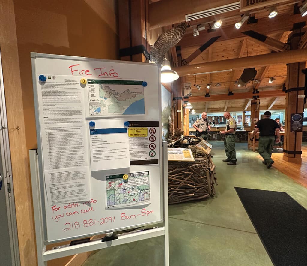
Officials representing multiple agencies, including the USFS-Superior National Forest, held a press conference yesterday at the Kawishiwi Ranger Station in Ely. They provided updates and plans for the wildfires burning in the Boundary Waters Canoe Area Wilderness and northeastern Minnesota.
Challenges not going away anytime soon
The USFS-Superior National Forest held a press conference to address the wildfires in the Boundary Waters Canoe Area Wilderness (BWCAW) yesterday at the Kawishiwi Ranger Station in Ely. In collaboration with multiple agencies, they provided information on the latest safety measures and closure plans, fire status and summary of operations, as well as the weather outlook and evacuation updates.
As of yesterday, 55,000 acres had burned across the Superior National Forest and BWCAW, with extensive additional fire in Quetico Provincial Park and Ontario. Officials don’t expect it to end soon. Local communities, businesses, outfitters, and visitors have been quickly pivoting as conditions change daily.
Agencies provide updates
Jason Randall, Safety Officer with the National Incident Management Organization, emphasized that their focus is on public and firefighter safety. He opened the meeting by noting that someone had spotted a drone near one of the fires. He warned everyone that drones are prohibited because they endanger firefighting aircraft and personnel.
Dan Paulson, Operations Section Chief with the Minnesota Incident Command System, is overseeing ten fires between Crane Lake and Orr, which are outside of the wilderness, and said they’ve been using direct attack, which includes ground crews, dozers, and engines. He said that access has been a huge challenge.
Many people have asked about the status of the fires and how long they are expected to burn. Nick Petrack, Forest Fire Management Officer with the Superior National Forest, spent some time explaining the current fire status and a summary of operations. Currently, the largest fires in the BWCAW are the Sioux, Bear Trap, and the Thumb. Two of them have now pushed into Quetico Provincial Park, Canada. As a result, officials in Minnesota are also coordinating efforts with their partners in Canada.

Petrack said they’re prioritizing the Sioux wildfire due to nearby infrastructure along the Echo Trail. He mentioned the challenges to public safety posed by the Camp Fire, which led officials to close and evacuate the Fernberg Road corridor. Now there’s a new fire that has crossed into the wilderness from Ontario. Known as the Little Knife Fire, it’s west of the Gunflint Trail. That fire is now estimated at 30,000 acres, with 6,000 in the BWCAW.
Officials have given the northeastern region a higher priority. “In fact, our eastern area of northern Minnesota is number three in the nation,” Petrack said. He estimates that there are about 500 firefighters total including support, roughly 400 on the ground. Pilots will fly aircraft to drop water as visibility improves.
When someone asked Petrack why officials don’t simply let the forest burn, he said, “We really don’t say let’s let this burn. We understand the fire-dependent ecosystem. Number one, the Boundary Waters is the most heavily utilized wilderness in the United States.” He went on to add, “We have a huge public safety concern. And with that, we understand the economic, social, and political impacts along with the recreational opportunities that this wilderness exhibits for us in northeastern Minnesota.” Further, he said, “The problem is we have this many fires; we cannot insert this many people safely into areas like that. We may use different strategies; obviously we’re looking at natural boundaries to have less of an impact on the wilderness.” Officials assess each fire on a case-by-case basis.
“I highly feel that this is going on for a while, so I do ask for patience. If we do see some rain, that does not mean they’re out. These are longer-term events,” Petrack said. In some places, the fire has burned to 2-3’ deep into the soil, getting down beyond pine duff.
Weather a “momentary pause”

Incident meteorologist Phillip Manuel echoed Petrack’s mention of ongoing challenges and uncertainty with the weather. The season started out mostly dry and hot. Then, July 6th storms that pushed through the north didn’t bring much rain; however, according to Manuel, they produced over 1,000 lightning strikes. These resulted in the wildfires the region is experiencing now. Unseasonably high temperatures and wind have increased the risk of hazardous conditions. Although less wind, cooler temperatures, and possible rain are in the forecast, Manuel called these a “momentary pause.”
He said even if some precipitation comes, which will help, the sun and warm temps will return. Worse, he said, wildfires create their own weather. As fires grow and evolve, they take hold of the landscape and no longer need wind to keep them going. “It can move 6-7 miles in about half a day’s time”, Manuel emphasized. As a result, it doesn’t give people much time to respond. More concerning, fire managers expect some of these fires to continue burning until winter arrives.
Fire response and evacuation updates
The St. Louis County Sheriff’s Office has provided an Emergency Management Hub which shows the current status of evacuation zones within St. Louis, Lake and Cook counties. All of the Fernberg Road corridor has been evacuated. The Echo Trail, from 200 Road to North Arm Road, is closed. Lake County Sheriff Nathan Stadler said the Camp Fire 5 miles north of Winton is most concerning to public safety at the moment.
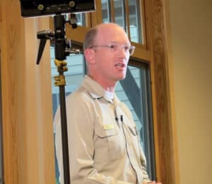
The Superior National Forest has closed all entry points to the BWCAW, which went into effect on July 14. Tom Hall, Agency Administrator with the Superior National Forest, said, “We are evaluating that on a daily basis, four days out, to cancel permits.”
In addition to state and local resources currently on scene, Hall said national resources are also on the way. He estimated that 90% of people who were in the wilderness had been reached and notified. Forest Service staff are still out “sweeping the lakes” to make sure people are ushered to safety. Permits are canceled through Sunday, July 19, but that could change.
This wildfire incident is rapidly evolving. Follow the links and resources below for the latest information.
- Superior National Forest
- Facebook page – Provides current information and closures
- Alerts page
- Daily Facts Sheet
- St. Louis County Sheriff’s Office
- Emergency Management Hub – Shows evacuation zone locations
- Ely Community Response – Provides support, resources, and volunteers for area residents and visitors impacted by wildfires
- Minnesota Incident Command System Facebook page – Provides incident updates
- Weather forecast resource (recommended by the incident meteorologist)
- Air quality
- Wind direction and speed
- Western Fire Chiefs map – Tracks fires throughout the United States.
- Watch Duty – Shows wildfire locations, acres burned, and evacuation zones
- ArcGIS smoke and fire viewer
Get Fire Updates
Stay informed on recent wildfires, campfire bans, park closures, straight to your inbox.