


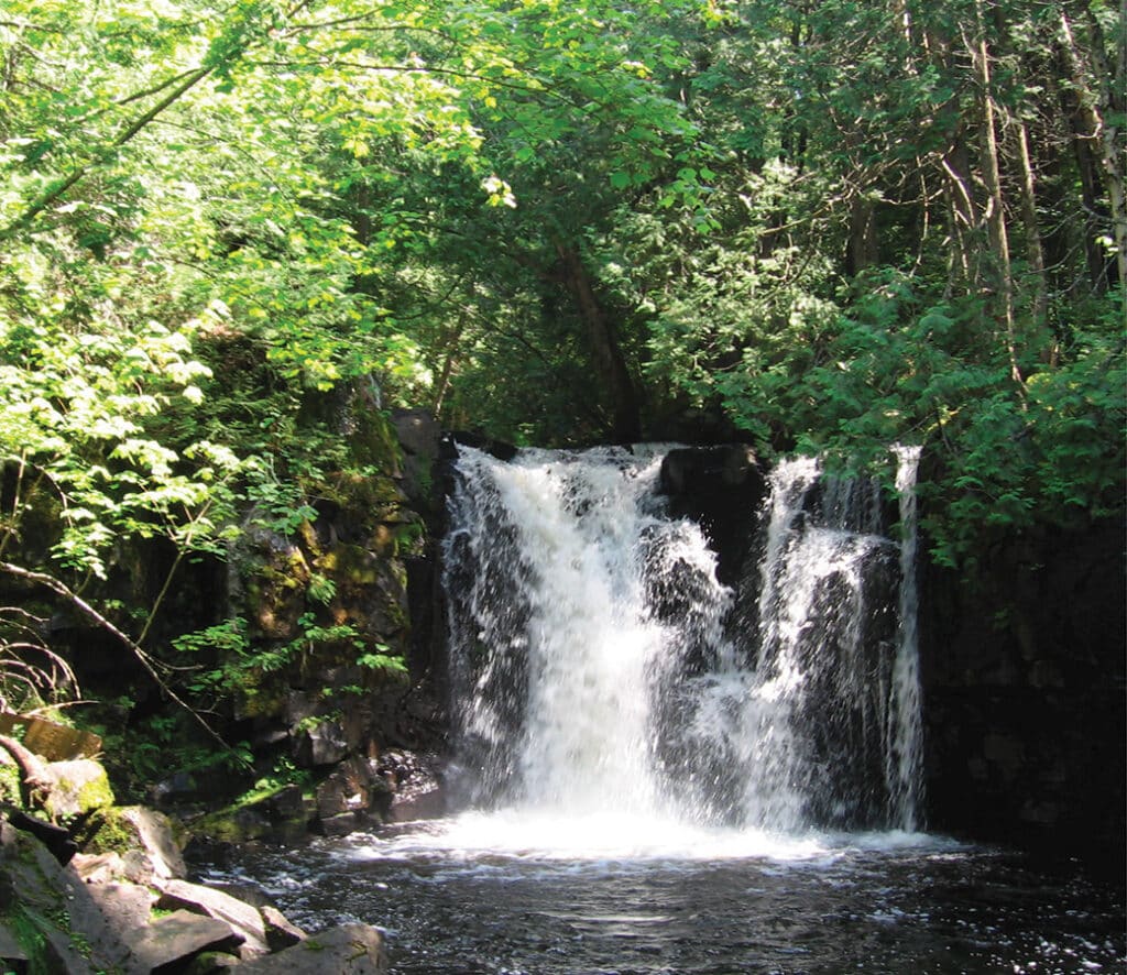
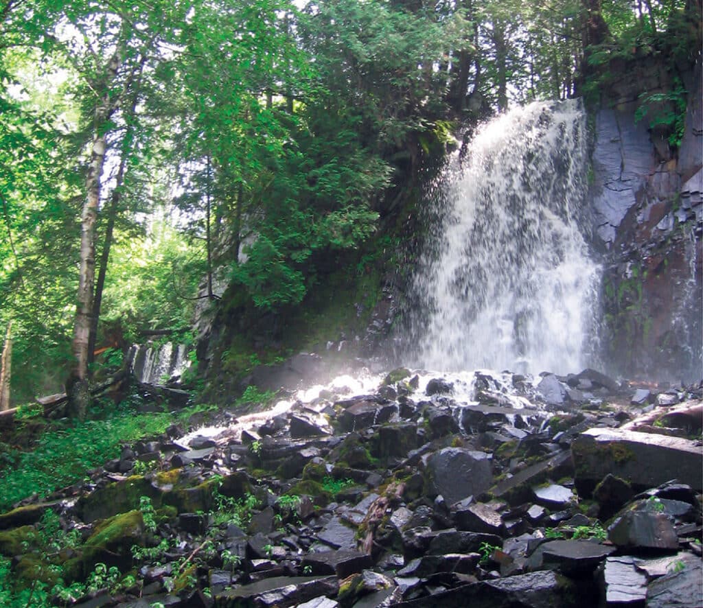
Waterfalls and cascades appear throughout many parts of the Boundary Waters Canoe Area Wilderness (BWCAW). These natural features, often found between lakes and rivers, add excitement and beauty for paddlers and anglers exploring by canoe. Many portage trails follow these dynamic stretches of moving water. In fact, these waterfalls are a big reason portages exist in the first place. We’ve put together a list of 8 must-see waterfalls to add to your next adventure.
The BWCAW spans over a million acres of untouched wilderness in northern Minnesota. Lakes, rivers, and streams shape the region’s rugged terrain. Each year, roughly 150,000 people visit the area—most of them traveling by canoe.
Glacial activity and erosion carved the landscape from the tilted layers of the Canadian Shield. Massive ice sheets scraped the terrain during the last glacial period, carving deep depressions that later filled with water and formed a myriad of lakes. Over time, softer downstream rocks in rivers eroded more quickly than the harder upstream rock, creating the waterfalls and cascades we see today.
A permit is always required to enter the wilderness
Although the wilderness contains countless rapids, cascades, and waterfalls, most of them are only accessible by canoe (with some exceptions). We’ve highlighted options for both day-trippers and multi-day explorers, and we’ve noted any spots you can reach by hiking.
Visitors taking an overnight paddle, motor, or hiking trip or a motorized day trip into the BWCAW from May 1 – September 30 are required to obtain a quota permit through recreation.gov. Walk-in permits may be obtained at any permit issuing station on the entry date or one day prior when available. However, reservations are recommended since there are a limited number of quota permits for each entry point.
Self-issued permits are required for all visitors from October 1 – April 30. Those permits are available from kiosks at BWCAW entry points and Forest Service offices (no reservation required and no recreation fees).
As you plan your visit, keep in mind that each group is limited to one permit per trip, with a maximum of nine people and four watercraft. Also, everyone in the group must stay at the same campsite. The USFS-Superior National Forest has put out a helpful planning guide. Always exercise extreme caution around moving water, and never attempt to “shoot” the rapids. Water levels and temperatures can change quickly.
Refer to the Google map at the end of the article, which marks all the locations of the waterfalls discussed below.
Curtain Falls
Situated along the Canadian border, this dramatic waterfall spills across nearly 200 feet of granite. It is characterized by one large drop, multiple chutes, and cascades. It’s part of the historic French fur trader route and has been used by Indigenous people who lived and traveled through the area for thousands of years. The falls can be accessed along canoe routes through a few entry points along the Echo Trail, north of Ely. Visitors should note that this is one of the more remote waterfalls in the wilderness and, as a result, should plan for multiple days to paddle and portage there. The falls are most dramatic in the spring and early summer when water levels tend to be higher.
Nearest Entry Points | Ely
Moose/Portage River (north) #16
Stuart River #19
Angleworm Lake #20
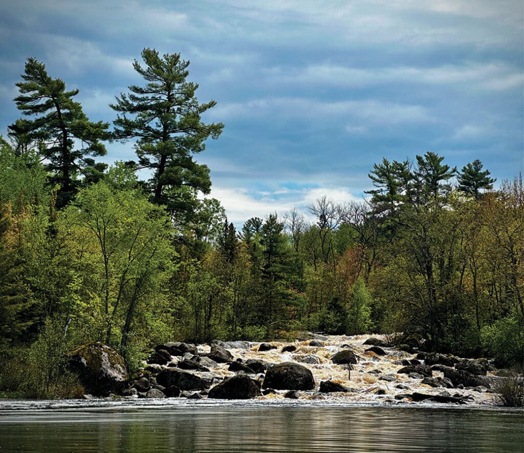
Nina Moose Cascade
This cascade flows along a section of the Nina Moose River, just off the Echo Trail north of Ely. White pines and willows line the river’s edge, and moose have been spotted along the way. Paddlers can reach the area in about a half day’s journey, but it’s best enjoyed as part of an overnight trip. The route follows the river at the north end of Nina Moose Lake. Shortly after, a portage trail leads paddlers right alongside the cascade. A short walk down the trail brings you to the top of the falls, where you can pause and take in the view of the “slide”—a smooth tongue of water gliding over rock. Depending on water levels, this spot also makes for a great lunch break.
Nearest Entry Point | Ely
Moose/Portage River (north) #16
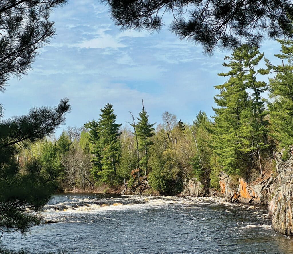
Pipestone Falls
This waterfall flows between dramatic cliffs streaked with sun-colored lichen. It flows in a region rich with history. In the early 1900s, logging camps spread across the area, hauling out timber bound for paper mills. Later, small fishing resorts appeared along the shores of Basswood Lake to the north. Though removed long ago, visitors can still spot traces of both industries.
At the entry point, paddlers head north on Fall Lake. Don’t miss Newton Cascade, located along the first portage, as it’s also another nice stretch of moving water. After paddling through Newton Lake, visitors will take the portage into Pipestone Bay, which is part of Basswood Lake. Be sure to pause at the overlook among the pines to take in the lofty view of the falls. Anglers often gather at the base of the falls, hoping to catch walleye. This route allows both motorized and non-motorized boats, and the portage trails are wide, gently graded, and easy to navigate. Travel to the falls is about 8 miles round trip and can be done in a day.
Nearest Entry Point | Ely
Fall Lake #24
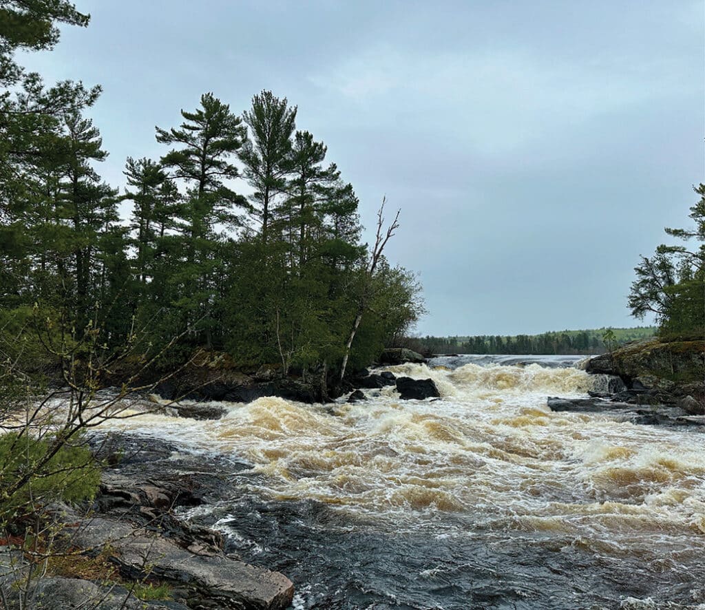
Lower Basswood Falls
Another unique waterfall along the Minnesota-Canadian border draws visitors with its stunning scenery and nearby campsites. Starting in the 1600s, French fur traders known as Voyageurs navigated these waters in large canoes in search of beaver pelts. Long before them, Indigenous people traveled these same routes for thousands of years.
Part of the Basswood chain of waterfalls and cascades, Lower Basswood stands out with a large rock that splits the falls. Two sets of falls converge on this river-like stretch of Crooked Lake—a smaller one from the south and a larger one from the east. Paddlers should take the Canadian portage on the north side of the Basswood River for the best view of all the falls (yes, that’s legal). Granite cliffs near the falls offer plenty of great lunch spots. Please note that you cannot camp on the Canadian side unless you have a Remote Area Border Crossing Permit.
Be sure to leave time to paddle one mile north along the border to view an interesting set of pictographs. They are likely between 500 and 1,000 years old. The falls are most easily accessed along two separate canoe routes. One is north along the Echo Trail, and the other is east of Ely on Fernberg Road.
Nearest Entry Points | Ely
Mudro Lake #22
Fall Lake #24
Devil’s Cascade
This cascade, one of the more unique features in the BWCAW, cuts between 80-foot cliffs along the Sioux River North. A large, elevated campsite sits just above the cataract, offering sweeping views of the river valley to the north. While visitors should approach the edge of the cliffs with caution, they’ll enjoy the soothing sound of rushing water beside an evening campfire. The campsite lies off a short spur along the portage trail between Lower Pauness Lake and the Sioux River. Overnight campers should collect water near the start of the trail, as there’s no direct water access from the site. The Sioux-Hustler Hiking Trail loops through this area of thick boreal forest. The cascade can be accessed along a canoe route north of Ely along the Echo Trail.
Nearest Entry Point | Ely
Sioux River (north) #14
Johnson Falls
This stunning double set of falls rewards visitors who take the time to see both the upper and lower sections. Paddlers can complete the scenic route in a day, weather permitting. Depending on water levels, one or two pools near the falls offer great spots for a swim. To reach the falls, paddlers cross four lakes and navigate several portage trails. A spur trail leading west from the southwestern portage on Pine Lake provides access to the falls. If you’re traveling from Canoe Lake into Pine Lake, keep in mind that the portage is one mile long each way and hilly.
Nearest Entry Points | Grand Marais
Clearwater Lake #62
East Bearskin Lake #64
Rose Falls
Cedar trees and ferns frame these 30-foot falls with a picturesque wilderness charm. For those seeking a taste of the backcountry, this popular spot makes an excellent day trip. Visitors can reach the falls in a few different ways. Day trippers can paddle to the falls on a 5-mile round-trip route starting from Bearskin Lake. Park at the gravel lot on the lake’s west end, then paddle across Bearskin to the short, 75-rod portage into Duncan Lake. From there, paddle north about a mile to Stairway Portage, where you can leave your canoe near the start of the trail (be sure to tie it off if it’s windy). Follow the trail a little ways north to the waterfall.
Hikers can reach the falls via the Caribou Rock Trail—a challenging but scenic 7.7-mile round-trip hike. Backpackers traveling the Border Route Trail will also pass by Rose Falls and should take the chance to rest and refill water while enjoying the view.
Nearest Entry Points | Grand Marais
Duncan Lake #60
Bridal Veil Falls
Cool air and mist surround this aptly named waterfall, where multiple streams cascade down sixty feet before crashing into a jumble of Precambrian bedrock. Depending on water levels, hikers can dip their feet into the cool, clear pools at the base. This 7.7-mile round-trip hike along the Crab Lake spur trail is considered challenging, thanks to elevation changes and rugged wilderness.
When the spur connects to the Border Route Trail, follow it west to the next trail intersection. Then, hike north on the trail to reach the falls. Pay attention to the trail and follow directions carefully, as the area is not well marked. Because of its remote location, you might have the place to yourself. To access the trail, take Loon Lake Road off the Gunflint Trail. Follow the road past the “Dead End” sign to a small National Forest parking lot. Be sure not to park at Loon Lake Lodge, as some maps tend to lead people there. While the falls are just outside of the BWCAW boundary, you will still need a permit if you hike the Crab Lake Spur to Border Route Trail. Alternatively, paddlers can access this waterfall from Gunflint Lake, which is outside the wilderness boundary.
Nearest Entry Points | Grand Marais
Border Route Trail (east) #83
Gunflint Lake (no entry point or permit is required on the south side of the lake or trail)
Boat and camping gear rentals
Whether you’re planning a day trip or a multi-day adventure, outfitters in the gateway communities of Ely, Tofte, and Grand Marais rent motorboats, canoes, and a wide range of camping gear. They’ll also provide maps and up-to-date route information to help you plan your adventure. You can find a list of most of these outfitters online.
Google Map locations have been provided for planning. Please use topographic maps for accurate navigation.
Wilderness guide and outdoorswoman Pam Wright has been exploring wild places since her youth. Remaining curious, she has navigated remote lakes in Canada by canoe, backpacked some of the highest mountains in the Sierra Nevada, and completed a thru-hike of the Superior Hiking Trail. Her professional roles include working as a wilderness guide in northern Minnesota and providing online education for outdoor enthusiasts.