

Size: 33 acres
Status: 100% Contained
Cause: Likely chainsaw operations by U.S. Forest Service personnel (see below)
Personnel: 72


June 5 Update:
Firefighters reached 43% containment and shifted to mop-up operations Friday, extinguishing hot spots and removing hazard trees. All evacuations have been lifted. The public is still asked to stay clear of the North Arm Road area due to active equipment and firefighter traffic; the drone TFR remains in effect.
A Minnesota DNR State Fire Investigator concluded the fire likely started when chainsaw operations by U.S. Forest Service crews — who were cutting control lines in preparation for the planned Geraldine prescribed burn — ignited dry fuels nearby. No prescribed burning was underway at the time, only chainsaw work. “We are committed to transparency regarding the findings of this investigation and to reviewing the incident to identify lessons learned,” said Drew Stroberg, Acting Forest Supervisor for the Superior National Forest.
Fire restrictions take effect in the BWCAW beginning Saturday, June 6 through June 30. Wood and charcoal fires are prohibited; gas and propane stoves remain permitted.
June 3 Update:
Size: 35 acres
Status: 30% Contained
Cause: Unknown, under investigation
Personnel: 80
Location: West of the North Arm of Burntside Lake, approximately 8 miles northwest of Ely, MN — Kawishiwi Ranger District, Superior National Forest
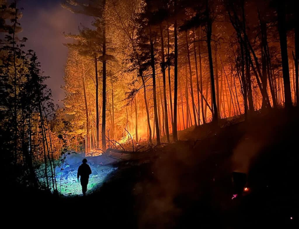
A wildfire broke out on the afternoon of June 1 near the intersection of Lindskog Road and North Arm Road on Burntside Lake. Driven by hot, dry conditions and light southeast winds, it spread quickly to an estimated 30 acres by evening, burning into an existing prescribed burn unit. Sixty-five personnel were assigned as of June 2, including a Hotshot crew. Two water-scooping aircraft stationed in Duluth responded quickly alongside two helicopters with water buckets; because the fire burns so close to Burntside Lake, aircraft have been able to maintain a fast turnaround on water drops. Nine seasonal cabins along the southern end of North Arm Road near Lindskog Road were evacuated; the fire burned to within a quarter mile of the road, according to St. Louis County Sheriff Gordon Ramsay. No structures have been reported lost.
Two YMCA camps on the North Arm of Burntside Lake — Camp Du Nord and Camp Widjiwagan — are located near the fire. Neither camp is in danger, Sheriff Ramsay said.
Near-critical fire weather continues June 2, with high temperatures, low humidity, and south winds of 5–10 mph forecast. The Superior National Forest is asking the public to avoid the North Arm Road area, keep Burntside Lake clear for scooping aircraft, and ground all drones near the fire.
Get Fire Updates
Stay informed on recent wildfires, campfire bans, park closures, straight to your inbox.


