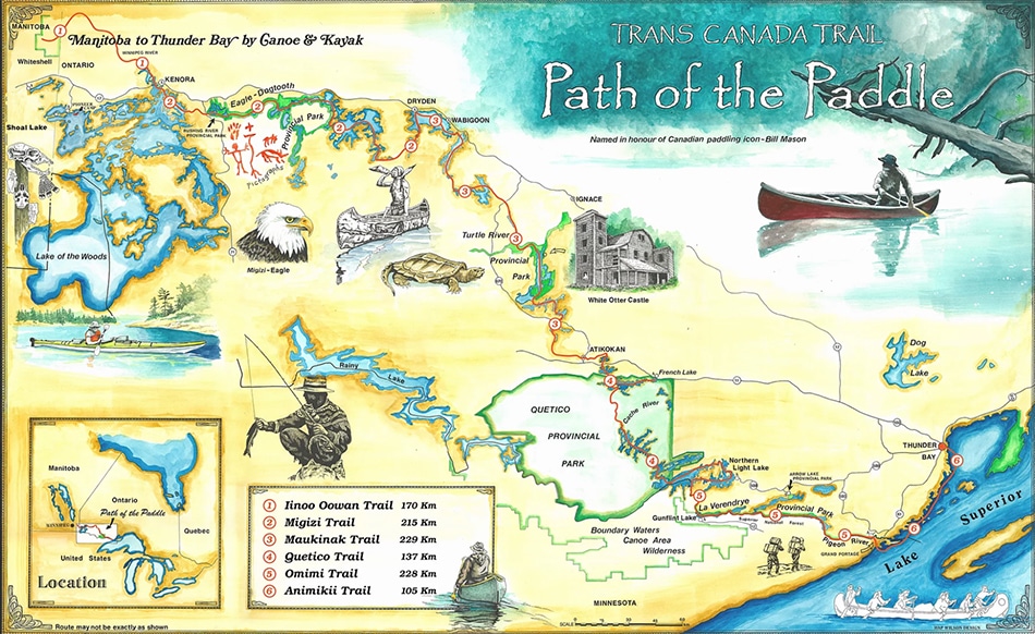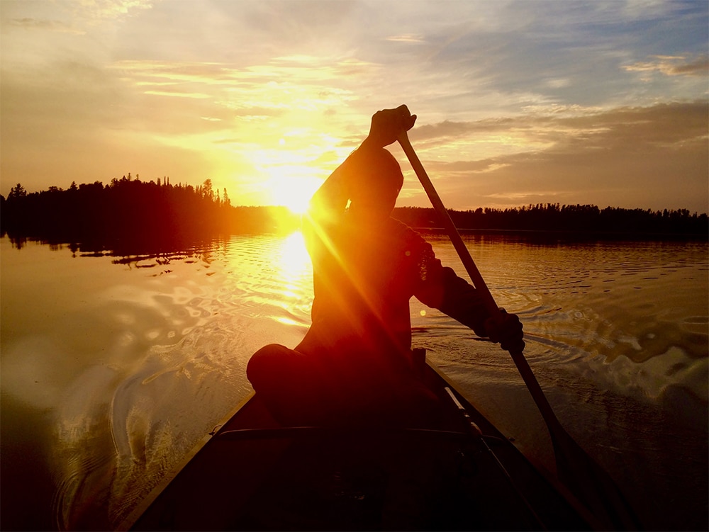
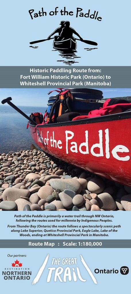
The “Path of the Paddle” is more than 680 miles of canoe route through northwestern Ontario. The trail reaches from Thunder Bay on Lake Superior to Whiteshell Provincial Park in Manitoba. Along the way, it passes through extraordinary canoe country, including Quetico Provincial Park and follows the edge of the Boundary Waters Canoe Area Wilderness.
The route is one section of Canada’s Great Trail, which traverses the country from the Pacific to Atlantic Ocean, following a network of nonmotorized greenways. In other sections, trail users can bicycle, hike, ski, snowshoe, and more. But in the Quetico-Superior region, where lakes, rivers, and portages have carried travelers for centuries, the trail follows historic canoe routes.
“When the route planners came through Northwestern Ontario, it was decided that a water route seemed to be the most interesting,” said Clara Butikofer, board chair of Path of the Paddle. “It would simulate the mode of transportation for Canada’s early residents, settlers and entrepreneurs.”
Last month, the nonprofit Path of the Paddle Association released an overview map of the canoe route. The project was funded by Destination Northern Ontario, a provincial agency that seeks to increase tourism opportunities in the region. The new map provides a timely opportunity to plan a trip on the Path of the Paddle. American canoeists have been cut off from Canada’s wilderness this year as the border has remained closed throughout the open-water season due to COVID-19, and many Canadians have also skipped trips.
“This map has been created for the purpose of trip planning and route overview,” said Butikofer. “During this time of the pandemic, when everyone is advised to stay safe and stay close to home, there is no better resource available for planning adventures into the wilderness of Northwestern Ontario.”
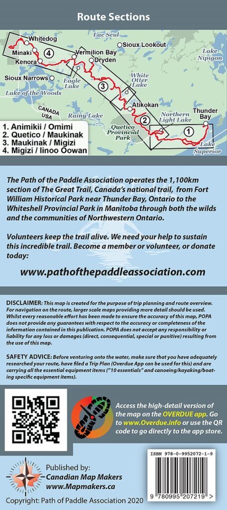
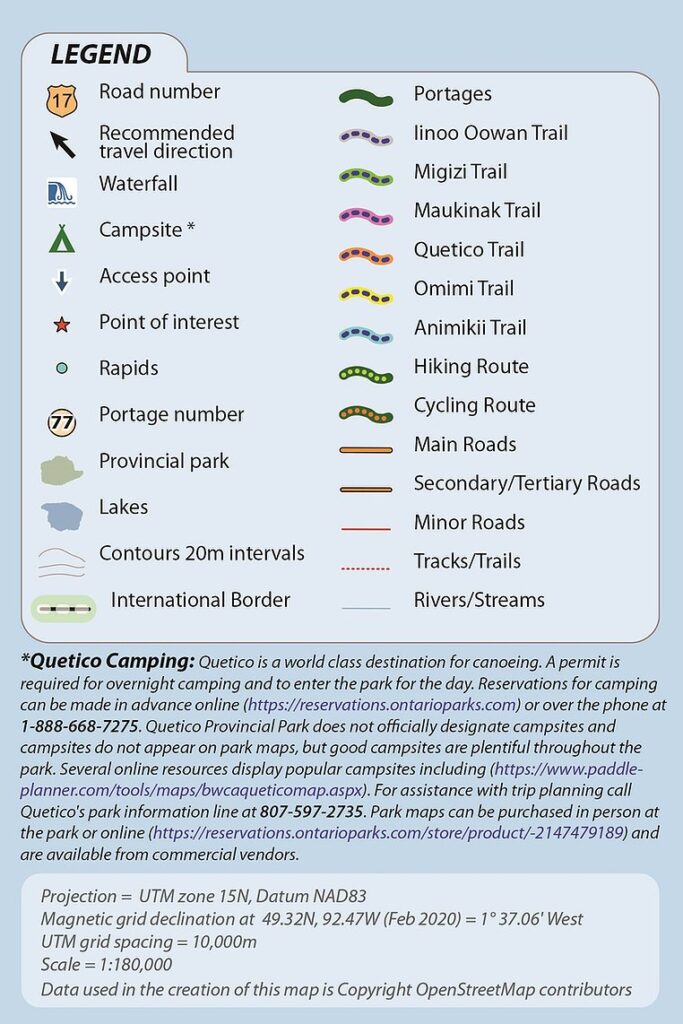
The map includes access points, campsites, and portages throughout most of the route. From Thunder Bay, the Path of the Paddle follows the Lake Superior shoreline for about 60 miles to the Pigeon River. Travelers can then follow the historic “Voyageur Highway” – the rivers and lakes that form the international border, featuring the Pigeon River, Partridge Falls, Gunflint Lake, portions of the Boundary Waters Canoe Area Wilderness and La Verendrye Provincial Park.
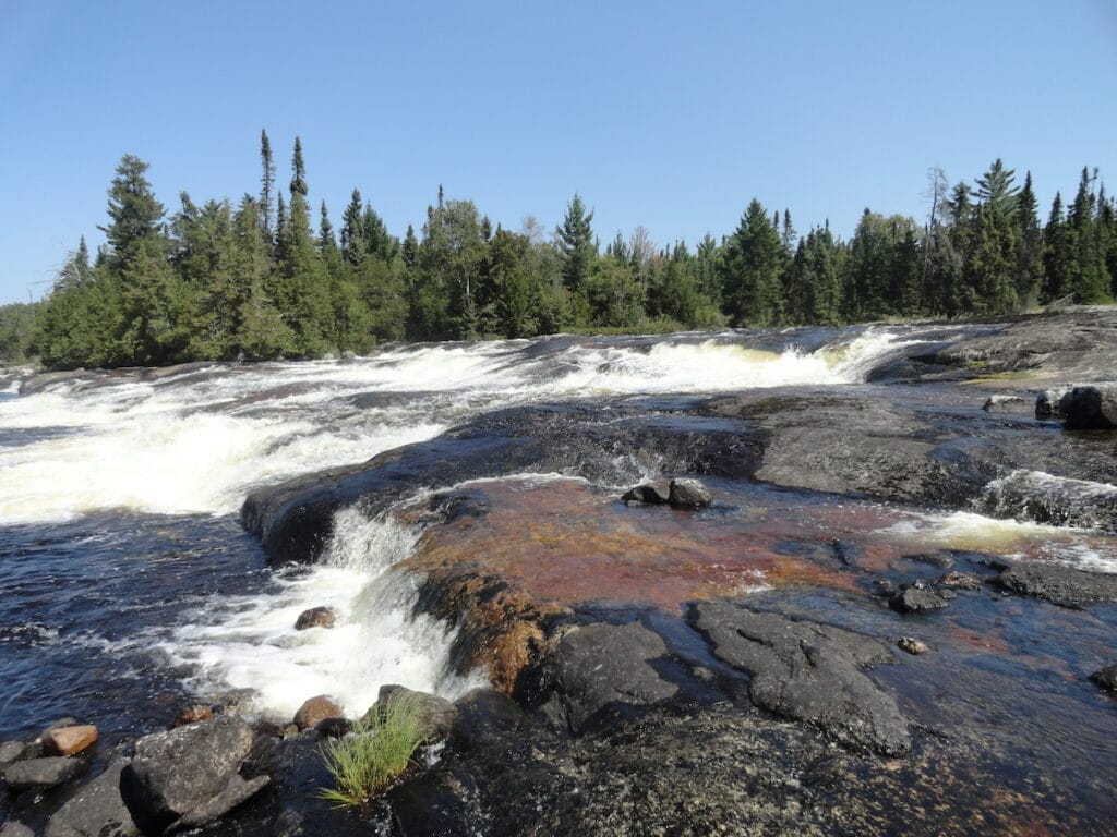
In Quetico, the Path of the Paddle passes through pristine wilderness and beautiful sights. The route enters Quetico at the Cache Bay ranger station on Saganaga Lake and at Nym Lake along the park’s northern boundary. In the park, paddlers travel past some of the park’s most scenic waterfalls, including Silver, Kennbas, Snake, Split Rock, and Chatterton Falls.
“Although much of Path of the Paddle is remote and beautiful, the complete absence of development and absolute exclusion of motor boats in Quetico guarantee excellent fishing, pristine water — the ultimate wilderness experience,” said Lise Sorensen, Path of the Paddle’s trails officer.
After exiting Quetico, the route continues down the Atikokan River. There is a series of Class 1 rapids and a few big waterfalls requiring a carry. The town of Atikokan hosts the only “urban portage” on the Path of the Paddle, letting travelers pass through town and resupply.
If you’ve paddled part of the “Path” you’re invited to share photos and stories with the Association. The group also promotes a Trail Ambassadors program to help educate about the trail, share real stories of their travels, tips and inspiration.