
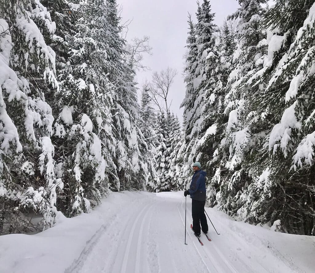
While we wait for snow to blanket the ground, we dream of gliding over ski trails through dense pockets of woods and alongside frozen lakes in northern Minnesota. Just north of Grand Marais, miles of cross-country ski trails wind through the surrounding landscape. We share a bit of history behind the trails, along with pro tips to help you explore them.
Gliding through the woods
As winter descends on northern Minnesota, one of the most enjoyable ways to experience the snowy woods is on cross-country skis. Along the Gunflint Trail, a scenic 57-mile byway stretching north from Grand Marais, visitors will find miles of groomed cross-country ski trails. According to the Gunflint Trail Association, there are over 180 km (112 miles) of classic and skate-style skiing.
Trails up north are scenic and offer plenty of opportunities to enjoy the quiet woods. Many wind through dense pockets of boreal forest and along frozen lakes at the edges of the Boundary Waters Canoe Area Wilderness (BWCAW). One of those groomed trails, the Banadad Ski Trail, runs within the wilderness itself.
The skiing season goes from about mid-November to April, depending on snowfall. On average, northern Minnesota receives about 100 inches of annual snowfall. As a result, trail operators groom miles of ski trails all season long.
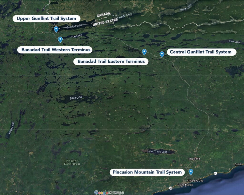


Breakdown of trail systems
We highlight some of the region’s more established ski trails, but there are many other tracked and untracked trails to explore. You can also venture off the beaten path and create your own adventure by breaking trail across one of the area’s many lakes. Be sure to check ice conditions and review our “Before you go” guidance at the bottom of the page.
Pincushion Mountain Ski Trail System
Located just outside of Grand Marais and up along the Gunflint Trail, this system has almost 16 miles (25 km) of groomed classic and skate ski trails. These scenic trails wind through the woods above the Devil Track River. The trails offer options for all levels of experience, ranging from easy to most difficult. Stop at the warming house for a rest near the trailhead parking area. For a map and the latest conditions, visit the Pincushion Ski & Run Club website.
Ski pass: The Great Minnesota Ski Pass is required to use this trail system and can be purchased online or in person at a state park ranger station.
Central Gunflint Ski Trail System
Located halfway up the Gunflint Trail, these trails run deep in the forest and are surrounded by parts of the Superior National Forest and BWCAW. Some trails wind along scenic lakes bordered by pine-covered hills. Bring some hot cocoa and pause at one of the unheated shelters along the trail. There are over 43 miles (70 km) of groomed trail, with options for everyone.
Ski pass: Local resorts and outfitters maintain these ski trails. You can purchase a pass at Golden Eagle Lodge or Bearskin Lodge.
Upper Gunflint Ski Trail System
These ski trails wind through thick woods just south of the Canadian border. In some places, the trail skirts near lakes and ponds, as well as woods impacted by the 2007 Ham Lake Fire. The habitat supports plenty of wildlife, including moose. Watch for moose rubs where they’ve scraped away bark on trees. There are about 43 miles (70 km) of groomed ski trails, with routes ranging from easy to most difficult. The system connects to the separately maintained Banadad Ski Trail, which stretches through the BWCAW. When you’re done, stop at a local resort for a hot cup of your favorite beverage.
Ski pass: Local resorts and outfitters maintain these ski trails. You can purchase a pass at Gunflint Lodge or Gunflint Pines Resort.
Banadad Ski Trail System
This is likely the most remote of the Gunflint Trail ski systems. Much of it cuts through the BWCAW, making it the longest groomed trail in the wilderness. The singletrack winds through dense forest and alongside beautiful lakes and ponds. This area is filled with wildlife. Keep an eye out for animal tracks, including moose, wolves, and otters. There are no amenities along the trail; plan to be self-sufficient if you ski this trail, which is open only to classic-style skiing. The trail is considered moderate in difficulty, depending on your fitness level, weather conditions, and how much of the 17 miles (27 km) you cover. Check out this handy guide to using the trail, which includes a map and more.
Ski pass: You need a pass and a permit to use this system. A self-issued Boundary Waters Canoe Area Wilderness permit is required, but it doesn’t require a reservation or fee. Pick one up at an outfitter or at the trailhead parking lot kiosk. Keep it in a waterproof bag in an accessible place. Then, the Great Minnesota Ski Pass is also required and can be purchased online.


The Boundary Waters, delivered weekly
Join thousands of readers receiving free wilderness news and weekly updates from the Northwoods.
Brief history of ski trails
Beginning in the early 1970s, outfitters and resorts worked with the Forest Service to develop groomed ski trails along old logging roads, logging routes, old footpaths, and resort networks. According to an article by Bearskin Lodge, early resort owners Dave and Barb Tuttle were instrumental in developing the Central Gunflint ski trails. During this same period, outfitters to the north also began developing the Upper Gunflint trails. This was around the time skiing was experiencing a resurgence as a winter sport in Minnesota.
Then, in 1979, the newly incorporated North Superior Ski and Running Club began developing the trails around Pincushion Mountain, just outside of Grand Marais. Later, they changed the name to Pincushion Ski & Run Club.
Finally, in 1982, crews constructed the Banadad Trail as a single-track, classic-style, cross-country ski trail connecting the Upper and Central Gunflint trail systems. Like the others, the trail was stitched together from old logging roads that existed from the 1920s until the 1950s. For about 25 years, visitors could also stay at one of the backcountry yurts along the trail, though those have since closed.
Before you go
Cell phone coverage is limited along the Gunflint Trail. Some of the ski trails are wild and remote. Some roads branching off the Gunflint Trail may require a four-wheel-drive vehicle. Carry emergency supplies in case you get stuck. However, the county regularly plows roads to year-round outfitters and resorts. Find information on plowed roads online.
When skiing, you may want to carry a satellite communicator. You can also rent one from a local outfitter. Stock up before you go, as you’ll find few places to refuel or buy groceries. Either way, let someone know where you’re going and when you expect to return. Because of this, it’s a good idea to carry a daypack containing a paper map, compass, water, a first-aid kit, fire-starting supplies, a headlamp, and extra clothing.
Don’t have the gear? Local outfitters along the Gunflint Trail and shops in Grand Marais rent winter equipment. They’re also great resources for the latest trail conditions.
More info:
- Visit Cook County: Gunflint Trail
- Pincushion Mountain Ski & Run Club
- Central Gunflint Ski Trail System
- Upper Gunflint Ski Trail System