
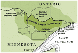

The Knife Lake Fire burned 5,000 acres in the Boundary Waters Canoe Area Wilderness this past summer. Since then, the Forest Service has assessed campsite damage and identified eight sites that need restoration. Crews have begun work on those sites, and officials hope to reopen most areas next summer, depending on how much work they get done. We also traveled to the area and show what the landscape looks like after the fire.
Restoration begins after fire
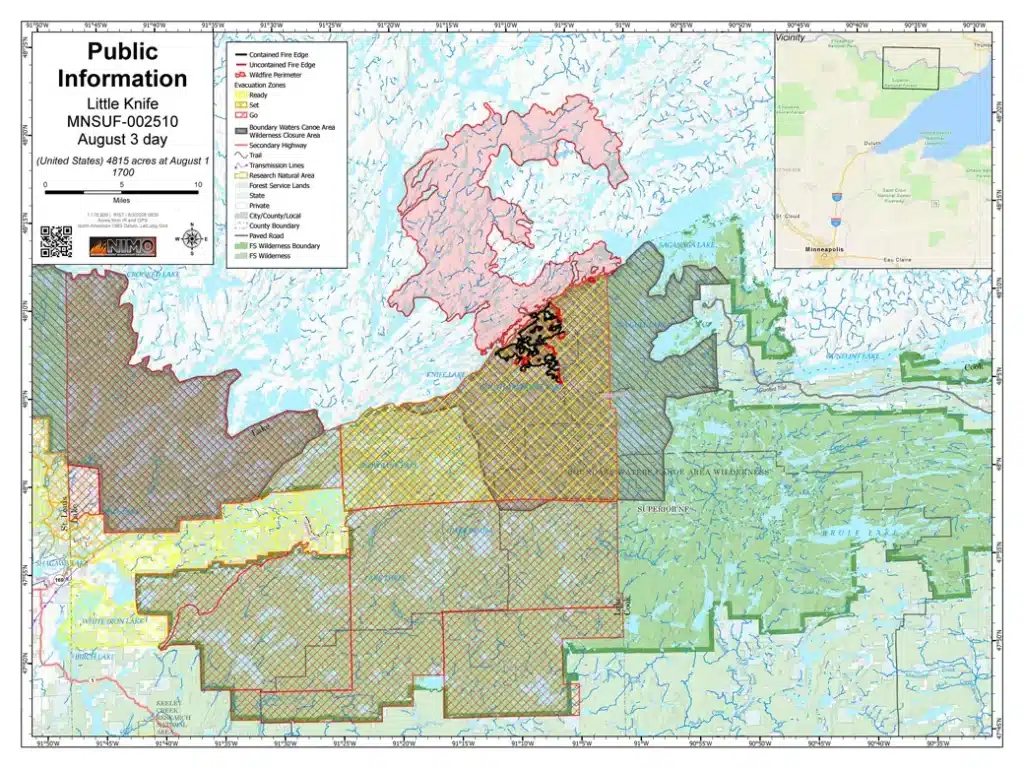
During the summer of 2026, more than 62,000 acres burned in the Boundary Waters Canoe Area Wilderness (BWCAW). One of those wildfires was the Little Knife Fire. Situated along the Minnesota-Canadian border, it started in Quetico Provincial Park, Canada, and crossed into Minnesota. It burned roughly 30,000 acres, with 5,000 in the state, and was concentrated northwest of the Gunflint Trail.
Late in the summer and into fall, Forest Service crews assessed damage to the area, including campsites and portage trails. In a WTIP article, crews said eight campsites remain closed, and three had damaged latrines. Since the assessment, crews replaced the latrines. Crews will continue restoration on portage trails and campsites in the spring. Work will include removing trees that pose a safety risk. Some areas, like burned hillsides, will need erosion control to prevent soil from washing away.
“We plan to reassess site conditions as soon as spring snowmelt allows crews to access the area. Sites will reopen once they meet safety and ecological standards,” Quinn told the news.


The Boundary Waters, delivered weekly
Join thousands of readers receiving free wilderness news and weekly updates from the Northwoods.

After the fire
The Little Knife Fire, known as FOR028 in Quetico, had already been burning thousands of acres when it spread south into the BWCAW. When it was detected, the BWCAW located to the south was already closed to visitors because of fire and smoke in nearby areas. Incident command crews, supported by air support, worked for many weeks to manage wildfires throughout the wilderness. By the end of August, the Little Knife Fire had been 95% contained.

In early September, I led a canoe trip through the area after the Forest Service reopened it. Only a small portion, including about a half-dozen lakes and other smaller bodies of water, remained closed to visitors. Our journey started at Moose Lake, and part of our route went through Knife Lake, right along the international border. From there, we skirted around the closure area, paddling through Ottertrack, Ester, and Hanson lakes. Eventually, we passed through the South Arm of Knife Lake.
The landscape was a mosaic of areas the fire had touched and left untouched. In some pockets, the fire completely scorched and blackened the land. In others, it burned lightly, leaving live trees standing as it spread quickly across the ground. Some fires ended at the outer edges of campsites; their clearing and lack of brush likely helped stop some of the spread.
As it was early fall, it was encouraging to see new aspen and birch seedlings, along with other plants, taking hold in the sooty soil. While the BWCAW is a fire-dependent landscape, it will take many years for this area to return to how it looked before the fire.
Though officials plan to open all eight sites affected by the Knife Lake Fire next season, some may remain closed. The fire affected many areas of the 1.1 million-acre wilderness, and crews will need time to address campsites and portages throughout. For the latest information on closures and wilderness updates, visit the Superior National Forest webpage.


More info:
- Forest Service plans spring work to reopen BWCAW campsites affected by Little Knife Fire – WTIP
- USFS – Superior National Forest Alerts
- July Lightning Incident/Little Knife Fire Daily Update – USFS – Superior National Forest