


The Minnesota DNR is seeking public comment on the state’s Lake Superior Coastal Program. They have provided a draft plan that evaluates the program’s effectiveness and suggests priorities for future improvements. Through this program, the agency supports healthy and sustainable coastal communities while protecting Lake Superior’s natural resources.
The Minnesota Department of Natural Resources (DNR) is asking the public to comment on its proposed coastal management plan, which reviews the effectiveness of the state’s coastal programs along Lake Superior. In the late 90’s, the Minnesota Lake Superior Coastal Program (MLSCP) began overseeing and enhancing improvements along the lake.
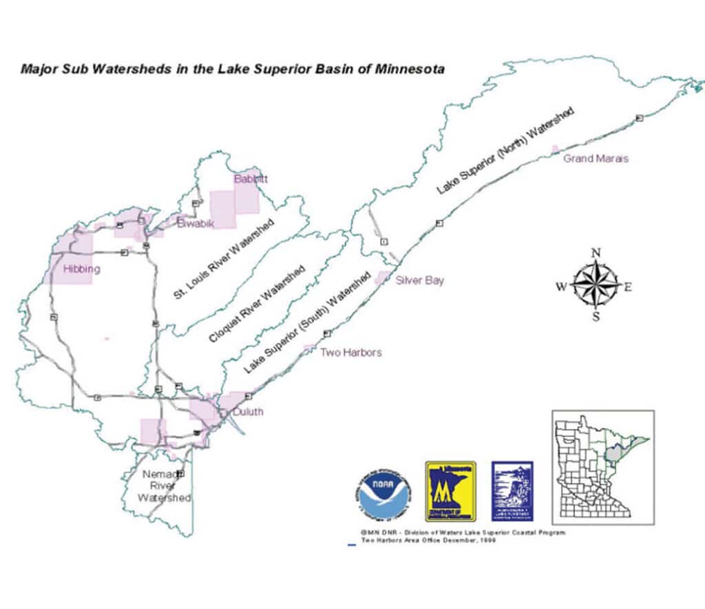
Every five years, the MLSCP reviews its plan. Throughout the process, they focus on nine key areas. According to their plan, these include assessments of wetlands, lake resources, coastal hazards, marine debris, and the impacts of development; plans for special areas; energy and government facility siting; and aquaculture. To support their work, the MLSCP published a 2026-2030 Assessment and Strategy document that explores the nine focus areas in depth. The document also outlines their five-year plan, identifying the most important coastal hazards.
“We’re excited to learn what the public has to say about our assessment and the strategy to enhance Minnesota’s management of Lake Superior’s coast,” said Amber Westerbur, DNR coastal program manager. “Engagement with stakeholders and partners was critically important to get us to this point. Additional feedback will help us improve the final product.”


Largest Great Lake
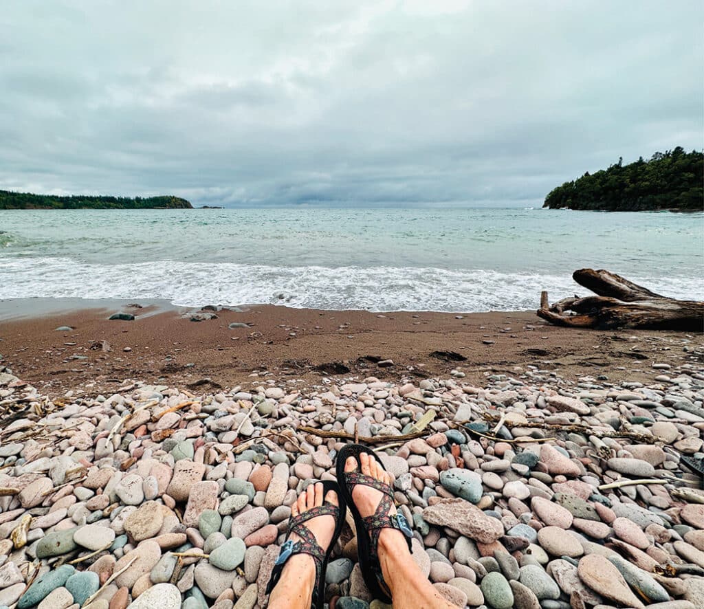
Along the North Shore are the state’s highest point, Eagle Mountain (2,301 feet), and its lowest point, 602 feet above sea level. The coastal shore runs 206 miles and is defined by the St. Louis River to the south and the Pigeon River at the U.S and Canadian border. Lake Superior is the largest of the Great Lakes and has the most surface area of freshwater in the world. The coldest of the Great Lakes, it averages 500 feet in depth, with the deepest point at 1,332 feet. The shoreline is a mix of rocky, steep cliffs, small bays, and cobblestone or sandy beaches. Rivers carve numerous waterfalls through the landscape, eventually flowing into the great lake.
The landscape is rugged but scenic. Mixed hardwood and boreal forest blanket the area. Billions of years ago, volcanic activity in the Mid-Continent rift pushed up what’s now known as the “Sawtooth Mountains.” Glaciation and erosion later shaped this range.
Today, the region draws visitors with numerous recreational opportunities, including hiking to dramatic overlooks, relaxing on its many beaches, and exploring the waterfalls along the coast. Along the shore are numerous state parks, a dozen cities, and a national monument, as well as two Indigenous communities: the Grand Portage and Fond du Lac, both of the Lake Superior Chippewa.
Share your input
Once the comments are received, the DNR will forward the assessment and strategy document to the National Oceanic and Atmospheric Administration (NOAA). For over two decades, the state has worked with NOAA to preserve and improve 189 miles of Lake Superior shoreline.
Comments can be made to the DNR until 4:30 pm (CST) on February 23. Upon NOAA’s approval, Minnesota will be qualified to receive funding for the next five years. Each year, the state funds projects and provides services to protect and improve coastal environments while helping communities build resilience.
More info:
- Lake Superior Rocky Shoreline Vegetation 6.01.24 – Arrowhead Native Plants
- Minnesota Coastal Management Program Assessment and Strategy 2026 to 2030