

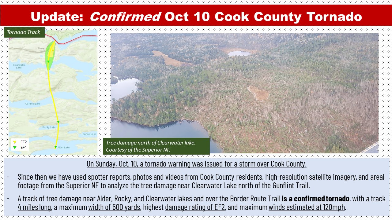
The National Weather Service has confirmed that a tornado tore through part of the Boundary Waters Canoe Area Wilderness last month. The twister was the first recorded tornado in the area in the month of October since record-keeping began in 1988.

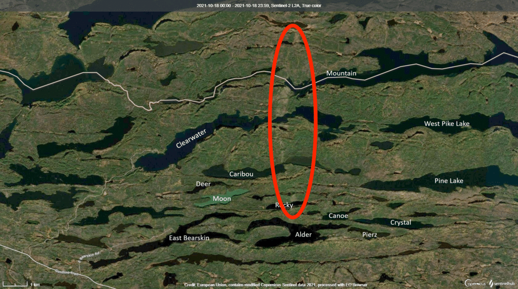
The tornado left a track four miles long and 500 yards wide, and was rated an EF2 by the Weather Service, with winds reaching up to 120 miles per hour. It hit north of the Gunflint Trail, near Alder Lake, continuing due north across Rocky, Caribou, and Clearwater Lakes. The tornado then crossed the border into Canada on the west end of Mountain Lake before it lifted off the ground or dissipated.
“The tornado formed in conditions that were conducive to the development of severe thunderstorms and tornadoes,” the Minnesota Department of Natural Resources reported. “A strong low-pressure system and upper-level disturbance pivoted northward through western Minnesota, pulling moist and unstable right up to the Canadian border. This system had produced a mini-outbreak of small tornadoes in South Dakota and Minnesota one day earlier, and the ingredients for tornadoes improved in many ways as the system turned northward.”
The route took it directly across the popular Border Route Hiking Trail. The Forest Service reports that the section of trail is now impassable due to down trees. The Border Route Hiking Trail Association is aware and already planning trail-clearing efforts.
Tornadoes are generally caused by severe storms that form when warm and low fronts collide. This late season tornado might be blamed on a warming Lake Superior. Meteorologist Joe Moore told KBJR 6 that high water temperatures helped keep the air warm enough for the storm to stay together even as it approached the lake.
The high temperature on the Gunflint Trail on Oct. 10 was 66 degrees, 14 degrees warmer than normal. The day set a new record for the highest low temperature, with the mercury only dipping to 58 degrees.
People in the path of the tornado had more than a half-hour warning for the possible tornado. The National Weather Service issued a Tornado Warning at 5:47 p.m., based on radar, with the twister touching down at 6:20 p.m. Emergency weather radios can alert campers to such warnings.