

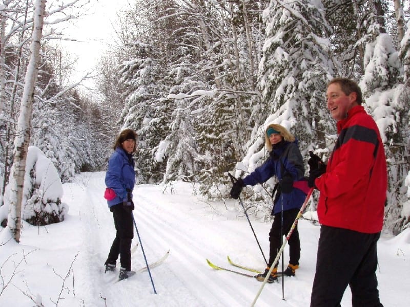
Snow underfoot, dark pines towering above, a white path beckons cross-country skiers into the Boundary Waters and offers glimpses into its past.
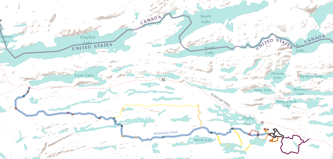
At 27 kilometers, the Banadad Ski Trail is the longest groomed ski trail in the BWCAW. Glide along former logging roads from the Gunflint Trail system and into the protected wilderness area.
History of the Banadad
Beginning in the 1920s, a series of logging camps were established in the region of Poplar Lake, moving timber to Grand Marais along the Gunflint. Resorts and lodges later developed cross-country ski trails for winter guests. When the Boundary Waters Canoe Area was established in 1964 and then designated as a roadless Wilderness in 1978, logging officially ceased and vehicles were prohibited – with an exception made for maintaining the new ski trails via snowmobile. Now, nature is reclaiming the forest and leaving just a few traces of human disturbance.
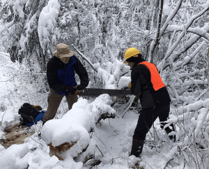
Kept alive by volunteers
The trail is maintained by a devoted community of volunteers, The Banadad Trail Association, who spend hundreds of hours each year clearing brush and performing maintenance with hand tools.
Points of Interest:
- Remnants of a former logging camp
- Crossing the Laurentian Divide
- Hills aptly named ‘Whoopee One’ and ‘Whoopee Two’
- Near lodging and yurt-to-yurt ski accommodations
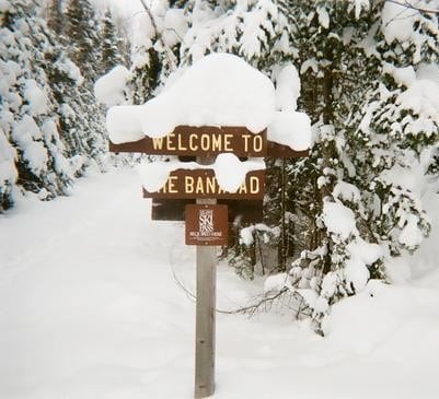
Where to find the Banadad Ski Trail
From Grand Marais turn west up the Gunflint Trail (Cook County Rd 12). Drive 29 miles to Lima Grade road, turn left, drive one mile to Little Ollie road, turn right. Drive one mile to eastern trailhead. Parking is free, a Minnesota Ski Pass and a free BWCAW Entry Day Permit is required. The ski trail is open generally from November to April.
Check out detailed interactive maps and more information here: https://www.banadad.org/trail-info
For more information: The Banadad Ski Trail System via the Heart of the Continent

