
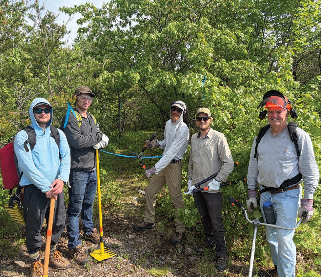
A new section of the Kekekabic Hiking Trail is being built east of Ely. Volunteer crews began working earlier this summer at the western terminus and are making their way west. Eventually, the segment will reach Kawishiwi Falls, eliminating a road walk along Fernberg Road.
New trail will eliminate road walk
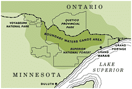
While the Boundary Waters Canoe Area Wilderness (BWCAW) has miles and miles of water trail, there are also hiking trails dotted throughout the region. The Kekekabic Trail, known as the “Kek”, bisects remote portions of the wilderness beginning near Snowbank Lake, east of Ely, and ending at the Gunflint Trail, north of Grand Marais. It is part of the North Country Scenic Trail (NCST) system, which spans 4,800 miles over eight states. 850 miles of it are in northern Minnesota.
The Kek portion of the NCST is 39 miles long. Along the way, there are primitive, first-come, first-served campsites situated beside scenic lakes surrounded by boreal forest. Due to its remoteness and ruggedness, the trail is much quieter than other well-known trails in Minnesota. The name comes from a lake located roughly midway along the trail. It is Ojibwe for hawk-cliff or hawk-iron lake.
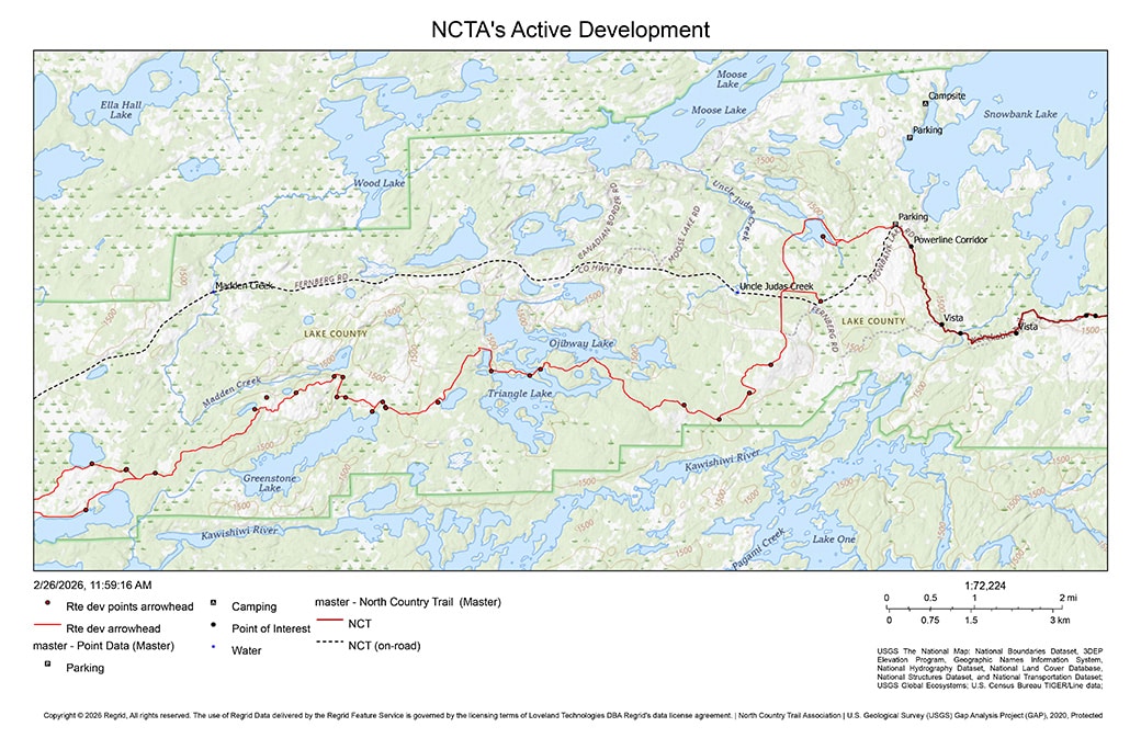
In a social media post, the chapter said that, “We are growing and happy to share our most exciting news yet! In early May, we received official blessing from the U.S. Forest Service that we can start building a new trail from our current western terminus at Snowbank Lake to Kawishiwi Falls.”
Earlier this summer, volunteers with the Kekekabic Trail Chapter began working on 15 miles, beginning near the western terminus. We reached out to chapter president Eric Campbell, who told us, “We have a proposed trail flagged from the Snowbank trailhead west and south to the Fernberg Road. The trail will cross the Fernberg and head up the hill to the top of the hill (Lookout area) where there was an old fire tower.” He said they hope to construct 7–8 miles of trail this season. They are slowly working their way west toward Ojibway/Triangle Lakes. Later, they’ll move onto the Glipi Road section.
Mapping the route to Ely
Once complete, a total of around 26-30 miles will connect the western terminus of the Kek to the town of Ely. Hikers will no longer have to walk along the Fernberg Road, which can be busy with seasonal tourist traffic. Plans also included eventually building trail segments from Ely to Bear Head Lake State Park. Campbell said, “Our goal is to have a simple footpath in the woods or prairie all across the state.”
Scenery helped inspire the route. “We have had the opportunity to route the trail along ridges and water to provide more scenery and a more interesting hiking experience. The trail will pass by several remote lakes, Ojibway, Triangle, Jewell, Greenstone, Madden and Pickeral,” Campbell noted. As a result, visitors will be able to access and filter water from many lakes. When the new section is finished, hikers will be able to use newly developed campsites, located every 3-4 miles.


Path built to access fire towers
Crews built a path in the mid-1930s to access four fire towers in what was then the Superior Roadless Area. According to an article in the Timberjay, planners considered building road or rail access to the area but eventually abandoned the idea because construction costs were too high.
Later on, the Forest Service built the fire towers, which required trail access. The article noted that in 1934, crews began brushing out paths that would become parts of the Kek. Eventually, aircraft replaced fire towers for wildfire spotting, and the trails fell into disuse.
Bill Rom and the trail club’s revival
Local outfitter and conservationist Bill Rom’s support for expanding hiking trails in the area led to the formation of the Kekekabic Trail Club in 1990. Throughout the years, storms and wind threatened to obliterate the trail; however, the club remained. Since then, dedicated groups of volunteers have ensured the trail remains open.


The Boundary Waters, delivered weekly
Join thousands of readers receiving free wilderness news and weekly updates from the Northwoods.
Section will have water access, campsites
A certified trail builder will oversee construction, with volunteer support. More volunteers are needed to help complete the new trail segment. Campbell said that the plan has been an interesting process. “Almost all the current approved trail is on Forest Service land,” he said. “We’ve worked with them closely for the last 6 years to develop a possible trail corridor and finalize the approval (NEPA). The route was based on land ownership, terrain, and scenic trail goals. Initially, a possible route was developed by mapping, and over the last several years crews have been out flagging the trail and making adjustments based on on-the-ground experiences.”
How to volunteer
The chapter has scheduled monthly trail-building dates throughout the summer and into September; however, with ongoing wildfires in the area, people should contact the organization before signing up. Campbell said that while the work is challenging, no experience is needed. The crew leaders will train you on the equipment. Arrangements have been made with a private camp near the worksites to host volunteers. The workday starts around 9 am and wraps up around 4 pm. Food is provided.
Work within the wilderness will be done with hand tools, while other segments outside the BWCAW boundary will use power tools. When it’s complete, hikers will enjoy the quiet and solitude of an 18” dirt path through the woods.
Funding and partners
In partnership with the National Park Service, the NCTA oversees trail policy, planning, and development of the trail system. Funding for this project has come from grants provided by Friends of the Boundary Waters and the NCTA. The chapter is also applying for additional grants from other Minnesota-based organizations.
