

The Kawishiwi Ranger District is developing a forest plan to reduce the risk of wildfires near the Boundary Waters Canoe Area Wilderness (BWCAW) and surrounding communities. The goal is to support a diverse and healthy forest while reducing combustible fuel along this boundary and to assist wildland firefighters in managing forest fires more effectively. Multiple management options are being considered as public commenting comes to a close.
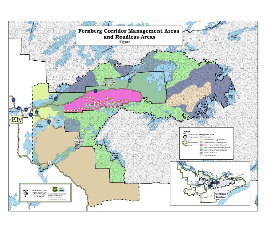
The Fernberg Road Project aims to close the gap between the current state of the land and the goals set out in the Forest Plan. Studies along the corridor where urban areas meet wilderness show that action is needed because the present forest is vulnerable to wildfires, insect infestations, climate change, and disease. These factors create a challenging environment for both residents and those managing fire risks. If approved, the project will enable the Forest Service to better manage areas to the east and south of Ely, MN.
Aaron Kania, Kawishiwi District ranger for the Superior National Forest, told Outdoor News, “The Fernberg Project focuses on creating resilient forests while protecting lives, private property, and firefighter safety.” He added, “The project was developed in collaboration with the residents of Ely, our partners, and the tribal bands. It’s important that everyone has the opportunity to voice their opinions and submit comments.”
Multi-decade process
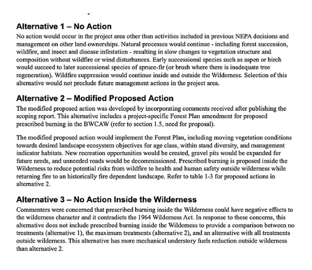
The project is expected to span two decades, with flexibility to adapt as the forest evolves. This approach allows managers to apply the best treatments at the right times based on changing conditions. While the original plan is part of the Forest Management Plan, three additional approaches are under consideration. They developed these after the initial report was published in 2023 and the public submitted their comments. The purpose of the three alternatives is to allow the USFS to explore other options for achieving the project goals. This approach also aims to minimize environmental impact.
Other activities will focus on improving forest diversity, enhancing forest health, and promoting wildlife habitats. Timber harvest will also cover about 9,000 acres.
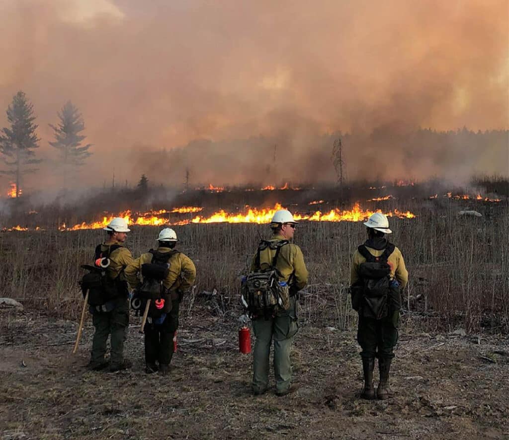
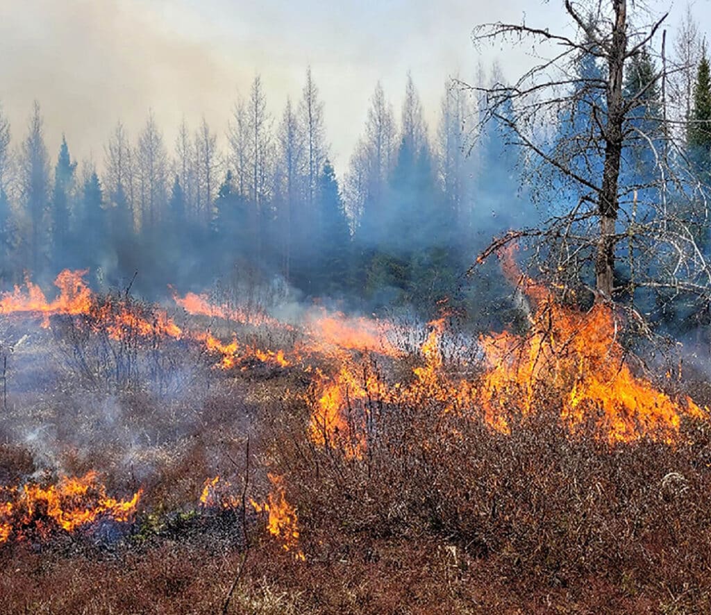
One choice involves deciding whether to allow lightning-caused fires to burn in the BWCAW, maintaining natural cycles. Fire crews will still conduct controlled burns in the spring and fall where there is an increased risk of fire near populated areas.
While the Forest Service had previously planned an open house on the project, they replaced that event with a 30-minute informational video that anyone can watch. Public comments are being welcomed until February 14, 2025 with the final decision to be published sometime in October.
More info:
- Fernberg Corridor Landscape Management Project – USFS-Superior National Forest
- Comments sought on Fernberg Project in and adjacent to Minnesota’s Boundary Waters – Outdoor News
- Fernberg Corridor Landscape-Management Project Draft Environmental Assessment – Kawishiwi Ranger District