


Reported size: 45 Acres
Contained: 50%
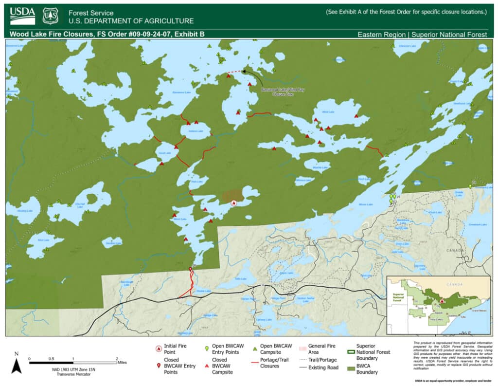
The USDA Forest Service reinstated EMERGENCY CLOSURE ORDER 09-09-24-07 Effective September 17, 2024:
BWCA Portages restricted:
- Wood Lake Entry Point Parking Lot to Wood Lake
- Wood Lake to Hula Lake, Hula Lake to Good Lake
- Good Lake to Good Creek, Good Lake to Hoist Bay (Basswood Lake)
- Good Lake to Indiana Lake, Indiana Lake to Basswood Lake
- Indiana Lake to Wind Bay Creek (Wind Bay, Basswood Lake)
BWCAW Entry Point closures:
- #26 Wood Lake

September 20, 2024:
Reported size: 27 Acres
Contained: 25%
The USDA Forest Service updated EMERGENCY CLOSURE ORDER 09-09-24-07 Effective September 17, 2024:
BWCA Portages restricted:
- Wood Lake Entry Point Parking Lot to Wood Lake
- Wood Lake to Hula Lake, Hula Lake to Good Lake
- Good Lake to Good Creek, Good Lake to Hoist Bay (Basswood Lake)
- Good Lake to Indiana Lake, Indiana Lake to Basswood Lake
- Indiana Lake to Wind Bay Creek (Wind Bay, Basswood Lake)
BWCAW Entry Point closures:
- #26 Wood Lake
Restricted lakes:
- Wood Lake
- Hula Lake
- Good Lake
- Indiana Lake
Update: September 15, 2024:
Reported size: 27 Acres
Contained: 25%
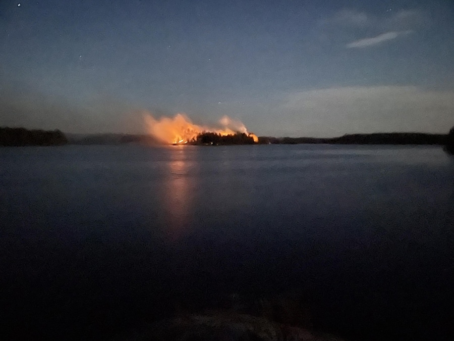
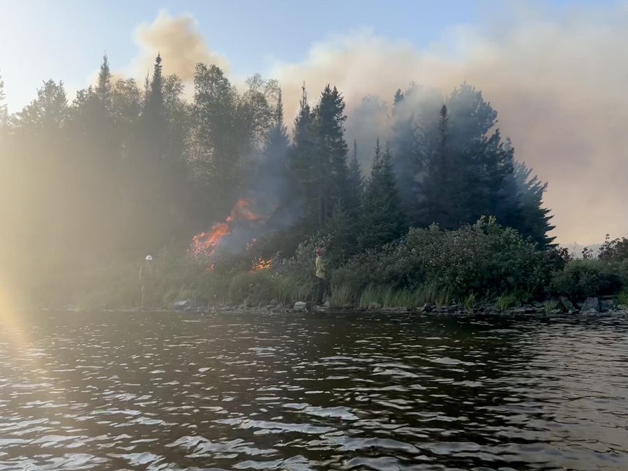
Firefighters continue to suppress the fire. The fire has spread especially in pockets of spruce budworm infested balsam fir. Aircraft are working the fire to prevent more intense crown and running fire behavior. The Superior National Forest implemented Emergency Closure Order #09-09-24-07 for the public’s health and safety due to the Wood Lake fire within the vicinity of recreation areas.
BWCA Portages restricted:
- Wood Lake Entry Point Parking Lot to Wood Lake
- Wood Lake to Hula Lake
- Hula Lake to Good Lake
- Good Lake to Good Creek
- Good Lake to Hoist Bay (Basswood Lake)
- Good Lake to Indiana Lake
- Indiana Lake to Basswood Lake
- Indiana Lake to Wind Bay Creek (Wind Bay, Basswood Lake)
- Wind Bay to Wind Lake
- Wind Lake to Washte Lake
- Wind Lake to Moose Lake
BWCAW Entry Point closures:
- #26 Wood Lake
Restricted lakes:
- Wood Lake
- Hula Lake
- Good Lake
- Indiana Lake
- Wind Bay (Basswood Lake)
- Wind Lake
- Washte Lake
September 12, 2024:
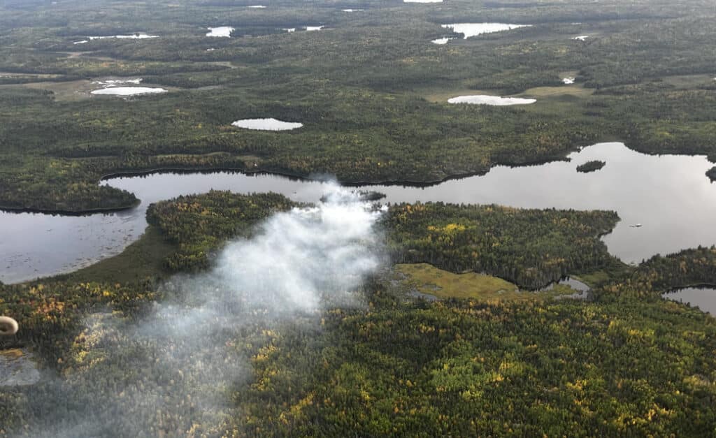
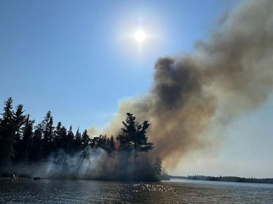
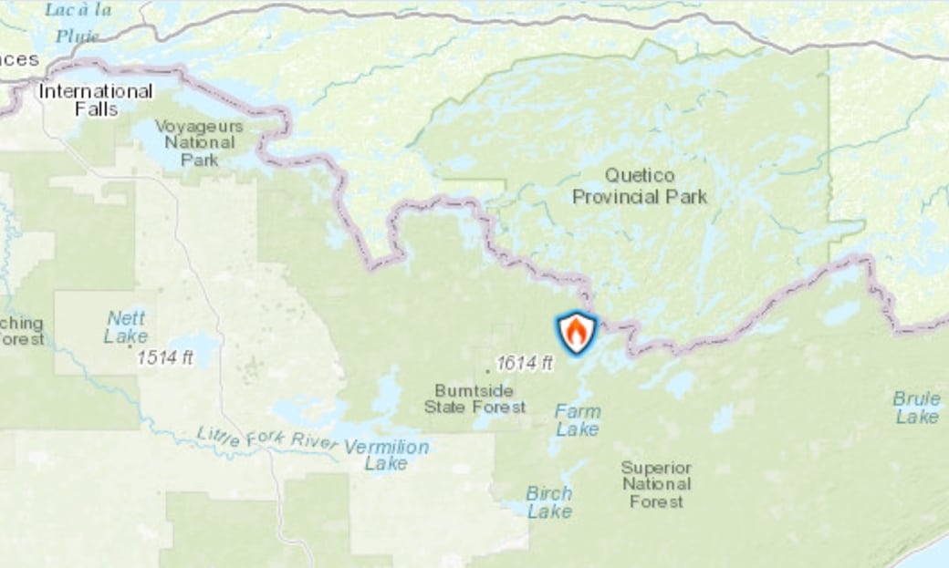
The USDA Forest Service reports that a fire was detected on Tuesday, September 10, 2024, on an island of Wood Lake within the Boundary Waters Canoe Area Wilderness (BWCAW). The fire is approximately 3-5 acres and is burning in timber within the Superior National Forest. The fire is suspected to be human caused; however, an official fire investigation has not occurred yet.
As of Wednesday, the fire was creeping, smoldering, and holding in place due to favorable humidity levels and light winds. However, above average temperatures and drought conditions continue across the region. The fire area and surrounding landscape has thick vegetation and a significant amount of spruce budworm infested balsam fir.
The Superior National Forest is utilizing aircraft to cool the fire and they expect the highest likelihood of success. Firefighters are working on full suppression tactics; however, ground conditions and access to the island are difficult. Additional aircraft have been ordered to assist with the fire as they become available.
Closures and further information: Due to safety concerns, BWCAW Entry Point #26 permittees have been contacted. As conditions may change rapidly, the Forest Service asks the public to stay away from the area and seek alternate routes. For the safety of firefighting resources, no drones are allowed near the fire area. Subscribe for updates >
More information:
Wood Lake Fire Fact Sheet (Inciweb)
Wood Lake Fire Information (USDA Forest Service)