Updated October 4:
THE BOUNDARY WATERS CANOE AREA WILDERNESS REOPENS
Officials announced Friday that the remaining BWCAW closures have been lifted, and the Boundary Waters Canoe Area Wilderness is now completely reopened to visitors.
See Superior National Forest Alerts, USDA Forest Service Updates via Facebook
Superior National Forest Fire Information Line:
218-214-7844
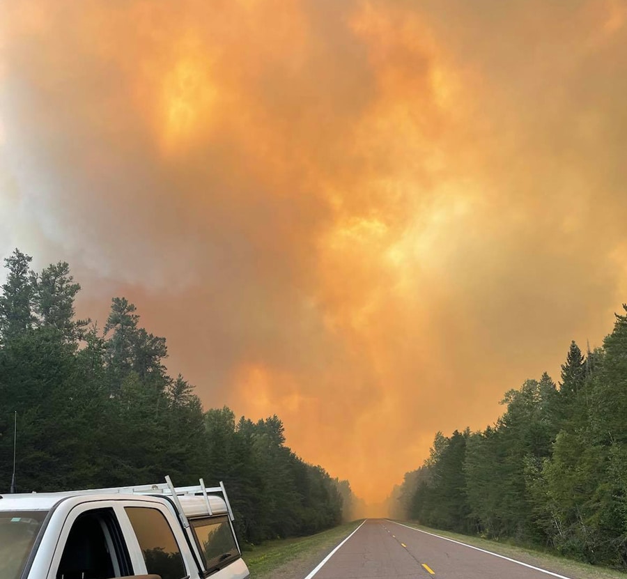
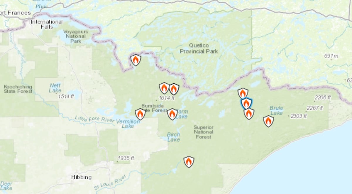
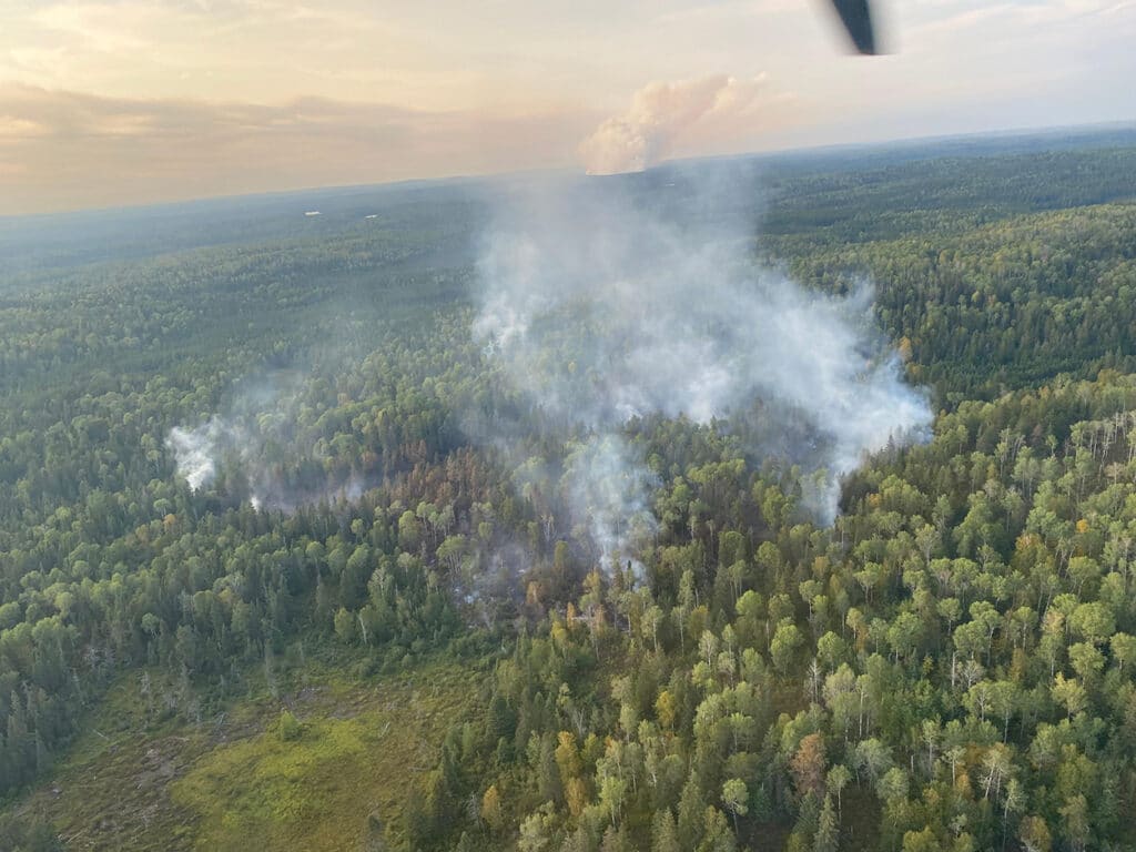
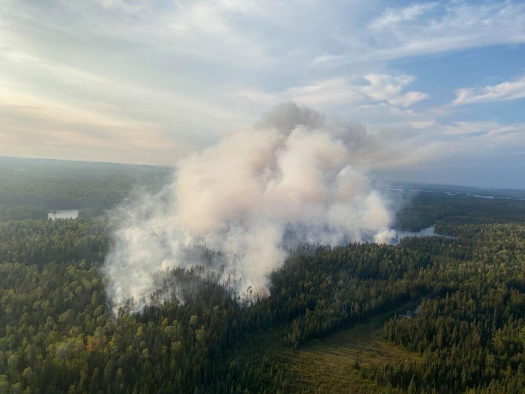
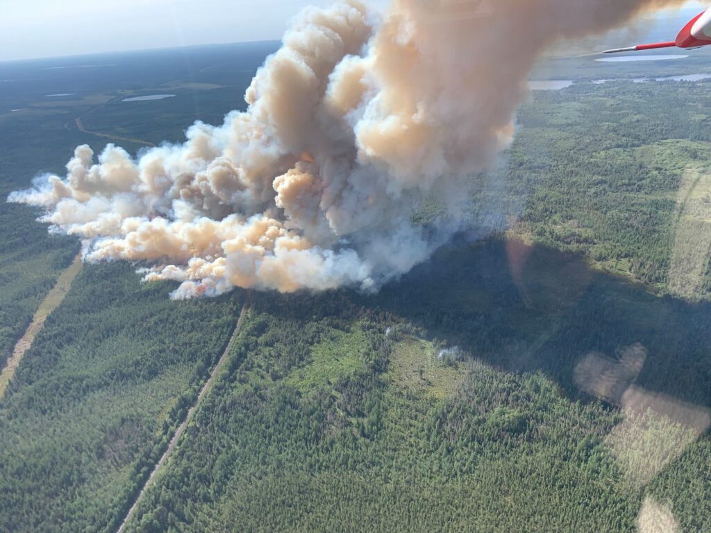
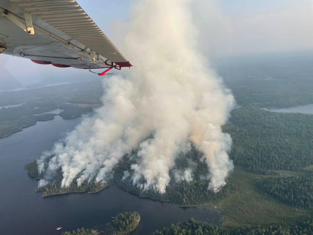
Greenwood Fire detected near Greenwood Lake on the Laurentian Ranger District in Superior National Forest, ignited by lightning. It is approximately 15 miles SW of Isabella. The fire moves very quickly due to strong gusts of wind and dry vegetation. Fire crews are suppressing the fire on the ground and from the air. There was substantial fire growth, the area of the fire was estimated at over 26,700 acres in late September. As of October 1 it was reported as 80% contained.
Detected late on August 14, the John Ek Fire was started by lightning. It is in a remote area 2.5 miles south of Little Saganaga Lake in the Wilderness on the Tofte Ranger District. By September 4, it was estimated at 1,300 acres.
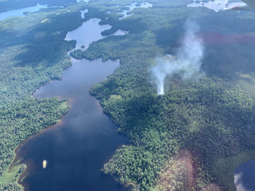
The Petit Fire, detected August 23, is located 1 mile north of Crescent Lake within the BWCAW. It is currently .5 acre in size and a crew is on site working to suppress the fire.
The Gabi Fire, detected August 23, is located west of Gabimichigami Lake within the BWCAW. It is currently estimated to be .5 acre in size. Because of poor access it is currently unstaffed and will be monitored by aircraft.
The Moose Lake Fire was detected on August 18 near Britt, MN, south of Lake Leander and Lake 14. It is reported to be 25 acres in size and 100% contained.
The Whelp Fire is another lightning-caused fire that was detected late on August 14, at approximately 5 acres in size. It is four miles west/northwest of Sawbill Lake. Similar to the John Ek Fire, this fire is in a remote area of the Wilderness on the Tofte Ranger District. No fire-fighting crews have been sent in due to difficult access, limited helicopter resources and safety concerns. Aircraft will perform water drops to suppress this fire as we continue to gather information. As of August 21 it was estimated at 50 acres in size.
Clara Lake Island Fire is located 10 miles NNW of Lutsen, outside of the BWCAW. It was detected on August 12 and is the result of an illegal campfire. A sprinkler system allows for water to be continuously added to the fire while also reducing firefighter exposure to falling dead trees. Aircraft and ground crews will continue to monitor daily.
The Rice Bay Fire is west of Phantom Lake within the BWCAW, detected on August 23. The fire was .5 acre in size.
The Second Creek Fire is located northwest of Angleworm Lake within the BWCAW. It was detected on August 23. The fire was .5 acre in size.
The Steep Fire was detected on August 20 and is located within the BWCAW approximately three miles south of the Canada border. It was estimated to be 2.5 acres in size.
The Bunggee Fire is located east of Sundial South Fire and is approximately 1 acre in size. The Vivid Fire is southwest of Vivid Lake and is approximately 5 acres. 100% contained.
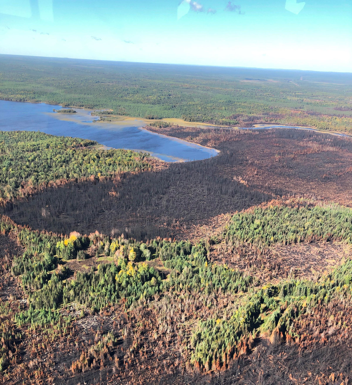
Fourtown Lake Fire detected on July 25 and is estimated now to impact 265 acres. It is located between Fourtown and Horse Lakes between the BWCAW. On July 27 fire managers determined the best course of action was an aerial “burn-out” operation in order to lead the fire to a natural barrier in a controlled manner. The weather window was brief but the Forest Service calls it a success.
The Ima Fire is located approximately five miles east of Snowbank, and the Slowfoot Fire is located one mile southeast of the Delta Fire. Declared controlled. The USDA Forest Service says all current fires and any new starts will be fully suppressed.
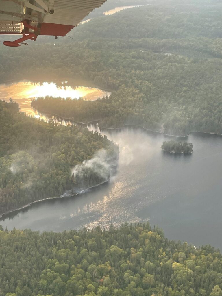
The Agamok Fire, located .25 miles east of the Kekekabic Trail, in the BWCAW on the Gunflint Ranger District. The fire is believed to be caused by a lightning strike was detected on July 25. It is currently one-acre smoldering. Crews are responding. The Beth Fire was detected on July 26 near a portage between Grace Lake and Beth Lake about three miles SW of Sawbill Lake on the Tofte Ranger District. A four-person crew is going in to assess and determine next steps for response.
Delta Lake Fire Update: 62 acres, 100% contained as of July 30. Infrared flight flew over the fire and crews are conducting mop-up operations focus on any interior pockets of heat that remain. Recent rain has moderated fire behavior. A closure area in the BWCAW near the Delta Lake Fire was lifted on July 23rd.
Bear Creek Fire was reported west of Ely on July 22 near Lake Vermilion and is currently burning in a hardwood stand. It is estimated to be 7 acres and experienced some growth due to heavy winds. 100% contained.
The Phantom Creek Fire was detected July 24, and is believed to be caused by lightning. It is estimated at 3.5 acres, five miles east of Bear Creek Fire and about half a mile south of Hassel Lake Fire. 100% contained.
Other Superior West Zone Fires: The Sundial South Fire, detected on July 21, is still showing smoke but does not appear to have grown. This area is inaccessible to fire crews due to the remote location and hazardous fuels but will continue to be monitored.
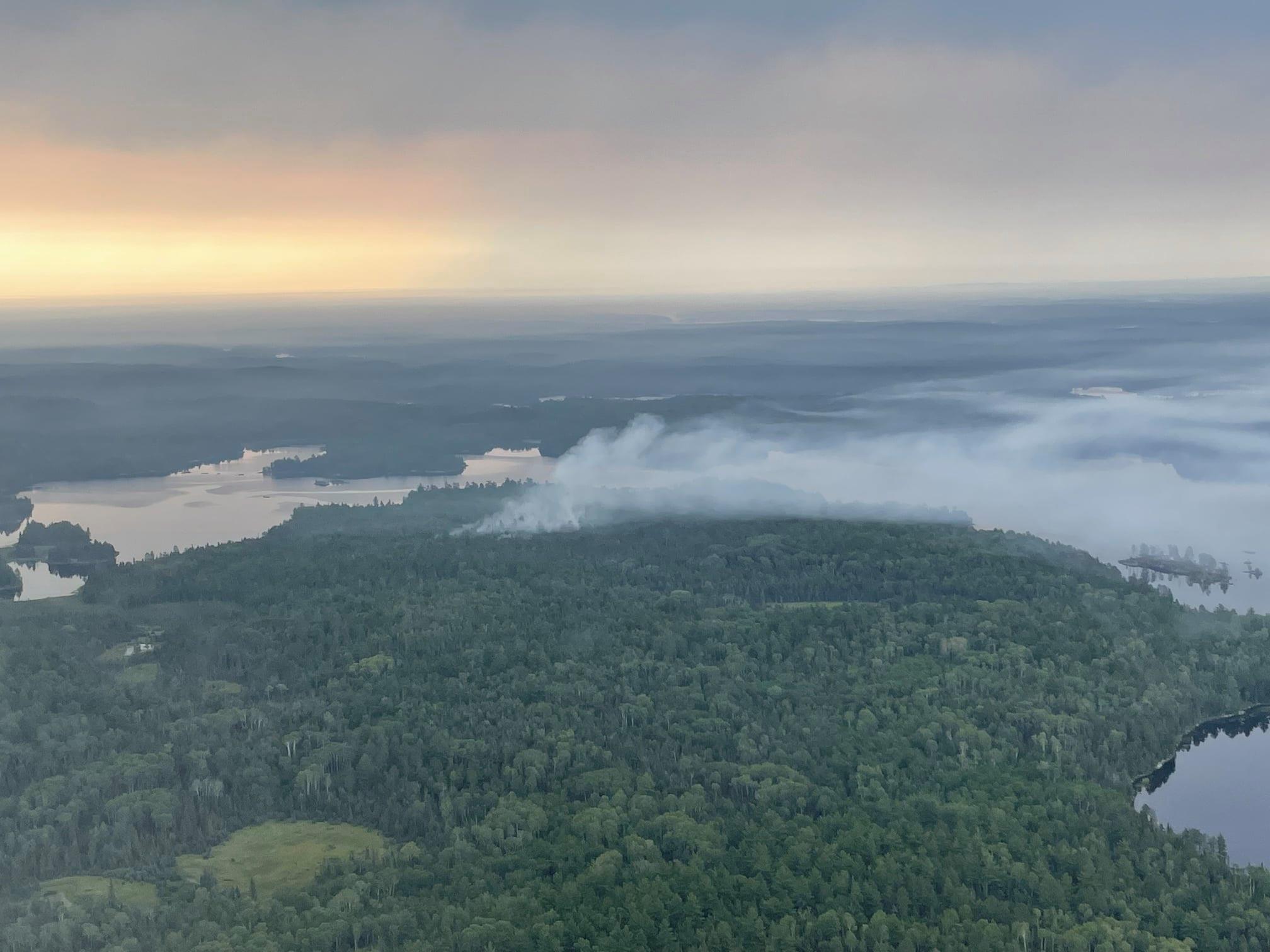
Canada Fires: Quetico Provincial Park has several fires burning north of the international border from the BWCAW. Three of the fires have the potential to spread across the border into areas near Crooked and Iron Lakes. The Superior National Forest continues to monitor and assess these fires daily.
More Updates via U.S. Forest Service
JULY 27:
Wildfires in and near Boundary Waters cause closures and campfire ban
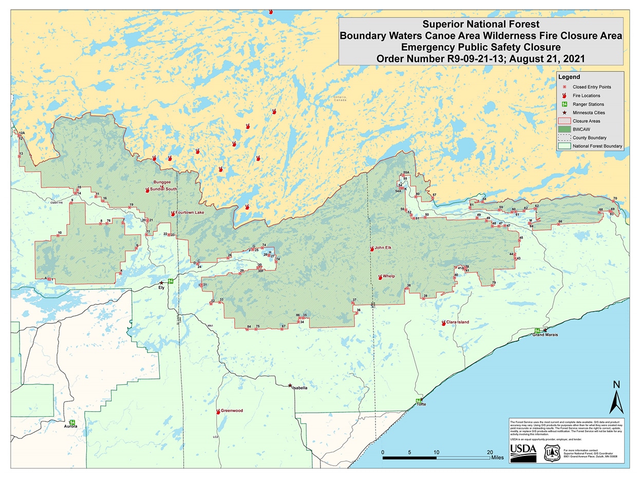
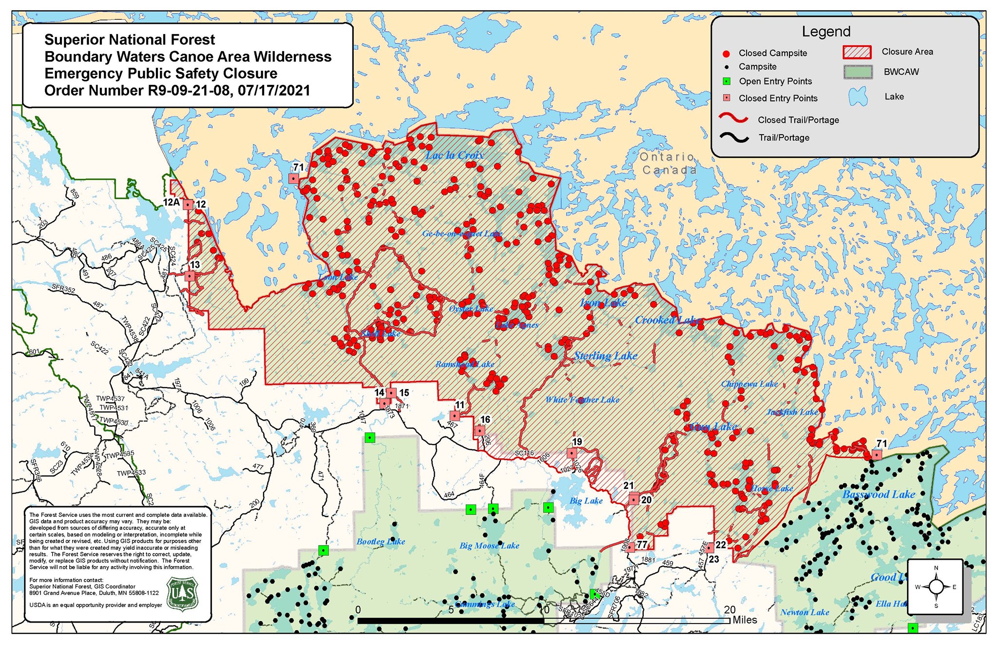
Due to fires across the border in Canada, the Superior National Forest has closed additional areas in the Boundary Waters north of Ely. The newly expanded order, which took effect July 17, includes 12 more BWCA entry points and the area around Lac la Croix, in addition to the areas around Crooked and Iron lakes that had previously been included. Click here for entry point and lake closure information.
“The Forest has enacted this closure order given the increased fire activity of the Canada fires, and the time required to locate and move BWCAW visitors out of the area if the wildfires spread into the US and create hazardous conditions. The Forest closed entry points that feed into the closure areas where the fire could threaten public safety. Travel times to these areas in the BWCAW are measured in days, not hours, and this would not allow for rapid evacuation of the area. Quetico Provincial Park has already enacted a closure area for the fires.” – USDA Forest Service release.
As of Saturday, July 10, four wildfires were spotted in and near to the Boundary Waters Canoe Area Wilderness. Efforts are underway to contain the blazes, while the Forest Service has now closed entry points, lakes, and campsites in response. Firefighters are working to suppress and contain the fires. There are also multiple fires burning across the international border in Quetico Provincial Park, including a pair of fires totaling about 175 acres near Burt Lake. All Canadian fires are currently being monitored and fire restrictions have been put in place across northwest Ontario, but the fires are not being suppressed.
The entire region is currently in moderate drought, with the dry conditions contributing to the fire risk. Storms producing lightning have moved through the area in recent days, which is believed to have ignited all current fires.
Four fire fights
The four fires on the Superior National Forest, all within 20 miles of Ely, are being managed together as the West Zone Superior Fires:
- Delta Fire: approximately 62 acres, south of Snowbank Lake, approximately 19 miles east of Ely; burning in an area of heavy blowdown with Spruce budworm-killed balsam fir.
- Astray Fire: approximately one acre, east of Clearwater Lake in the BWCAW, 11 miles east of Ely, burning in mixed timber forest and blowdown.
- Picketts Lake Fire: approximately one-tenth acre, burning in balsam fir forest and blowdown south of Picketts Lake, four miles northeast of Ely.
- Hassel Fire: approximately 10 acres in the BWCAW west of Crab and Burntside Lakes, 10 miles northeast of Tower.
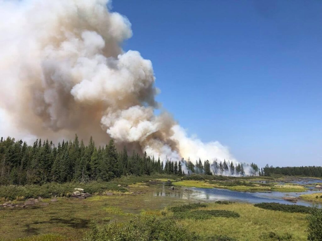
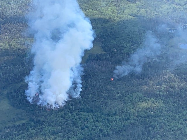
The Delta Fire, the largest of the group, is burning in “heavy blowdown” from a 2016 storm. It is located on National Forest land just outside the Boundary Waters at the end of the Fernberg Road. On Friday, a special team of incident managers took over leadership of the Delta Lake effort.
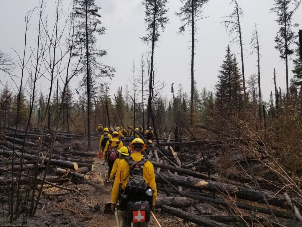
At that time, there were 13 firefighters, three fire engines, and various aircraft working on the Delta Lake Fire. Firefighters on the ground were using chainsaws to cut a firebreak along the southern edge of the fire, as well as putting out spot fires ignited by embers outside the main zone. They had to first cut access, escape routes, and helipads in the blowdown before they could safely engage the fire.
Additional firefighters, engines, aircraft and other resources were being requested from around the country, but the Forest Service reports national personnel and equipment shortages are making it difficult to secure reinforcements.
Precautionary closures
On July 9 the Forest Service took steps to keep visitors safe and prevent more fires. The agency announced a Forest-wide campfire ban, except in approved structures in some campgrounds, and closed a swath of the wilderness east of the Delta Fire to all visitors.
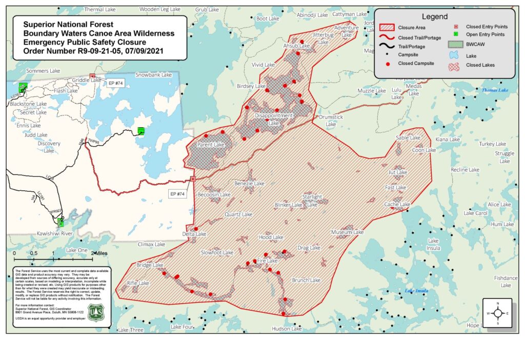
The closed area was not actively burning, but is in the area where firefighters believe the fire could expand if conditions allow and the blaze runs with the wind. The closure essentially includes the entire Kekekabic Hiking Trail. The extensive closure is also a precaution because of the limited resources available to suppress the fire.
Hot, dry season
This year has already been active for wildfires in northern Minnesota — mirroring the early, intense fire season in the western U.S. In May, the Bezhik Fire began in the western Boundary Waters. Ultimately burning almost 800 acres, it also destroyed four private structures outside the wilderness.
The Boundary Waters region has a slight chance of light precipitation over the next week, but nothing significant. Fire conditions are expected to remain risky.
Fire has long been a part of the Boundary Waters ecosystem and is important for healthy forests and the primordial scenery sought by visitors. Regular fire can prevent the build-up of dead wood that fuels ferocious fires. Iconic tree species like jackpine require fire to reproduce.
In addition to lightning-caused fires, recent research has revealed that humans have been intentionally setting fires in parts of what is now the Boundary Waters for centuries, if not longer. The Forest Service and other land managers continue to conduct prescribed burns on the Superior National Forest, but rarely in the Boundary Waters.
While the major fires currently burning were all believed to be started by lightning, across the country, nine out of 10 wildfires are ignited by people. That includes very destructive wildfires in the Boundary Waters, such as the Ham Lake Fire of 2007.
For the latest information:
- USDA Forest Service Updates via Facebook
- BWCAW / Superior National Forest Fire Restrictions
- West Zone Superior Fires – InciWeb
- Forest Fires Information, Ontario Ministry of Natural Resources and Forestry