


The Ely Economic Development Authority (EEDA) is constructing a new trailhead complex just west of Ely, Minnesota. The facility will serve as a trailhead hub for multi-use trails such as the Taconite Snowmobile Trail, Prospectors Loop ATV Trail, and Mesabi Trail. Eventually, the North Country Scenic Trail will have a connector here as well. This development coincides with efforts by the North Country Trail Association (NCTA) and local chapters to develop new sections of the trail system near the Boundary Waters Canoe Area Wilderness (BWCAW). City planners and outdoor groups hope that it will become a central location for outdoor enthusiasts as well as benefit the economy.
January 24, 2025 Update via the EEDA:
The new complex west of Ely is nearly finished. The Development Authority says the center will open to the public sometime in late June.
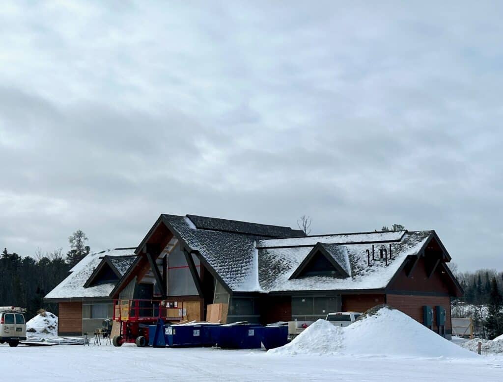
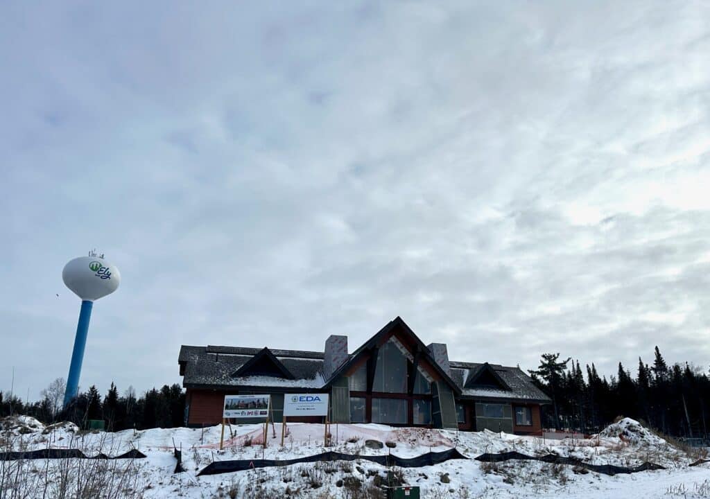
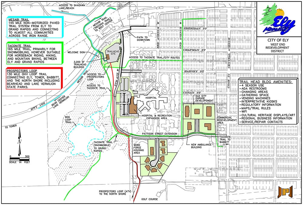
The building will be located along Hwy 169, which serves as the primary route into town. According to the EEDA, the facility will feature cultural heritage displays, tourism offices, regional business information, ADA restrooms, interpretive kiosks, and changing areas. Trail users will be able to obtain maps for one of the four trail systems in the area.
Hiking trail expands
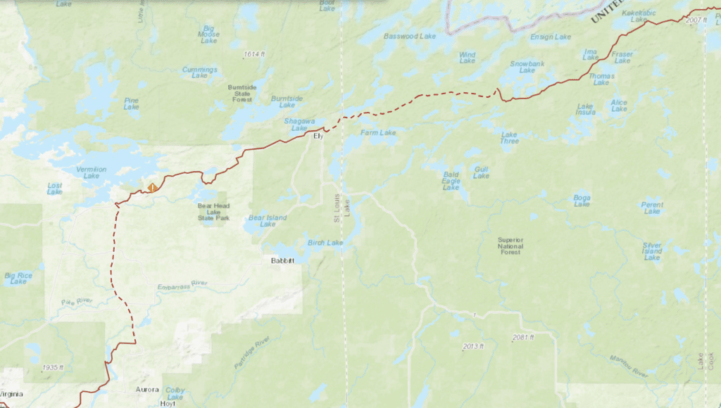
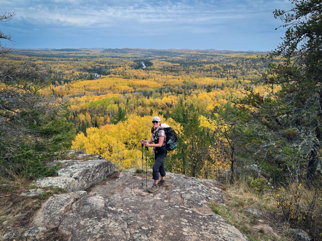
The North Country Trail bisects northern Minnesota for 850 miles. Federal and local organizations are currently developing a new section of this 4,800-mile, multi-state trail system near Ely. The trail spans the Arrowhead region, traversing the Boundary Waters Canoe Area Wilderness, two national forests, four state forests, and ten state parks. The newest segments are expected to be completed by the end of 2025
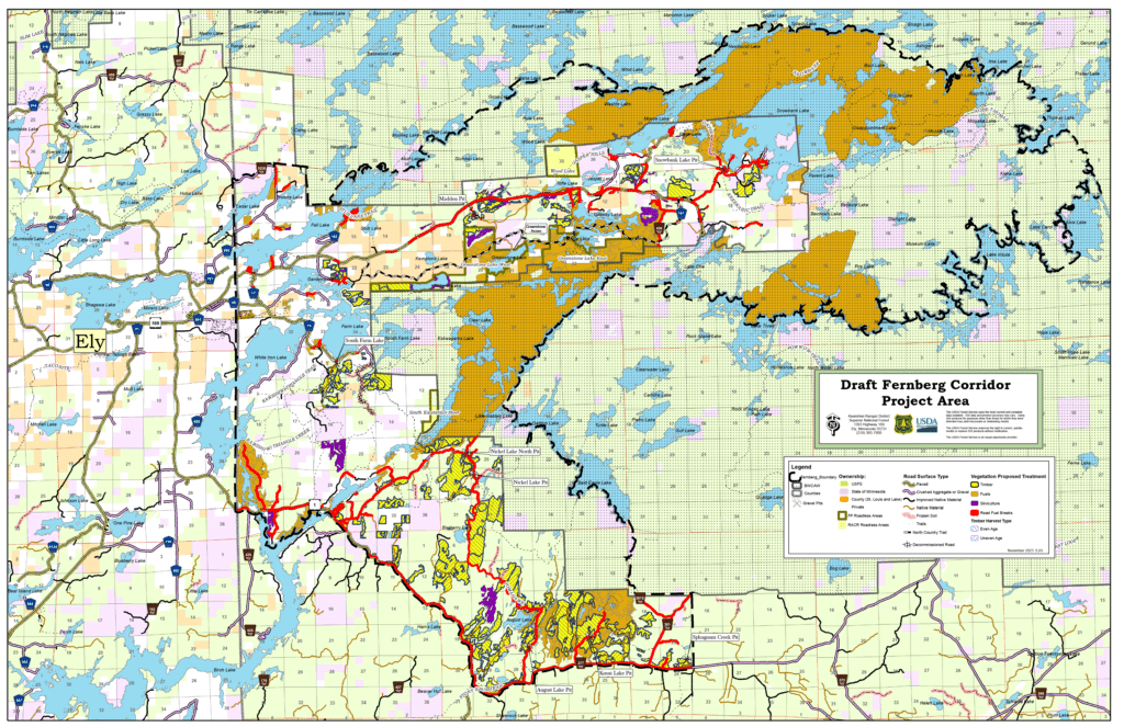
Over the past year, the NCTA and the National Park Service (NPS) conducted a preliminary route assessment with input from the local community. Enthusiastic public support led to the formation of the Ely Northwoods Chapter of the NCT. Once the USFS completes its environmental review, trail construction will begin on the 12 miles starting at the Kekekabic Trailhead, located 21 miles east of town. A certified trail builder will oversee the construction, supplemented by volunteer efforts. Plans include eventually building trail segments from Kawishiwi Falls into Ely as well as Ely to Bear Head Lake State Park.
World class hiking in northern Minnesota
Matt Davis, the NCTA Regional Trail Coordinator, told the Forest North podcast, “Volunteers urged the park service—we have 400 miles of world-class hiking. Let’s integrate it with the NCT.” He added, “Finally, in 2019, Congress passed legislation establishing this as the official trail route.”
Davis continued, “Now, hikers entering MN from WI turn right onto the Superior Hiking Trail, then left onto the Border Route Trail, and continue onto the Kekekabic Trail. However, we still need to connect the western end of the Kek to the Chippewa National Forest, spanning approximately 150 miles.” As a result, NCT’s Ely Northwoods and Kekekabic Chapters are collaborating to develop the trail system from Bear Head Lake State Park to the east of Ely.
In partnership with the National Park Service, the NCTA oversees trail policy, planning, and development across eight states.
Multi-use trails will connect
The North Country hiking trail, along with three other multi-use trails, will benefit from the centralized trailhead complex in Ely. While some connector trails are still under development, trail groups are actively developing plans to complete all routes into town.
Mesabi Trail
Stretching from the Mississippi River to the BWCAW, this 150+ mile paved trail offers users a scenic way to experience the north country. Visitors can enjoy biking, hiking, walking, and inline skating in the summer. In winter, the trail is groomed for cross-country skiing, snowshoeing, and winter hiking.
Taconite Trail
This multi-use trail, paved and natural, originates in Grand Rapids and extends 145 miles northeast to Ely. It winds through forests of birch, aspen, and pine, passing by numerous isolated lakes and streams. The route follows the undulating landscape of the Canadian Shield. Formed by volcanic activity long ago, it is one of the oldest rock formations on Earth.
Prospectors Trail
Lastly, this 130-mile OHV trail utilizes forest roads, wooded trails, and county road rights-of-way to connect users with communities such as Ely, Babbitt, Embarrass, Tower, and Soudan. The trail traverses diverse forest types and ecosystems, ranging from northern pine and aspen landscapes with ledge outcrops to lowlands, bogs, and wetlands.
More info:
- Multi Trail Facility Ely Trailhead / Part of the West End Redevelopment District – Ely Economic Development Authority
- North Country Trail Update and Songbird Migration – Forest North

Wilderness guide and outdoorswoman Pam Wright has been exploring wild places since her youth. Remaining curious, she has navigated remote lakes in Canada by canoe, backpacked some of the highest mountains in the Sierra Nevada, and completed a thru-hike of the Superior Hiking Trail. Her professional roles include working as a wilderness guide in northern Minnesota and providing online education for outdoor enthusiasts.