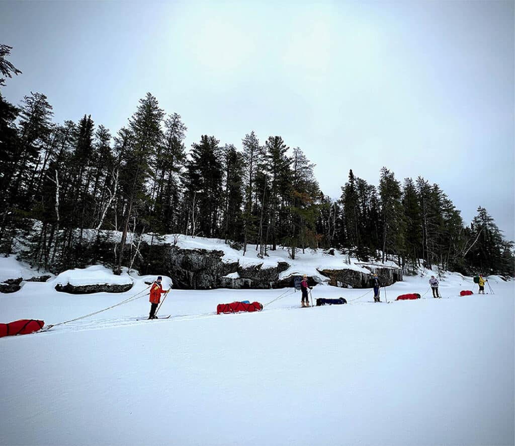
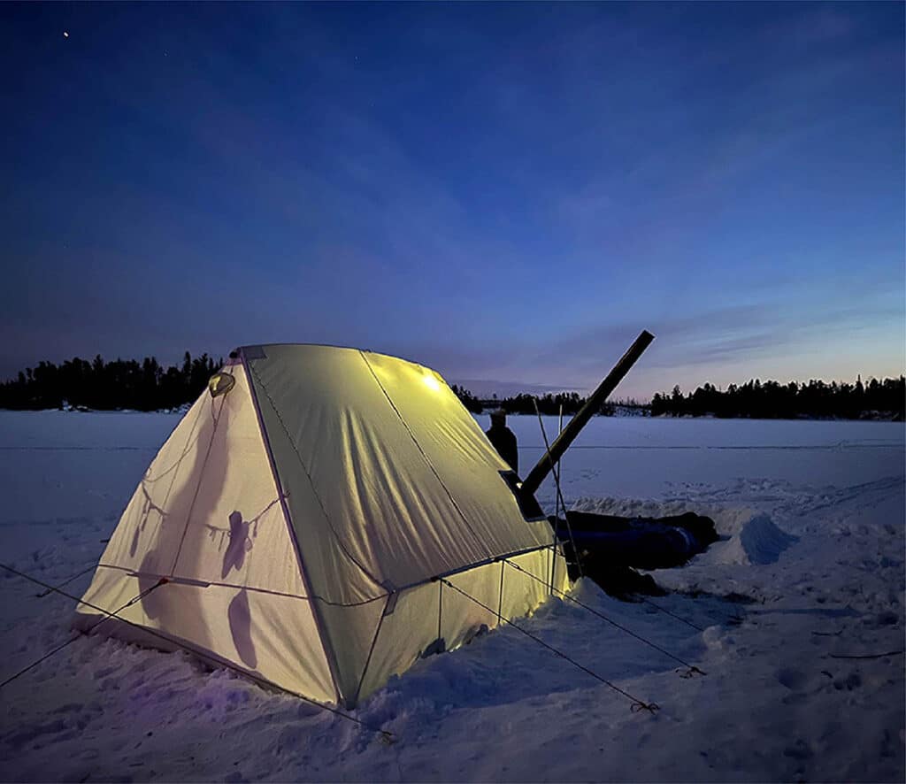
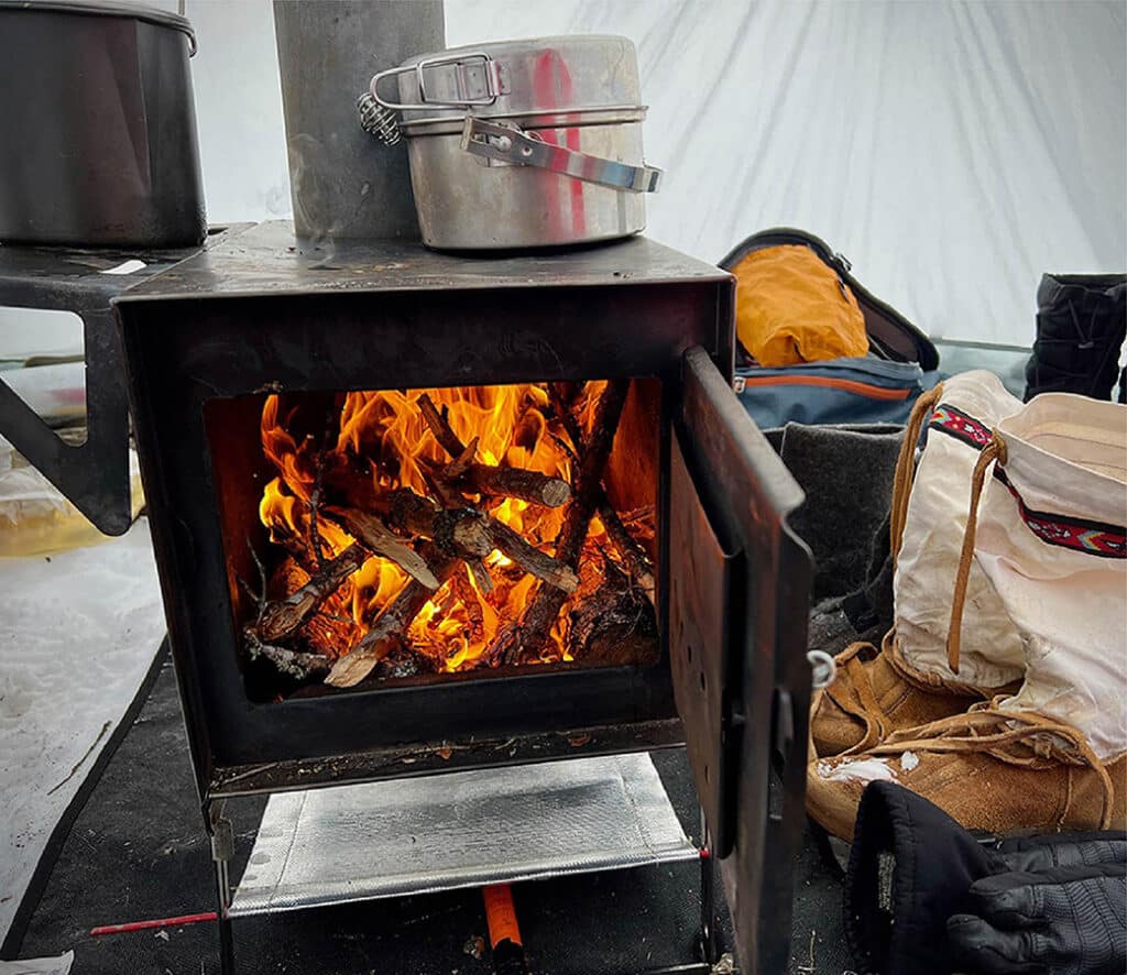
Winter camping in the Boundary Waters Canoe Area Wilderness provides a magical way to embrace the season’s silence. It’s a great time to explore the region by snowshoe or skis. Animal tracks dot the snowscape. It’s not unusual to see wolves and otters traveling over the ice. Anglers are also drawn to large wilderness lakes seeking lake trout and walleye. We’re highlighting three winter camping routes for all interests and experience levels. Plus, we’ll share a few helpful resources to get you started.
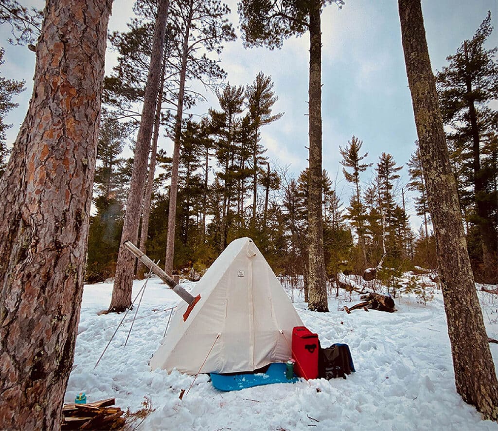
Route 1 | Lake One, Entry Point #30
This route takes you through quiet lakes dotted with iconic, pine-studded islands. Between 1893 and 1923, lumber companies extensively logged the area around Lake One until legislation was enacted to preserve the wilderness. The Pagami Creek Fire subsequently impacted the area in 2011, and traces of the fire remain visible along the southern shorelines. A lightning strike caused the wildfire, which ultimately burned over 92,000 acres. Because of this, the landscape is a mix of thick boreal forest with areas affected by wildfire. Since then, new growth has emerged.
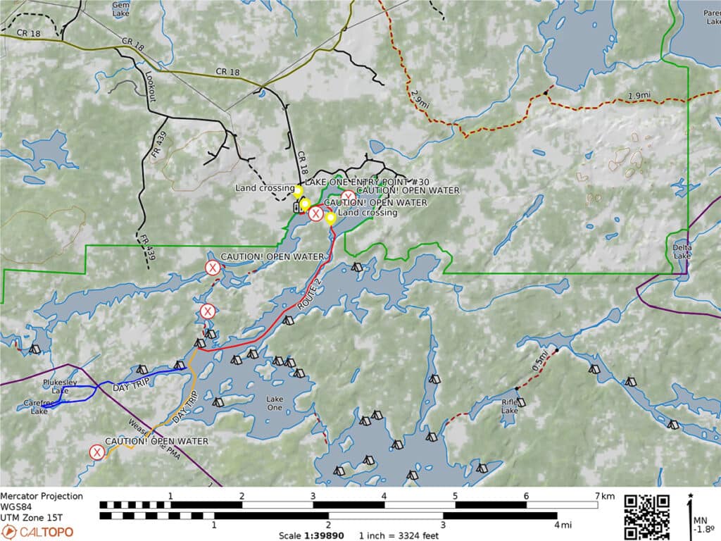
Lake One lies about 30 miles east of Ely. The entry point is regularly plowed in winter and has a pit toilet. A self-issued permit is required to enter the wilderness and can be obtained at the trailhead kiosk. The map provides route details and mileage.
Route 2 | Sawbill Lake, Entry Point #38
This area offers multiple opportunities for the winter traveler to explore. The landscape features smaller to medium-sized lakes and slow-moving creeks. A great day trip takes you along the Kelso River, where a large dolmen sits just before the creek flows into Lujendia Lake. Legend has it that Vikings discovered copper in the area and marked the mine with a large rock. During the Great Depression, a Civilian Conservation Corps camp operated six miles south of the lake.
Sawbill Lake lies twenty-five miles north of Tofte. A Forest Service cabin, outfitter, and campground sit near the entry point. Sawbill Canoe Outfitters does not maintain physical hours; they take phone calls or email only. This entry point is regularly plowed in winter, and there is a large parking lot and vault toilets nearby. They do not maintain the campground in winter.
Please be conscious of your impact. Do not park or camp where it is not allowed (call or email Sawbill if you’re unsure). Pack out all garbage—do not leave it in the outfitters’ trash bins. Enjoy the groomed ski trails in the area, but please do not snowshoe or walk on them.
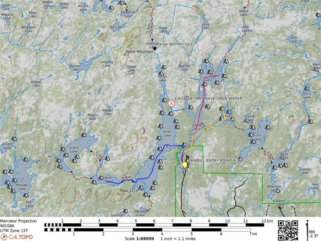
Obtain a self-issued permit at the trailhead kiosk to enter the wilderness. The map provides route details and highlights areas of caution.
Route 3 | Moose Lake, Entry Point #25
This looped route follows the Canadian Border, turning west at Prairie Portage. Eventually, it drops south through Wind Bay and Wind Lake before returning to Moose Lake landing. The trip is moderate to difficult, depending on conditions, and is best suited for experienced winter campers who prefer moving camp regularly.
The area around Prairie Portage has been used for over 10,000 years, with evidence of early inhabitation along border lakes. It is the traditional homeland of the Anishinaabe people, including the Bois Forte, Fond du Lac, and Grand Portage Bands of Chippewa. The region also holds cultural significance for these communities. Later, it became part of the French-Canadian voyageurs’ historic route, where men in birch bark canoes transported trade goods and furs across the Great Lakes and into Canada during the 18th and 19th centuries.
The Moose Lake entry point lies 20 miles east of Ely. The MNDOT regularly plows this entry point in winter. There is a large parking lot and a pit toilet. Obtain a self-issued permit at the trailhead kiosk to enter the wilderness. The map provides route details and highlights areas of caution.

Resources for winter campers
With some preparation and planning, almost anyone can organize a winter camping trip. Always check the weather before you go. Contact local outfitters, guides, or the Forest Service for ice conditions. Plan a trip that suits your (and your group’s) skills, experience, and abilities. Additionally, you can also hire winter guides for a wilderness camping experience. Reach out to local outfitters to arrange a guided trip. Follow Leave No Trace principles by packing out your garbage, not cutting live trees, and researching where camping is allowed. Inform someone of your plans, including where you’re going and when you’ll return.
The USFS – Superior National Forest has released a planning guide for winter camping in the wilderness. All visitors need to obtain self-issued permits from October 1 to April 30. You can pick up a self-issued permit at entry point kiosks or Forest Service offices. Reservations are not required, and there are no recreation fees.
Multiple outfitters rent winter camping gear in northern Minnesota and can offer advice on equipment. You can find BWCA outfitters from web sites like Ely.org, the Gunflint Trail Association and Explore Minnesota.
More info:
- Boundary Waters Canoe Area Wilderness permits – Recreation.gov
- Boundary Waters Canoe Area Wilderness (rules & regulations, planning guide) – USFS – Superior National Forest
- How to Winter Camp in the Boundary Waters – Minnesota DNR
Wilderness guide and outdoorswoman Pam Wright has been exploring wild places since her youth. Remaining curious, she has navigated remote lakes in Canada by canoe, backpacked some of the highest mountains in the Sierra Nevada, and completed a thru-hike of the Superior Hiking Trail. Her professional roles include working as a wilderness guide in northern Minnesota and providing online education for outdoor enthusiasts.

